Dec 30 – Jan 2, 2017
The skiing around Christmas was awesome this year, with lots of good powder skiing on the North Shore, mostly in the Hollyburn area. While spending four more days skiing on the North Shore didn’t seem like the worst idea given the rare low snow-line this year, Greg and I thought maybe a change was needed from the usual programming. With four days and what looked like a decent weather window, we started scheming of a few ideas.
The night before our departure, I was drawing up routes on Google Earth, and trying to visualize how the ski conditions might shape up. There was a lot of snowfall on Dec 28 and 29. The latest ski reports of deep trailbreaking conditions left me questioning the idea of doing a traverse, or heading somewhere less visited, with just two of us.
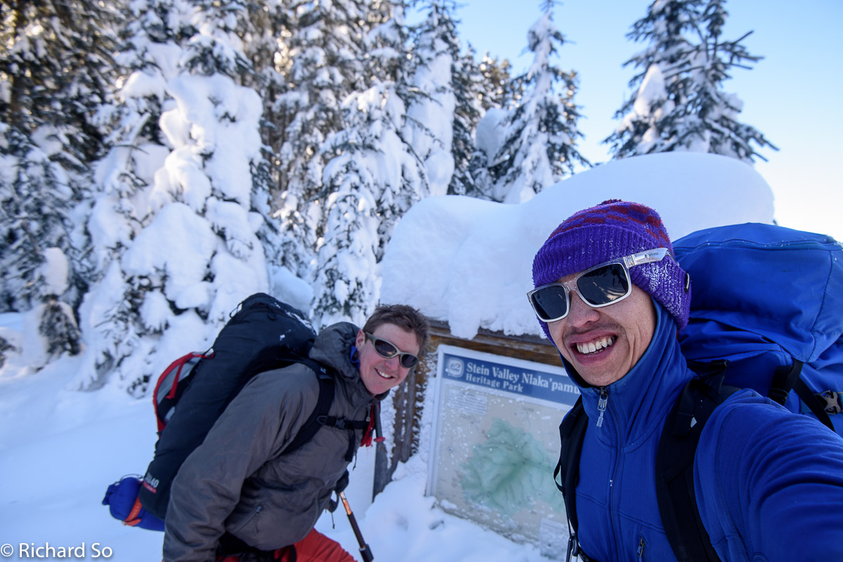
Skiing into the Lizzie Creek cabin wasn’t decided until we drove through Mount Currie. After talking through Plan A and Plan B, we settled for Plan C, a long slog up the Lizzie Creek road. Greg sent Lisa a message describing our change in plan, and we were off driving down the icy Lillooet Lake road. Cold conditions had left the road in very icy conditions, making for slow winter driving. I was able to drive up to the washout on the Lizzie Creek road, where two other cars had parked.
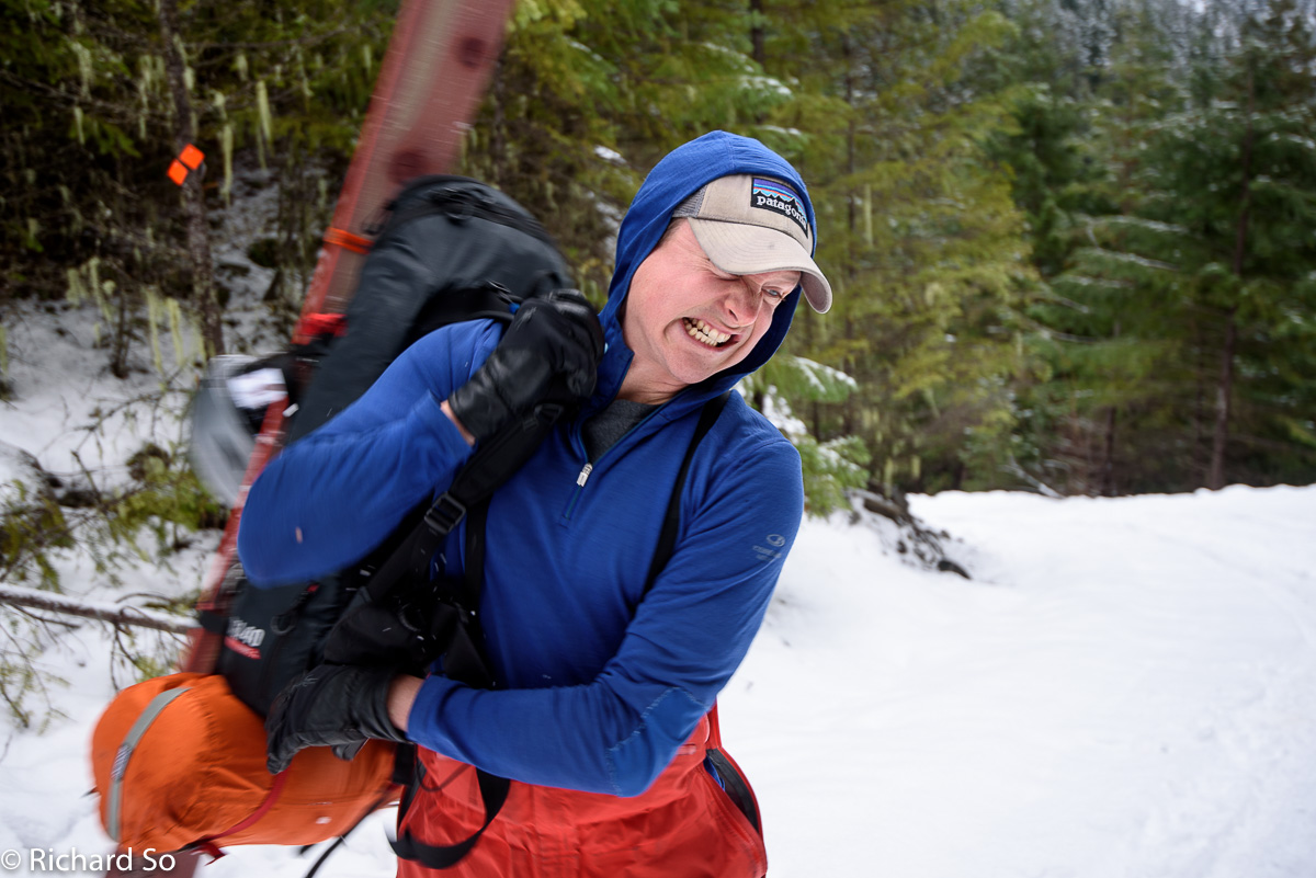
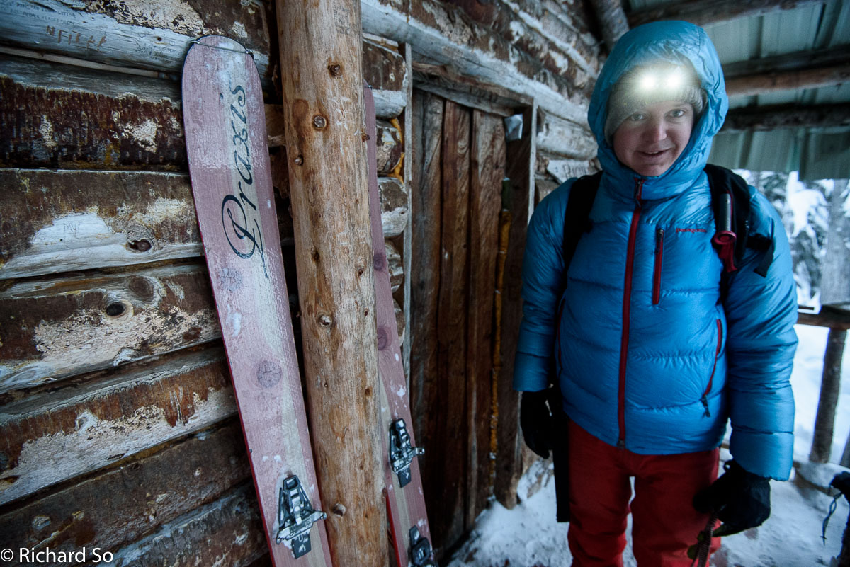
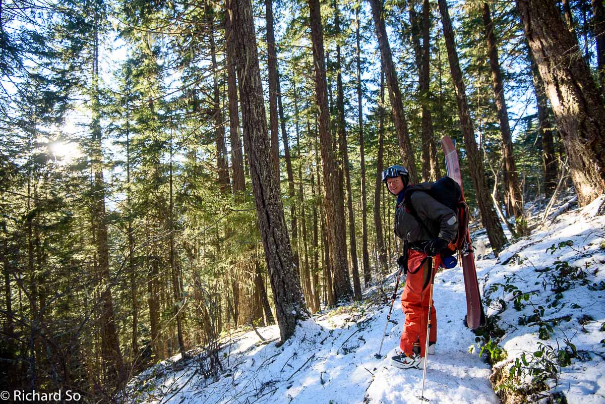
With chains on, you could probably drive further up the road, instead of skinning up the hill. This is Greg shouldering his pack at the start of the lower Lizzie Creek bypass trail. Back in May, Greg had exactly the same look on his face, as he shouldered a nine-day pack on our Stein ski traverse. When you have to start the trip with a bootpack, in January, you might also have this look on your face.
Do not take the lower bypass trail. While this trail will get you to the road, it consists of a narrow sidehill on a steep slope. Doing this in ski boots in icy conditions is not that much fun. Do not follow these shiny orange markers.
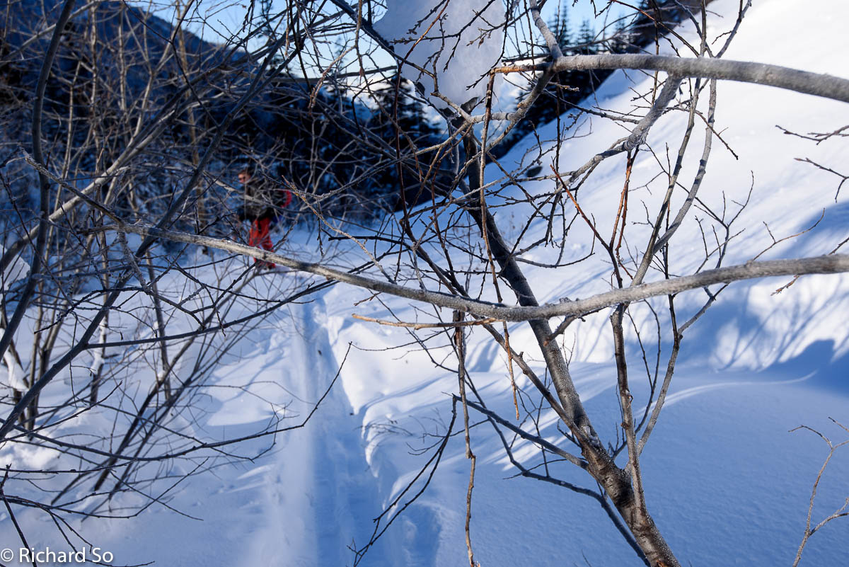
Instead, continue up the road, to the upper bypass trail, which is also marked with shiny orange trail markers. This trail has been worked on more this past summer since the last time I visited it. We took it on the way out, and it is definitely the way to go. The trail has been widened since my last visit in May and takes a very nice contour along some boulderfields. There is a good trail through the boulderfield, with lots of orange markers to guide you on the path. There is just a small descent down to the road.
The summer of 2016 saw more work on the Lizzie Creek road and the Stein Valley trail in general. I believe it was a group from the Lil’wat First Nations, the Salish fire unit that came in this summer to do some heavy-duty brushing of the road, and also the summer trail. The VOC has also organized two work hikes to brush out the road and to help with cabin upkeep. Big thanks to those who put in the effort to make travel condition way easier!
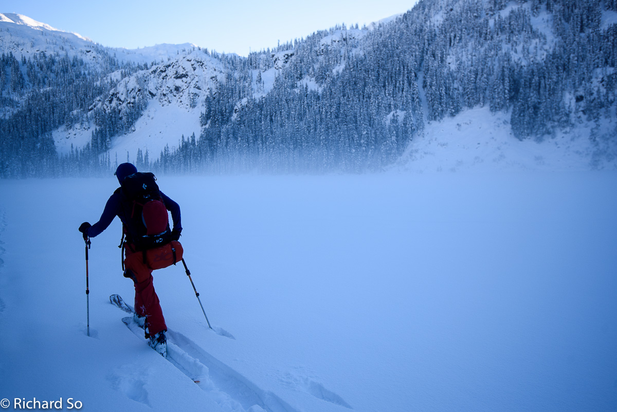
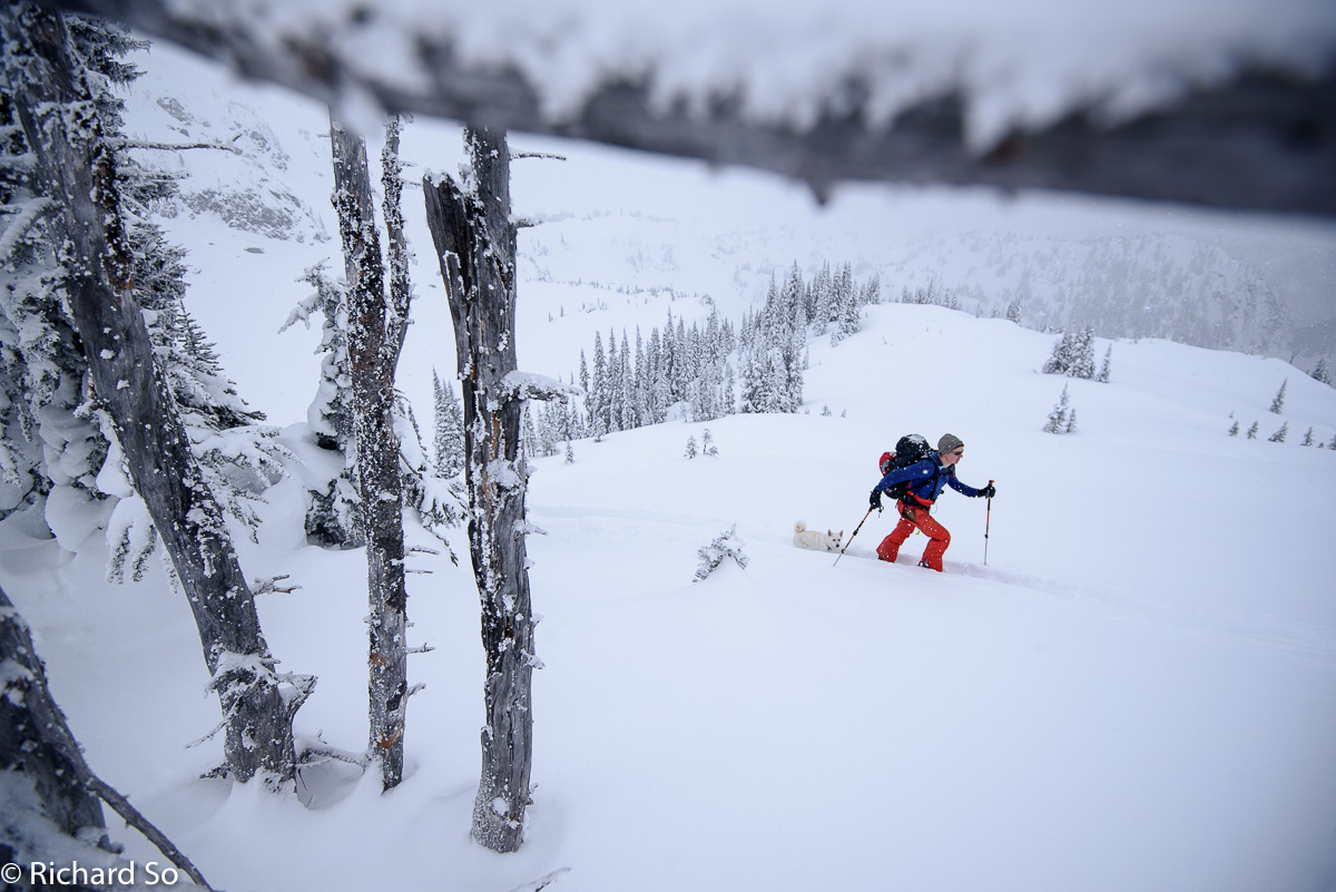
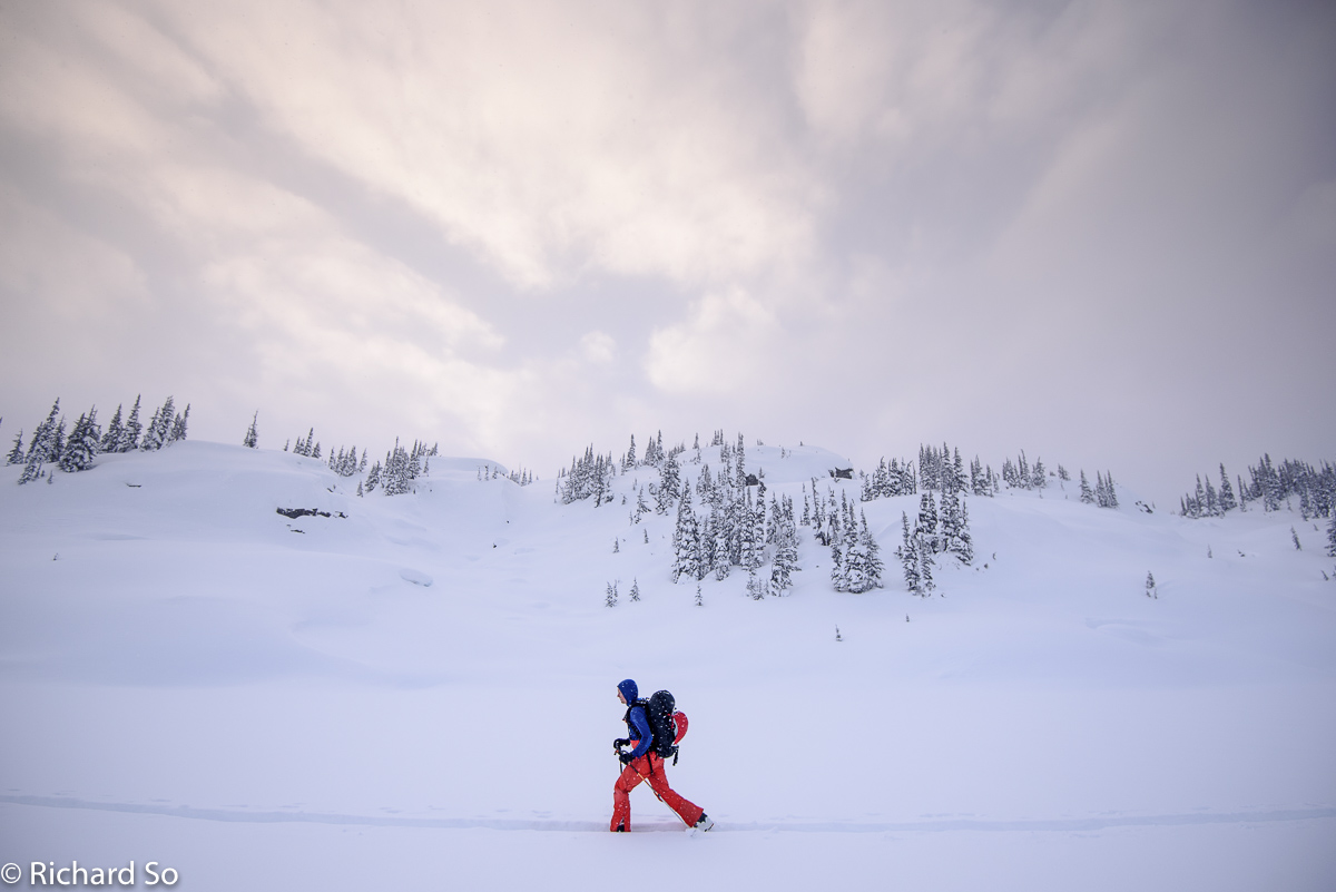
Compared to last winter, when Sarah and I were basically alder whacking our way up to Lizzie Lake, it was a really nice slog for me and Greg. We were also following the skin track from the two groups of skiers up there, so it was pretty easy travel. It took us about four hours to go from the car to the lake at a pretty relaxed pace.
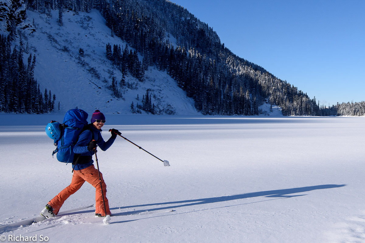
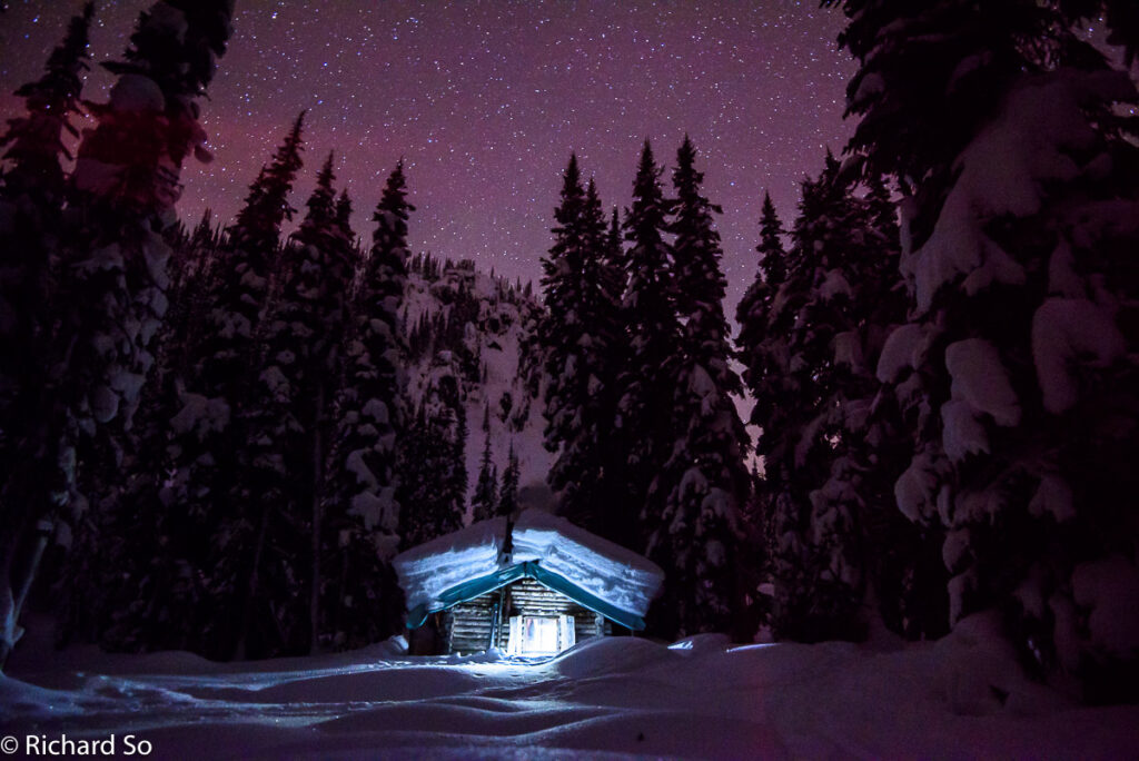
Just looking at this photo makes me feel a little cold. The lake seemed to be frozen enough, but our skis would still uncover the ice underneath the snow. Crossing Lizzie Lake with a frozen Chilko. It was cold crossing the lake, as it always seems to be when you get here in the late afternoon. It was -16C at the head of the lake.
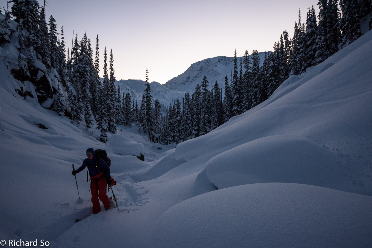
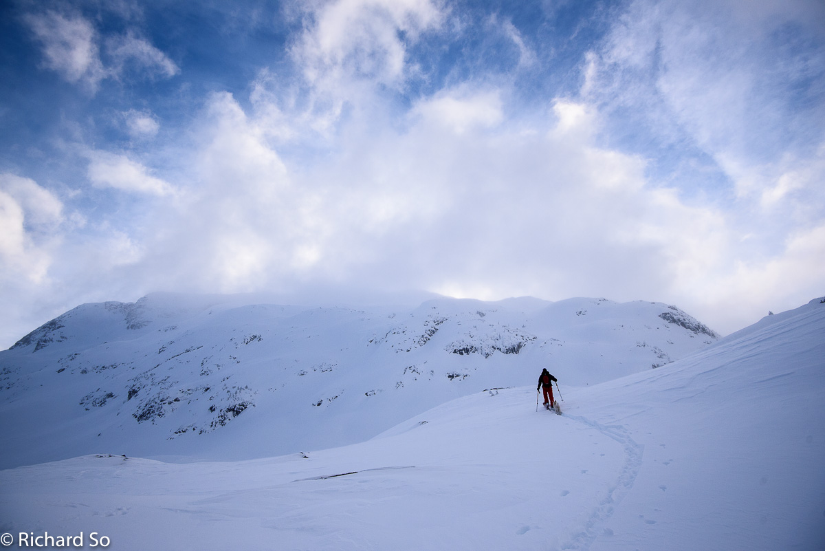
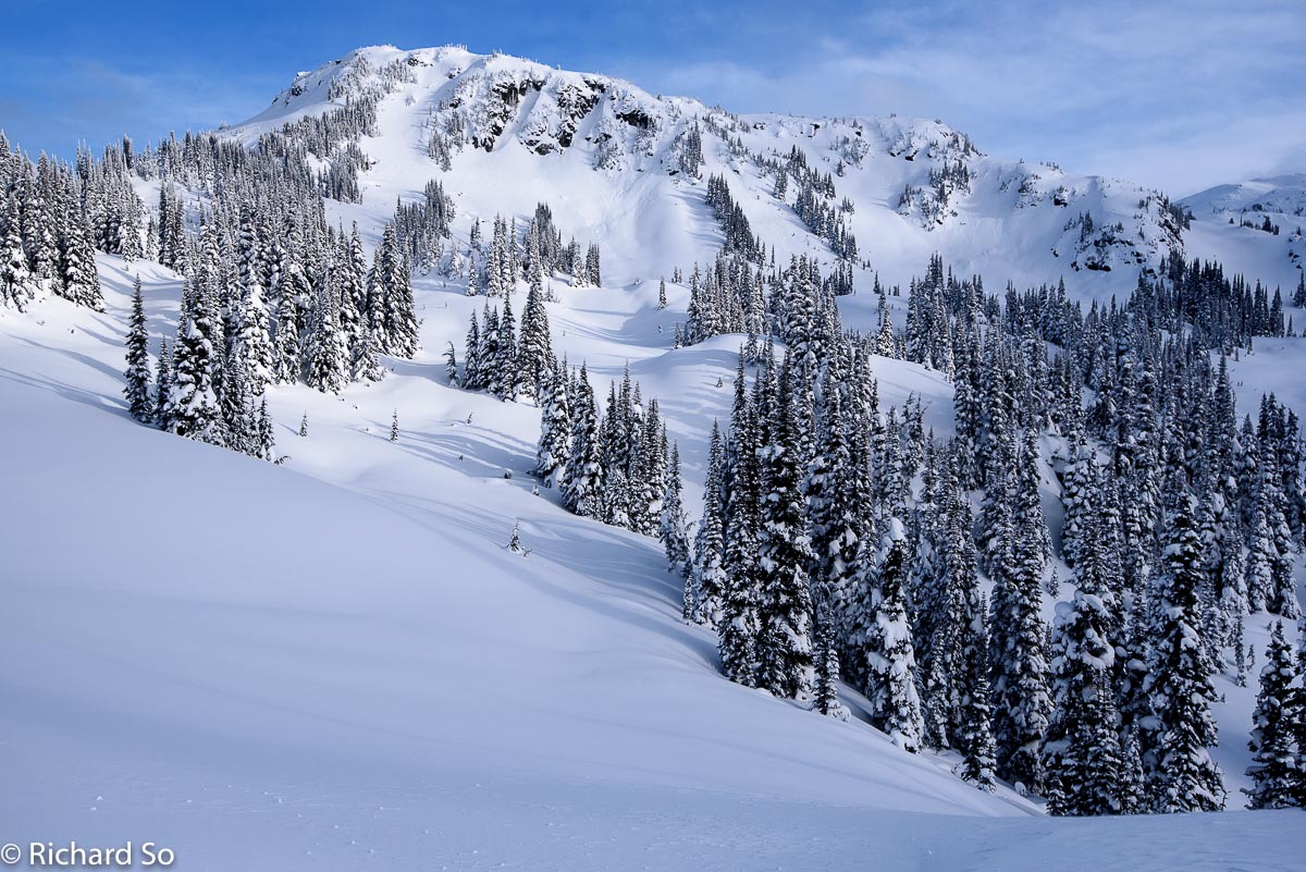
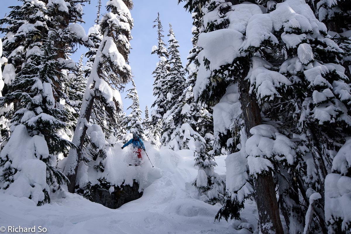
We lost the skin track up through the forest shortly after leaving the lake. Both ski parties had either taken the summer trail or a route that followed the south side of the creek that drains out of the Gates of Shangri-La. The problem with both of these routes is that the forest is steep, has a cliff band or two, and lots of deadfalls. You will likely find yourself side stepping up something steep.
The better way to go is to work further southwest towards an avalanche path. You can skin up in the open area, almost going the wrong direction, and then contour your way back towards the Gates of Shangri-La when you’re at the right elevation. Look it up on Google Earth, it’ll make sense. Plan ahead. Expect a long slog to the hut. Many parties do not make it to the cabin on their first day on their first attempt.
The trail breaking was tough here and slow going. It was probably a toss up between struggling with a crappy skin track in the forest or breaking our own trail. Lizzie is always further than what people think. It took us four hours to get to the lake, and then almost another three hours to cross the lake and climb up to the cabin.
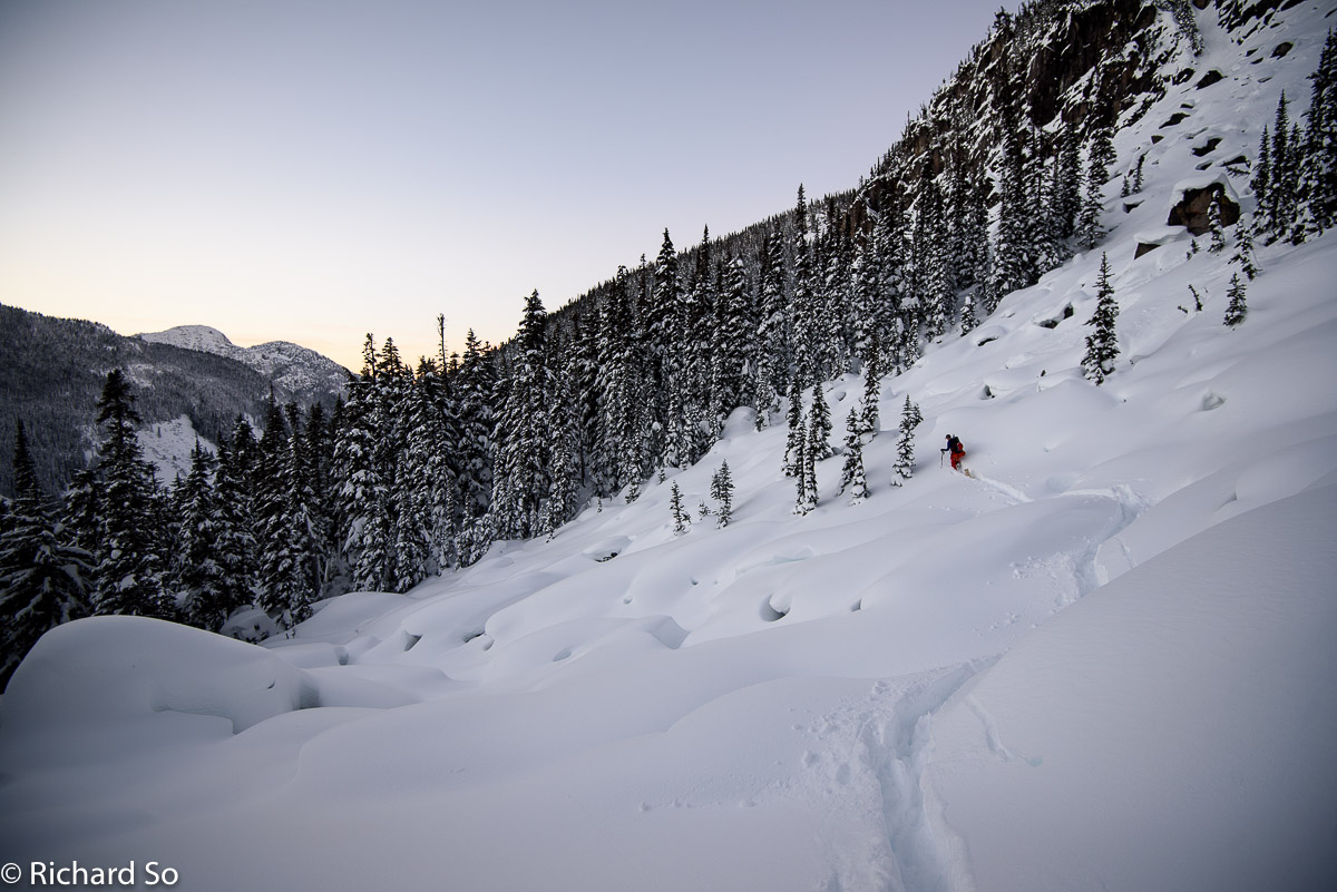
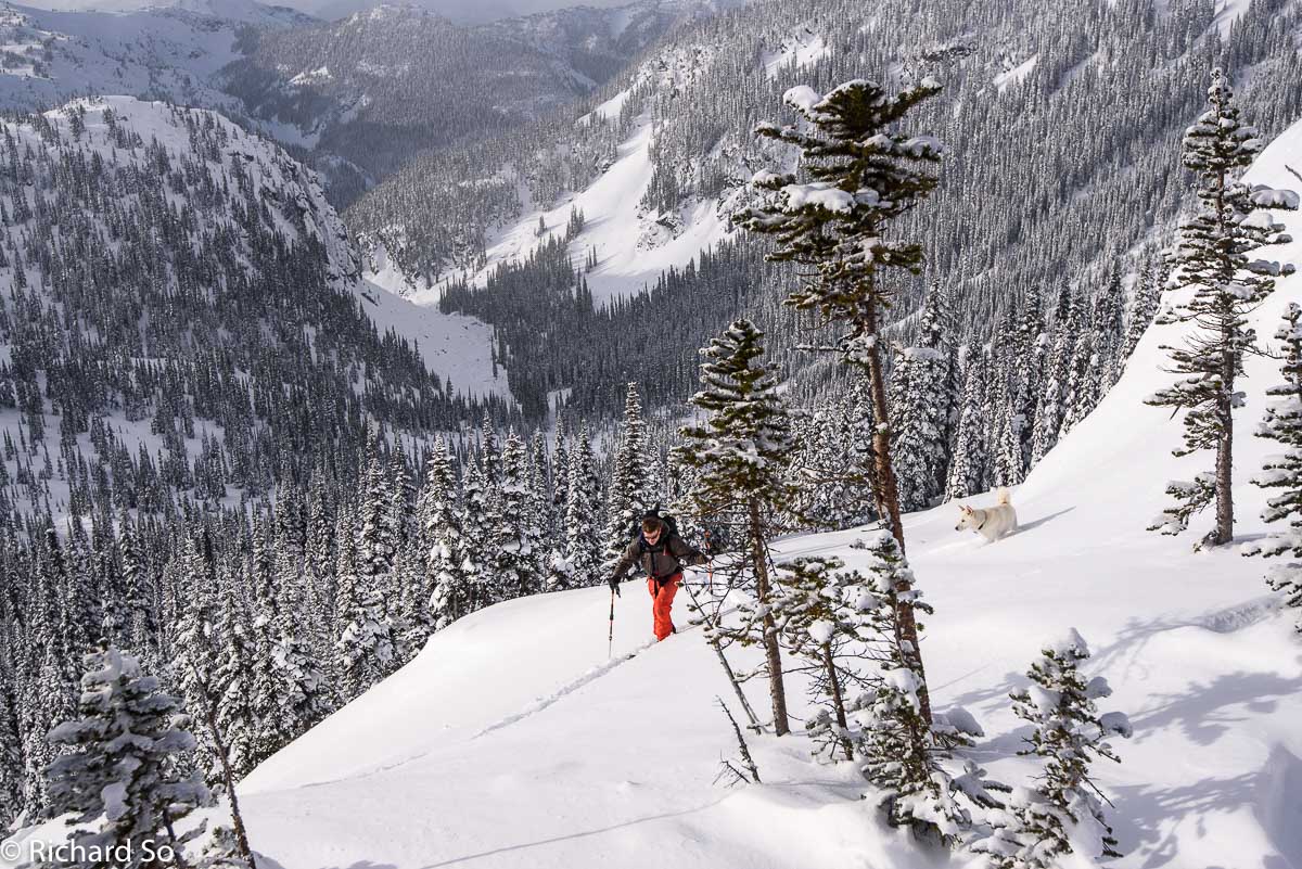
Contouring towards the Gates of Shangri-La, not obvious in this photo. It’s the set of cliffs above Greg. Once you hit these boulder fields, you should stay near the bottom edge, as you don’t need to skin too hard above the creek draining out of the Gates. Just contour across.
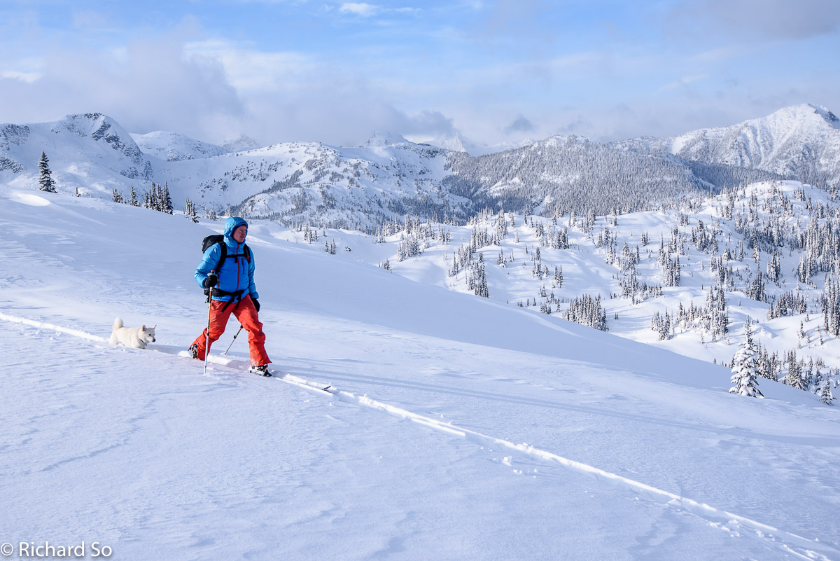
Greg skinning up through the Gates. The light was fading, but no headlamps were needed. After seven hours of travel, we arrived at the cabin. There was no trail above the lake to follow, so it was slower than what is possible. Expect to take at least six to ten hours to reach the cabin, depending on travel conditions.
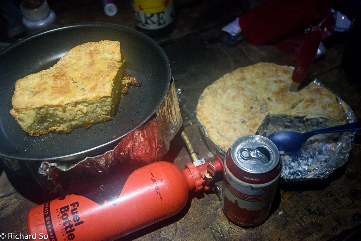
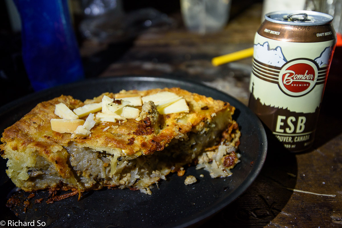
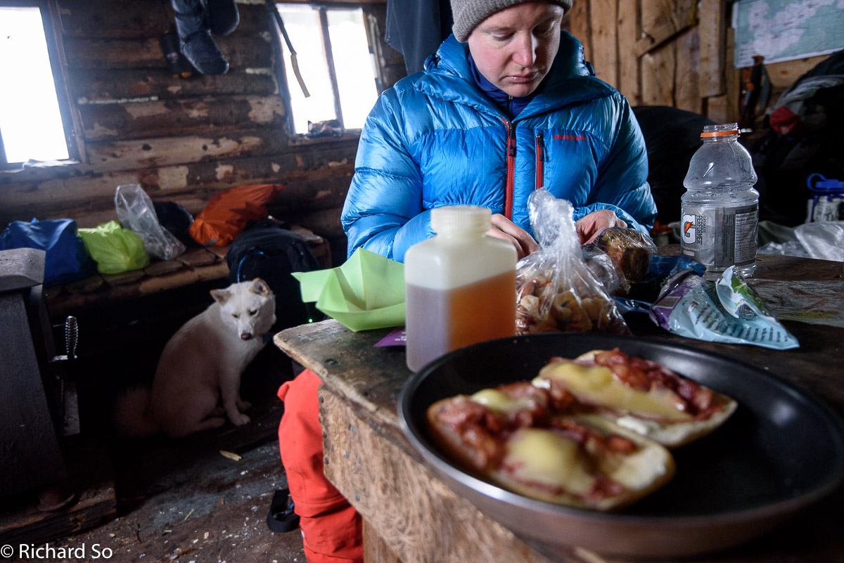
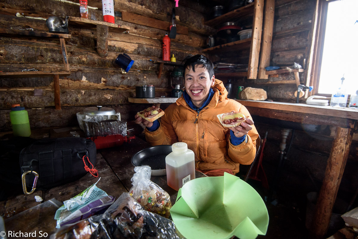
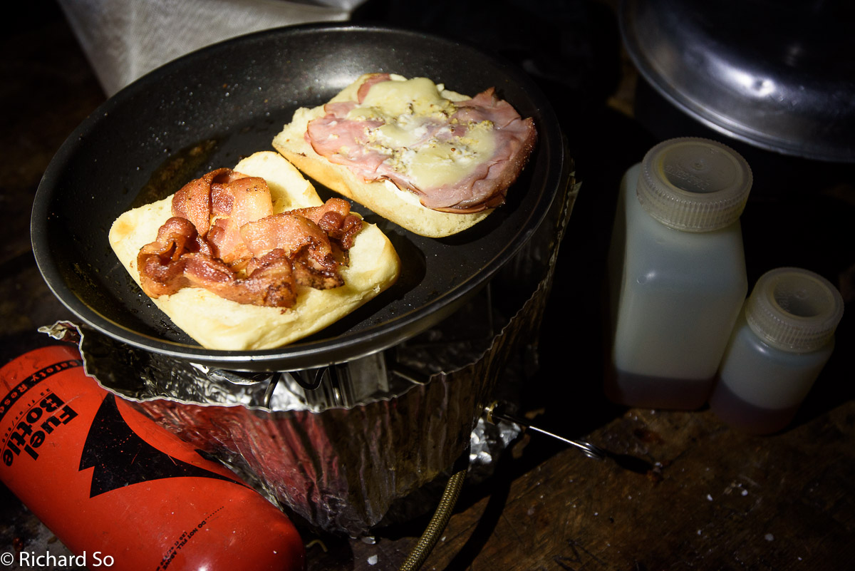
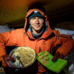
This was not a fast and light trip, so I felt ok with bringing the oven along. This also simplified my dinner plan. For each of the three nights up here, I enjoyed one-third of my homemade tourtiere – ground pork, potatoes, onions in a cheese crust. For extra calories, I added coconut oil to the pan while baking. The pie went well with the Bomber ESB and Bomber IPA that I also carried up. Unfortunately, nobody else was in attendance at the Lizzie Creek Cabin edition of the South Coast Pie and Beer Club. Super easy backcountry meal preparation.
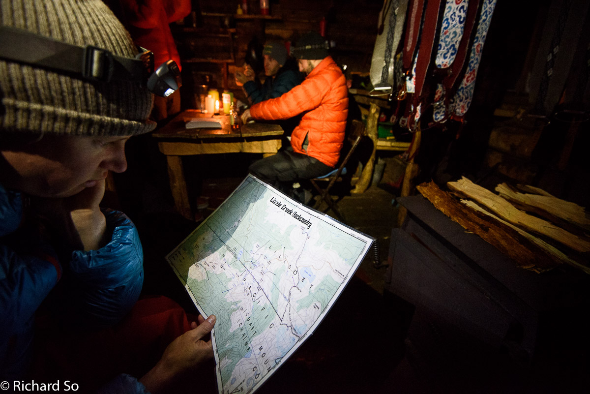
Greg checks out the Lizzie Creek backcountry map, that Dan Durston has created. He has an excellent reference on his website for all the information that you need for the Stein Valley. Here is a link to the .pdf file to browse, to plan your next ski trip into this area (Note. Unfortunately this link is down at the moment, I’ll update when it’s back up again).
You can check out the “tame,” “nice,” and “gnar” lines in the area. Disclaimer: Dan has not skied all these lines and some of them may just be dreamlines from Google Earth. Keep in mind that some of the other roads in the area are heavily overgrown. You may not want to visit Tao Lake until more snow falls.
Dan and his crew were up at the cabin just after Christmas, and we crossed paths just after the creek crossing as he was skiing out. Hey Dan, I never did find your skin track up through the forest.
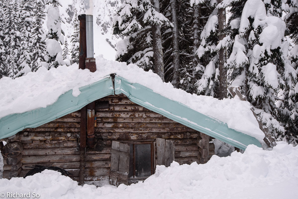
There were five other people staying at the cabin, but they left the next morning. Greg and I kept wondering if anybody else would show up for New Years. It’s hut prime time. The Lizzie Creek Cabin is somewhat comfortable with seven people instead but becomes very tight beyond that. You can sleep six upstairs, and two or three people on the wide benches on the ground floor. Bring a tent though, you’ll likely end up needing it on the first day if you don’t make it to the hut, and the hut isn’t exactly a spacious palace either.
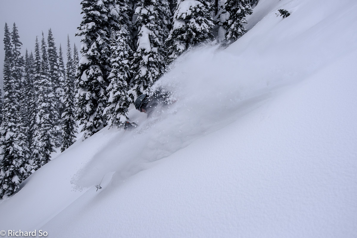
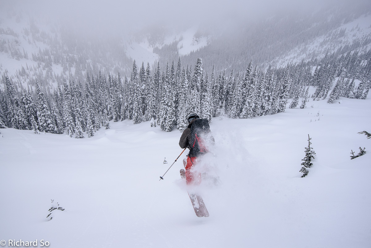
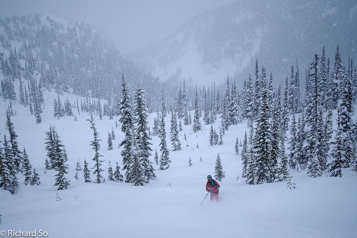
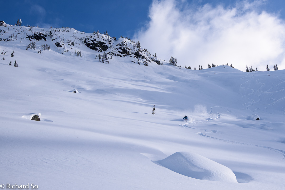
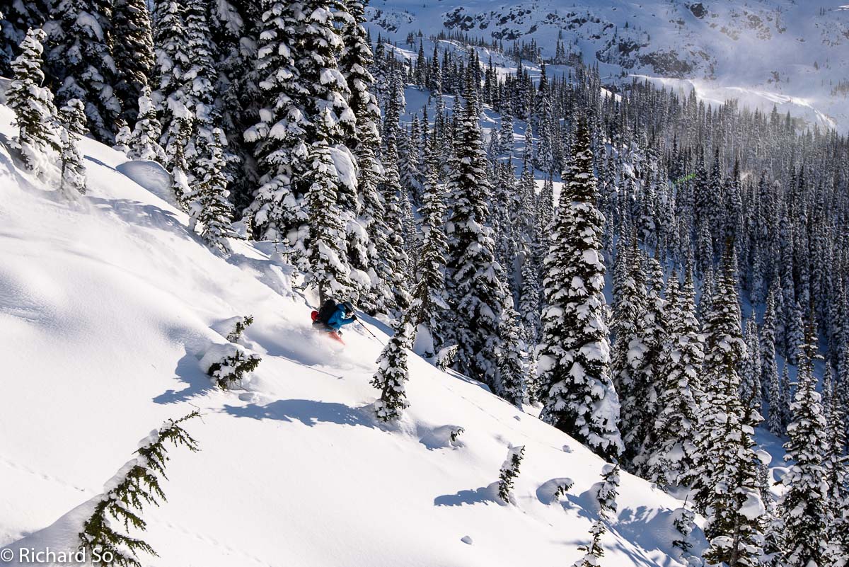
We skinned up to Intern Ridge, where we found some more short, but good skiing back down to the cabin. The best terrain to ski when the visibility is poor is the stuff off White Lupine Ridge, Unfortunately, those south facing avalanche paths were getting crusty so we avoided them today. Daytime temperatures were around -10C to -13C. On the coldest morning, it was down to -18C.
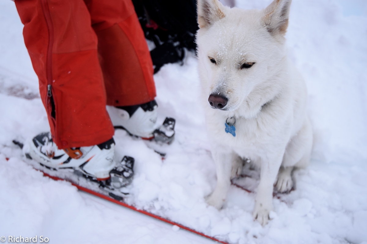
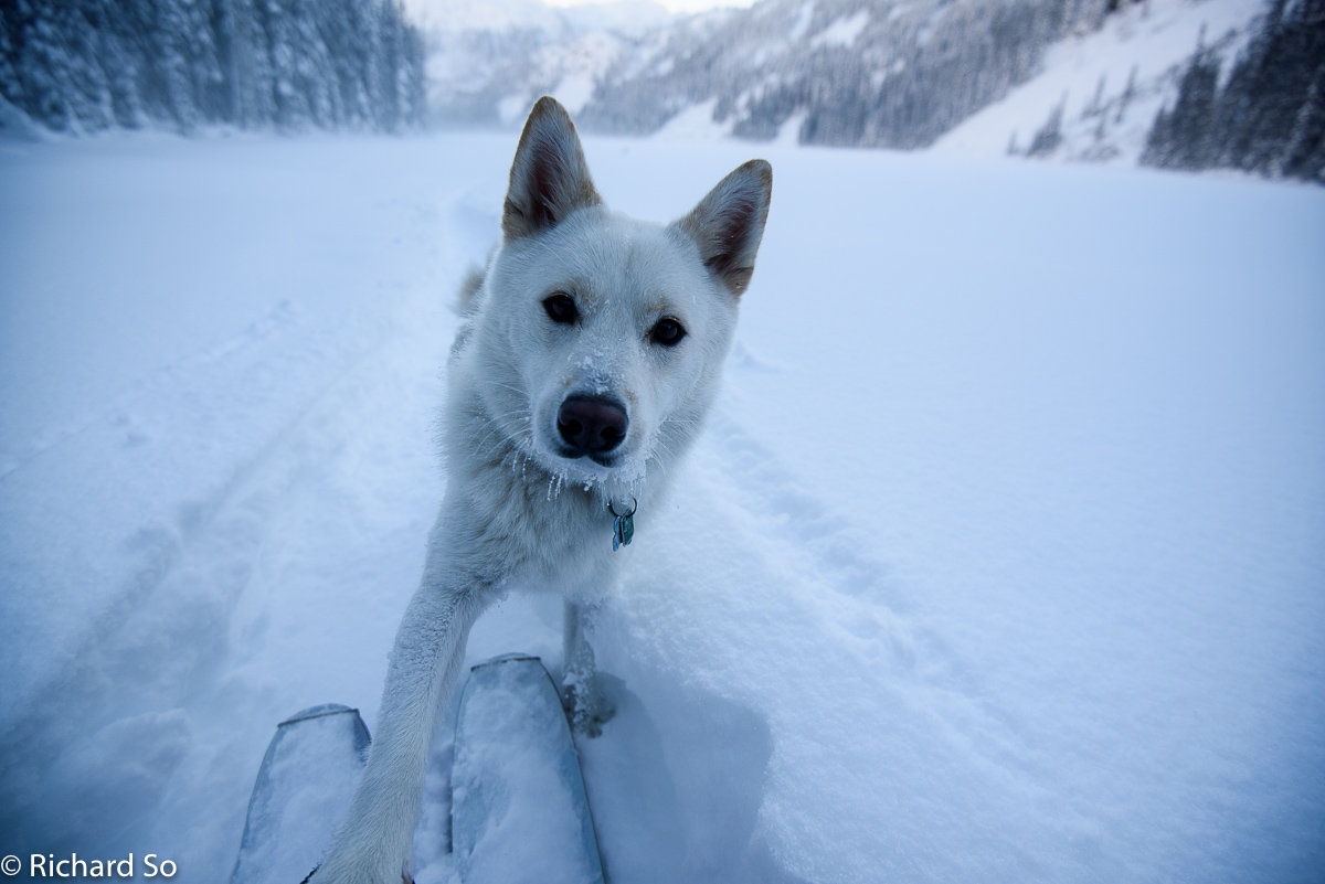
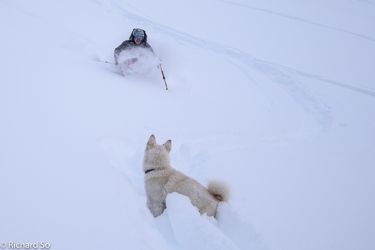
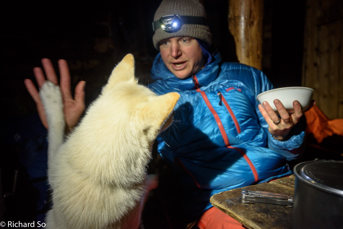
Chilko Bear, wondering when he can go back to his warm apartment. This was actually Chilko’s first overnight trip, and we thought a four-day trip, somewhat far away, with forecasted cold temperatures in a drafty cabin would be a good trial run. The original plan actually involved three nights in a sil-tarp snow trench.
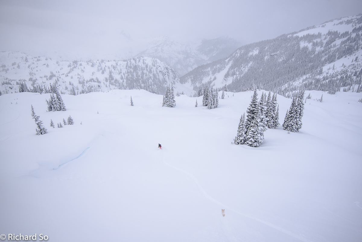
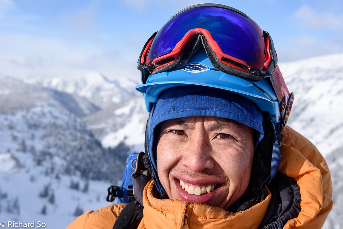
The snow is usually good for skiing, or good for peak bagging, rarely both up at Lizzie Creek. This time, it was all about the skiing. Due to some strong winds later, we never made it to any significant high point. Based on Greg’s facial expression here, he was completely fine with that.

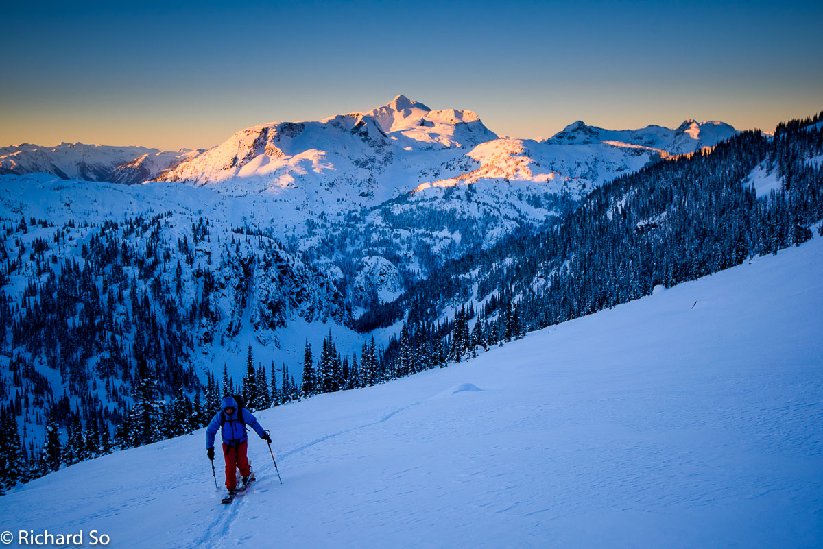
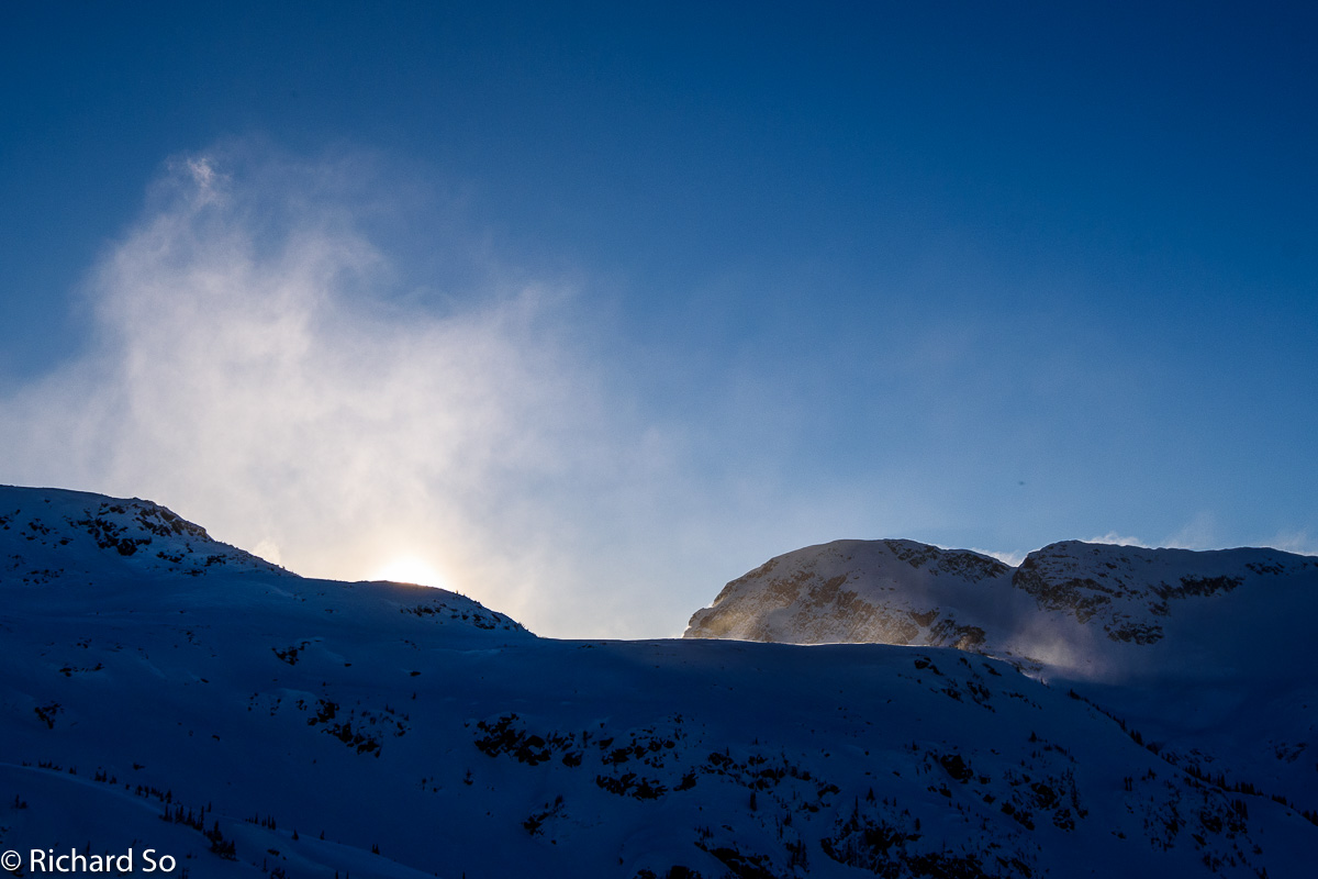
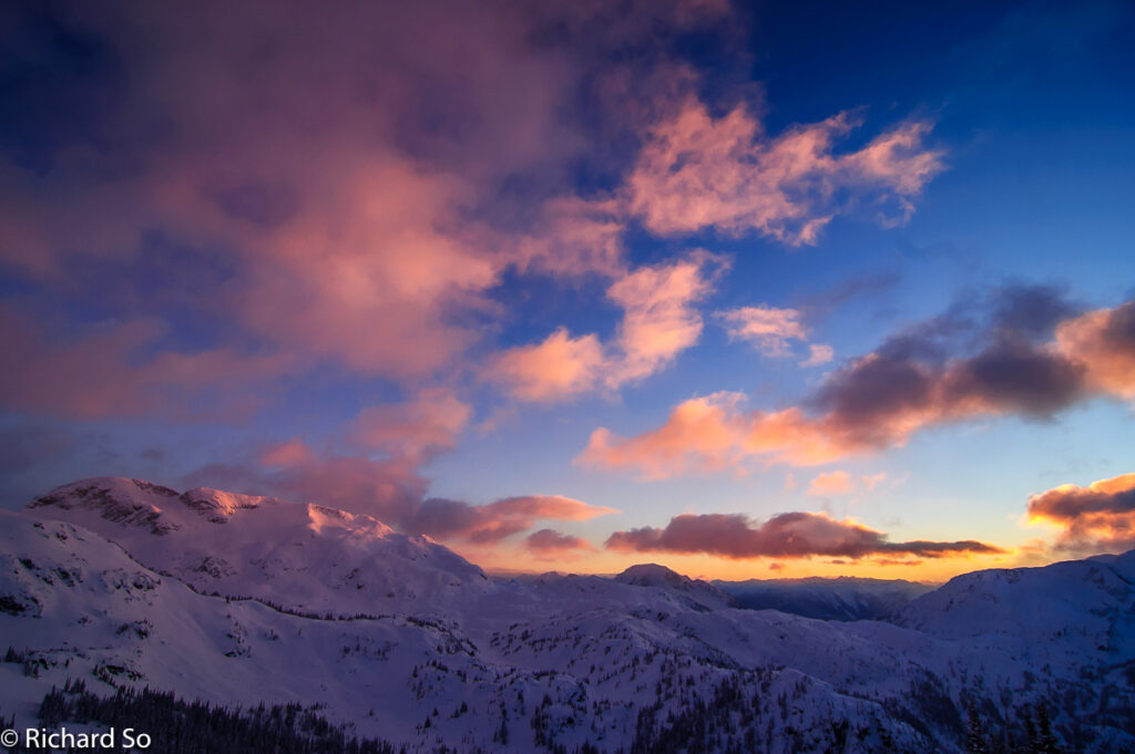
On the third day of the trip, the weather was looking better. It was windy that night, and we heard the sounds of the trees blowing around, and the snow bombs crashing onto the cabin roof. We decided to venture into the alpine, which was a bad idea given how cold and windy it turned out to be. It wasn’t so bad crossing Long Lake, but the winds picked up as we skinned towards Crystal Tarns. We were hoping to ski the bowl to the south of it. Note that the northwest face of Long Peak does a great job of channeling the northeast outflow winds to the col.
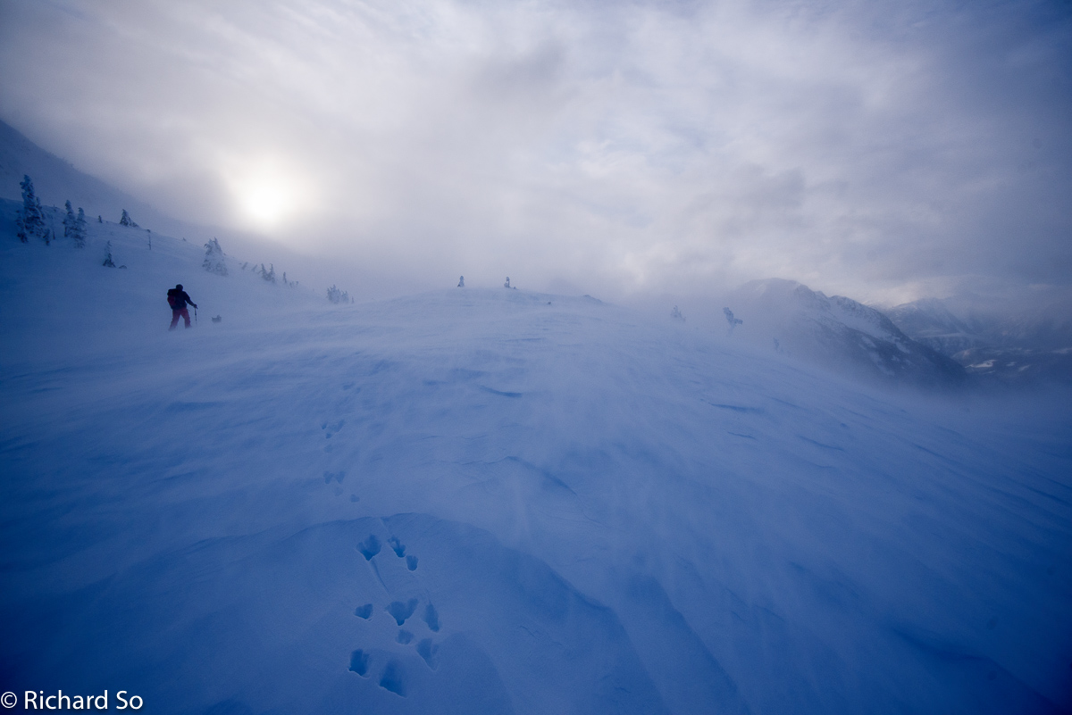
Not sure what the plan was, but we continued to skin towards the area with the least amount of visiblity. The wind was just blowing all the clouds into the Rogers Creek valley. We got to the edge of the bowl. There was no good view of what we thought we were going to ski and we watched the wind whip the snow off the ridge top. We are not skiing there today!
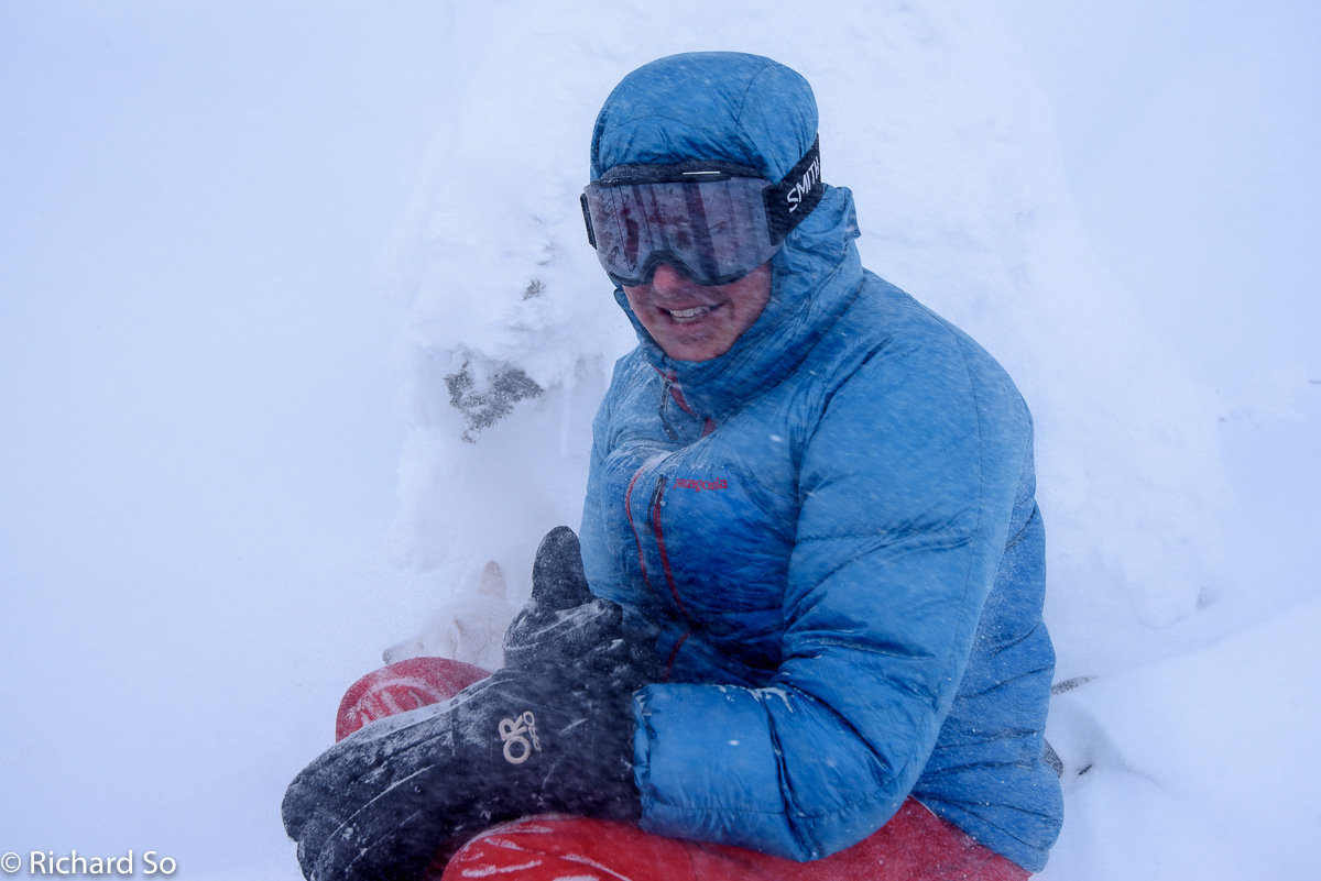
We found a tree to hide behind. The visibility was worse than what this photo shows. The worst part of this was getting down to this slightly sheltered spot. There is a lot of micro terrain in this area, as I discovered last year when we headed out to Cloudraker Mountain. Greg took us on the most classic of downhill skintracks, which involved sidestepping down a steep slope to the col with the wind blasting at us. He’s actually notorious for downhill skintracks, and all our friends end up breaking trail for him instead.
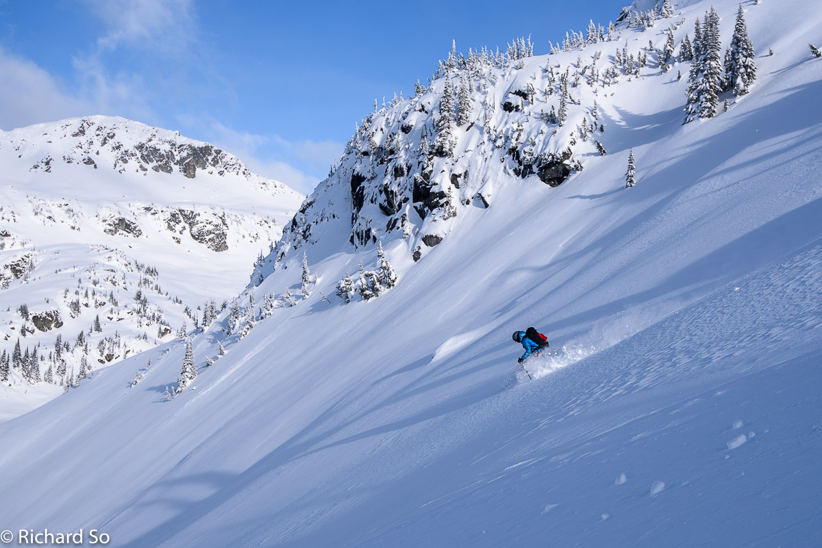
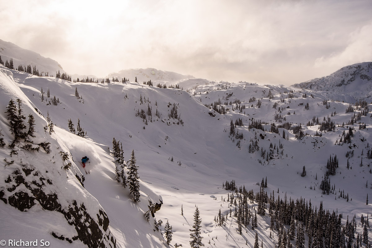
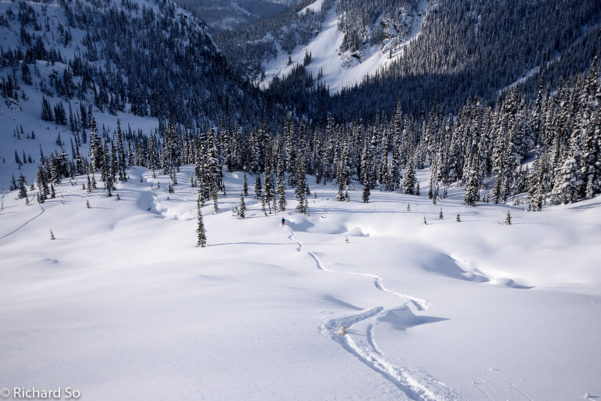
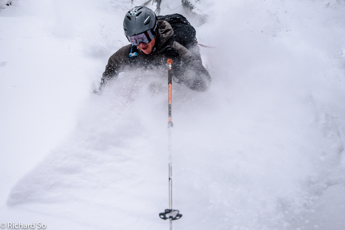
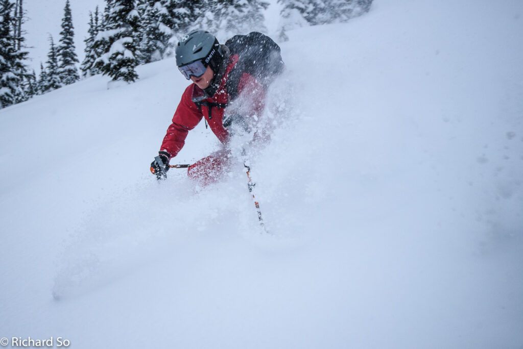
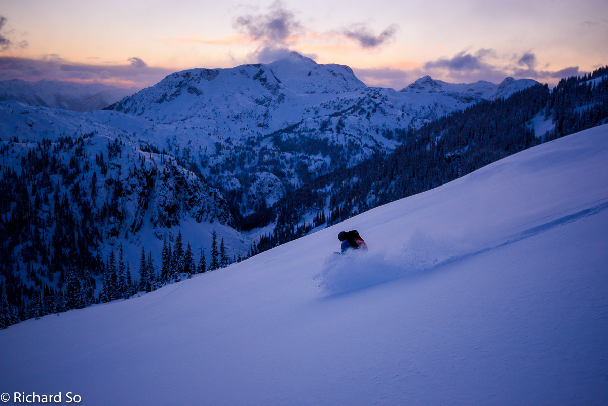
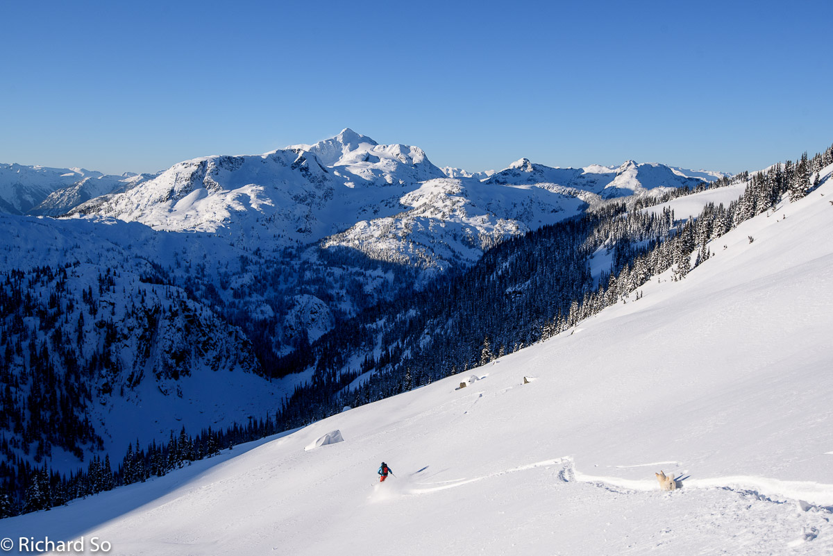
One more run. We decided to follow the steep skintrack up the south facing avalanche path off White Lupine Ridge. We were pretty happy to have this track set in, thanks Dan! It must have been quite the effort. This is 400m of fall line skiing from treeline, or 500m if you go to the ridgetop.
Cloudraker Mountain. My amazing artist friend, Charlie Easton, has painted a few of my photos. This one of them. Check out his select gallery on this website.
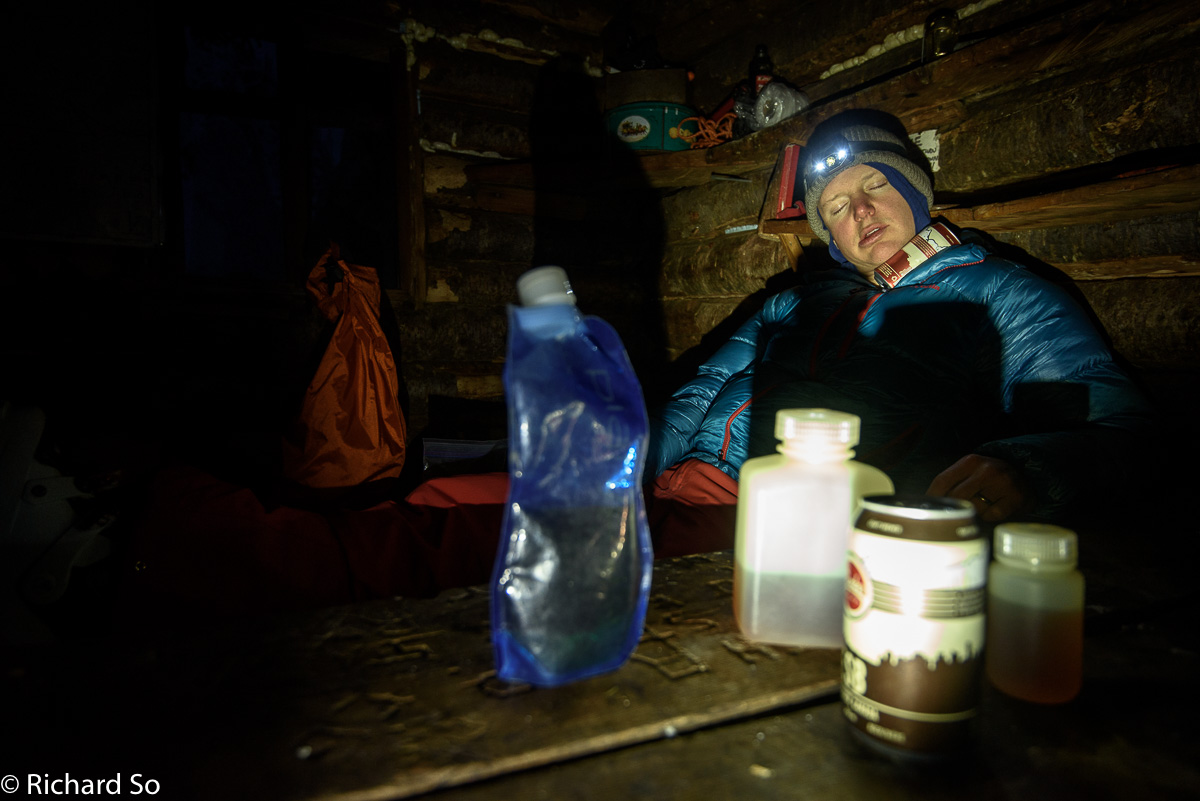
It was another cold night in the Lizzie Creek Cabin. Despite the efforts of the VOC to seal up some of the cracks in the cabin, it’s still cold inside with the wood stove going. It didn’t help that it was -18C outside. With the big puffy on, it was comfortable at -8C inside without the wood stove going. Once we finally got it started, the cabin warmed up to a comfortable -5C. The dusting of snow on the logs that we set ontop of the wood stove to dry out, didn’t even melt. With a limited wood supply, we just had the fire stoked at the end of the evening to give some warmth upstairs.
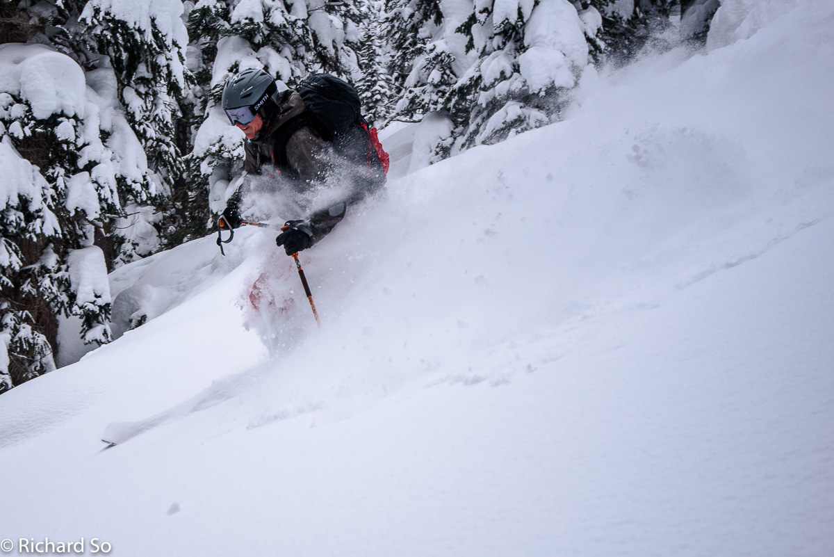
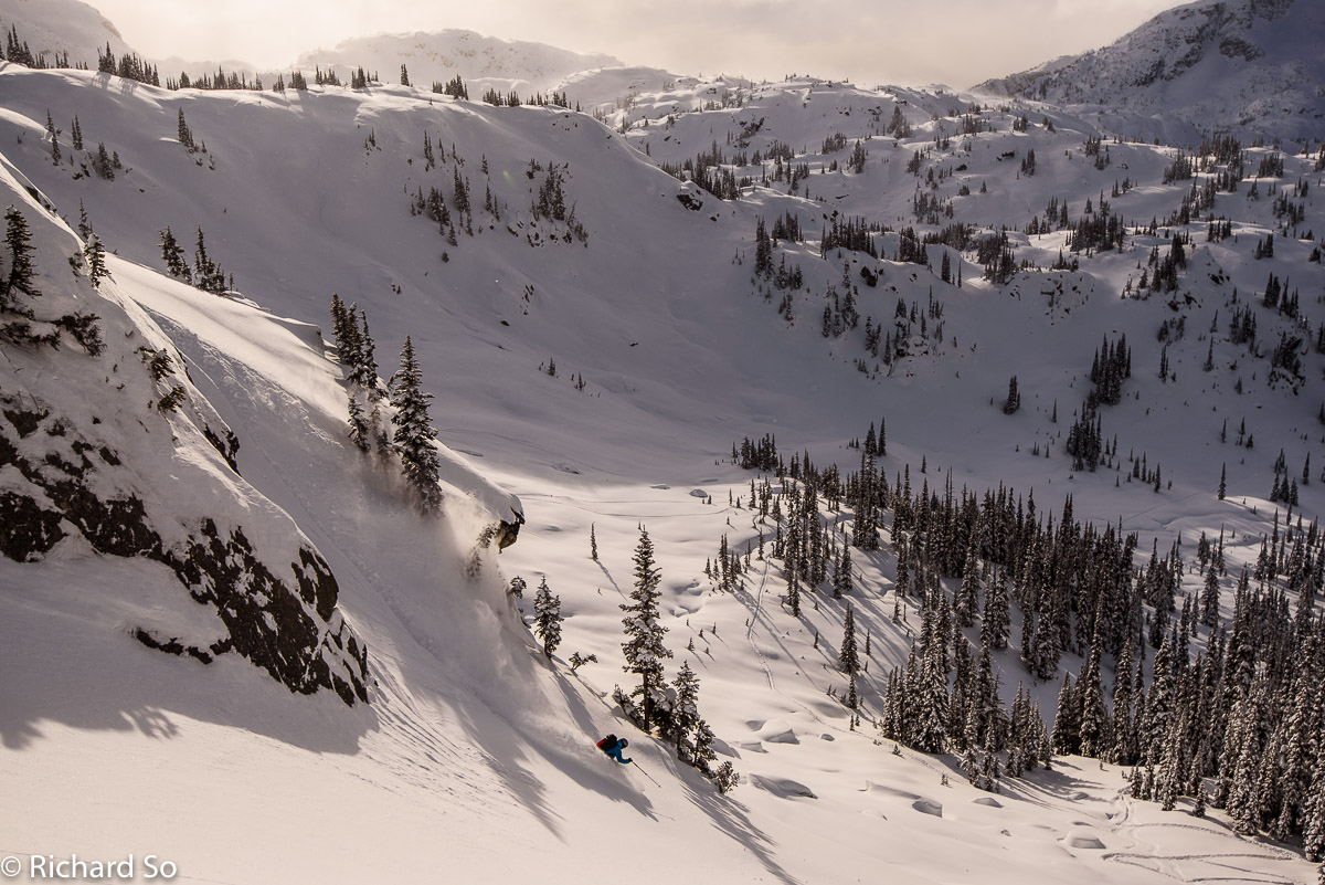
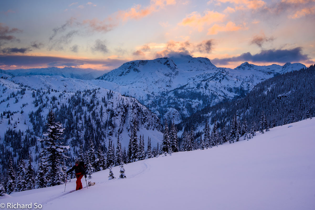
Monday was forecasted to be the coldest day of our trip. The morning temperature outside the cabin was -18C. After Greg thawed out his toes, we were out of the cabin before sunrise, back up to White Lupine Ridge.
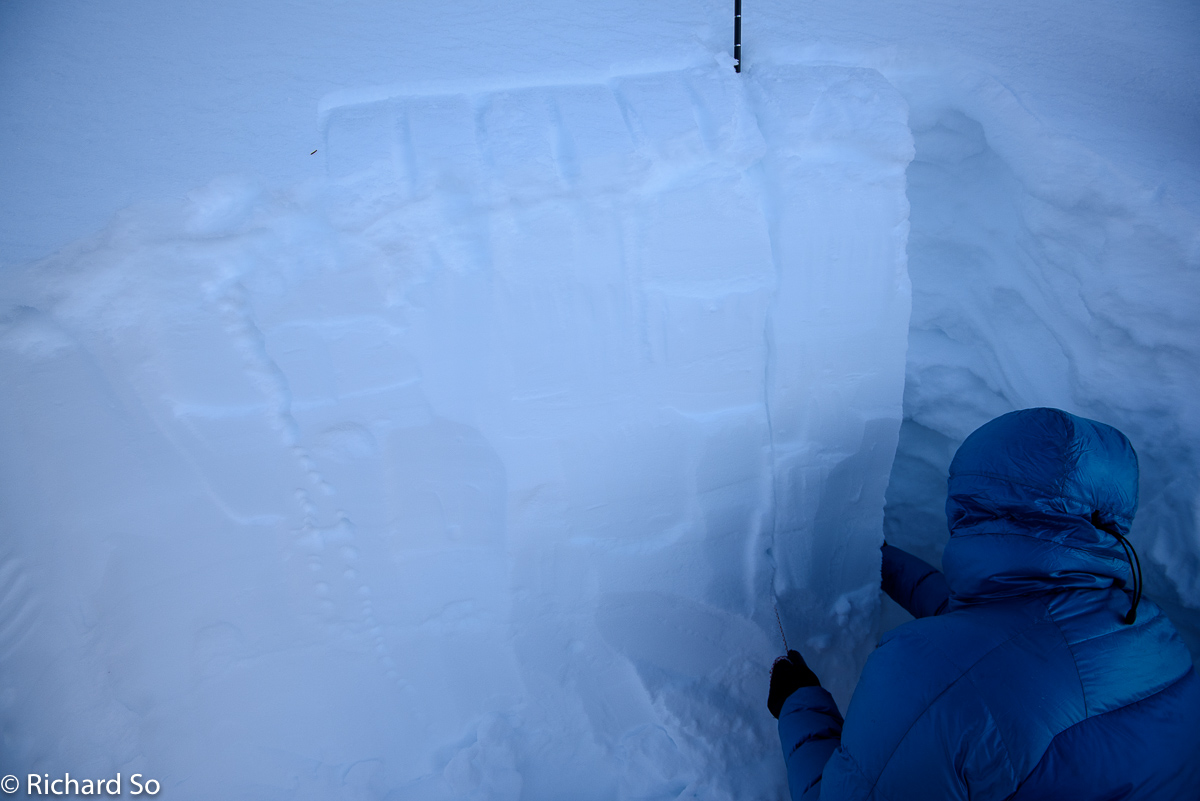
It would have been nice to get up to the ridge top, but we took a look at the snowpack, thought about the reverse loading from the northerly winds onto the south aspects. We decided not to go to the top, and just ski from treeline.
We headed back to the cabin, packed up, cleaned up the cabin and headed out by noon. The ski out was uneventful. Downski ski-bushwhacking is far easier than the alternative.
This is as bad as the alder got on the upper road. There were a few sections on the lower road where the alder seemed to have a mind of its own, and did an annoying job of grabbing me, and pulling me down into the snow. Thanks to the brushing efforts, there are only a few spots like that now.
Walking through the forest on the upper bypass trail. With all the effort that has gone into the Lizzie Creek access, it was a very fast exit. From the cabin to the car, it was only 3.5 hours at a relaxed pace. There are a few sections of double poling, but it is mostly a slow and long downhill glide along the Lizzie Creek road.
Have fun up there and post a comment if you had fun up there!
More photos at my Flickr Page
My first ski trip to the Lizzie Creek Cabin with the Varsity Outdoors Club for New Years Trip in 2011
Great photos Rich! Thanks for sharing. Also thanks for packing down the skin track on the road so we could glide right out.
The snow was indeed ridiculous – perhaps the deepest I've skied. We didn't get many photos because it was snowing so hard. Looks like it got a lot colder – did you find that big snag we felled near the outside? It took us two evenings to chop that down, but we split lots of wood off and there should be enough wood in that log for the rest of the winter.
Glad you guys tried the new bypass trail. It sure is nice. I was pretty impressed that my buddies Subaru make it up to the entrance (they left a day before us). Huge debt to whomever pick-axed that in. The Stein is getting to be in pretty good shape right now with the new bypass, improved road and then main valley trail project. Might be time to try another Stein traverse speed record attempt.
Yeah that map has some "dreamlines" on it for sure. It's a combination of personal experience, reading other TR's (mostly yours) and dreaming on Google Earth. Maybe I should have put a disclaimer on it – I definitely haven't skied most of those lines. The NW face of Caltha needs to be skied sometime though. I was looking at in April/May last year and it looks like it works. Links to the edit-able map and finished PDF map are below:
http://caltopo.com/m/73B2
https://dandurston.files.wordpress.com/2015/07/lizzie-creek-backcountry-map.pdf
Thanks for beta on ascending to the gates of Shangri-La. I think I see what you mean. I edited the above CalTopo link to add the route you describe (if I understand it correctly). On the way in we tried the south side of the creek but stayed next to the creek since it was dark and we didn't want to start skinning in circles. We made good progress for the first 2/3rds, but it was well after dark and we hit a lot of cliff bands in the upper 1/3 that took us forever. We ended up just dropping into the creek bed for the last 50m of vertical and putting in a super aggressive skin track up that. We were 5 hrs from the lake to the cabin.
On the way out skied down on the North side of the creek. Indeed there are cliff bands here too, and some sections with big timber down, but we lucked upon quite a good line though all that which would have also worked well for ascending.
Kudo's for the Stein traverse last year – that's awesome. I'm going to try my ski traverse/packraft route again this year in April.
https://intocascadia.com/2016/04/13/winter-hard-trip-stein-south-divide/
Nice to meet you there! I guess I shouldn't have been too surprised.
We were originally going to ski to Battleship Lake and then over to Lizzie, but decided rightly that it was better when the trailbreaking was easier! It was definitely cold, even Lizzie lake on the first day was cold! Thanks for the wood!
Did you see Peter and Nicola's FKT from late last summer? Definitely this summer will be great for that.
Thanks for the link to the maps. I'll edit my post and include it up there. Your line on caltopo is basically the route I've taken up both times. The lower part leaving the lake is flat and just crosses those two creeks. I usually just take a compass bearing and go until I hit the open slopes. On my very first ski trip there in 2011, we did take the forest, and ended up skinning up logs by headlamp.
Good luck with the ski traverse! I hope the conditions work out for you, there is some seriously big terrain back there! Let me know if you have any questions before that, I still haven't worked on those photos and trip report from that yet…
Makes sense on the route. I'll try that next time.
Yeah I did see that FKT. Sub 24 hrs from the lower washout is really impressive. Would be good if people post times from the TH at Lizzie Lake too, just in case the road gets re-opened some day.
I sorta tried a Stein FKT in 2012 but the logistics weren't great. Ended up with quite a bit of sleep time (17hrs over 2 nights), but my on-trail time of 26 hrs with an overnight pack and no running has me convinced I could get close to 20 hours with an ultrarunner approach.
2017 isn't the year for me though, as I'm all booked up. Quitting work to ski the Duffey all of April, climb in Squamish in May and then thru-hike the Rockies May-Sept.