Update: South Chilcotin Mountains Park is currently closed due to the Gun Lake wildfire.
“There will be wild mountains, grizzlies, river crossings, black bears, mud, scree, snow, mountain goats, blueberry bushes, mining relics, and alpine lakes. You could also be the first to complete the 100 mile route. All of the routes are extremely remote, so wilderness preparedness is a must.”
An accurate event description by Alex
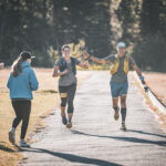
On July 22, 2023, Tim and I were the only ones to attempt the 70 miler route of the Club Fat Ass Pioneer 50k/50m/70m/100m event. Alex organized this event previously in 2020, when all trail races were cancelled, and it seemed like a good time to organize a low-key totally self supported event in the wilderness. No one finished the 100miler course, but a few runners completed over 100km’s of running through this spectacular place. After a two-year hiatus, the event was back, with some slight modification in the courses, cherry picking the very best trails of the Chilcotins.
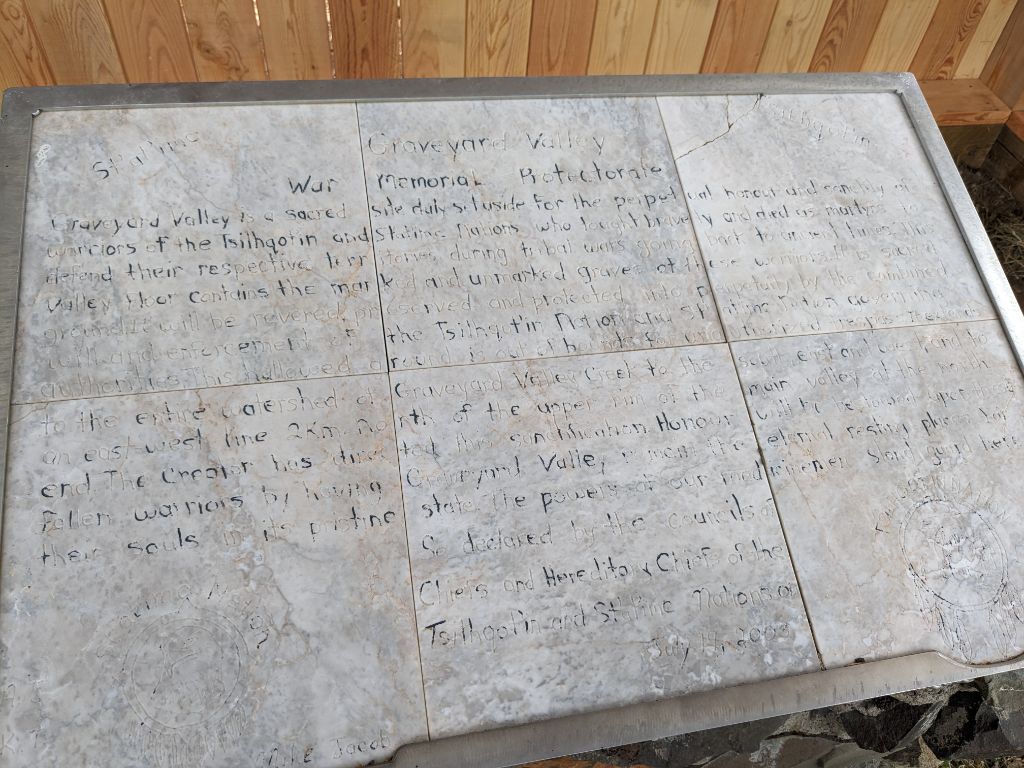
This was the route, running through the traditional territory of the St’át’imc, Tŝilhqot’in and Secwépemc nations. Wild, scenic and remote. Singletrack, double track, no track. Many highpoints, some low points and only one pie point.
Originally, I was planning for the 50miler as a training run for my 100 miler in September (IMTUF), and then maybe the 50km since that’s what everybody else was interested in and a social run is always fun, but then Tim reached out and said he wanted to do the 70miler. As a four time Fat Dog 120 finisher (plus another finish as two-person relay), Tim is no stranger to long endurance events. I just hoped I could keep up with Tim, despite not having done much in the last couple years together. A good opportunity to catch up.
We left North Van on Friday afternoon and drove over the Hurley to camp near Tyaughton Lake. The July forest fire off the south side of Mount Dickson was flaring up, but we hoped the smoke wouldn’t be too bad for the weekend. Meanwhile, Alex had spent Thursday and Friday trail clearing beyond Warner Lake. Most of the course was in a good shape thanks to others, but the Battlement Creek and Denain Creek trails had the most deadfall. This route is also a great fast-packing route if you’re not interested in a single push. Some masochistic people also bike-pack this, although it’s recommended to go the other direction for better bike descents.
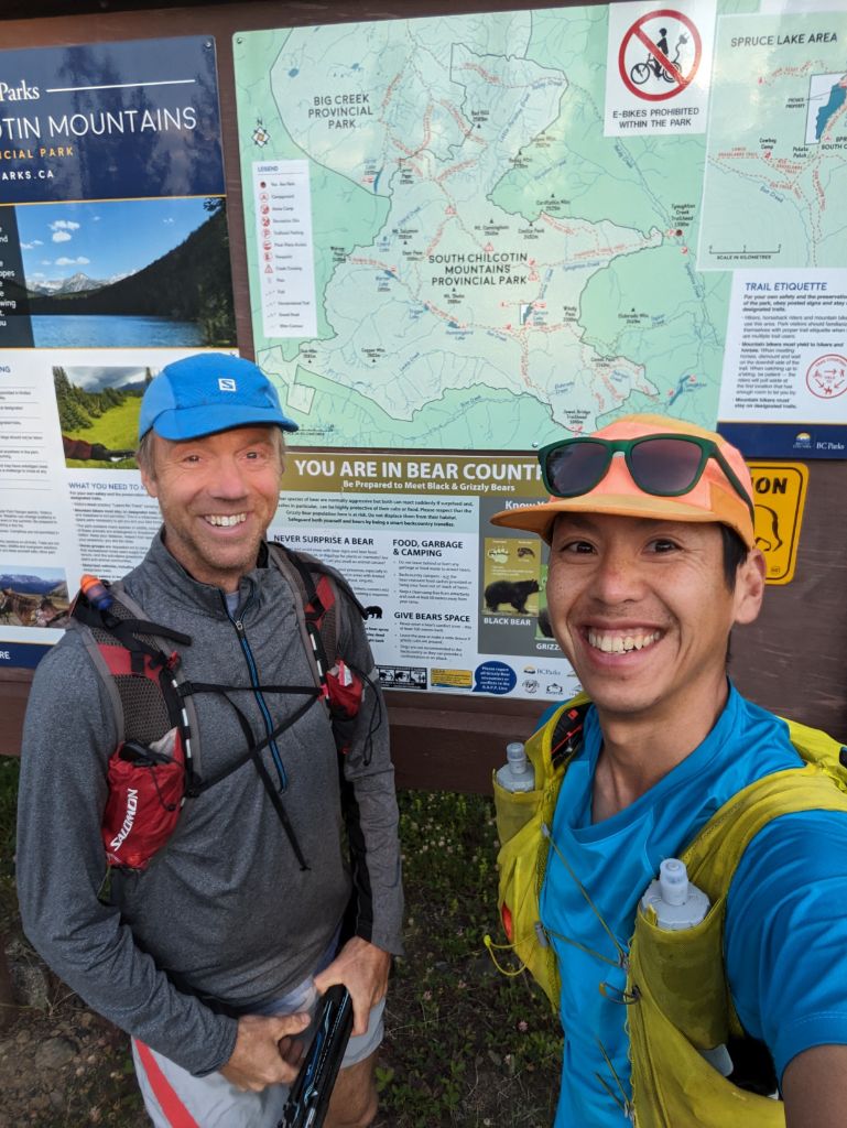
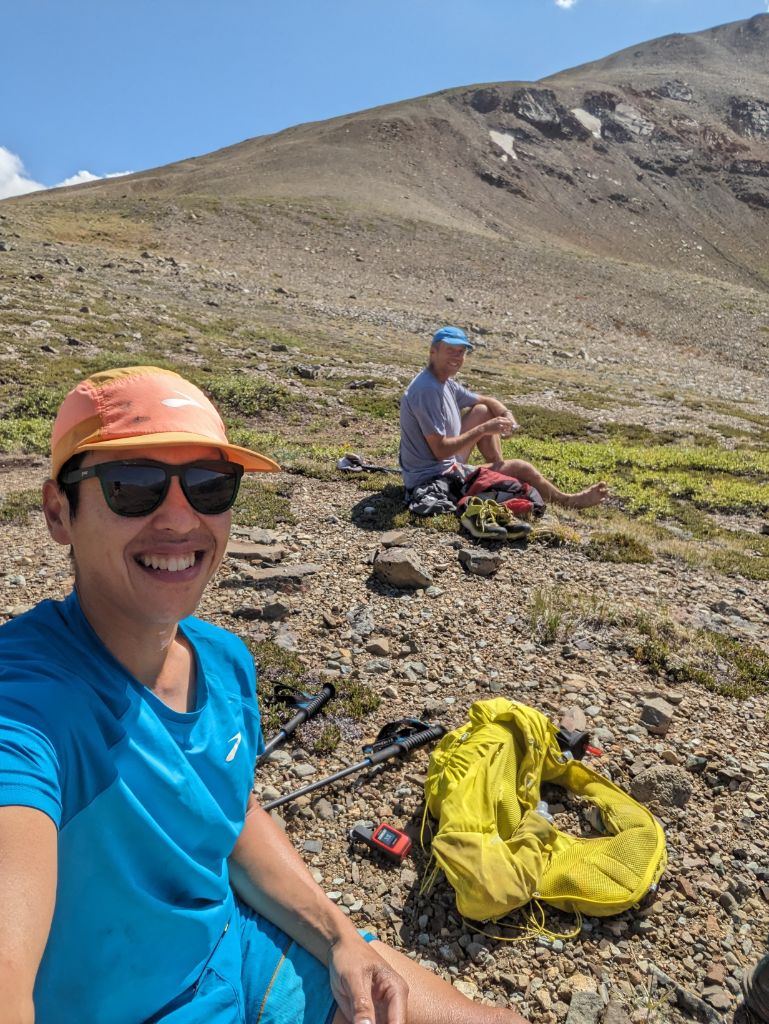
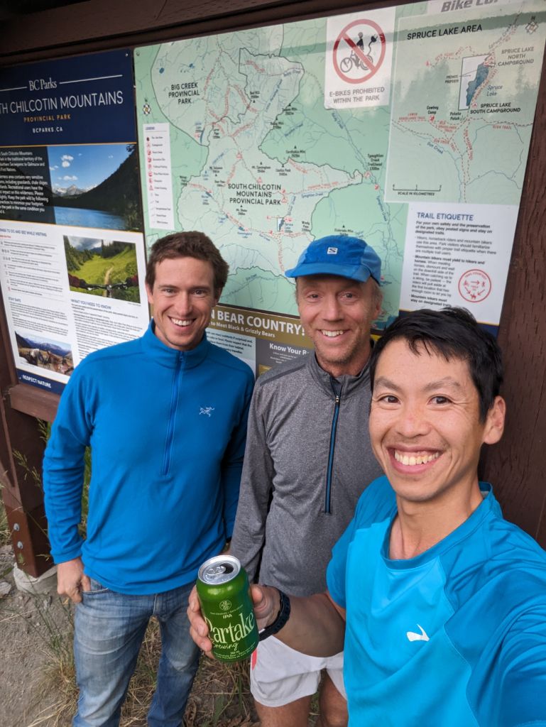
For the shuttle, Tim and I drove two vehicles to the Tyaughton Creek trailhead off the Paradise Creek FSR, the start of our 70miler route. From here, we would run a horseshoe loop to the west and back to Jewel Bridge. The 50k runners (there were six) would finish here, and then drive the vehicles back to the Tyax Lodge, about 30 minute away. I thought if we were really fast, we might finish in 21 hours, which was a 3:30am arrive at Jewel Bridge. Wildly optimistic, but something to aim for. Alex planned to camp at the Jewel Bridge to pick us up, which was very generous of him. My plan was to send occasional updates via my Inreach Mini at the major passes to update Alex on our progress.
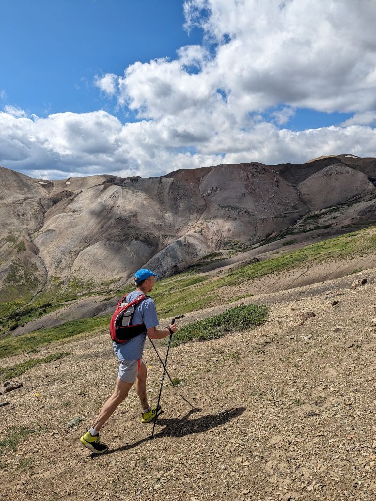
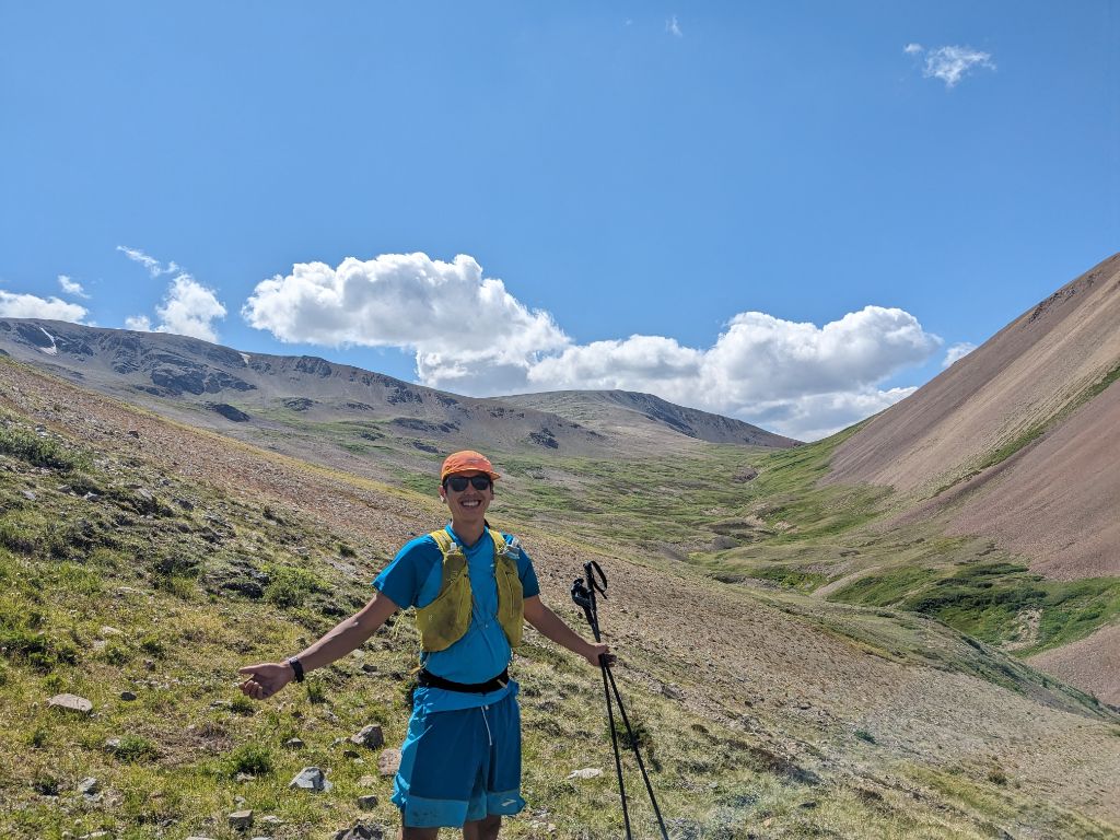
5am alarm followed by a breakfast smoothie and a granola bar and coffee. Then Tim and I drove the cars to the Tyaughton trailhead. We started moving at 6:50am, slightly later than planned but I was glad to get quality sleep. Since this was a fully self-supported run, without any aid station and far from help, my pack was loaded down with 4500 calories in the form of Tailwind powder, gels, shotblocks, Honey stinger waffles, bars, and a pie. The event was named Pioneer, I debated whether the weight/low calorie density of a pie was suitable for this trip (approx. 2.5-3 calories/gram), but the savoury qualities of the quiche was a winner when I got tired of sugars later on, and I have a big sweet tooth. I also carried bear spray, this is grizzly country after all. Without the Tyax air traffic this summer, increased wildlife encounters seemed likely. I brought a Salomon XA filter with 3x 500mL flask. Water is plentiful from snowmelt in July, and I rarely carried more than a litre at a time. Poles (BD Distance FLZ) were essential for all the powerwalking and river crossings to come. Other things in my pack were: emergency bivy sack, stripped down first aid kit, Inreach Mini, windbreaker, long sleeve, gloves, paper map, sunscreen. Since I had so much stuff in my pack, I also used a Naked belt to distribute the weight lower, and also not to blow out my zipper.
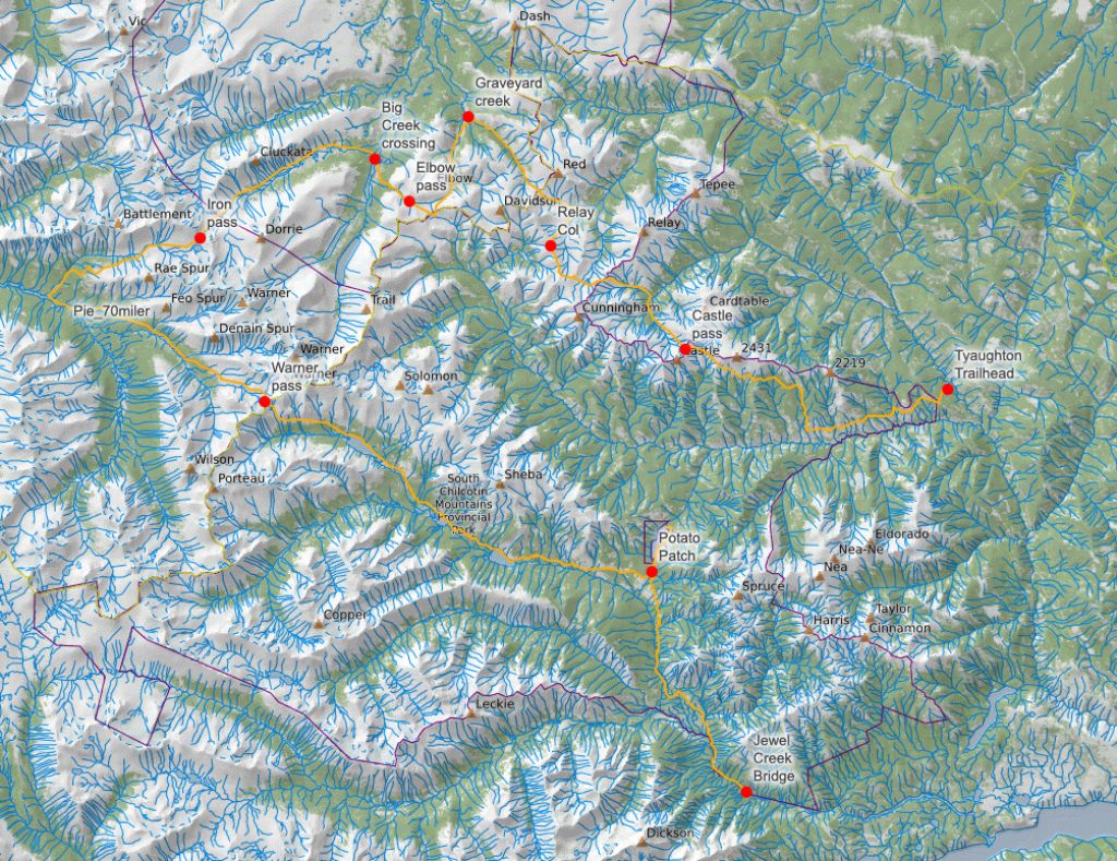
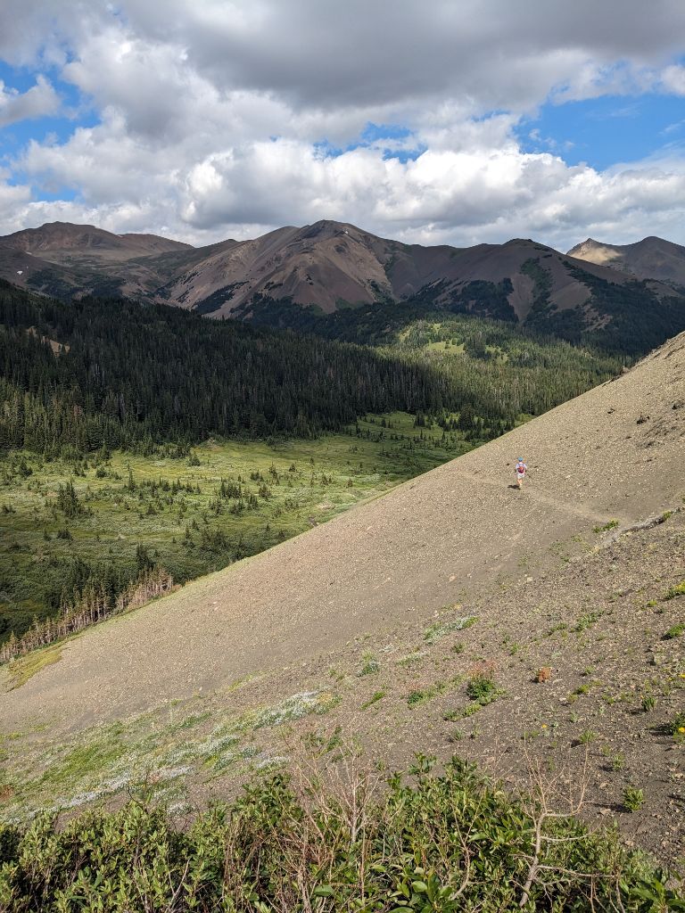
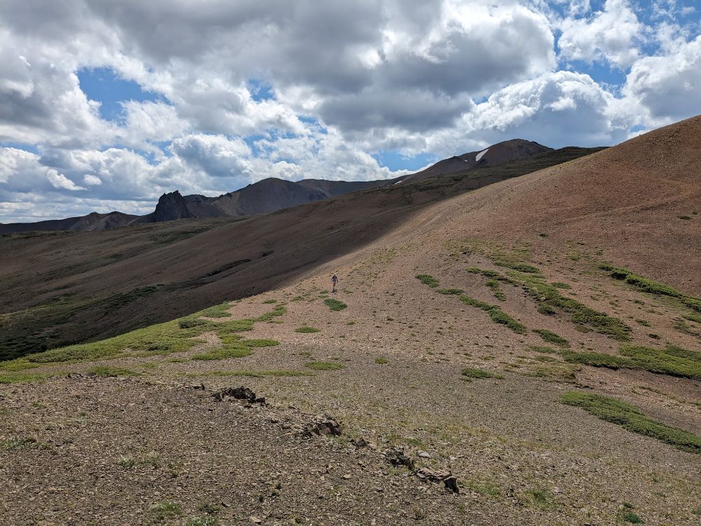
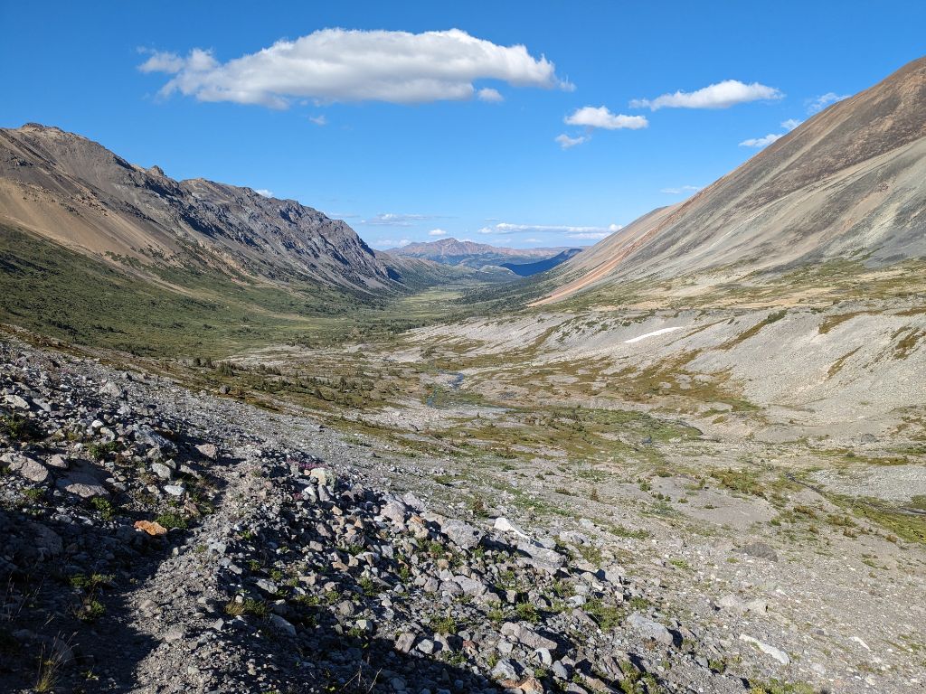
Leg 1: Tyaughton Trailhead to Castle Pass – 0 to 17km (17km)
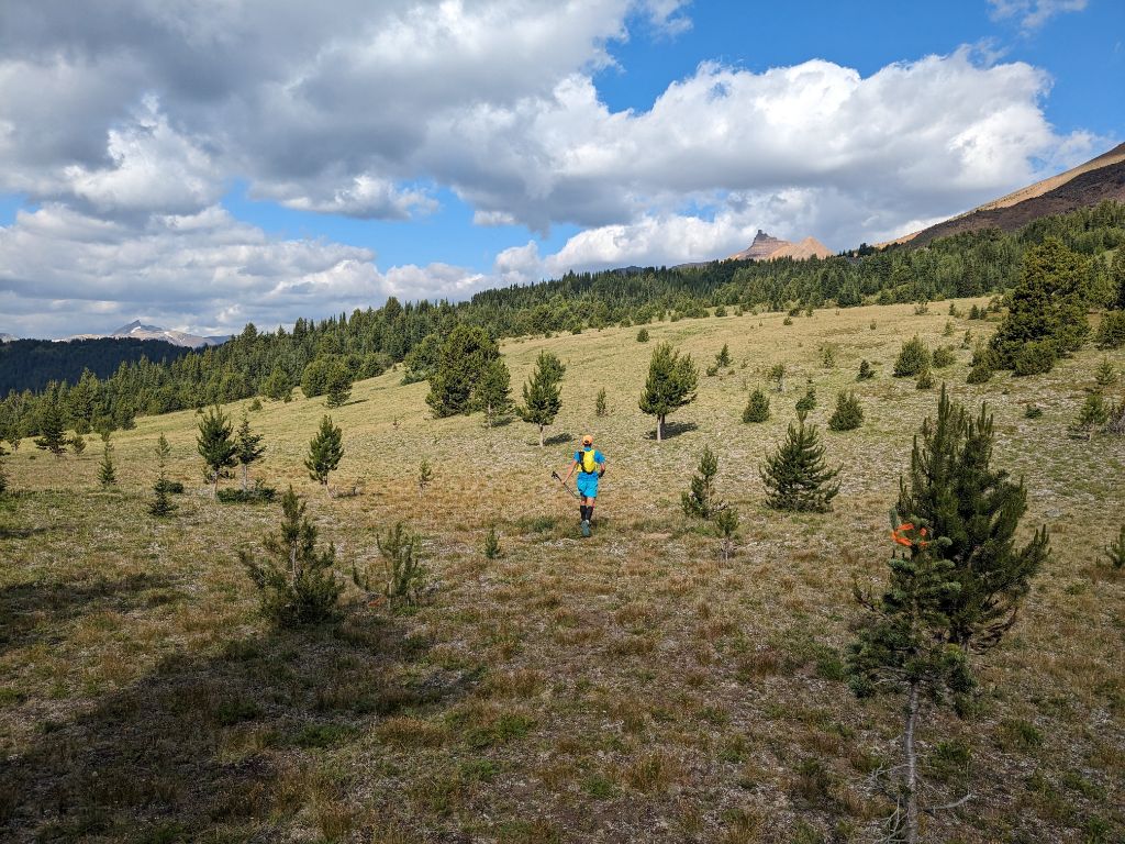
We started with a short climb, followed by a runnable stretch along the Tyaughton Creek trail until the turnoff to the Castle Pass trail at 8km. The route passes through gorgeous sub-alpine meadows below Fortress Ridge, with the distinct castle-like shape of Castle Peak and Castle Pass beyond. This was my first time in this part of the Chilcotins, and I was loving it. We made it to Castle Pass at 10am. Pacing and fueling are key for these endurance events, and my plan was roughly 200 calories and 500ml of water every hour. Normally in an ultra, you can get away with gels while running, and then get real food at the aid stations but going self-supported was a different thing.
Leg 2: Castle Pass to Little Graveyard Pass via Relay Col – 17-32km (15km)
The trail gets indistinct down in the Paradise Creek valley after Castle Pass, but it wasn’t too hard to find the turnoff up the North Fork of Paradise Creek, leading to the Relay col. We bumped in a group of parents and kids from Revelstoke here, on their way out for a couple nights in the woods.
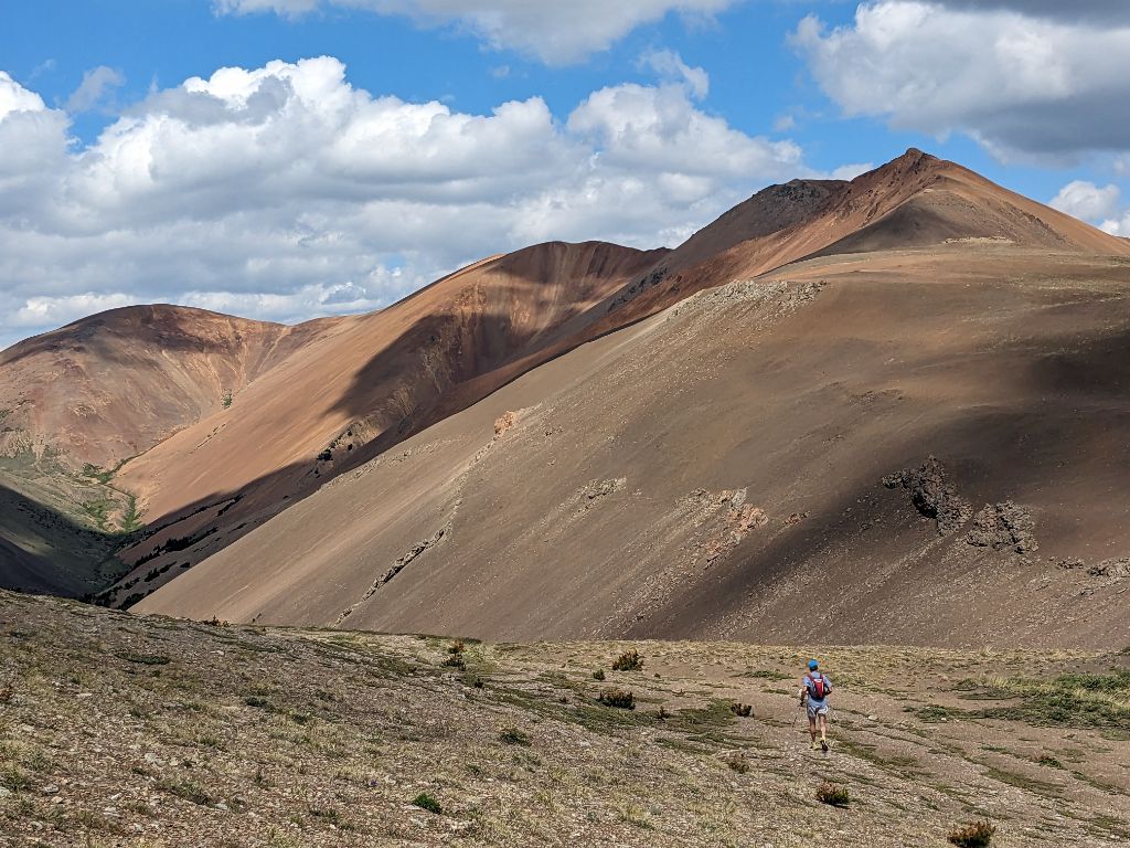
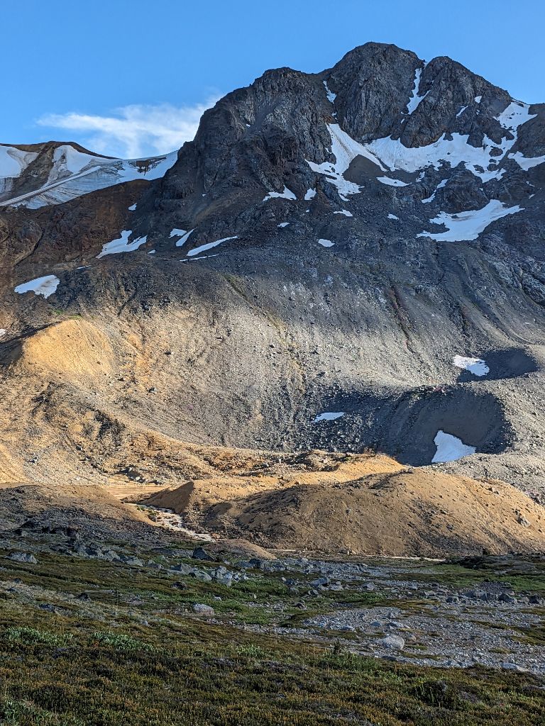
The Relay col and Relay ridge section is somewhat vague in my memory, but the trail just follows the ridge, running along open scree slopes, until an obvious decision point – west down Manson Creek, northwest along the Tyoax Pass trail, or northeast down Little Paradise Creek. Alex set a cutoff of 3pm for Relay col, and we reached the junction around 12pm. The fastest way to Elbow Pass is via Tyoax Pass, contouring the scree slopes of Mount Davidson, which Tim had hiked with his family two years ago when they came in from Relay Creek on route to the Dil-Dil plateau. There’s no wrong way. But the Pioneer 70 route dropped us in Little Paradise Creek, back up to Little Graveyard Pass, down Little Graveyard Creek and then back up Graveyard Creek. A more scenic tour of the lesser travelled trails.
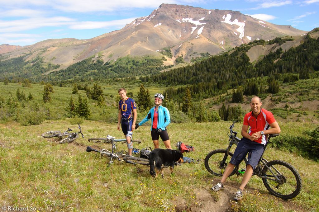
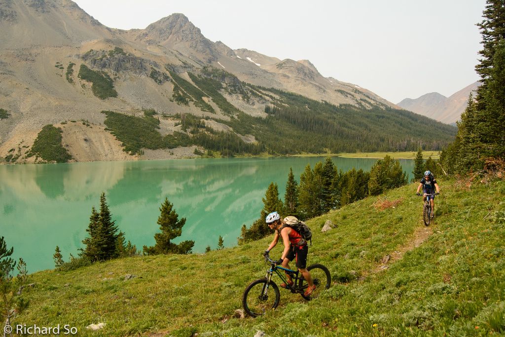
I’ve spent very little time in this part of the Chilcotins. The last time was over a decade ago, on my very first bike trip to the Chilcotins with Alex Maddy and Cam, when we rode up Little Paradise Creek. Photo below is from a long time ago, on my first ever bike trip to the Chilcotins with Alex, Maddy and Cam, we tried to bike up Little Paradise Creek from Relay Creek. We didn’t get very far though.
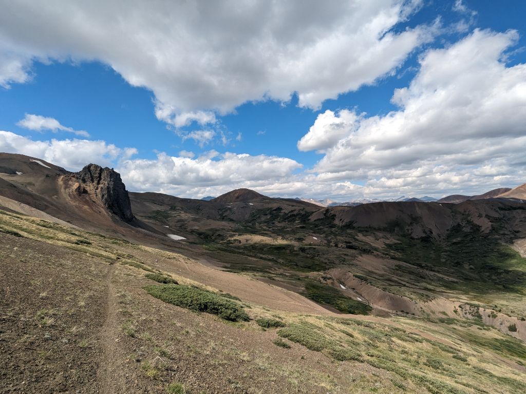
We passed a small tarn just south of Little Graveyard Pass, that would make for a fantastic campsite. It felt like walking up through a Windows wallpaper as we approached the grassy narrow col.
Leg 3: Little Graveyard Pass to Elbow Pass via Graveyard Creek – 32-43km (11km)
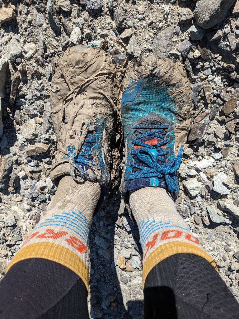
The upper half of the Little Graveyard Pass trail was good, but soon we were doing some minor bushwhacking through blueberry bushes, and walking through the blueberry bushes, losing the trail here and there, and also trying to keep our feet dry stepping around some of the wetter muddier parts. We took a stretch break partway down, Tim’s legs were tight, and I didn’t mind a break to eat my bars, which I found harder to chew, at our current pace. The downhills are never long enough to open up and stride out, we were always just shuffling along.
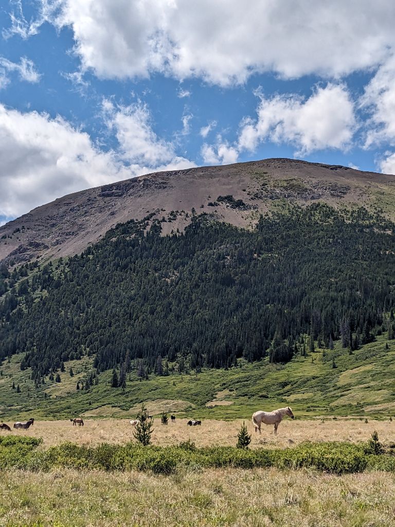
We reached the Graveyard Creek junction at 2pm, where a large number of St’át’imc and Tŝilhqot’in Nation citizens were gathered for a commemorative peace ceremony in this sacred valley. They would be the last people we talked with for the rest of our run. We walked past all their horses grazing in the valley.
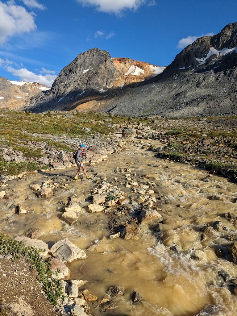
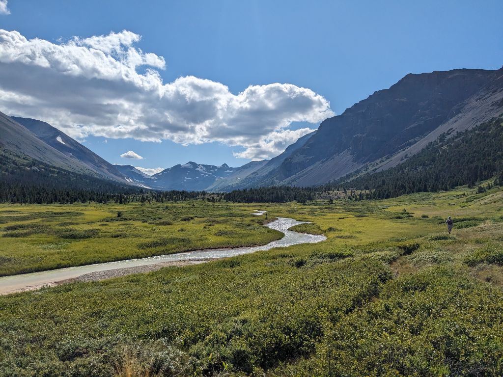
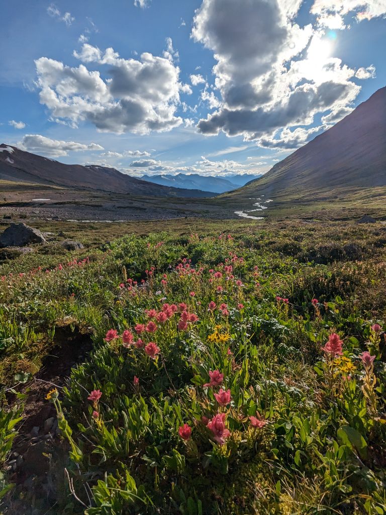
At this point in the afternoon, the forecasted winds picked up, as we ultra-shuffled our way up the flat valley. If it wasn’t so windy, this might feel like an easy jog, but that’s not how I was feeling as we tried to eat up the easy miles. The climb up to Elbow Pass did not feel easy, but the views of Elbow Mountain and beyond made up for it. I made sure to keep on fueling, keeping an eye on my watch for the time since my last snack. Ideally, fuelling every 15 minutes. We stopped to dry out our feet at Elbow Pass, although it might be futile since a wet creek/swamp crossing is never far off when travelling in the Chilcotins, with Big Creek below us.
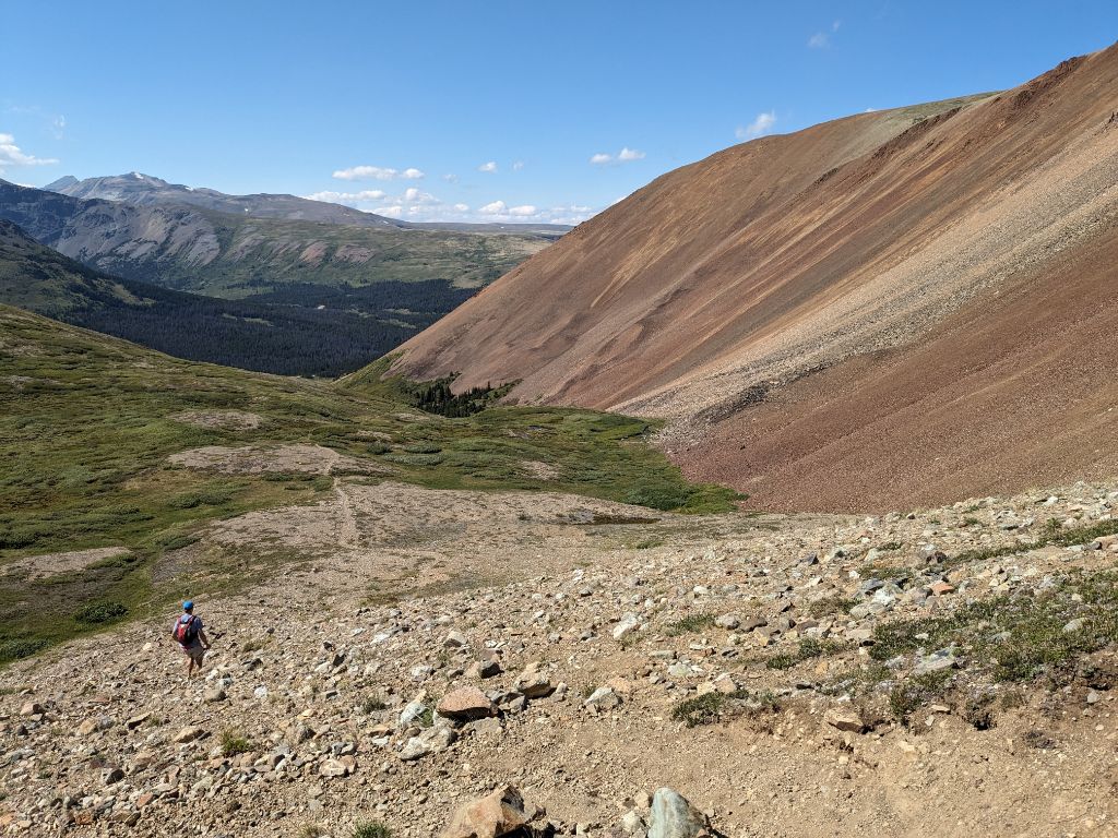
Leg 4: Elbow Pass to Iron Pass – 43-56km (13km)
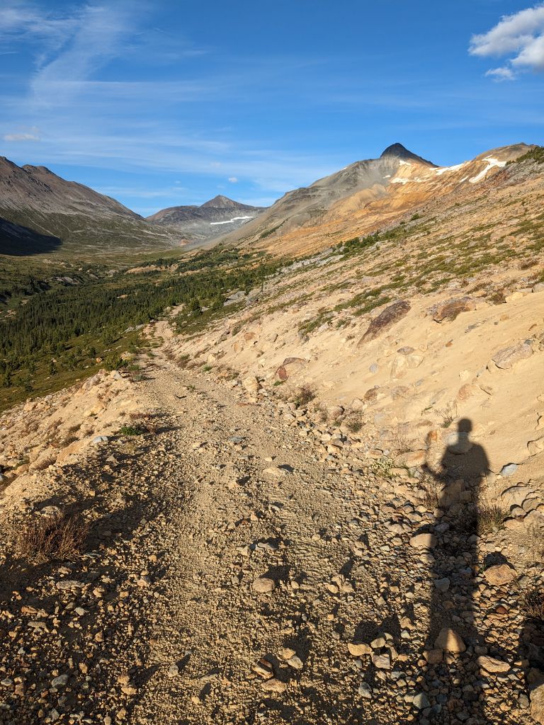
We descended the Elbow Pass trail down to Big Creek. All trails are referenced as labelled on the Chilcotins map (an essential map for the area), there are no trail markers anywhere here, and sometimes trail is a generous term, but the gpx route I had seemed pretty good, and I was using a combo of my phone and watch with the gpx track to navigate with.
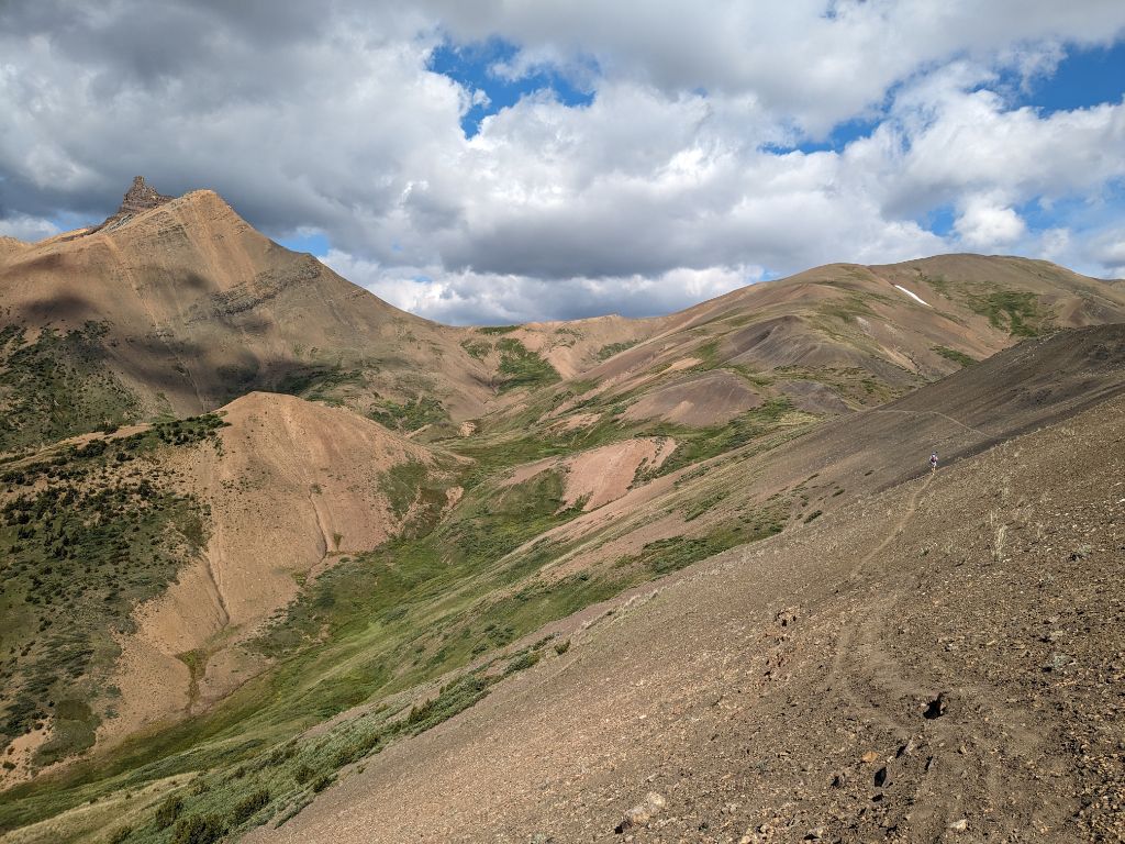
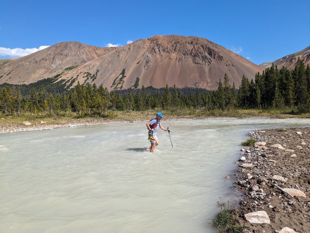
We crossed Big Creek at 4pm, which drains out of Lorna Lake. A beautiful spot, only knee deep crossing and a good chance to cool down. It wasn’t that hot today with the wind, but I still felt the effects of the full sun. My low point of the run started as I climbed up the Grant Creek trail towards Iron Pass. The trail was recently cleared, but still goes through blueberry bushes. It’s a mix of running for ten seconds, then power hiking, repeat that a hundred times up a gradual climb. My hamstrings were feeling tight, I was having a harder time eating and keeping up with Tim. I also wiped out in a patch of clay, right when I looked down and saw a nice fresh grizzly imprint. The headwind didn’t help either. Once the proper climbing started to the pass, we were out of the sun. It was windy, I was getting cold, and probably should have stopped to put on a jacket.
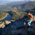
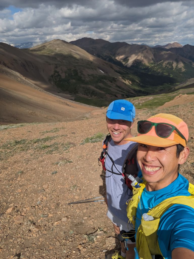
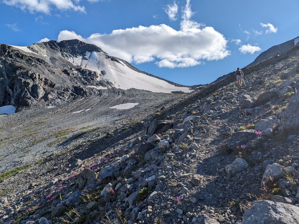
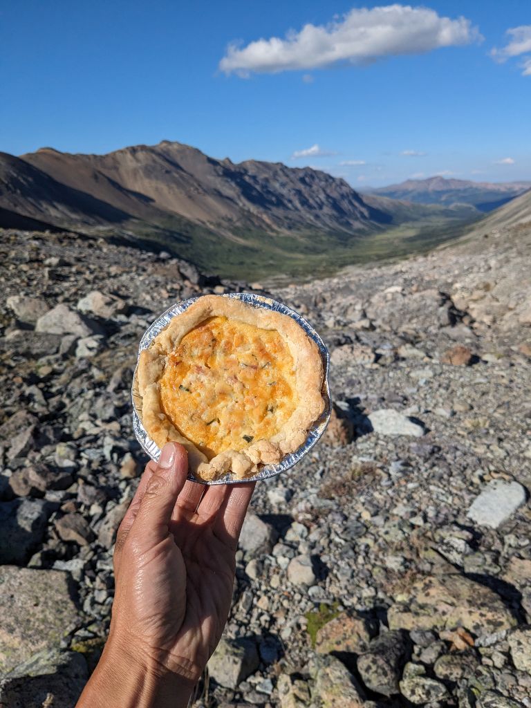
We reached Iron Pass at 6pm, the last remote high-point. Warner Pass was higher, which I wasn’t sure of at the time. Minimal pre-planning of the route was done beforehand, despite almost 80 kilometre of new to me terrain. The views were spectacular the whole way up, and there’s nothing better than travelling in new landscapes.
I was hungry, and pulled out my quiche to share with Tim for “dinner.” All-butter crust, with eggs, cream, bacon, yam, onion, cheddar, and basil for the filling. Over the years, I’ve learnt I really need savoury food for these longer missions, whether it’s pizza, pie, or an alpine sandwich. This was well-timed, as Tim was just starting to complain about the lack of savoury foods in his pack.
Leg 5: Iron Pass to Warner Pass – 56-76km (20km)
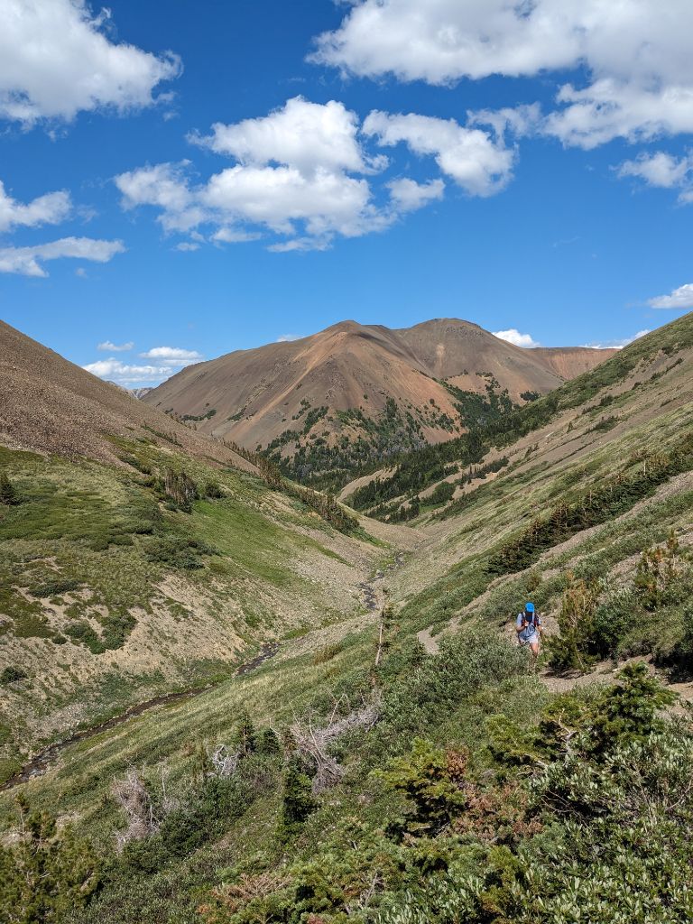
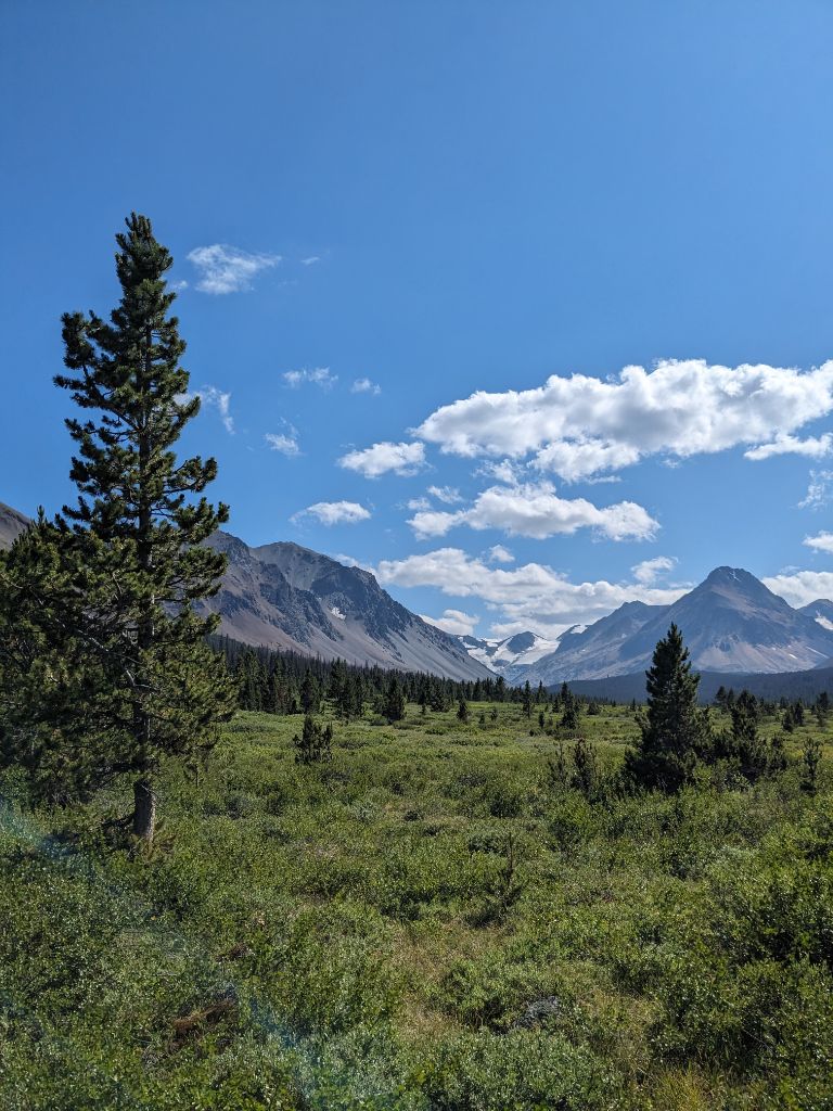
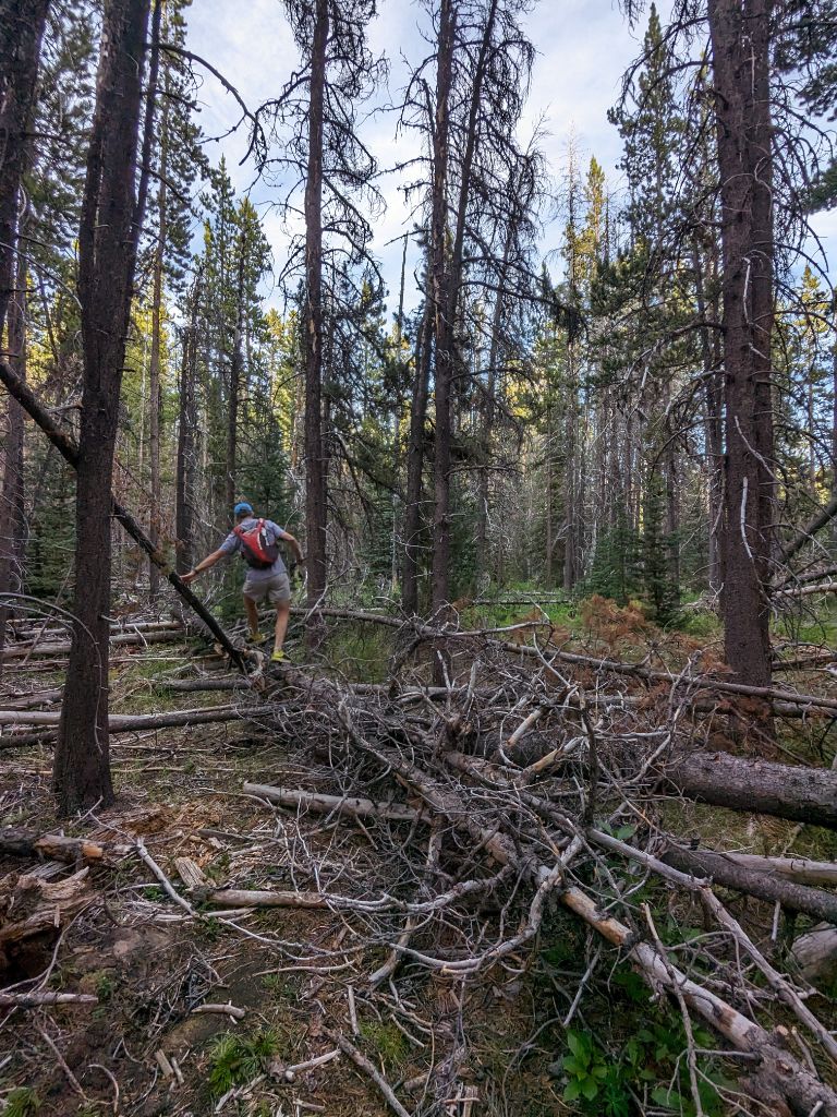
We only half-way into the run, and we were still running further west along the horseshoe away from the start, moving off the Chilcotins map down into Battlement Creek. This is a really nice alpine area. We found some creeks higher up to filter water from. We found a spot to cross Battlement Creek, in order to reach the old mining roads on the south side of the valley. The Taylor-Windfall gold mine was active in the 1920’s and 1930’s. The Gun Creek trail was created to service the mining activity up here. There are still relic buildings left over, but we were chasing daylight and had no time to explore.
My energy levels were still lower than I’d liked here, and didn’t quite have the energy to run the slightly uphills that Tim had. That’s the thing about doing a long run with a partner though, you’re likely to have high’s and low’s at different times. I had no problem going downhill though, or power-walking up. I wasn’t too worried though, the thing I’ve learnt is that usually these low points pass, and relentless forward progress with constant fuelling works 99% of the time. Dropping out and becoming grizzly-bait wasn’t an option.
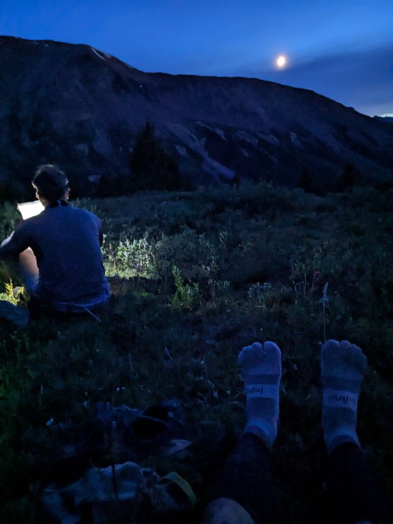
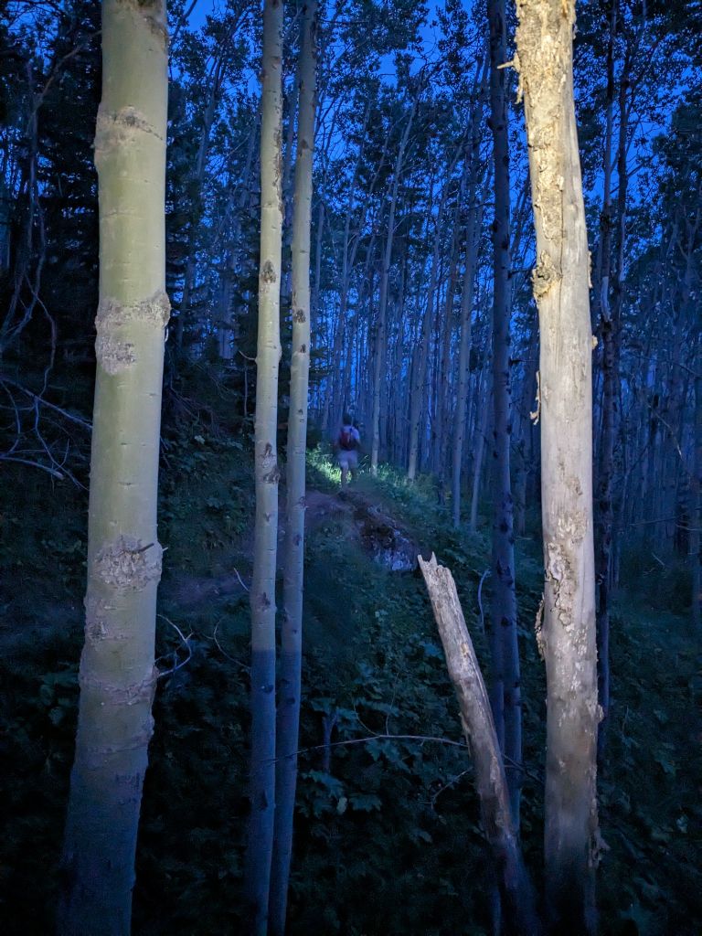
There were probably 20-30 deadfall to climb over on the descent down to the Taseko River. From here, it’s 13km and almost 800m climb from river to Warner Pass, the 2nd biggest climb of the route, next to Castle Pass, but on fatigued legs now. The headlamps came on before we broke into the alpine meadows. We missed the sunset, only catching glimpse of a stunning alpenglow through the forest. We passed through Alex’s chainsaw work, happy to make it through the worst of the deadfall before dark. At this point, I realized I might have brought too little food. I was low on the quick sugars (gel and shotblocks) if we were going to run “fast” from Warner Pass. Fortunately, Tim had plenty of sugary stuff, and I traded part of my Pro-Bar for his shotbloks, which were not going down well for him. I would run out of food for the last hour and half. Just before Warner Pass, I changed socks during another stretching break in the meadows. Foot care is important, I pre-taped my big and pinky toe, and ended up with no blisters while wearing Injinji midweight crew socks with the Brooks Cascadia 16.
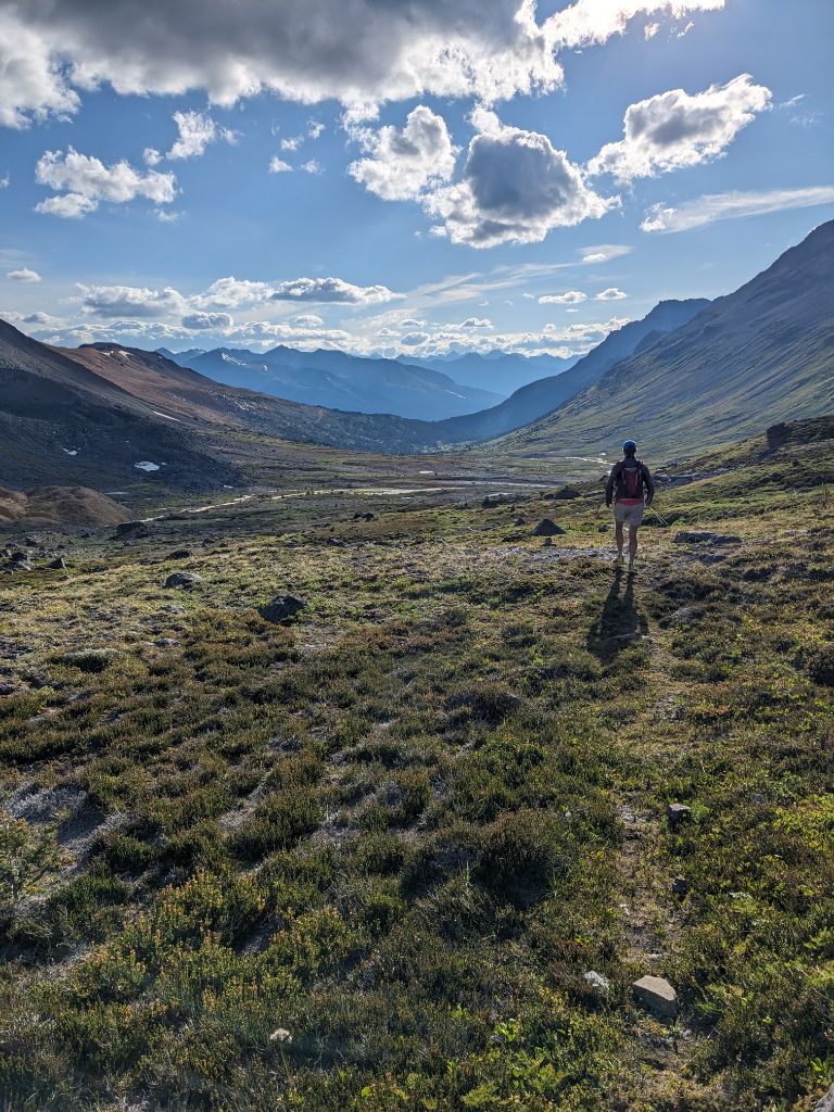

Leg 6: Warner Pass to Potato Patch – 76-99km (23km)
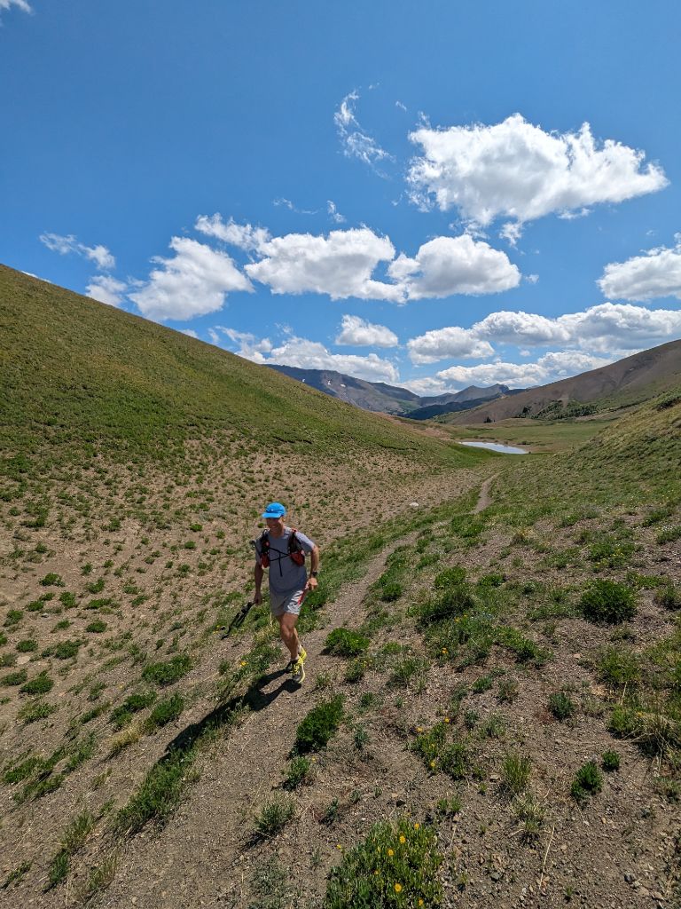
I’ve been to Warner Lake by bike, but never higher up to the pass. The trail is very rocky to start, and we were not running it. I wore a long sleeve over Warner Pass, but we were back to t-shirts for the rest of the run through the night. I was finally feeling good again, enjoying the cool evening temperatures, finding a rhythm and humming along. Even though we were on a well trodden trail now, a combination of fatigue and darkness meant we would occasionally stumble off the trail and inevitably bushwhack back up (happened when we walked into the horse camp before Trigger Lake). While we saw alot of animal scat, our only bear scare was along the talus slopes after Warner Lake. We were running along, when we heard the noise of a bear sprinting uphill through the rocks. We looked up, and there was a black bear twenty metres above us. After making some noise, the bear was in no rush to move. We slowly walked forward across the scree slope, making our presence known.
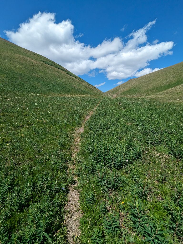
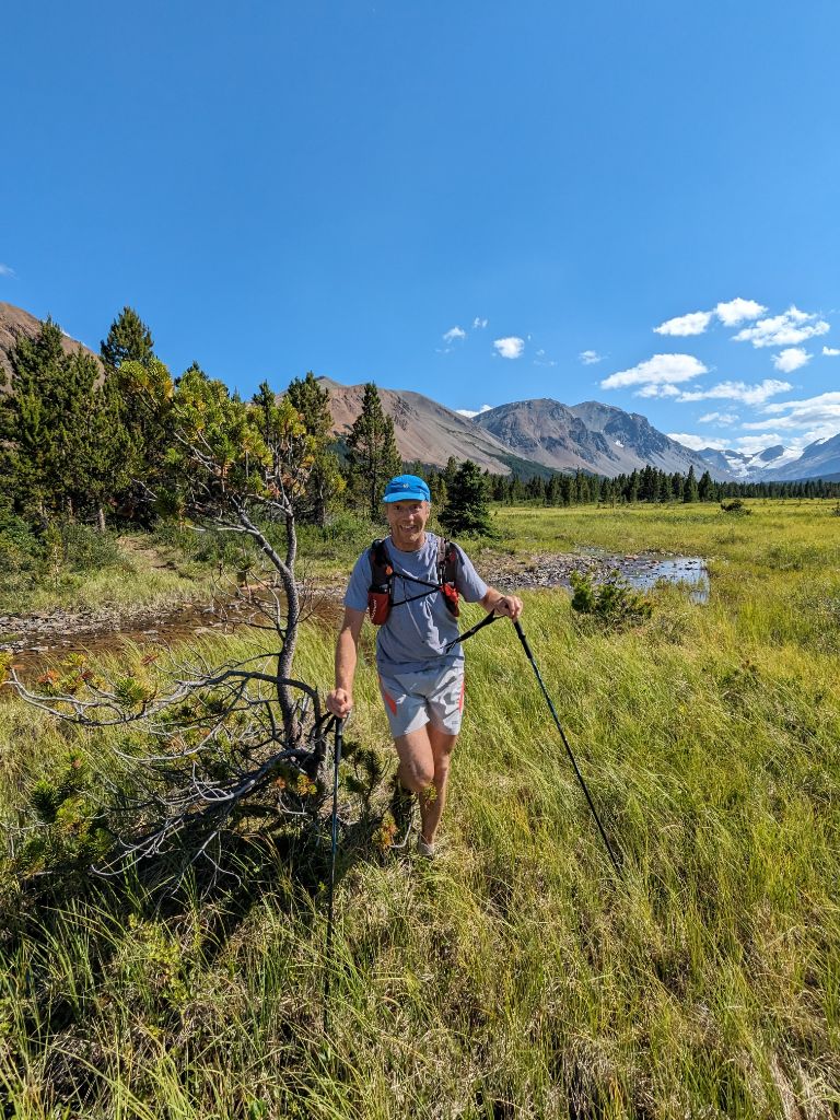
We took the mid-grassland trail to the “Potato Patch” south of Spruce Lake. More elevation gain this way, but the lower-grassland trail and Gun Creek trail is more overgrown compared to the Gun Meadows trail. It’s more scenic too, although a moot point when passing through in darkness.
Leg 7 Potato Patch to Jewel Bridge – 99-112km (13km)
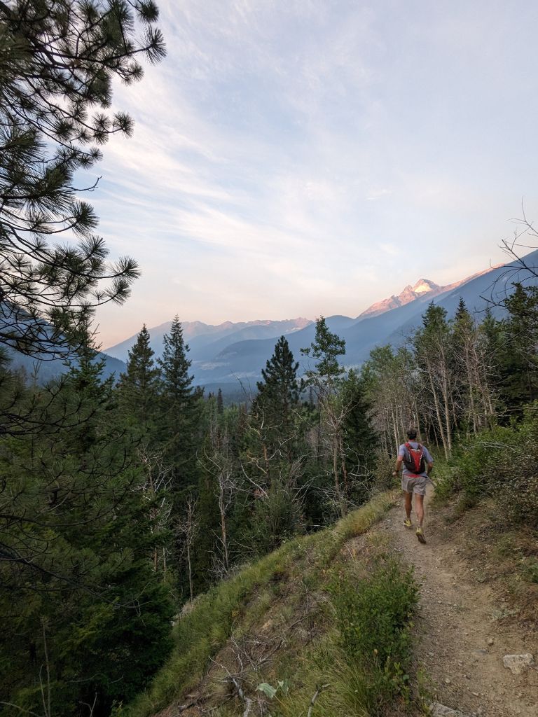
I sent Alex a message at 4am from the potato patch “feeling like a sack of potatoes, eta 6ish???” Not much to say about the final 13km. I’ve bonked here on my bike trying to keep up with Maddy and Alex on my first Chilcotins ride, so I figured it would feel about the same at the end of a 70 miler. We caught a smokey sunrise view of Mount Dickson with just 4km left to go. Those last 40 minutes, “running” at an average 10min/km pace did not come easy. There are just enough punchy little hills on this downhill finish.
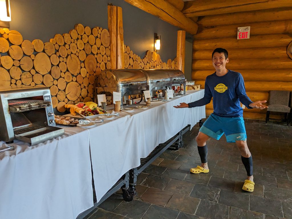
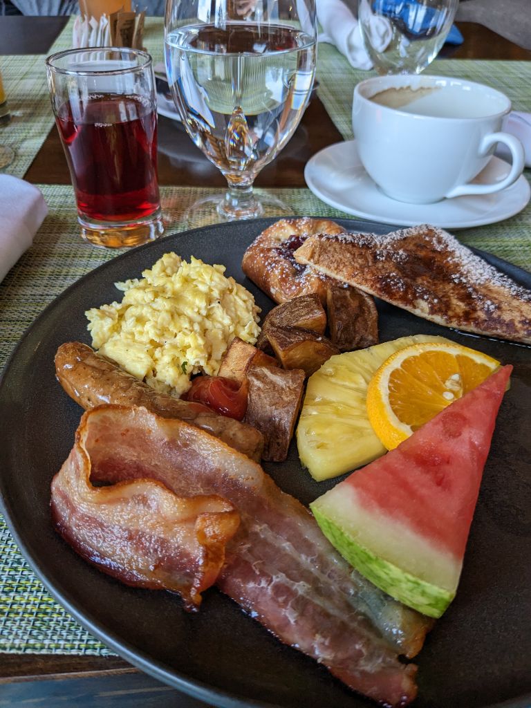
We made it to Jewel Bridge at 6:20am, with Alex ready to drive us back to the Tyax lodge for a breakfast buffet. I was starving, and ready for coffee and bacon. We were also very thankful that Caoimhe (one of the 50k runners) was able to drive us back to North Vancouver, as neither of us were in any shape to drive back without catching up on some much needed sleep.
Post-Run Thoughts
Final stats:
- 23:35:55 Elapsed Time
- 22:31:59 Moving Time
- 4443m Elevation Gain
- 112.58 Distance
- 9792 Calories
I ate about 4500 calories along the way, which was barely enough. Next time, I would bring more savoury foods – pizza for the longer stops, and more gels and shotblocks while running. Otherwise, pretty happy with how everything went and the recovery process too. I was pretty sleepy and hungry for the first couple days, which is my normal response to big all nighter pushes like this.
I hope this “race” report inspires you to get out there, especially the next time the Pioneer 100 happens! Who knows, maybe you’ll be the first to complete the 100 miler course?
Thank you Alex for making this happen, the inspiration, the hard work doing trail maintenance in the furthest sections, and camping out to meet us in the morning. This wouldn’t have been possible without your efforts.