IMTUF, or I’m Tuf for short, is a 100 mile running race through the Salmon Mountains of Idaho, about two hours north of Boise, or twelve hour drive from Vancouver. Close enough to home, a mountainous course and Hardrock qualifier, with a low-key vibe, but notoriously hard. Just go to the race website and scroll through to see what I mean. Fast times don’t come easy here. The beauty of IMTUF, unlike other popular races, is no lottery, no qualifiers to enter. I signed up in January, but Tim signed up two weeks before the race.
“Come to Idaho for IMTUF, ready for the race of your life. You may never give more of yourself and suffer more than on IMTUF raceday. ” – Jer
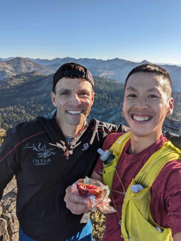
If you’re looking for more tongue in cheek race report with a bit of salty language, you should check out John Burton’s writeup for his version of the race. He won Fat Dog 120 in 2016 when I ran Fat Dog 70, when he gave up his buckle to one of the finishers who crossed the line well after the cutoff, after the finish line was taken down. Truly special stuff. I saw him again at Fat Dog last year, but ran behind him at IMTUF this year.
Training
After Fat Dog 120 and Finlayson Arm Double (100k+28k) back to back last year, I discovered anything was possible with the right mindset. I made some changes these past nine months, focusing mainly on working on my running economy rather than endless vert (hello BMO road marathon!), and going sober which made a massive difference for recovery between efforts and clarity.
The other big part of 2023, was being selected as an ambassador for Brooks Running, as part of the Brooks Run Happy Team. If there’s a more supportive group of human beings, that gets as excited about running and movement and finding joy in their run, I haven’t met them yet.
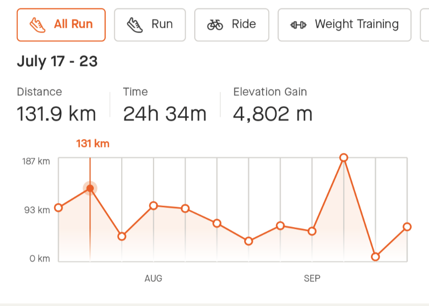
I was hoping to run more at IMTUF than I did at Fat Dog. In 2023 leading up to IMTUF, I spent a total of 333hr 34min, running 2419 km, with 71,626m total elevation gain. That’s a monthly average of 268 km with my biggest month of distance happening in July (458km, 21799m). Another interesting metric is the number of runs >30km in 2023, only 9. My total runs >25km in 2023 was 17. I would run more shorter 15-25 km runs, back to back to build up the legs, mixed with bigger efforts which were at adventure pace. I had four weeks with weekly mileage >100 km, majority were 70-90km.
In 2023, my races/long runs were:
- Mar 18 – Chuckanut 50k – 5:17:02
- May 7- BMO Vancouver Marathon – 3:27:21
- Jun 24 – Kusam Klimb 23km – 2:58:08
- July 22 – Pie-O-Neer 70 Miler – 23:35:55 – the most scenic run of the year
- Aug 12 – Fat Dog Sweeping Duties 87km – 26:17 – the most tiring run of the year
Showing up in Idaho this past weekend, I would find out if I had what it takes to run 100+ miles and over 6000m in mountainous terrain with heat and some altitude. Am I TUF enough? I wanted to see if I could make hard things feel fun, that was my goal and finish under the 36 hr cutoff. Deep down, I knew the answers already, but it’s important to keep challenging yourself.
Pre-Race
Tim and I drove down from North Vancouver on Thursday, two days before the race. This allowed us to do most of the drive on Thursday, camp along the way, and then enjoy a relaxing day before the race. We found a great free campsite along the Salmon River outside of Riggins, Idaho. We drove another hour to McCall on Friday, a resort town on the south shore of Payette Lake where we spent a bunch of time packing our dropbags. Without a crew, it’s reassuring to know you have everything you might need in the drop bags (six total). The key items would be: extra soft flasks, pre-mixed gel flasks (Large bottle of huckleberry flavoured Hammer gel, mixed five diluted servings per 250ml flask), headlamps and spare battery, change of t-shirt and shorts, long sleeves gloves and toque for night running, lube. And RedBull and TJ’s cold brew coffee in the later drop bags for that final caffeine kick.
Taper week looked like this: a 20km trail from home to Deep Cove on the Saturday, a recovery 8.7km on the seawall on Sunday, full rest on Monday, a 12.5 km up the Lillooet Berm as the last aerobic stimulus on Tuesday, easy 8km on Wednesday with a stop at the bank to get some USD, driving on Thursday with stretching breaks, and then a 4.5km walk around McCall on Friday. Just enough movement keep some muscular tension. In hindsight, knowing it would get hot, some last-minute heat training via sauna sessions would have been beneficial.
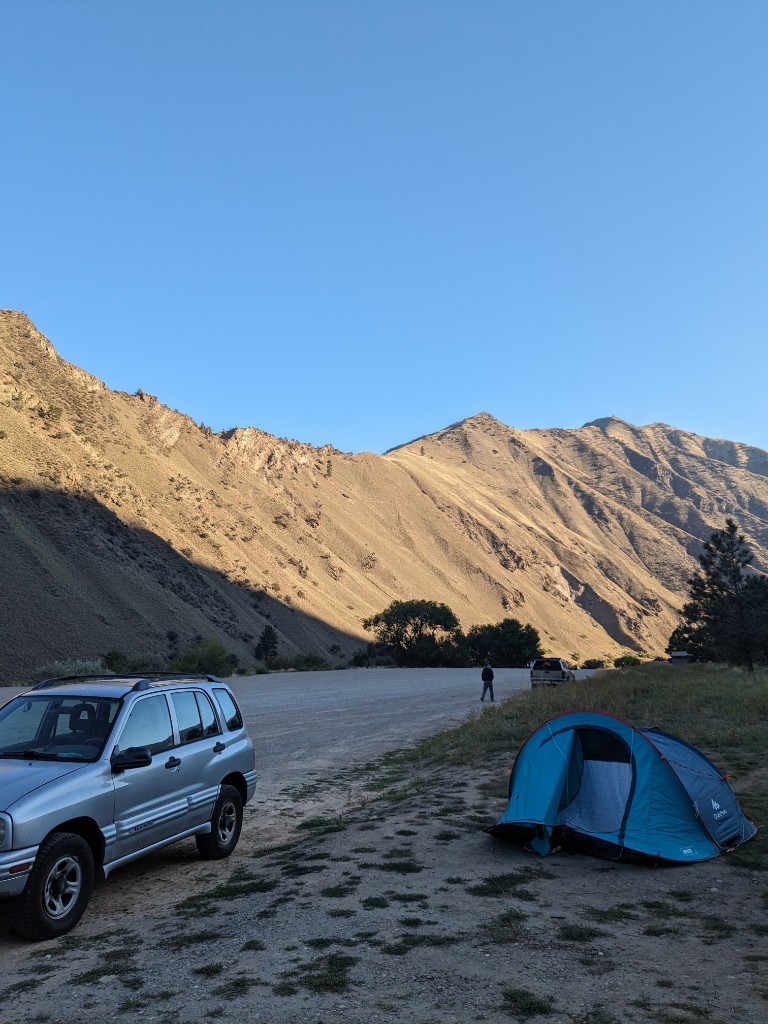
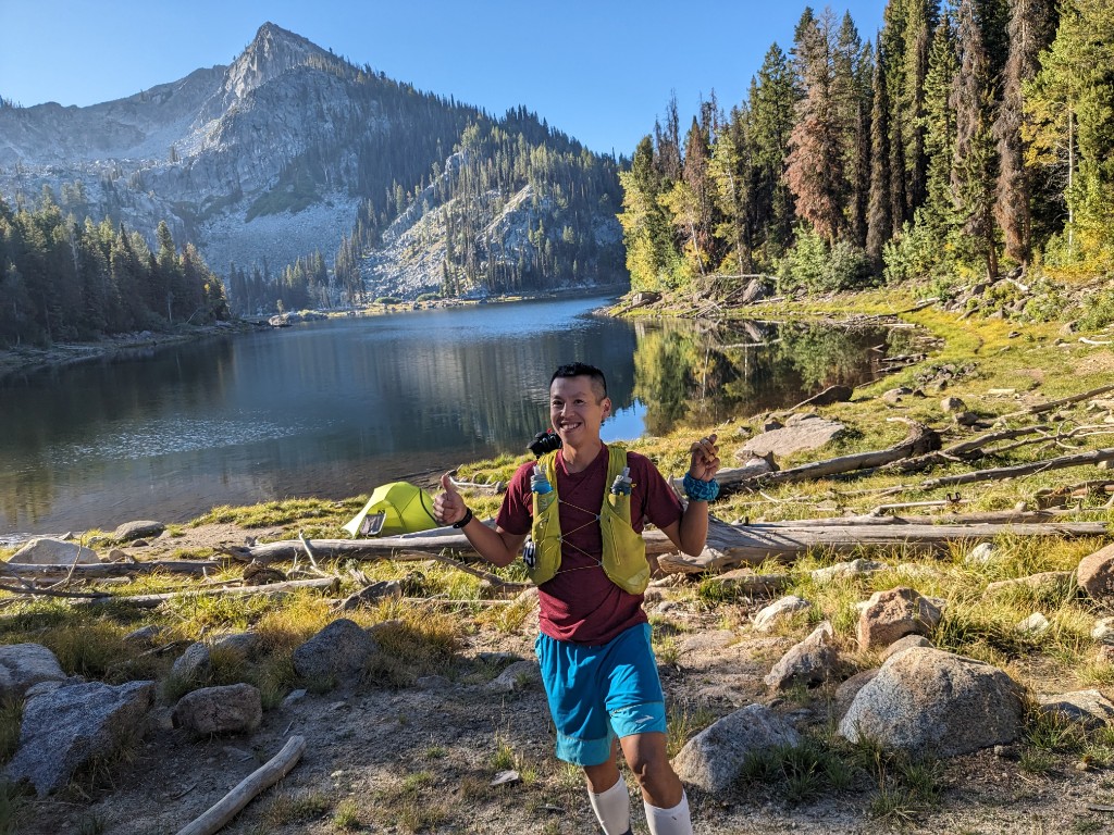
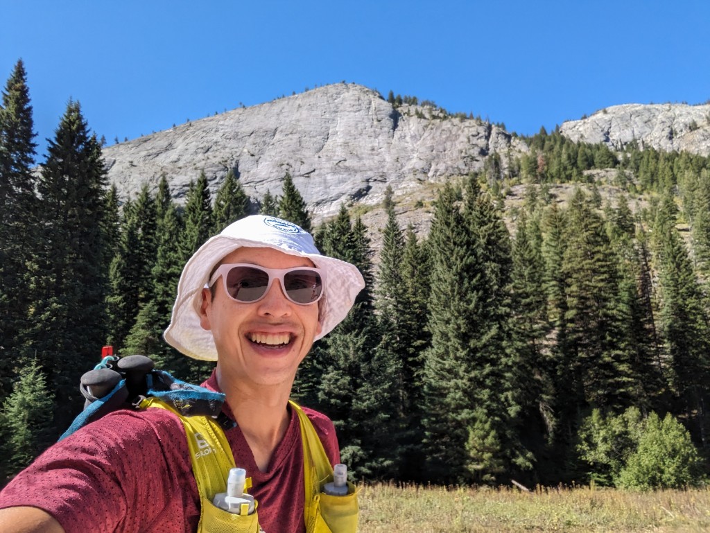
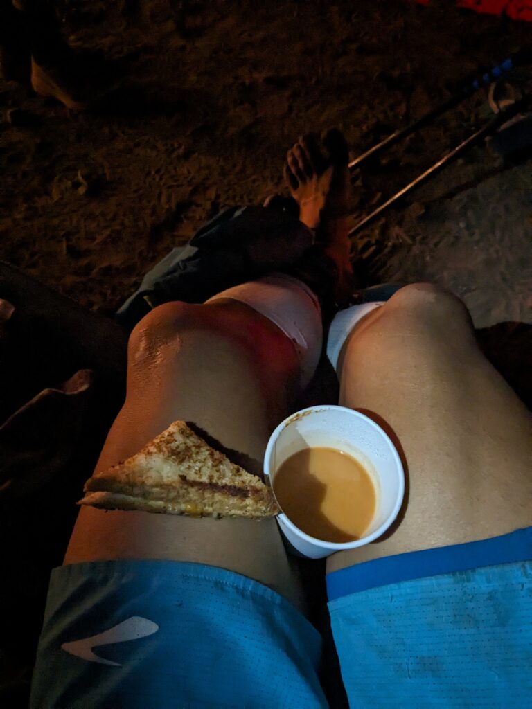
Race check-in was at the Jug Mountain Ranch golf course, as simple as it gets – name check-in, bib pickup, and a t-shirt. A map of the route on the table, and possible Q&A with the race director later, but I spent enough time studying the course and the latest trail updates on the Facebook page. We drove a bit further on a dirt road to reach the camp site – a large open field with a small creek, camp where ever you want. Tim went off for a shake-out run in warm evening sun, while I ate my early dinner – pasta and tomato sauce, with tapioca pudding for dessert. Boring, but easily digestible and works for me. I had half of a berry tart, and saved the other half for race day.
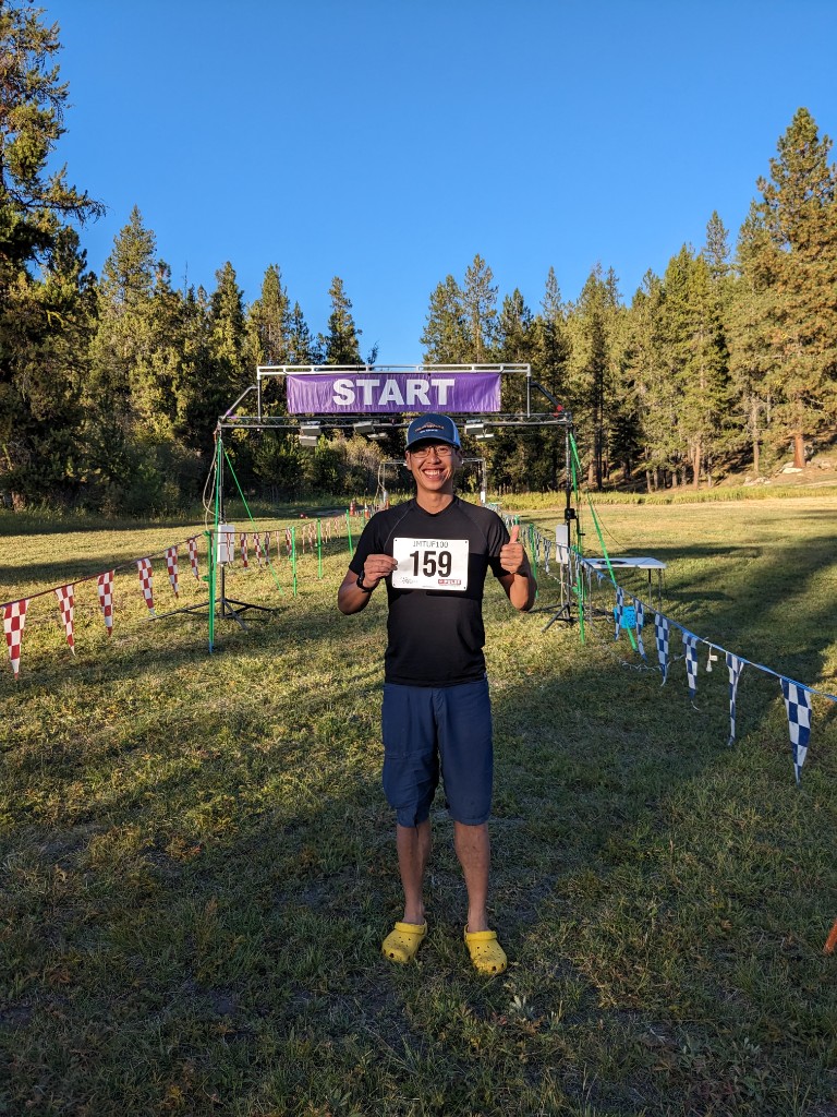
I never sleep well pre-race, and pre-IMTUF was no exception. I had quality sleep in the week leading up and banked on that. I was nervous and excited for a 2nd go at the 100+mile distance. I woke up and remembered to pre-tape my feet. I taped my big toe, 2nd toe, pinky toe and heel pre-emptively with leukotape, this stuff is magic. Doing this the night before seems to help the adhesion bond better. I ended up with a blister on each pinky toe, but that was the only damage. I heard the elk bugle and wolves howl in the woods beyond the start line. Nerves were high but I managed to get 4.5 hours of sleep.
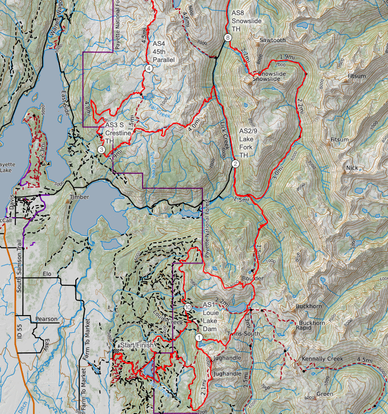
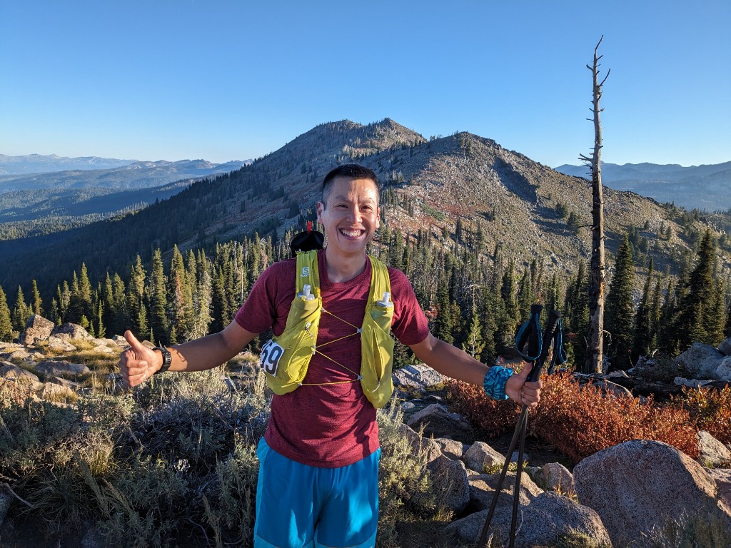
Leg 1: Jug Mountain Ranch to Louie Lake Dam – 0 to 20 km (20 km)
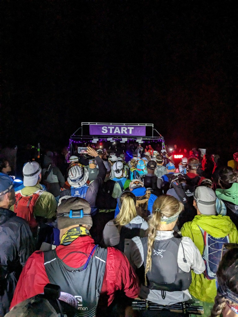
I woke up at 4:30 am to give myself time to digest my breakfast of oatmeal and coffee. More runners were starting to show up, we had to check-in again, and then dropped my drop bags near the start area. Runners were gathered in the cold near the start line, while I hung out in my tent until ten minutes to go, a benefit of camping at the start. My only warmup was a few minutes of jogging an hour out from start, just to get the digestive system going, it worked and I used the port-potty before the main rush.
We self-seeded ourselves at the start, listened to a few words from the race director, Jeremy Humphrey, and then we were off in the darkness a few minutes after 6am. I was further back, so I didn’t hear much except for “look out for each other on the trails.” I started next to Devon from Vancouver, who would pass me shortly after and run an amazing 28:18:09 finishing 2nd women in her 1st 100miler race. Leaving the grassy field, the trail quickly turns into a single track switchback, and the runners crowded up, fine for me at this point in a 100 mile race. I realized the AA battery in my backup Zebralight was running low, fortunately there were plenty of lights nearby for me to follow. It set my speed limit for starting off in the first hour before dawn.
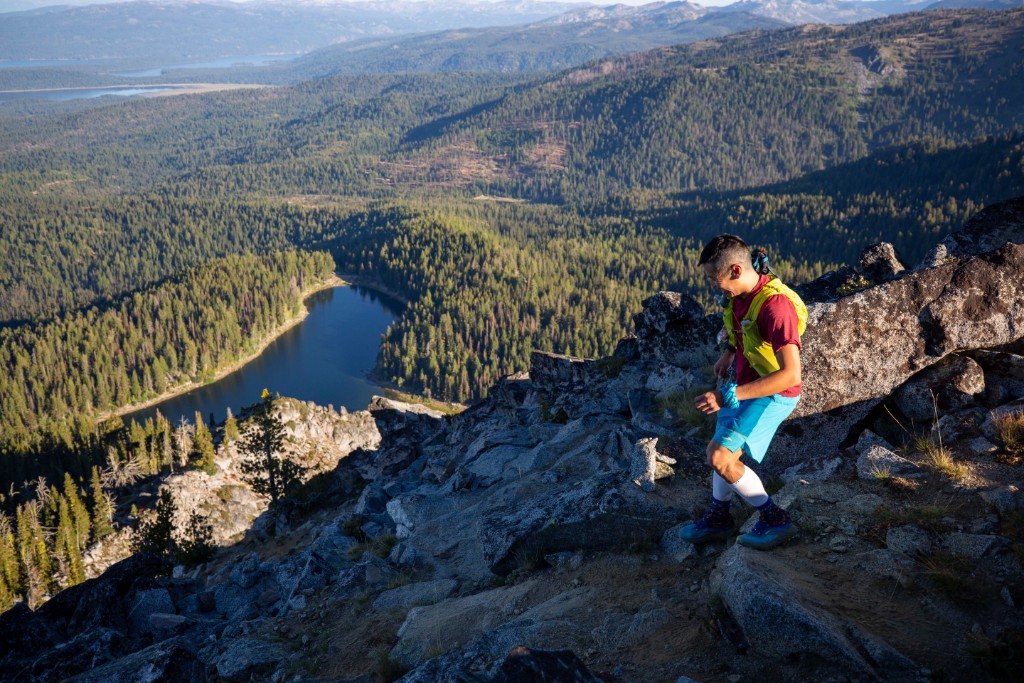
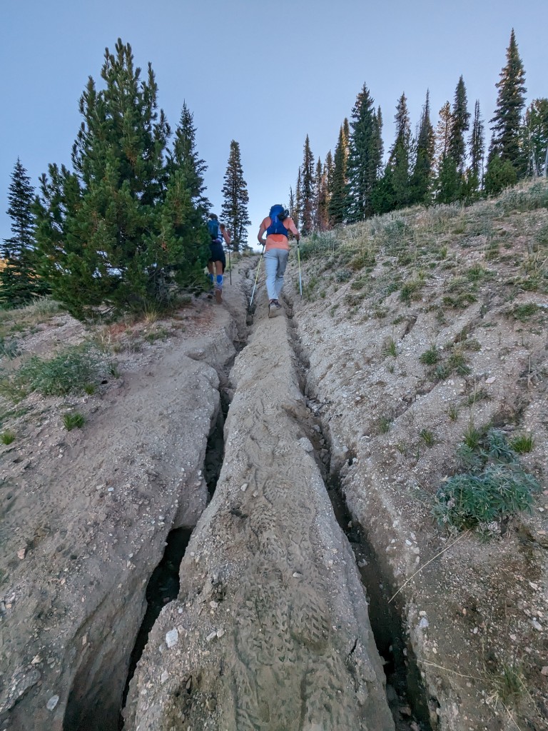
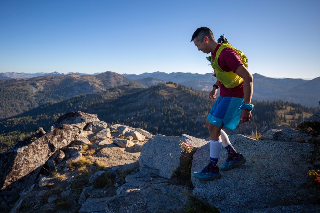
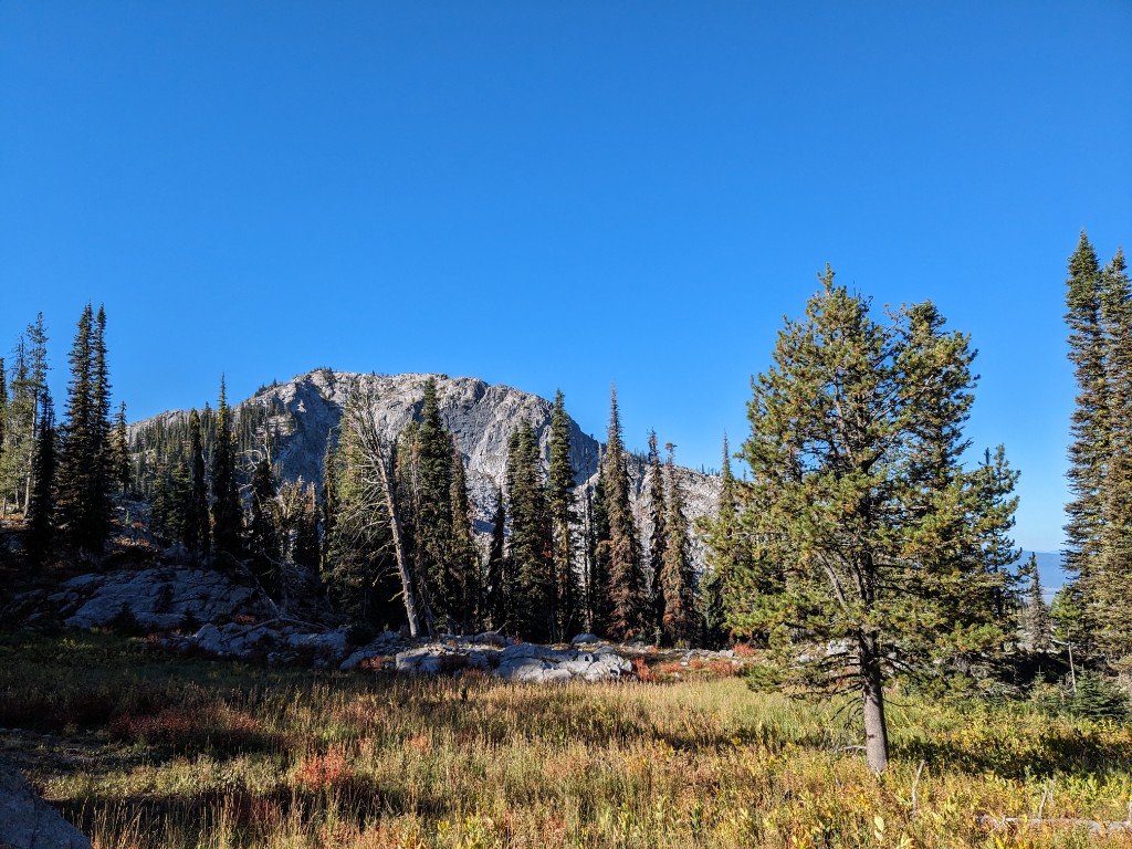
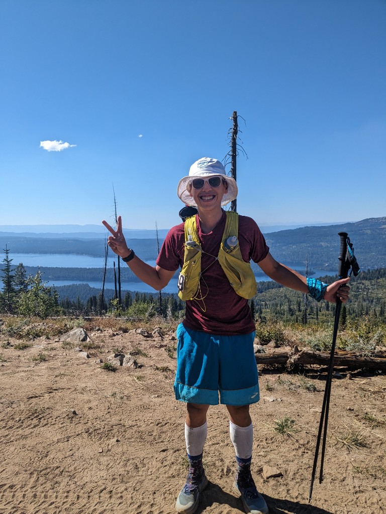
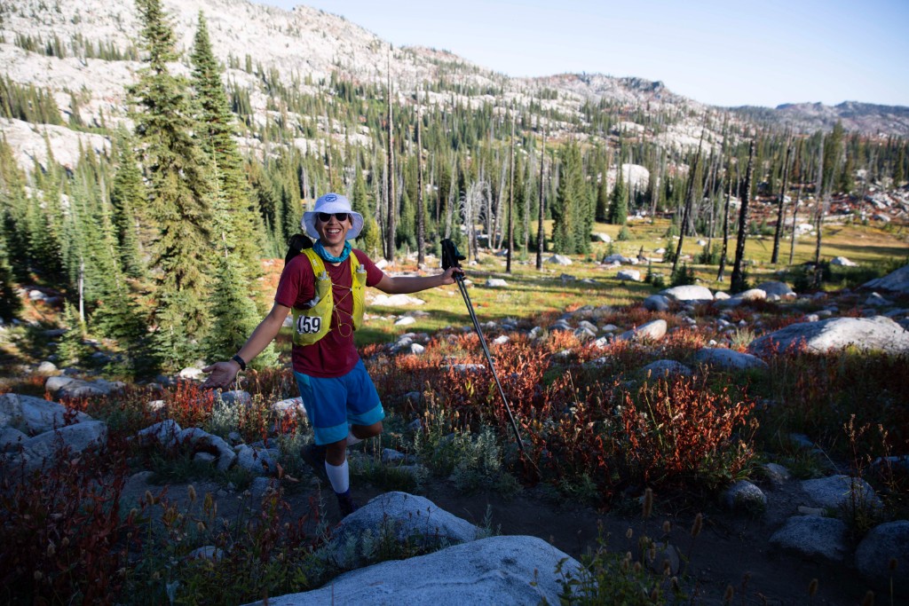
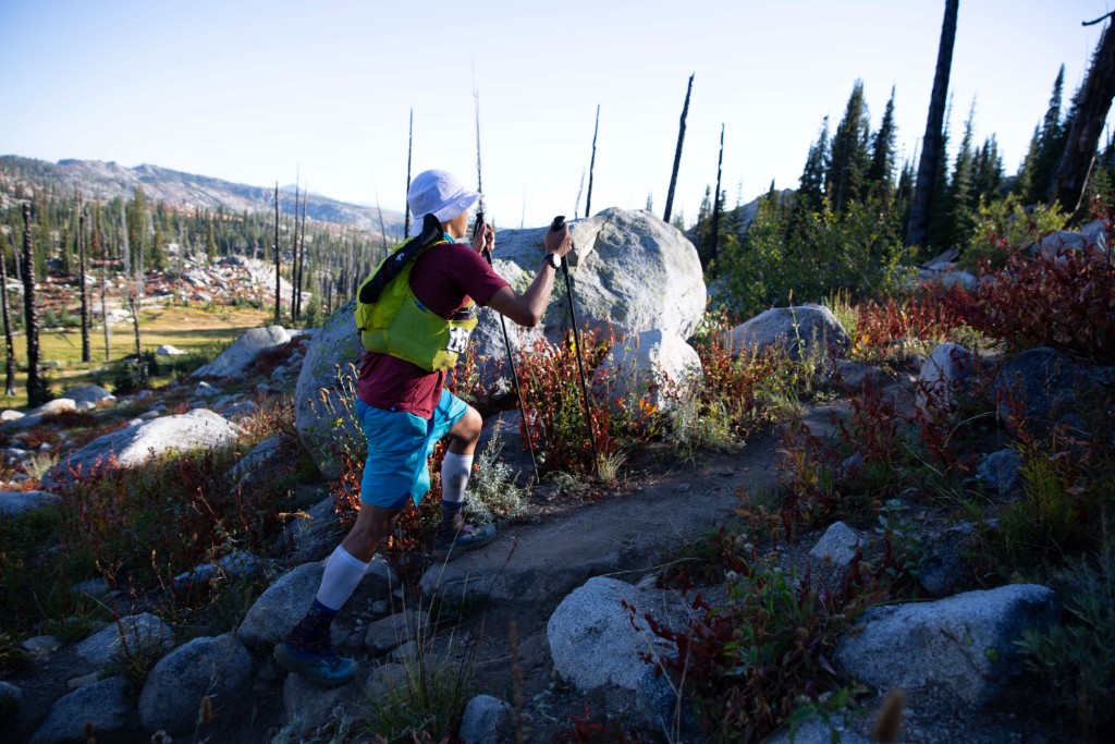
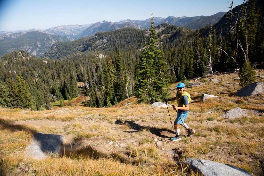
I wore shorts, t-shirt, arm sleeves, a light jacket and a buff, which was perfect. Cold in the meadows, but warmed quickly as we climbed higher up. Forecasted highs were 26C/79F, higher than usual for mid-September in western Idaho, and it would feel hotter than that on the exposed sunny sections at elevation. A bluebird morning as we made the first steep climb on a doubletrack up Ladybug Mountain. Steep, with a deep rut down the middle from heavy rains a few weeks earlier. With an average 18.5% grade for the 300m Ladybug climb aka Stupid Hill, I was glad to have poles right from the start. You will want poles for this course.
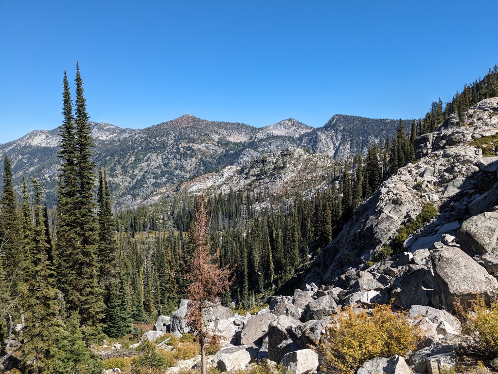
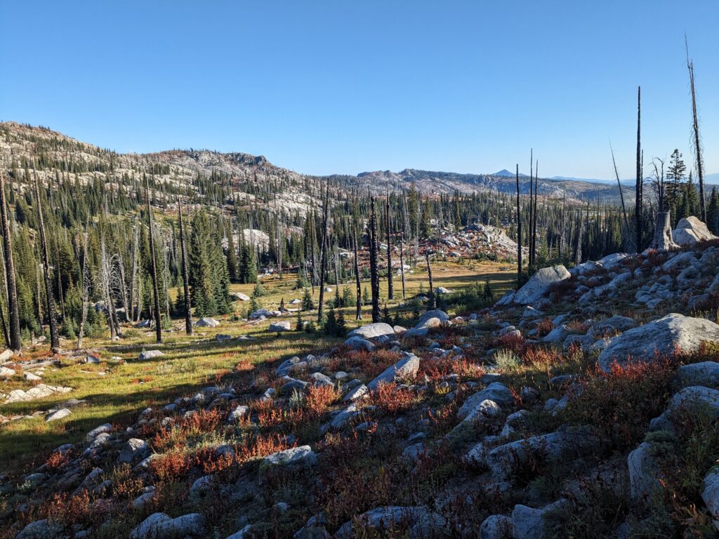
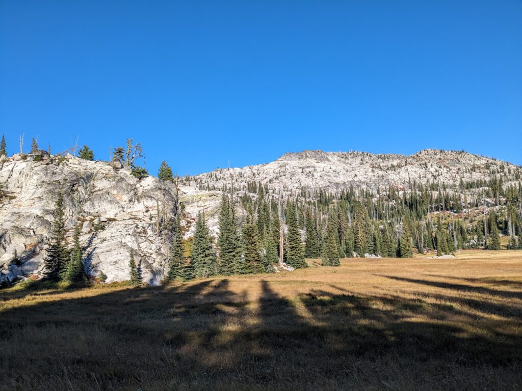
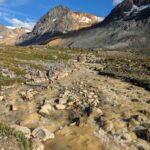
The climb over Jughandle Mountain was spectacular. The fall colours were out, with a panoramic view along the ridgeline as we worked north towards Jughandle Mountain, runners strewn out. It reminded me of the most technical sections of the Skyline ridge trail in Manning Park. Some of this was trail, but also off-trail traversing across meadows. But the gnarliest section comes after the summit of Jughandle Mountain, descending a short but steep talus field. This is walk only zone, and Jer personally oversees this rule standing on the precipice of the north face.
No running until you hit the real dirt trail below, about ¼ mile. Stay away from the cliff on the RIGHT. Continue along the ridge following tied off rocks as markers. At a notch, drop left and enter the talus piles. Pick through here carefully. Do not kick rocks down on others. Work together for routefinding and emerge onto the trail below. It is steep and rough and goes through another small section of rocks. Then, it gets pretty obvious and your pace will increase, but still RIDICULOUSLY STEEP.
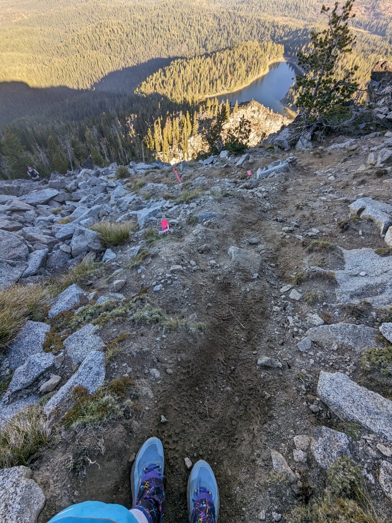
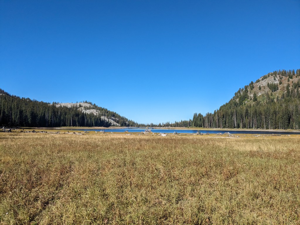
After the talus, flowly singletrack led us to the first aid station on the north end of Louie Lake, a 28% grade descent. A common reason for DNF’s on this race is from trashing your quads in the first 20 miles of the course. I topped up my soft flask with water, grabbed a couple chocolate Hammer gels, and continued on. I started the race with a concentrated 500mL soft flask of Tailwind (5 scoops plus water to top), a mix of Gu and Hammer gels, and two other flasks of water.
Leg 2: Louie Lake Dam to Lake Fork Trailhead #1 – 20 to 35.5 km (15.5 km)
The next section was trail running at its best, my favourite part of the course. Flowy meadows, short climbs, long single track descents. Everything felt good here, except I started to notice a random dull pain in my left ankle running downhill. Not something I noticed in training or a phantom taper pain, so I backed off the pace ever slightly, and took more care on rocky technical parts. This went away later.
In Idaho, the passes are called summits, and summits are mountains. We crested Boulder summit and descended into the Anderson valley, across South Lake Fork creek, then to the crossing of East lake Fork creek. Poles would be nice for balancing across slippery rocks here, but mine was stashed in the quiver and I dabbed one foot in. They were bound to get wet.
This section is the “land between the rivers” and is a rolling mile+ of nice trail and huckleberry thickets. Also a known hangout of Griffin the Goshawk- a viscous bird with a history of bird on human violence.
No Goshawk were sighted or heads harmed in this year’s IMTUF. This is the only section of the course repeated on the IMTUF Supercourse, from Boulder summit to the Lake Fork trailhead. Prior to 2020, the race was slightly shorter and started from the rustic Burgdorf hotsprings and alternated directions each year. The Supercourse is TUFer than ever, and started and finished at Jug Mountain ranch, running the same direction.
Leg 3: Lake Fork #1 to South Crestline – 35.5 to 51.5 km (16 km)
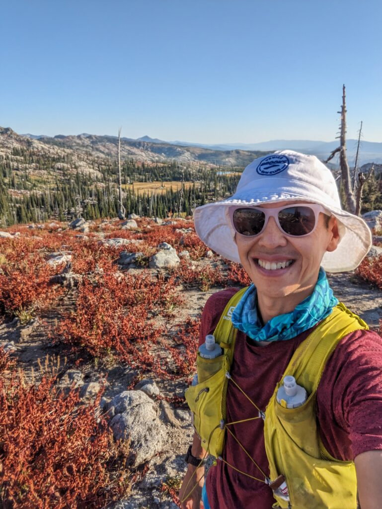
It took me six hours to cover the 35km to Lake Fork 1. I was hungry now, and had a pancake and bacon sandwich. I filled up my soft flasks, mixed into some tailwind powder from my drop bag and grabbed my sunglasses and bucket hat for hot and exposed journey ahead.
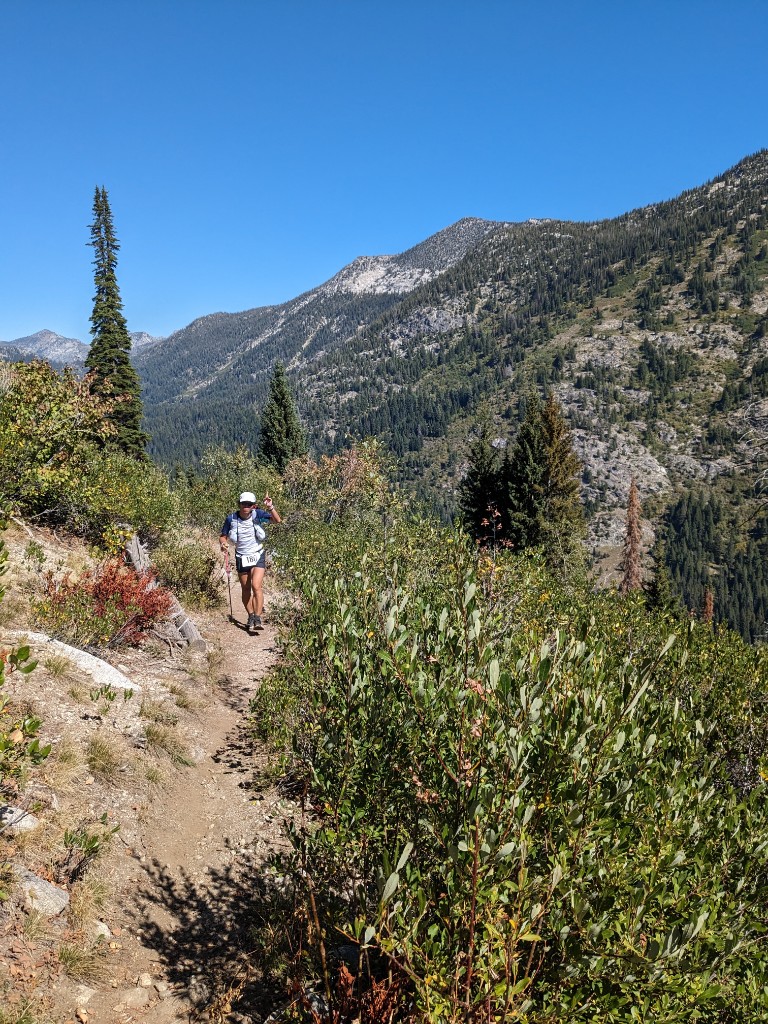
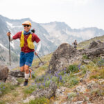
I left the aid station running with Di Wu, an ultrarunner living in eastern Washington, who had already finished Cocodona 250, Tahoe 200, Big Foot 200 this year, with Moab 240 coming up to complete the Triple Crown of 200 milers. He didn’t finish IMTUF last year after some gear issues, and offered me some good advice on how hard the Crestline section would be. The next 4.5 km were on a hot sunny forest road, and then climbed the Fall Creek trail together, a steep 700m climb over 4km (14.7% average grade). I backed off the intensity, crawling uphill, dunking myself in creeks in the first half of the climb. The scenery was stunning, craggy granite dome, reminding me of the Snow Creek wall in Leavenworth.
The trail has some switchbacks, but the angle is very steep and the footing is rocky and technical. Reach a flat, meadowy spot at 6900’, run to the back of the granite cirque and continue climbing a ridiculously steep trail blasting through the back of the cirque with a giant, overhanging granite wall on your left. Wild stuff.
No exaggeration in the description of this climb from the race guide. Think climber’s approach trail and that’s was the upper climb.
Next, a 7km descent, 700m descent from the Fall Creek saddle down to the South Crestline Trailhead along the Fall Creek ATV trail. Great views of Payette Lake. This course, and this section in particular, is known for the granite moondust inch deep over the trails, but we were lucky that the recent rains had settled the dust. I happily wore Dirty Girls gaiters all race long. Occasionally, I would wait behind somebody who passed me downhill, to let the dust settle as I find it irritates my lungs over time.
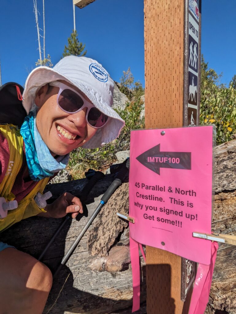
Leg 4: South Crestline to 45th Parallel Goats – 51.5 to 63 km (11.5 km)
I felt good at South Crestline, although I wasn’t moving as fast as planned. Jer was at the aid station (he’s almost everywhere on the course it seems), and thought I looked in good spirits. The first 50km of this course is tough, and many runners underestimate it. I ran the 50km in 9hr 10min. I grabbed a 4th soft flask from my drop bag, my nighttime headlamp, filled all four 500mL flasks for the afternoon heat, and left the aid station at 3:36pm. The cutoff is 4:30pm. The 28 kms across the Crestline is rough, and not the place to be if you’re not feeling the best, as I would soon find out.
Immediately after the aid station, I dipped my hat and arms in a big creek. I should have dipped my whole body into it, as the next 11 km were just a slow hot grind through shady forest and open burns and more runnable than I was expecting. I was planning to powerhike it but forced myself into a slow trot on the gentle inclines. Then my stomach started to fail me, I just felt a bloated feeling and couldn’t stomach my usual gels every 20-30 minutes. I slowed the pace some more, went to a gel an hour, ignoring my watch every time gave me a nutrition alert. I wasn’t alone, others around me were commenting on their stomachs, some feeling worse.
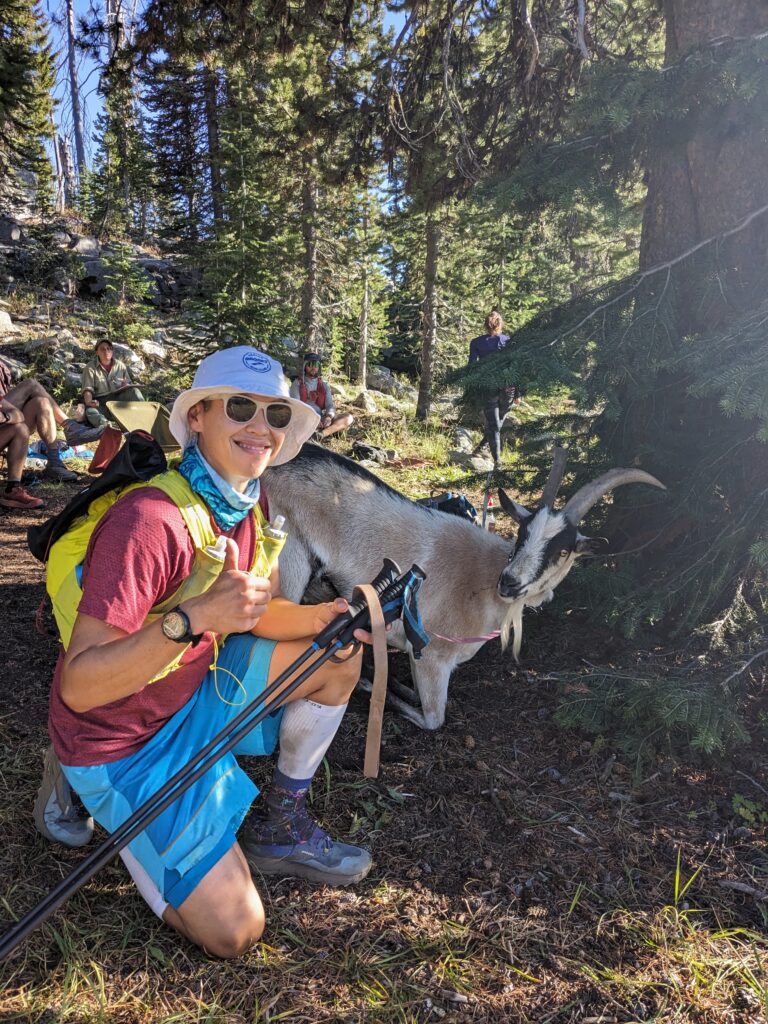
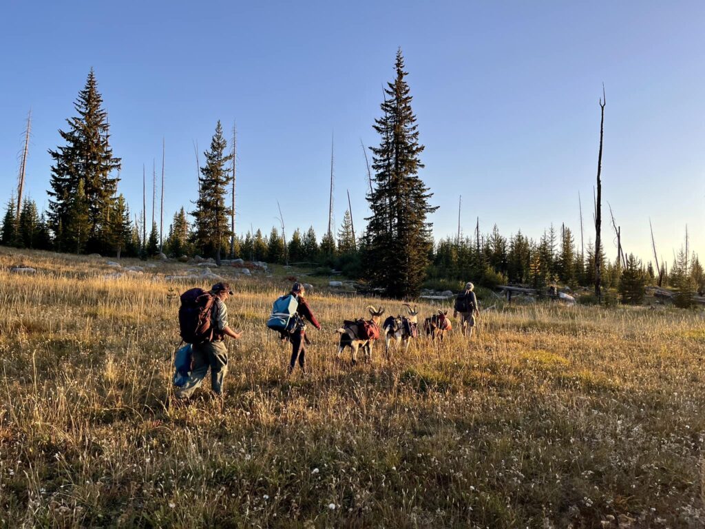
The granite country of the Crestline opened up just as I made it to the 45th parallel aid station, a small team of volunteers and goats who goat-packed in some supplies. Unfortunately they ran out of ginger ale, but I loaded up with more water, and grabbed a couple Hi-Chews and gels hoping those would work.
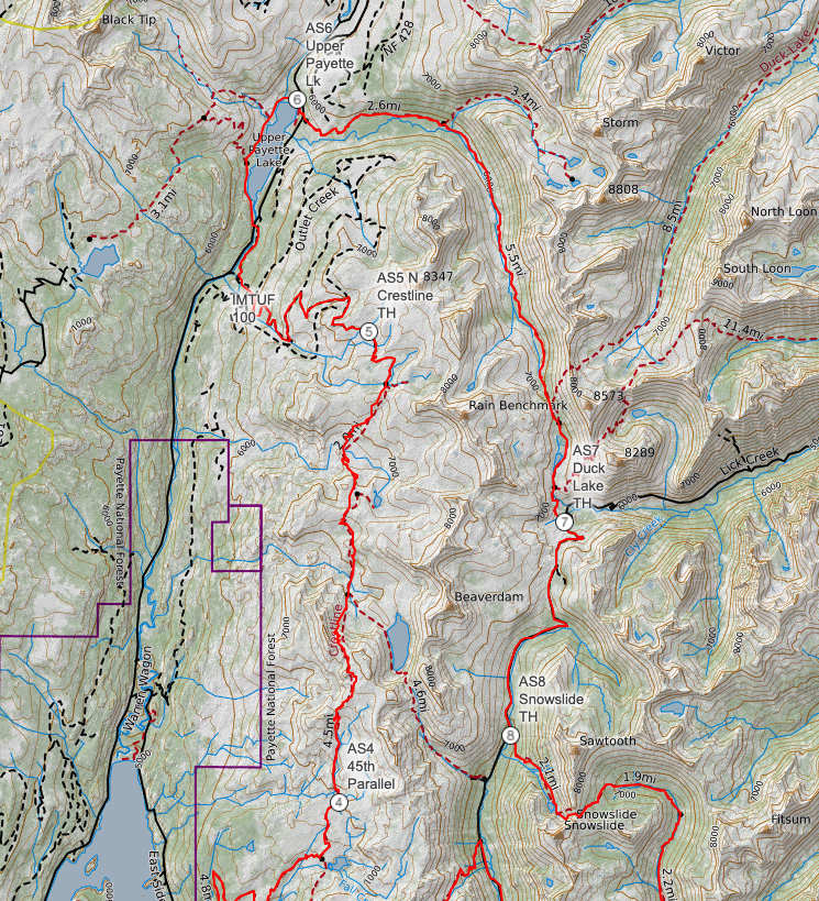
Leg 5: 45th Parallel Goats to North Crestline – 63 to 80 km (17 km)
I began to battle my self-doubt in the afternoon heat and altitude on the rugged sections of the Crestline. I knew nothing was wrong, I just couldn’t fuel enough to push the legs. So I walked as fast as my stomach would allow, keeping the effort low, maybe a gel an hour, Hi-chews, and TJ’s candied ginger, banking on a turn-around, or enduring a long walk all the way till I didn’t make a cutoff. I experienced this last year at Finlayson Arm (much worse then – dry heaving in the smoke and heat) so I knew if the temperatures dropped, I could get some solid fuel in and ignite the fire inside for the back 50miles.
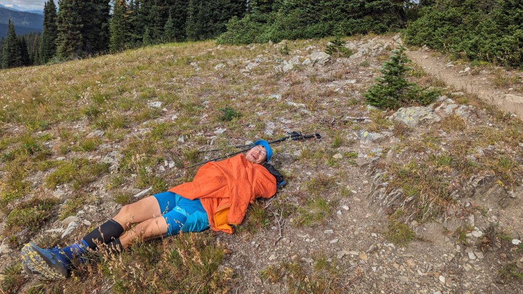
At one point, I stopped in a beautiful spot to snap a photo. I must have been so out of it, because I suddenly heard a voice behind me, the volunteer race photographer, Cary Johnson was hiding in the rocks waiting to take my photo. I commented that great minds think alike when it comes to photogenic locations and broke out a smile while suffering along.
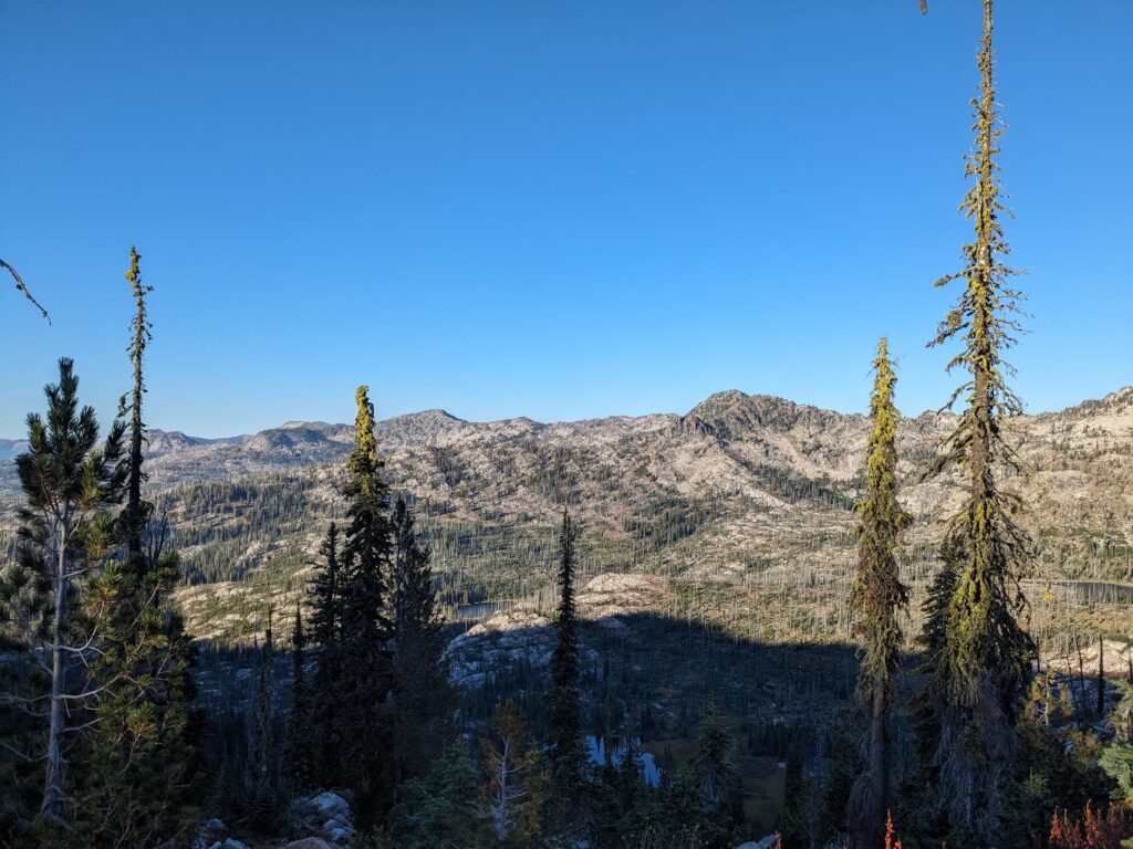
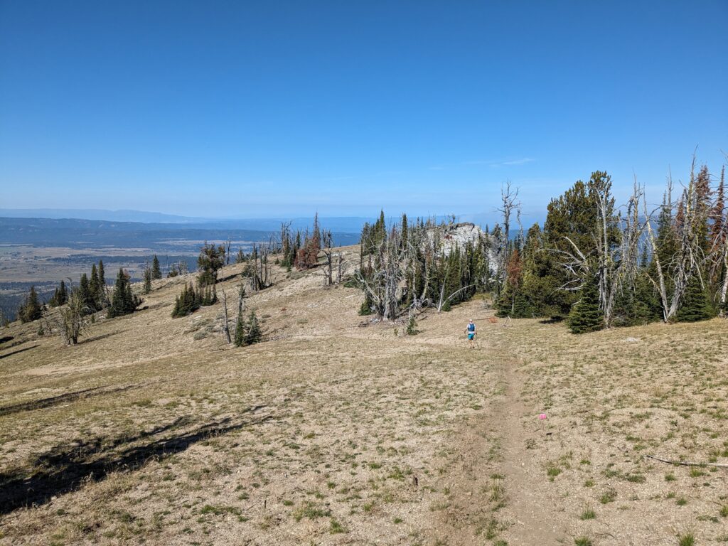
Enter a repeating pattern of steep and loose climbs, then small meadowy sections that are easy running. The final meadow passes under Box Peak and is spectacularly beautiful. More steep climbing brings you to the open country granite slabs section, one of the most memorable areas of IMTUF.
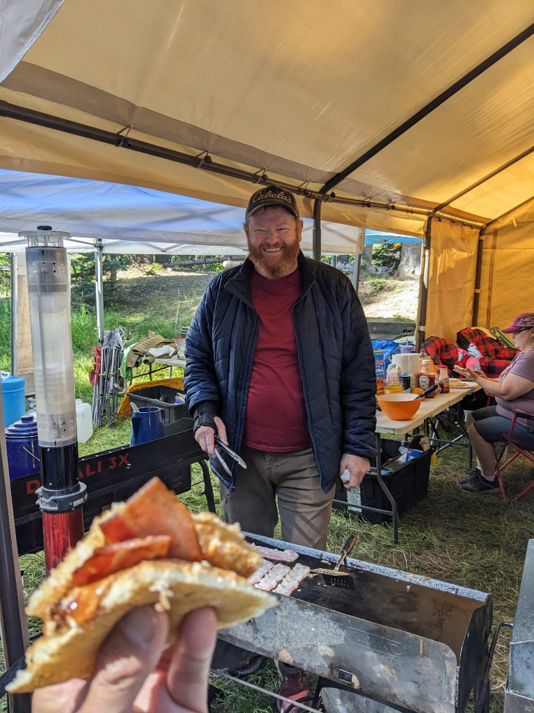
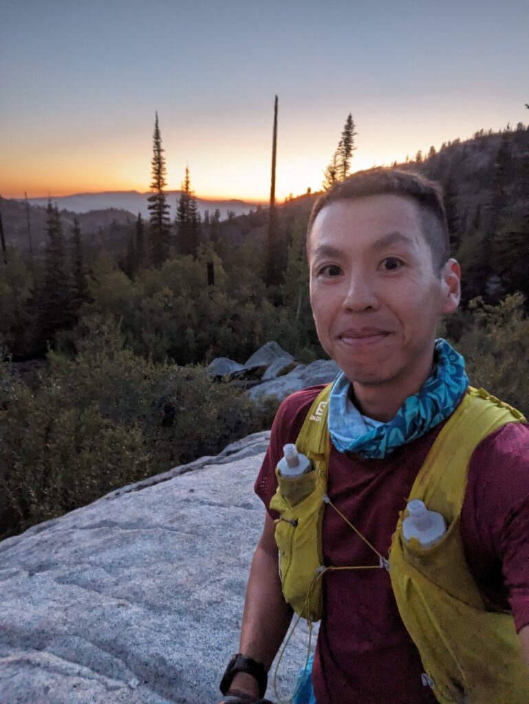
From the high point of the Crestline at 2400m, I descended down to Box Creek, followed by another climb and descent to Brush Creek, and a final climb up to the North Crestline trailhead. My headlamp came on about 35 minutes before reaching the aid station. I’m glad I picked up my primary headlamp at South Crestline. Some sections of the trail were rocky, others almost non-existent, just following pink flagging over rocky steps. But along here, and the rest of the race, the course was marked perfectly. Every section is personally marked by the race director himself to guide us through all the tricky junctions and unmarked trails. I have never seen so many ribbons and flags marking key junction. If you get off-trail, you can’t blame the lack of flagging. I had some company along the 2nd half of the Crestline, alternating leads depending on who was farting more (oh ultrarunning…), which helped me get through a rough patch. He didn’t have any stomach issues, just a bit of knee pain, and I was envious of his mashed potato wraps provided by his crew. Speaking of potatoes, the race had surprisingly few potatoes products aside from chips, in otherwise well-stocked aid stations. I could have eaten a plate of crispy pierogies for dinner. After the race, Tim told me he had the last three pierogies at Upper Payette Lake. I was just ahead of another runner who’s deep violent dry heaving sounds, who I tried to stay in front of. I was also burping alot from the ginger ale, but I could never trust what might come up.
Leg 6: North Crestline to Upper Payette Lake – 80 to 93.5 km (13.5 km)
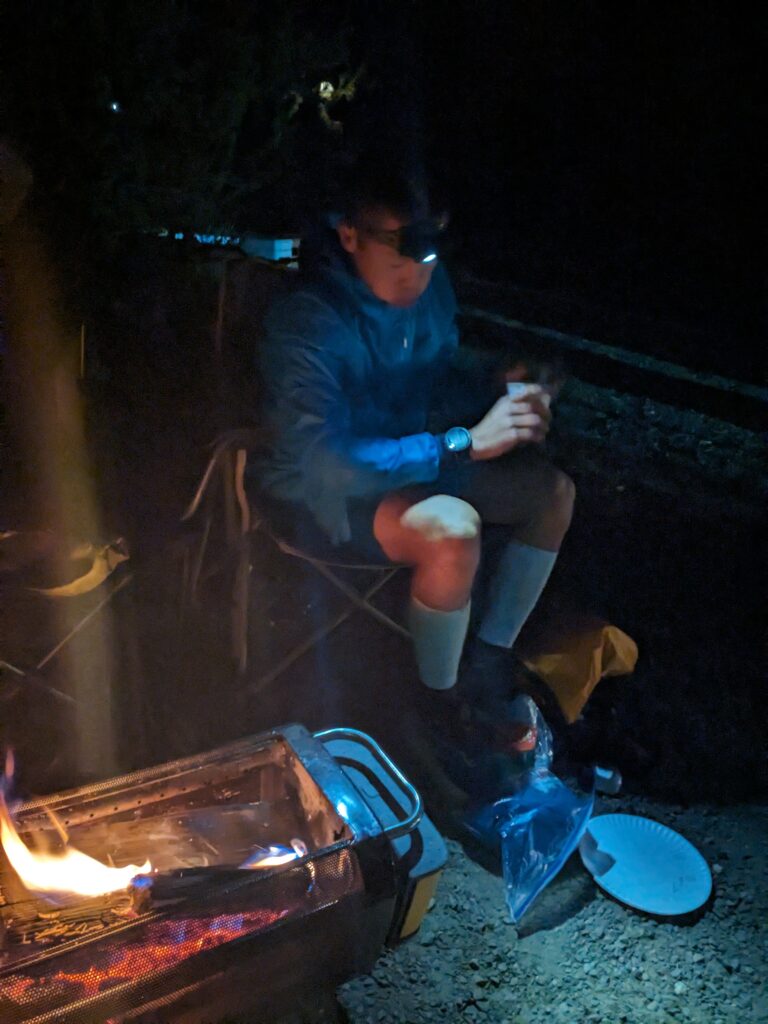
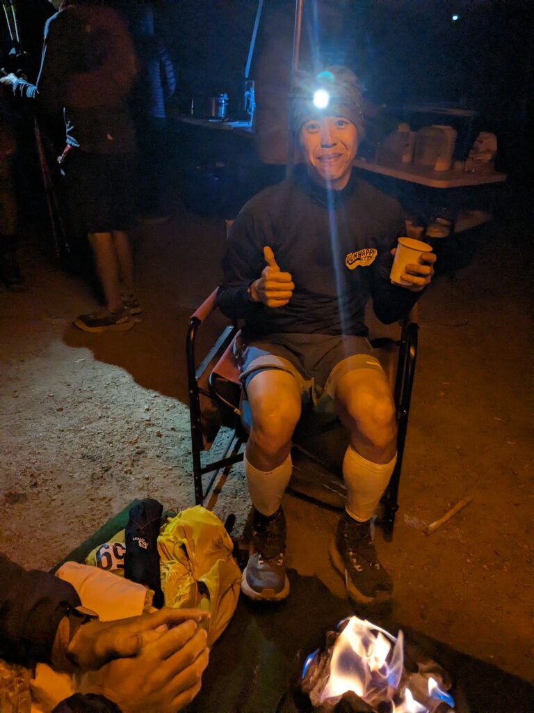
I made it to the North Crestline aid station at 9pm (mile 50). I sat down, an awesome volunteer brought me my drop bag, asked if i needed anything, and my first words were “anything savoury.” I inhaled some life-saving tomato soup and grilled cheese sandwich. And ramen and broth. And more broth. Finally I felt better. I changed from the Brooks Cascadias to the super cushy Brooks Calderas, with a determination to run hard in the 2nd half. I felt a surge of energy leaving the aid station after a quick turn-around. It just took some hot food and cool air. I power hiked for five minutes, to make sure everything would stay down, before breaking into a steady trot and ran my best leg of the course.
Its a 8km descent down the Pearl Creek forest road, similar grades to Mountain Highway in North Van which I trained on. I was feeling great, and began passing other runners who were walking down the road. Near the bottom, the course turns off the road down a sheep path, towards water crossing on the south side of Upper Payette Lake.
At about 5 miles after leaving North Crestline, you MUST catch a right turn onto Terrible Terrence Trail. It is signed and extremely well marked, but still possible to miss as you dodge the gravel chunks underfoot. Catch that RIGHT turn onto TTT and slow down. The TTT is 1.4mi long and rough throughout. This “trail” is no trail at all for the first few hundred feet of drop. The sheep just ate all the grass there, so at least you can see the footing.
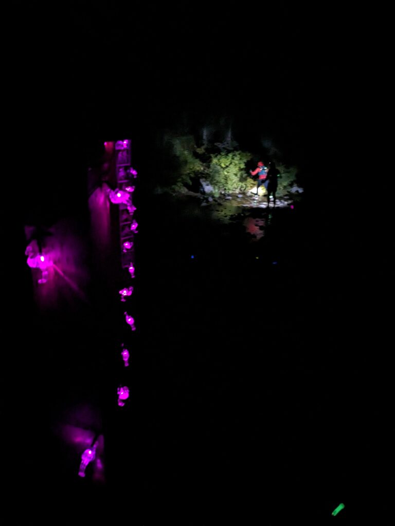
The Terrible Terrence Trail was a nice trail section that I enjoyed after the long road miles down. Another runner who’s headlamp died joined me along here. This reinforced my habit of always carrying a second headlamp for overnight pushes. The water crossing was easy. They stack rocks to keep your feet dry, a nice gesture, unlike at Finalyson Arm where they purposely remove the rocks so runners start the race with wet feet (Hi Myke if you’re reading this! Love your race) I settled into a run/walk rhythm rolling along the shores of Upper Payette Lake, dark and starry, running past campers, and a long line of crew vehicles hinting that I was close to the aid station. I felt like I came back from the dead, running with a new intensity.
Leg 7: Upper Payette Lake to Duck Lake – 93.5 to 110.5 km (17 km)
At Upper Payette Lake, I had a few more pieces of bacon, a delicious vegetable soup, quesadillas, and bananas. I had some help from Jacob? who gave me some advice for the rest of the course. I missed most of the details while I was trying to eat everything, and sort out my gear (switch out my small headlamp for a 2nd 18650 headlamp, picked up my toque and gloves). Most important advice was: don’t let yourself get too comfortable in an adventure-day pace, keep running, even if it’s ten seconds at a time, and the faster you finish the less heat you’ll deal with on Day 2. And that it’s going to be cold near the creeks, but up high it will stay warm. Going into this, I was confident the night would be my strong suit. No crew, no pacer, no problem. This will be fun.
DON’T TRUST ANY WOOD BRIDGE YOU COME ACROSS AT IMTUF. THEY ARE ALL SKETCHY AND YOU COULD BLOW THROUGH AND HURT A LEG. SOME HAVE BROKEN PLANKS.
If you’re used to the BC Parks trail maintenance strategy, then you’ll feel at home on the IMTUF course.
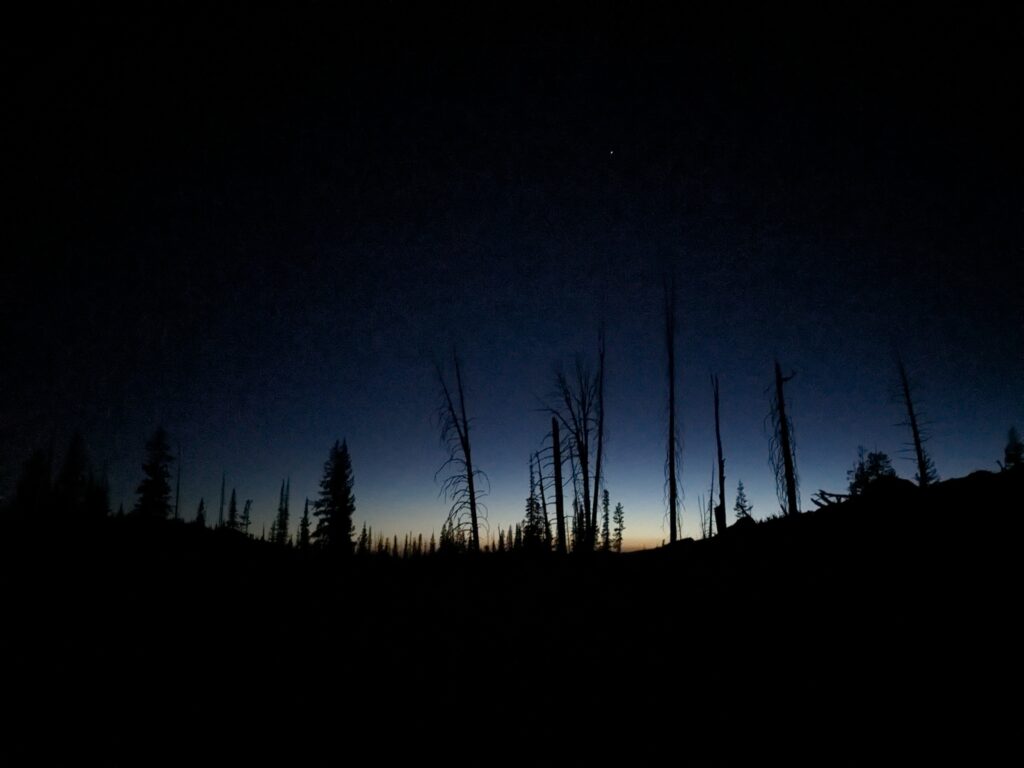
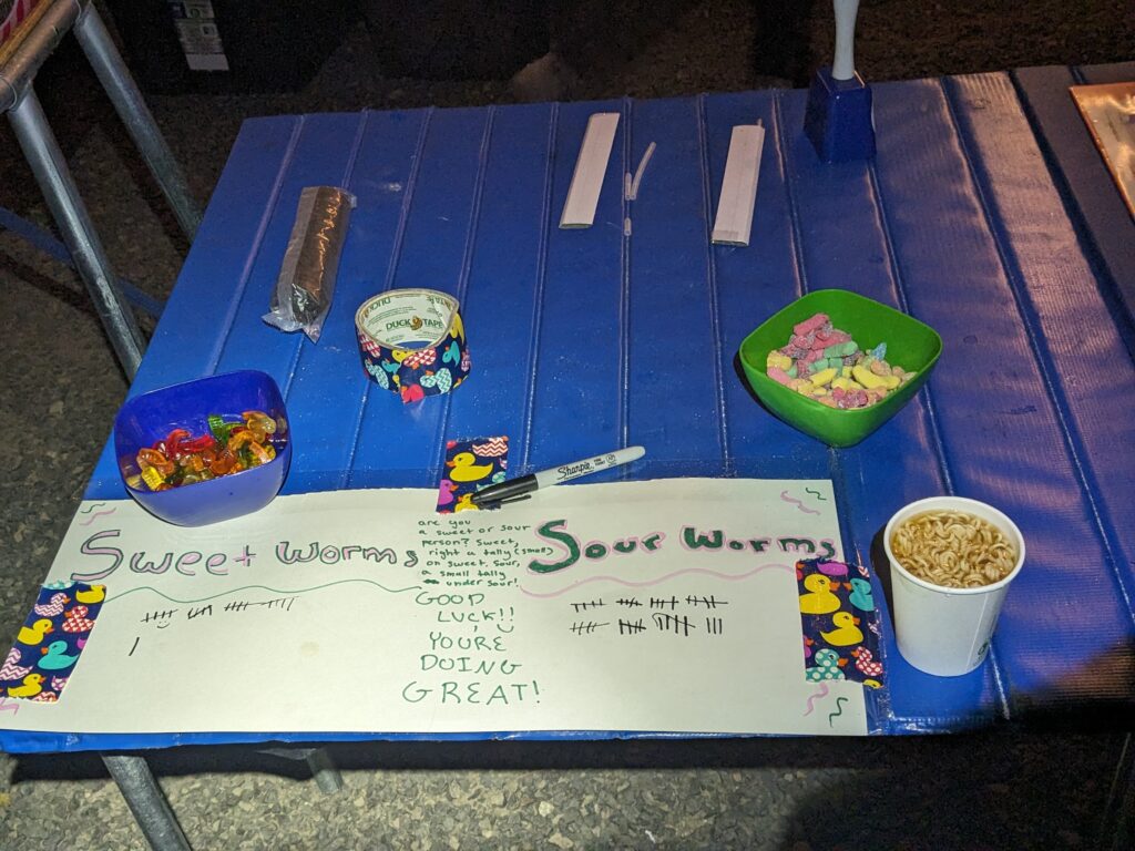
The first 5km section of the Twentymile Creek trail was runnable and I was having a great time, feeling alive and energetic. I passed through beautiful meadows in the dark. This section had 500m of climbing, and then 200m descending past Duck Lake to the Duck Lake TH aid station, arriving at 2:45am. I ate sour gummy worms, more ramen and broth.
Leg 8: Duck Lake to Snowslide – 110.5 to 118 km (7.5 km)
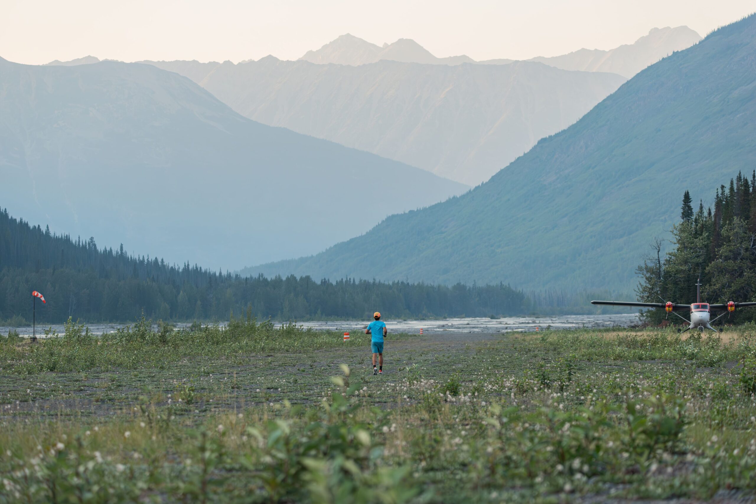
This section is absolutely stunning with granite peaks all around you and you are on a dirt road so you can look up and actually enjoy the view…but it is most likely dark so continue on into the inky blackness.
The road was so perfectly smooth and runnable, although I didn’t have the legs to do much more than a run-walk here under the stars on a mostly downhill section. I imagined how beautiful this section would be in the daylight.
100s are suppose to be hard, it’s why they’re worth doing. In the cool cold night, I lost track of time. My goal was to run just ten seconds at a time, and digging deeper each time to run just a bit longer, covering the miles between aid stations one step at a time.
Leg 9: Snowslide to Lake Fork #2 – 118 to 136.5 km (18.5 km)
Cross a small flat, then climb the ferocious mountain slope above with only a few switchbacks for help. Steep, loose and unrelenting. Catch your wind along Snowslide Lake’s shoreline. Again stunning views, but almost surely cloaked in darkness. Crank it up again above the lake climbing very steep ground towards the giant granite walls above and the tiny pass between Snowslide Peak to the south and Sawtooth Peak to the north. The final pitch to the pass is downright cruel in steepness and looseness.
I made it to Snowslide at 4am and had some more ramen and broth. Another runner was having a rough time getting food down, and was considering dropping. Out of ideas, she decided to have a beer here, and it was only thing that stayed down. I arrived just as she rallied with her pacer, and set off into the next penultimate climb. That gave me some more motivation, as I reminisced on my experience last year at Fat Dog when I rolled into the Trapper aid station with headache, and decided that the offer of a beer 7 hours into a 45 hour run was a good idea (it was!).
I poured a can of Redbull into my soft flask for a little perk me up along the way. The Snowslide climb is about as steep as they get, but I was able to catch the headlamps above me. This climb is no joke, a 600m climb over 3.3km (average 17.7% with the “flat” part in the middle) to the Snowslide Summit. This is suppose to be one of the nicest parts of the course, a granite amphitheatre around Snowslide Lake, but I wouldn’t see any of that. All I saw was a steep climb, rocky, loose at times, think BCMC trail but steeper and more raw. A climber’s trail that was relentless and borderline Type 2 fun on tired legs. I stopped once, turned off my headlamp, just to admire the dark starry sky.
The next 14.5km was a long descent down the East Fork Lake Fork valley. It started steep and technical, went through an avalanche path with fireweed obscuring the foot path, then turned into flowy meadows and rooty trails next in the canyon bottom. My strategy was to walk the steeper parts to save my quads, and jog when it flattened out. It was frosty and cold, but I was loving it just running in a t-shirt and gloves.
Leg 10: Lake Fork #2 to Boulder Lakes – 136.5 to 155.5 km (19 km)
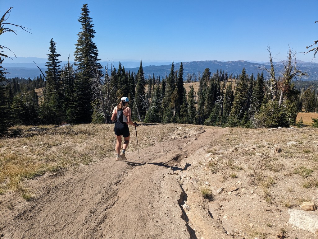
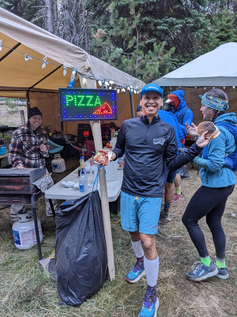
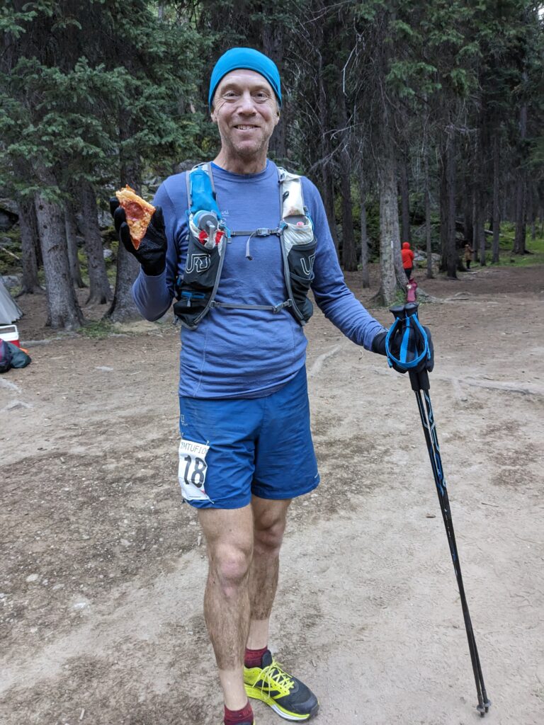
There’s a 2.5km out and back to the Lake Fork Trailhead aid station, which was a nice chance to see and cheer on the other runners heading out for their final climb. Knowing this was the last major aid station, I took my time here to reset. That meant a change of socks, change of shorts and t-shirt, and brushing my teeth at 8:30am. I knew this was the pizza aid station, and they delivered with a delicious pepperoni slice. I grabbed a pancake for the road too. Unfortunately, I rushed out and forgot to fill my soft flasks here, so I had to use my filter later on to top up my water for the hot climb up Boulder Mountain. I was confident now I could finish this.
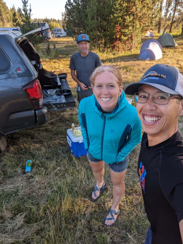
I caught up to Tim here, who was dealing with some stomach issues and could only eat at the aid stations. The distances between the aid stations are long at IMTUF, especially during the night sections for a mid-pack runner like myself, it was four hours from Snowslide to Lake Fork, and another four hours from Lake Fork to Boulder Lakes. Welcome to a remote mountain race.
I retraced the route from the previous day, climbing up back up to Boulder summit with a couple other runners and turning right to continue up Boulder Mountain, topping out at 11am with over 900m ascent, the 2nd biggest climb of the IMTUF course. I embraced the heat. It was all grit to the end. I was getting a bit parched. I still had to run down west ridge and then down into the Shaw Twin bypass.
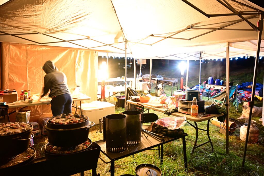
The Shaw Twin Cutoff section is pure IMTUF. Weird and continuously engaging, even though it is mostly downhill. Your brain and legs will be quite done with this kind of terrain by this point. This is the sting in the tail. I get more complaints about this section than all the others combined. Even the leaders find this Shaw Twin nonsense particularly cruel. At Lake Fork #2, eat some deep dish dutch oven pizza and put some extra TUF in your pack and get ready to use it all up and be a quivering mess by the time you get to Boulder Lake Aid.
Years ago the roads here were decommissioned, and the course weaves a snake and ladders line through unlikely cross-country terrain, classic pointless up and down terrain. Nothing was pleasant about this part. This was pure IMTUF terrain, a masochist’s delight. The course is designed to slowly break you down. I don’t think it’s even worth trying to follow Jeremy’s left and right or up and down directions at this point, your brain is mush, the terrain is so convoluted, you just trust the flagging, and ignore yourself every time you look up or down and say “seriously? no way” I kept hoping to find a creek but it was just the rustling of the leaves. Luckily I found a good creek below the road and I detoured to dip myself and cool down a bit before jogging the road to the Boulder Lake aid station with another runner. I made his day when I told him we didn’t need to climb back up Jug Mountain, something that he had fixated on and saved energy for. Imagine the carnage if that was the course.
Leg 11: Boulder Lakes to Finish – 155.5 to 166 km (10.5 km)
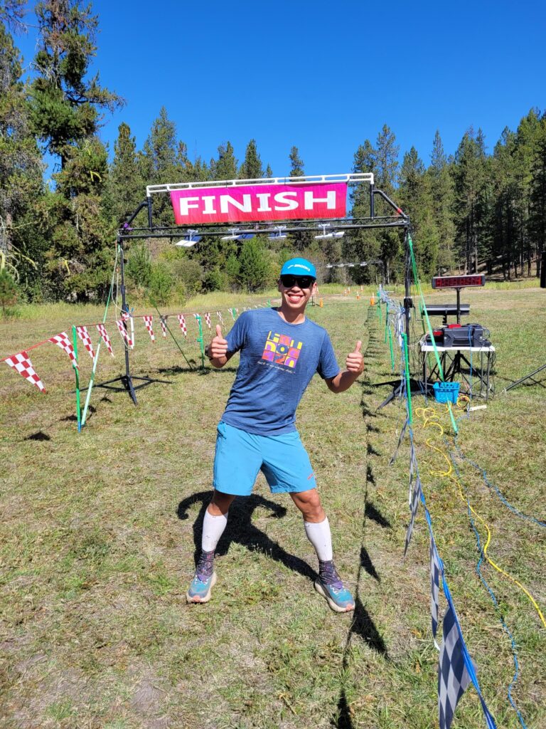
Descend Harpers Hollow through some cool, forested switchbacks and a few very short but heartbreaking uphill rollers. Really fun running without 100 miles on your legs. Harper’s swings by a creek on the far north end of JMR property, then enters open grass and you can see the finishing meadow below. The hair on the back of my neck is standing up and chills are hitting me as I type now. I am so excited for you to experience this. A few switchbacks in the grass and it is over. So much sacrifice, so many miles and so much pain and joy. IMTUF is all yours.
I stopped just long enough at Boulder aid station to fill my shirt and hat with some much needed ice, crushed my can of cold brew coffee, ate a couple chunks of watermelon, ditched anything unnecessary into my drop bag and made it out after 5 minutes.
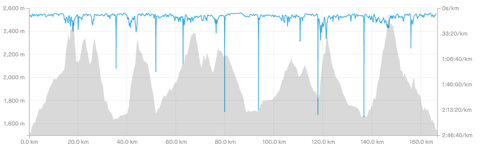
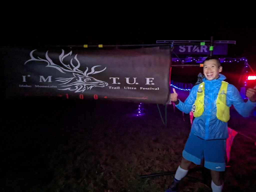
Just when you think the hills are over and it’s a cruise to the finish, a steep punchy climb comes out of nowhere. The next 10.5 km had 185m of ascent, with 540m descent, mostly on good trails. It took me 1hr 45 to get to the finish line. The last twenty minutes seemed to go on forever, those heartbreaking uphill rollers were exactly as described. I dug deep one last time and finally saw the meadows and jogged into the finish, after 32hr 24min on course, 58th/103 finishers, with 62 DNFs for a hard earned buckle. I was proud of myself for rallying the deepest and hardest I’ve ever done to run hard to the finish in the back 50+ miles.
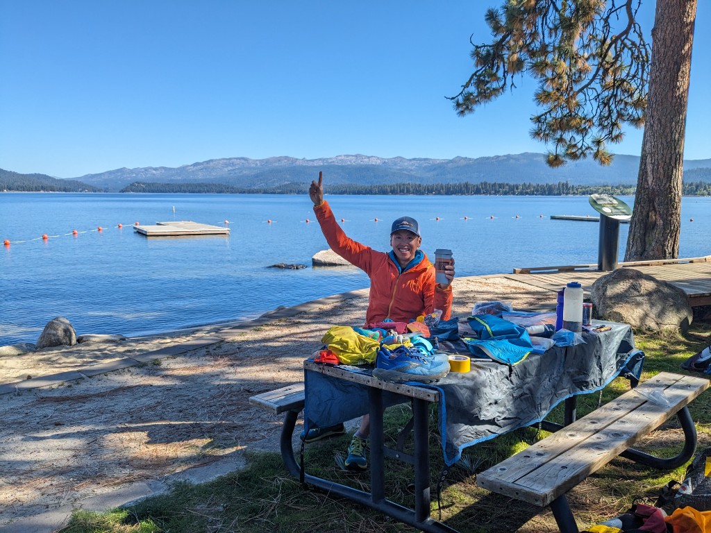
It was so hot, and I joined Marieve (4th woman!, 29:21:10) and family hiding in the one patch of shade at the finish line. It was an anti-climatic finish after all the emotions of the past 32 hours, and all I wanted was a can of coke. The finish line had hearty soup and homemade bread, which wasn’t too appealing in 30C, but they were the calories I needed. We watched Tim finish (33:17:36), cheered on the runners in the golden hour, the final hour before cutoff, and then it was a slow-moving process to pack up camp, get in the car, and drive back home. We drove an hour out of McCall fuelled by chicken strips and ice cream before another night camping by the Salmon River. It’s pretty entertaining to be so worn down, walking through the grocery store, wondering what your stomach can eat, and calculating the car snacks needed for the next day.
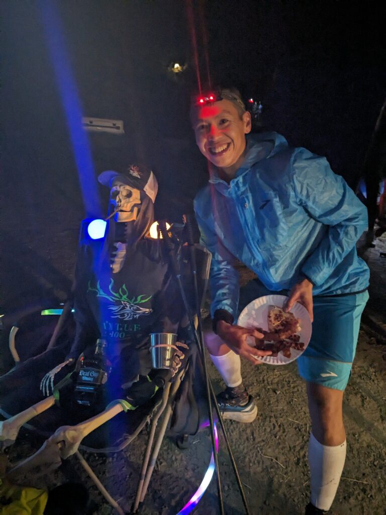
Endless thanks to everyone I got to run with this past year, every step building towards this goal. This race is incredible, you can feel the passion the race directors and volunteers pour into this event. Where else do you find a goat-packed aid station, or flawless course flagging. Thank you to the incredible volunteers who fed me along the way to the finish – ginger ale, ramen, broth, bacon soup, pizza, pancakes, watermelon, ice. Congratulations to all the runners who I got meet along the way. Thank you Jer and Brandi for all your efforts into creating this space to discover how TUF we are. 100 miles isn’t that far when you break it down into small pieces.
Post-Run Stats
Final stats based on my Coros Apex Pro:
- 32:24:20 Elapsed Time
- 1hr 36 min Time at aid stations buffets (Shortest was 2:30, longest was 15:53)
- 6077m/20000ft Elevation Gain (It feels like more)
- 166.68 km/103.5 miles
- 14277 Calories
Cost:
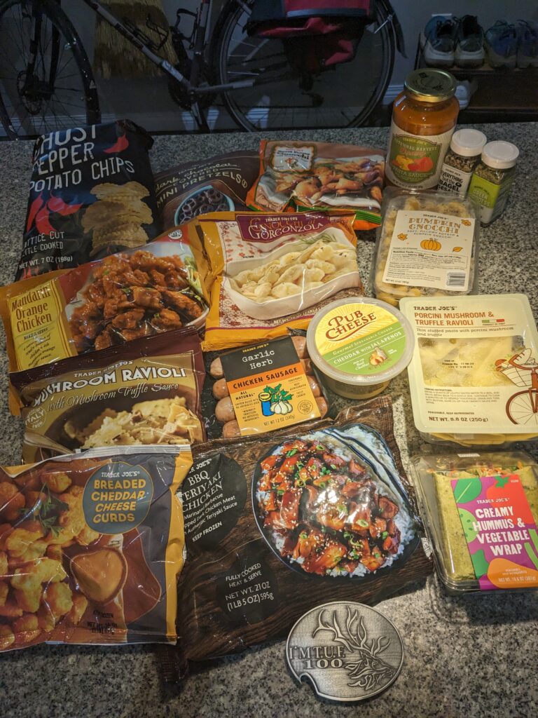
$336 USD for race entry taxes and processing fees, 2000km of cheap American gas, $40 for camping and two black toes. Worth it for the buckle and cool t-shirt.
Richard! You’re a bloody legend, mate. Truly mind-boggling, that anyone could do this feat. FYI I think you mean 166km not 116km
Thanks Mike! That’s a big typo! This is what happens post-ultra and everything goes mushy in your brain =)
Great race report! Super helpful and informative (though I did have to read it with my secret decoder ring by my side to figure out what these strange “kilometer” things were that you kept talking about. LOL. Say hi to Tim and all the BC folks for me. Hope to make it up your way again one day. And congrats again on the finish. URTUF!
Thanks John!!! Love your race recap too. Now imagine trying to run at IMTUF, where all the distances don’t really add up either, everyone telling you how many miles you’re at / how off the distances are, and now you’re trying to figure out what a 1/4 mile is in kilometres 30 hours in!