Sept 4-6, 2010
Over the Labour day long weekend, a group of friends and I traversed ridges, meadows and valleys from the south branch of Downton Creek, through Twin Lakes, through the Hurley Silver mine area, and finally out to Rohr Lake. Amongst my trip partners, it’s always hard to keep everybody happy. Some of us have been everywhere, some of us have only been to the really obscure places, some of us want to go and visit the obscure places, and some of us have forgotten where we’ve gone. And some of us are just content to be outside in the mountains. Our friend Robin had done a complete traverse of the Cayoosh Range many summers ago. Unfortunately we only had time for a short section of that line. This was our approximate route.
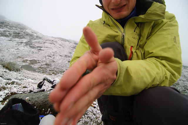
We left Vancouver early Saturday morning, left one vehicle at the north end of Duffey Lake, and drove the other vehicle up the Downton Creek south branch, which has some waterbars in the last kilometre. We left the first vehicle at the bottom of the Hurley Silver mine road because we didn’t realize we could make it to Rohr on this trip, until partway through the first day. As soon we we got out of the car, I realized that I left a significant chunk of my food back in the other vehicle, including most of my lunches and snacks. A few minutes later, Tim realized that he also left behind his jar of peanut butter at home. For most people, this wouldn’t be a problem since they would supplement it with many crackers and other snacks for lunch. But Tim is a highly efficient mountain climbing machine that runs only on pure peanut butter. Tim realized after a few trips that a spoon is a far more effective medium than crackers for delivering calorie-packed peanut butter into one’s mouth.
The hard work began right away, starting with a steep cutblock, and then a long plod up scree to the ridge on Peak 2560. I’m not sure if it was something I ate for breakfast that morning, or maybe it was just my general enthusiasm for being back outside in the mountains after a summer of inactivity, but I felt like I had a rocket propelling me up the hills.
Looking up at the headwaters of Downton Creek south.
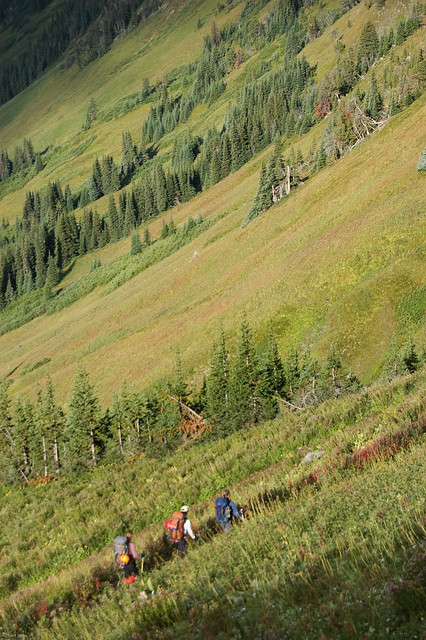
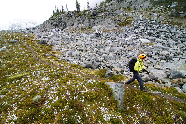
Tim on the way up to Peak 2560. We parked somewhere down there.
Views north towards Seton Peak. Many more ridges above Downton Creek.
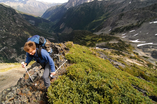
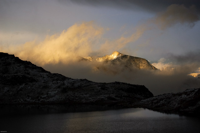
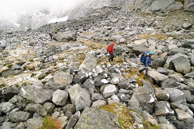
Chris hiking above Melvin Creek after a thunderstorm
To get to Twin Lakes, we dropped down to a few lakes below Peak 2560 to bypass a knife edged ridge, and then contoured across that ridge until the terrain mellowed out to more ramble-friendly terrain. On the way to Twin Lakes, we were plastered by snow and hail from the thunderstorms passing through the region. Usually I try to avoid trips when the weather isn’t great. But you only get that really special lightning right when the weather changes.

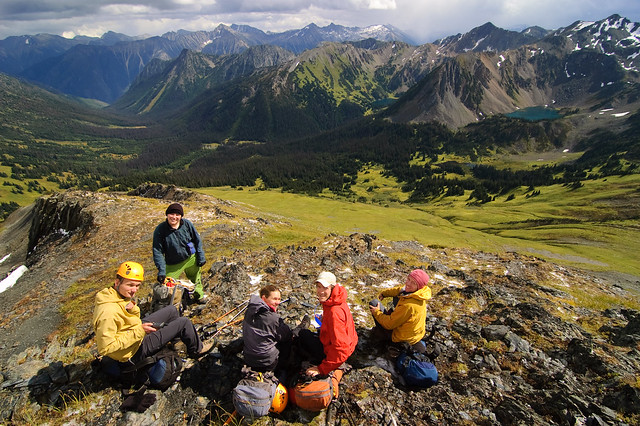
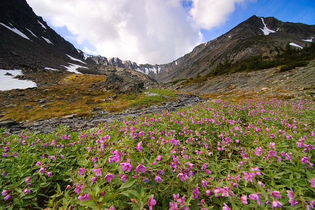
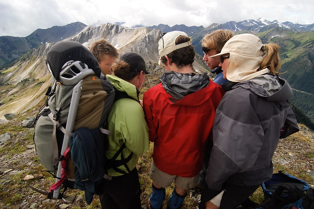
The gang above Melvin Creek. What a neat place! Definitely worth another visit.
We stopped frequently, to admire the meadows below in Melvin Creek where a ski resort was once planned, and gazed out at the mountains beyond and thought of future trips. I didn’t enjoy the breaks too much, since it would mean that I would have to eat my snacks. This will probably become known as the trip where I mooched food off everybody. Chris and I worked out a nice deal where I swapped my excess water for his chocolate covered almonds.
The gang on the final ridge leading to Twin Lakes .
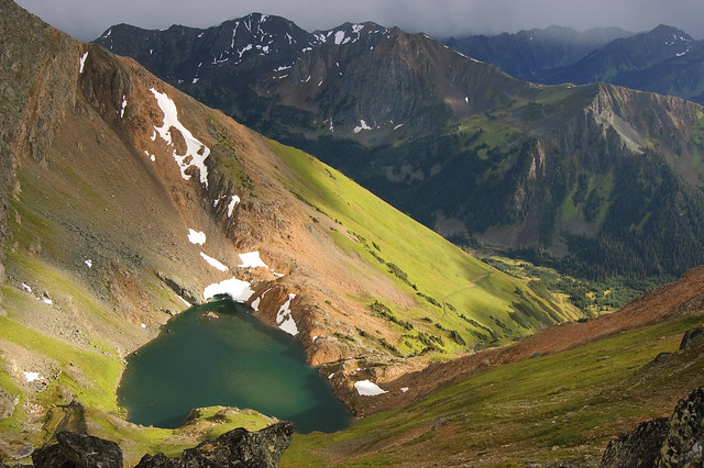
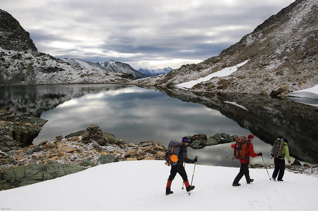
Twin Lakes is a very neat spot, and is located at the confluence of four different ridge systems. We camped at the scenic upper lake, and spent the evening trying to scramble up Crystal and Elliot Peak. A few years ago, Fred Robin and I did a very casual two day trip here where we hiked up through the Barkley valley and scrambled up both of those peaks in fine summer weather.
Evan, Greta, Tim and I had a different experience this time. I was near the top of the snow patch, when I heard a distinct buzzing sound on my iceaxe. The weather had been closing in on us this whole time, but we were all hoping that maybe this storm cell would pass through us. I looked up the slope towards Tim, who must have heard the thunder crashing around us, and the hail gaining speed towards us. Evan Greta and I decided that we had enough of getting wet up there, and made a hasty descent back towards our tents. Tim continued on towards the summit, and he later told us that he almost made it to the top, but decided to wait below it for a few minutes to see what the weather was doing. A few minutes later, Tim saw a few bolts of lightning strike the summit, and that was his cue to turn around.
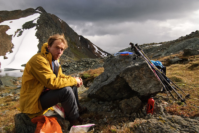
Tim taking a short break at our camp at the upper lake, wishing he had some peanut butter.
Looking down at the lower lake, taken from the ridge up towards Crystal Peak.
Evan, Tim and Greta walking back towards our camp to retrieve our ice axes for the route up Elliott Peak.
Evan descending down towards safety. The flashes of lightning around us motivated us to get down quickly.
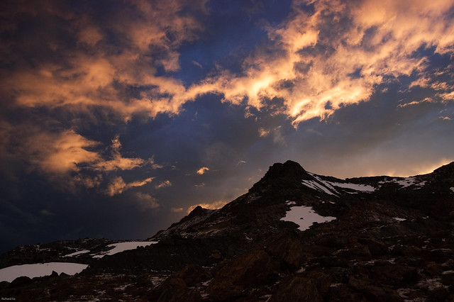
Thunderstorms combined with sunsets is a combination I sometimes dream of.
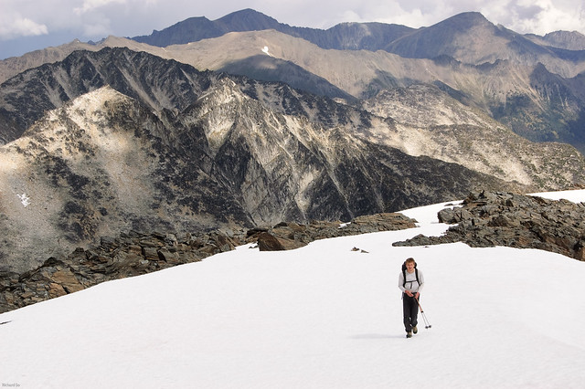
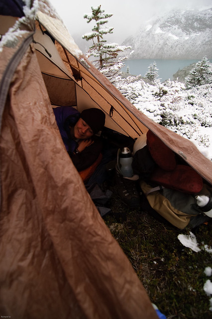
Both mornings on this trip shared a common theme. Partially frozen water, snow covered tents, and cold fingers. Our route on the second day took us down through the flower-covered meadows of Barkley Valley, and then up on a small lake near the headwaters of Elliott Creek. From the lake, we ascended a rocky pass to gain a ridge on the east side of Common Johnny Creek, which we then followed the rest of the way towards Mount Rohr. Easy routefinding right?
Frozen toes the next morning.
Descending down into the Barkley Valley.
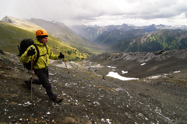
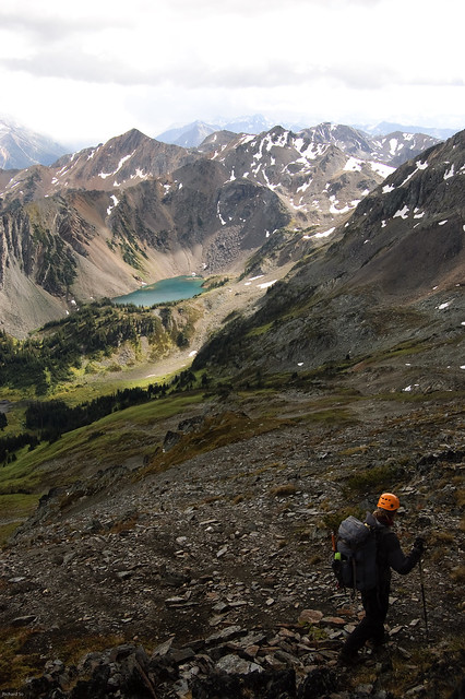
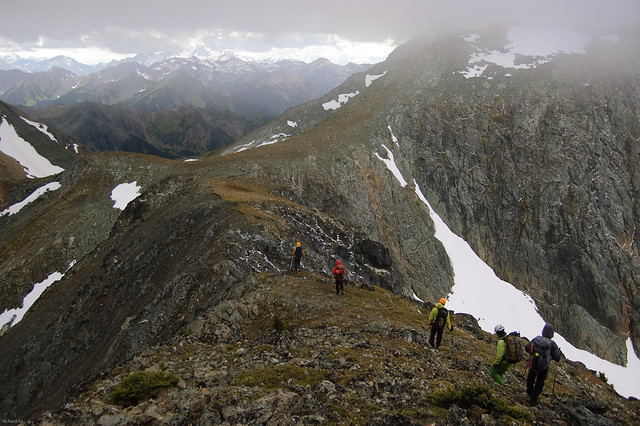
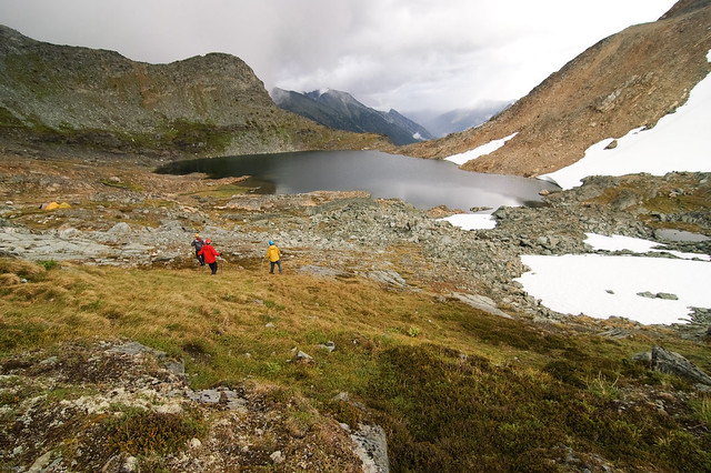
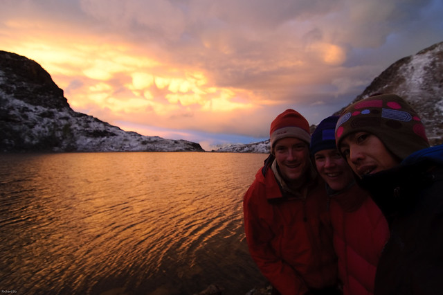
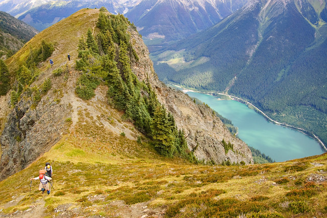
The section through the Hurley Silver mine basin offered excellent hands in pocket ridge rambling. We were most worried about the ridge between Peak 7400 and Mount Rohr. I remember reading a trip report where the author said the ridge was recommended and non-technical, so I tried my best to convince the others that it would work out. Our other options were to camp in the Hurley Silver mine basin if the weather turned foul, or to drop some significant elevation down into the headwaters of Common Johnny Creek to bypass the jagged roller coaster ridge. Part way through the ridge, when it looked like things might be going too slow for us to reach Mount Rohr, I suggested that there would only be three more sections of scrambling on the ridge. As it turned out, there were only one or two tricky sections along the entire ridge, and the rest of the route was on a well defined goat path. It was a blast to be on a ridge, with a steep dropoff on one side down to Duffey Lake, and rocky cliffs down to meadows on the other side. To quote Peter Croft, “when you do a ridge traverse, it’s like being on a summit all day long.” Of course this was just a stroll compared to the ridges that he’s climbed. We stumbled into camp at the heart-shape lake on the east side of Rohr, only twelve hours after leaving Twin Lakes that morning.
Checking the map to figure out how far we had to go, and options if the weather turned foul.
Ridge rambling along the goat path, and Duffey Lake below.
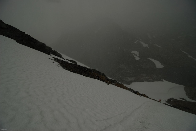
On the third morning, it snowed again. It could only be described as a whitebird morning, which changed into a greybird day. I tried to convince Krystil that it was a beautiful morning outside, given that Greta and I had just seen a small blue patch amongst the low clouds. Krystil unzipped her tent door, looked outside, and said, “you guys are so funny, it’s not nice outside.” And crawled back into her warm sleeping bag. Instead of going over the summit of Mount Rohr as planned, we contoured north into the headwaters of Halymore Creek and then back over a pass to drop into the meadows below the summit. The summit was socked in, and it was looked much more wintery up there.
Not quite ready to leave the comforts of a warm sleeping bag.
Chris warming up his lighter on a frosty morning.
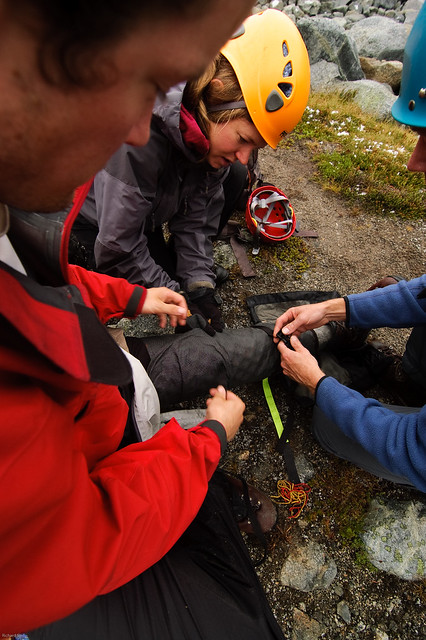
Once we picked up the summer trail, Tim and Chris went ahead, since they still had to hitchhike up the road to retrieve the cars. The rest of us hung back with Evan, who tweaked his knee the previous evening. A few straps, and one inflated thermarest around his knee eased the walk out. While hiking down the trail, Krystil and Greta started talking about their favourite recipes, one was about a really tasty sandwich, and another was for paplova. I started walking faster, knowing that there were blueberries down on the logging road, and I could only ask them to stop talking about food, as it was making me too hungry. We were on the road by early afternoon, and waited around at the salt shed for the cars to arrived. We looked at the map again, looking at exactly where we were, and I thought to myself how this was going to be a very nice line on my map wall.
Chris hiking out along the Rohr trail
Evan and Tim hiking along along the Rohr trail. Soon this will be covered in snow and we’ll be skiing again!
 Despite the setback, Evan had a speedy recovery and both him and Greta rode in the Whistler GranFondo the following next weekend!
More photos at Flickr