
Dec 25, 2016
Mount Mulligan is a small summit, mostly forested except where logged (and quite extensively!), just southeast of Squamish. Unlike the Red Heather area to the north, this area sees a lot less skier traffic, and more snowmobile traffic, as the access road is not plowed, nor is it in a park. However, the area offers a straightforward ascent, with some easy open skiing on smooth cutblocks
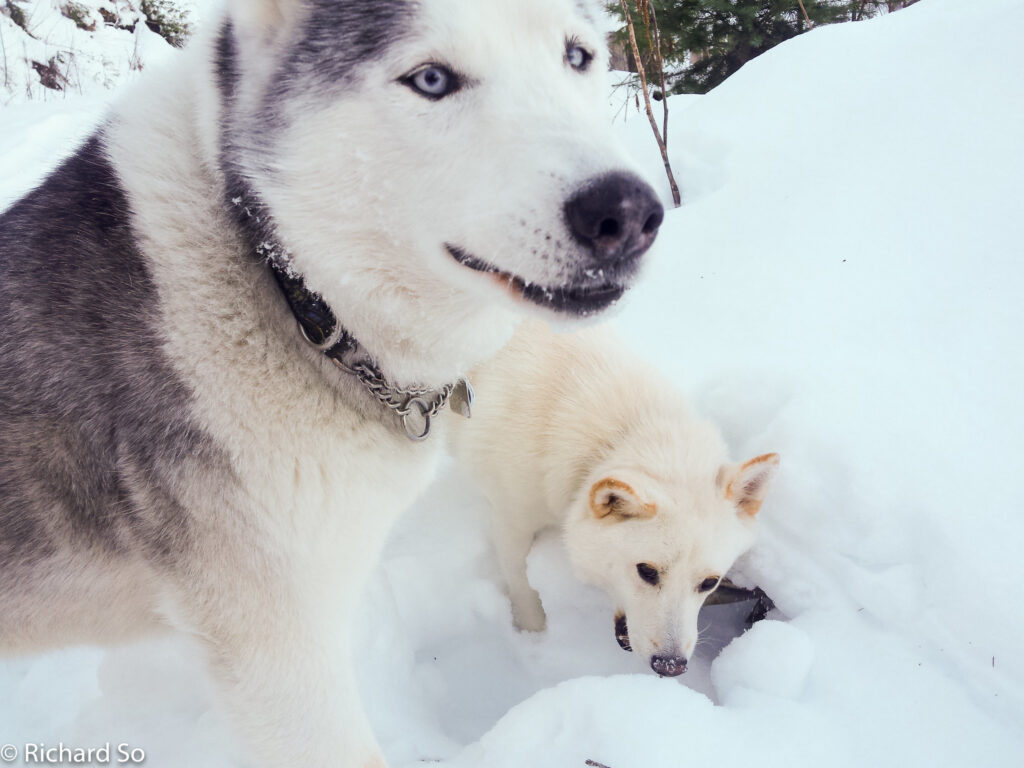
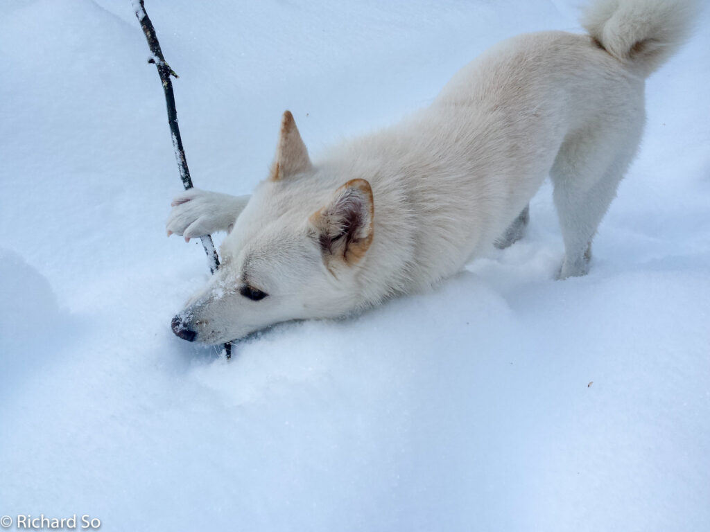
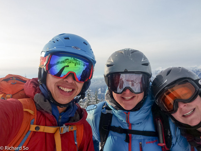
On Christmas Day, I found myself in the snowy Apron parking lot, wondering where my friends were. Greg and Lisa were in Squamish picking up their friend’s dog (Sky) and we were going to meet to go and ski Mulligan. “I’ll meet you at the Apron parking lot.” “Where’s that?” “Right by the Chief.” “Sorry Rich, you’ll have to be more specific than that.” Sometimes, I forget that not everybody is a climber.
Christmas day would have been awesome for skiing on the North Shore, but Greg and Lisa were up in Squamish for a dinner that evening. It was probably good to break up the North Shore skiing streak. Greg and I had skied Hollyburn the day before, and we would ski St Marks the following day, and then Hollyburn again after that. Ski conditions on the North Shore had been spectacular in late December, and it was hard to convince me to ski anywhere else. I found myself that morning, driving past the Cypress exit, wondering why I was driving further to worse snow!
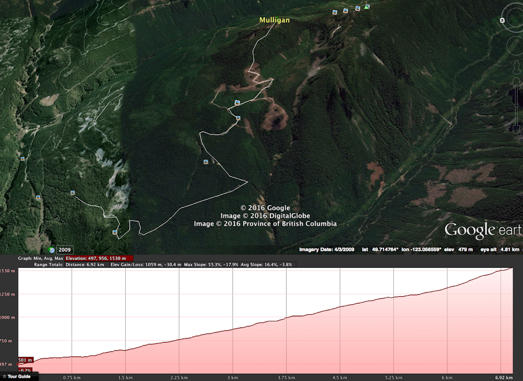
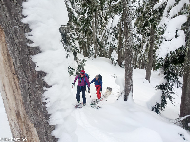
The snowpack in Squamish was thinner in comparison. We drove up the icy Mamquam Main, where chains would be a good idea. The Mamquam Main is plowed up to the Skookum Power Project, but you don’t need to go that far to get to Mulligan. The Mulligan spur road (M7) leaves the Mamquam Main at 6.8km, and branches off to the right, with an immediate switchback. The road climbs quickly, and depending on the snow condition, you may want to just park at the turnoff. Greg drove the 4Runner up to 520m, where we started skinning from. There are not many spots to turn around on, so drive up the road at your own caution. You might piss off a snowmobiler or two if you pick a poor spot to park.
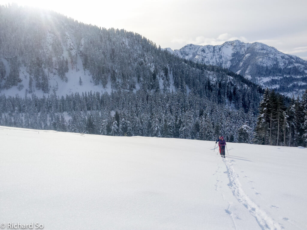
Snow conditions were pretty poor on the road. An inch of breakable crust at the lower elevations. The road only has a brief flat section, and otherwise climbs all the way up to 1200m, with a big cutblock ending at 1350m. From the end of the road, you can either ski up through the big open cutblock towards Mount Mulligan, or continue following the road towards the Mulligan-Anif col. Getting to the col is steep, but Anif Peak is a more open summit with good views of the Sky Pilot Group. There are some nice steep north facing bowls in complex terrain, to ski on both Anif and Mulligan.
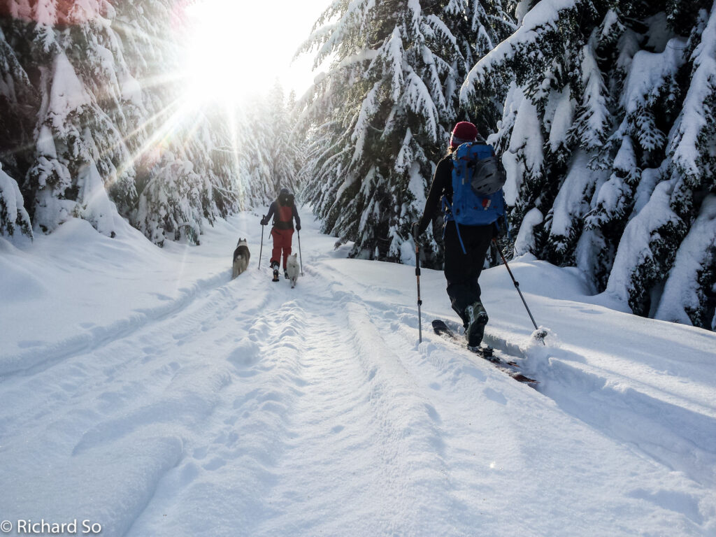
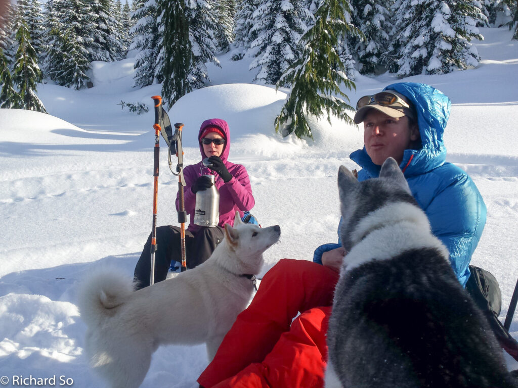
Fortunately for us, the snow quality improved as we climbed up the road. Low density boottop powder sat on top of the firm crust. I don’t know how busy this road gets on a normal weekend, but being Christmas day, it was completely quiet. This was also part of the reason I came here today. I figured most people have other plans today. We stopped for lunch just below the cutblock, and there was only one other skier who came by.
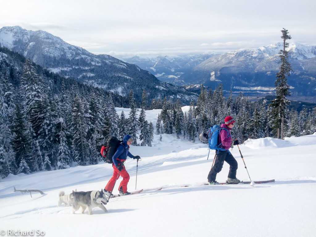
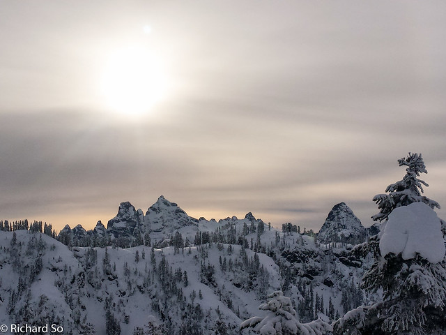
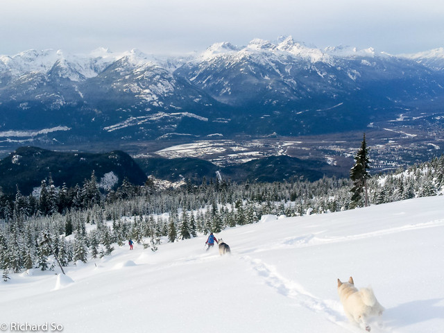
We headed up into the big cut block. If you look at the area on Google Earth, you will see that almost all sides of Mount Mulligan has been logged, save for the last 200m elevation band below the summit. The snow was probably as good as could be for this type of terrain. A big open green run, thanks to recent logging. There were only a few stumps that broke up the otherwise planar slope, no more than twenty degrees. I broke trail up towards the summit, enjoying the open trees leaving the cut block, and the boot-top powder over top of the firm crust. Greg and Lisa stopped just below the summit, while I continue up to get some more views of the Sky Pilot area. It started as a sunny morning, but the clouds associated with the next weather system moved in by the early afternoon.
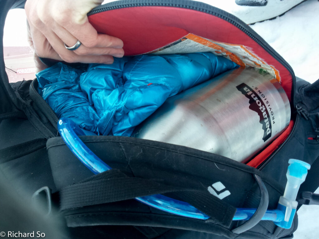
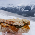
I skied back down to Greg and Lisa, where we celebrated Christmas by enjoying the apple crumble pie that I carried up. Greg also hauled up a full growler filled with hot chocolate and schnapps to go along with the pie. It was easy skiing through well spaced trees back to the cut block. You could actually continue skiing further down the trees along the northwest ridge, but we headed back out into the cut block.
The snow was just perfect for these conditions. Fast, light, blower powder. It was hero snow, but not too much of it. We had fun skiing down the gentle slopes, where any more snow, or heavier snow, would be a slow descent. The ski down to the truck is quick, as the road is almost all downhill, with a very short section of skating. I only took off my skis once near the bottom, on a steep hill with a surface of ice and gravel.
Mount Mulligan seems like a great place to go if you’re looking for some easy ski touring with good views, and as a nice alternative to Red Heather. From the end of the road and up to the summit, there are really great views of the Garibaldi area, the Tantalus Range, Skypilot, Howe Sound and Mamquam Mountain. I’m not sure how busy this place gets with snowmobile traffic during the winter. While we were up there, there were only two other snowmobiler-skiers up there on Christmas day. Later in the year, or in early season, you should be able to drive further up the road. This is a quick trip, with most of the time on the ascent up the road, and hopefully a fast easy glide out back down.


Hey, quit ruining my secret local zone! Just kidding, I think Mulligan is a good alternative to more popular areas like Red Heather although as you mention it's best to be prepared to share the area with sledders. There are some nice, albeit short, runs beyond the cut-block you mention.
Mostly I wanted to note that I believe the peak you refer to as Anif is actually Mulligan (based on Fairley and also widespread local usage). "Anif" I believe is an arbitrary bivouac name and should be abandoned.
Hey thanks Nick!
To be honest, I was just up in the area looking for a place to ski with my friends with their dogs (ie. No Red heather), but not too difficult as she is dealing with some knee problems. If this place blows up and becomes the new go to zone, I'll buy you some beers.
That would make sense about the peak naming, as the actual Mulligan is higher than the bump I skied on then. Thanks for the clarification!
Anif is the peak to the south and Mulligan to the north. I think Richard has it right in his description.
Actually, sorry Nick, I spoke too soon. I did a bit more research. In Dick Culbert's 1969 edition climbing guide he mentions Mulligan (5300ft), but makes no mention of Anif. Looking at the elevations on Bivouac, Mulligan is listed as 5033ft and Anif as 5397ft. Looks like you're correct. Sorry to have doubted.
I just checked Fairley's too, which says "The name Mt. Mulligan is incorrectly placed on map 92 G/11. It should be moved to the summit 1km S." Thanks for all the clarification!