
Oct 3-4 2015
This trip report is way way overdue, I’m posting these photos and trip report, only 13 months later. This trip was with my friends Sarah Hart and Nick Matwyuk exploring a remote area close to Squamish last fall. The full photo set can be viewed over on my Flickr Page.
The forecast was too good, with two days of sunshine in October and even on a weekend! I needed to go and camp outside somewhere. After staring at my map wall for some blank areas, I decided that a loop around Pinecone Lake would be just right. I’ve never been here before, making it even more interesting to me. There was so much potential exploring above treeline. With the shorter fall days, I wasn’t sure if I could pull off the loop around the lake, with ascents of the craggy summits (Seed, Pinecone, and Gillespie) all in a day, especially with the rough and uncertain access.
For me, two days was perfect, a way to break up the drive, spend the best time (sunset and sunrise) in the mountains. With longer summer days, this route would certainly be feasible for a day trip, roughly 25km and 2700m elevation gain, depending on where you drive to. Those are rough numbers, based on Google Earth estimates while drawing out the route with the various summits along the way. I don’t carry a GPS watch, or track my route on my phone, so I never have any idea how far I go. The only certainty is that there was enough effort put in on a trip that I never have any calzones, sandwiches or pastries leftover by the end of the trip.
I am far less motivated than Sarah or Nick to go “hard” in the mountains. The usual pre-weekend email started with Sarah asking, “What about Atwell in a day and then maybe something else the next day?” As the voice of reason, I quickly responded that Atwell is a choss pile in the summer and we should probably do something more reasonable, more slogging, less chossing. After what felt like endless emails, I finally convinced Sarah and Nick that we didn’t need to blast through the mountains in a day, and spending two days in some fine October weather up high was just fine. I tried to ignore the usual comments like, “Could we do it in a day if we pushed really hard? We can run the road.” “We can do 25km in a day, no?” “Can we just try to do in a day” “I want to go home in time for a boulder session.”
Of course, my usual response will be, “No, let’s camp out. If you guys don’t think it’s long enough, I can look up a longer loop elsewhere.” And that was the end of that discussion and soon we were sorting out the departure time. We met Sarah at 6:30am in Squamish. I wanted to show up earlier, but Sarah doesn’t function before that time of day.
 |
| This is basically my favourite thing to do post-trip. Not much has changed since I first put up the map wall. There’s nothing quite as exciting as inking down the route I travelled in the mountains! The trail is at the end of the E-110 branch. It’s a rough road, with loose sections and alder. The condition of this road will vary by year. We did a clockwise loop, climbing up over Seed, Pinecone on the first day, camping at a small lake north of Pinecone Lake, and climbing Mount Gillespie on the second day. |
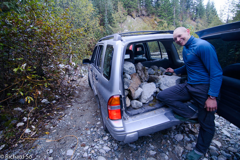
The trip didn’t start the way I hoped. Contrary to what the photo looks like, I’m not taking rocks home from the Mamquam FSR. The adventure started early on this trip on the drive up the logging road. To get to this area, you need to drive up the Mamquam FSR, well beyond Squamish. The road is good, if rutted and pot-holed in sections up to the Skookum IPP turnoff at 13.2km. But the driving gets rougher beyond. Both bridges at Km 25.2 and 25.8 (Bridge 4 and 5) are out as of Sept 2015. I had taken my Chevy Tracker through the creek at Bridge 5, with careful driving, on my first drive down this road when Nick Tyler and I climbed Meslilloet Mountain.
I was just as hesitant about this section this time. I had bottomed out climbing out of the creek on the opposite side last time. I drove up to the washout, stepped out of the car to take a look at the far side. I don’t know why I didn’t check where I parked at that moment. I was too focused on the section ahead, without thinking about where I had parked the car. A quite glance around, a few extra seconds would have prevented the ensuing near-disaster. Nick and Sarah were outside. I lightly accelerated and within seconds I drove the front of the car over the embankment leading down to the creek, with the front right tire hanging in mid air. I went straight when I should have turned hard to the left. The centre of the car was high-centered. Reversing didn’t work. Any attempts seemed to make things worse.
It was unlikely anybody would drive 25 kilometres up this logging road that day to pull me out. The Chevy Tracker is rear-wheel drive, so we got to work unloading all our gear, replacing our packs for rocks. Weight in the back was key. We stacked rocks as high as we could in the back. As much weight as possible over the rear tires to keep them from spinning. Nick also deflated the left tire for more traction. Sarah and Nick stood on the rear bumper, leaning and pulling as far back as they could. I tried reversing. Still no luck. The problem was still the front right tire which was hanging in the air.
Nick came up with the plan to build up the area below the tire. We didn’t need a flat road surface there, but the right tire needed to contact something. A few logs, some rocks, dirt did the trick. After one more attempt with Sarah and Nick on the back, I finally reversed myself out of an unfortunate situation. Sorry Chloe! We wasted nearly an hour and a half solving the problem. ‘
Driving up the other side of the washout was trivial in comparison. Soon enough, we turned up onto the E-100 and the E-110. The E-100 was in rough condition, with drainage ditches running along the road. The alder was growing in. It sounds like somebody has done some brush cutting on the road in the summer of 2016. Thanks! The E-110 climbs quite high. Parking is at 1280m, almost at treeline. Roads climb high every in the Mamquam Valley. Most of it has been logged as far as the eye can see. Many of the roads were in steep terrain, and are now washed out and grownover. For example, there’s a different road to the north which leads up towards Knothole Lake, an alternative access to the Pinecone Lake area. Reports on the internet describe the road as impassable, and the terrain of the Husqvarna.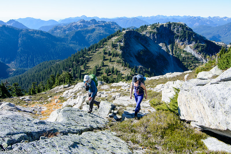
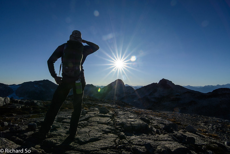
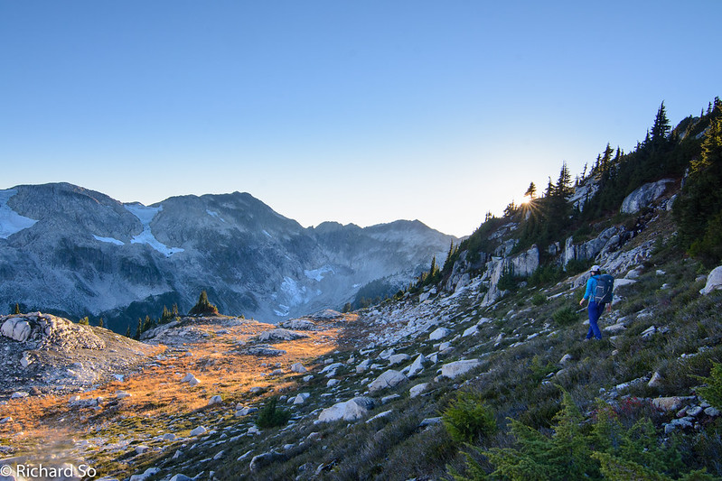
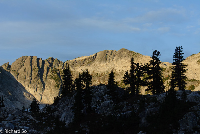
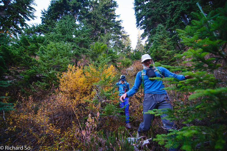
The first part of the trail follows a rough path through the edge of the cut block. We walked up the road briefly and found some flagging which guided us into the forest. Without any beta on the current trail conditions, we were pleasantly surprised to find a nice path through the old growth and meadows. There is less than 100m vertical from the end of the trees into the sub-alpine forest. If it wasn’t for the poor road conditions, the access into this area couldn’t be any easier. We were quickly in the alpine, enjoying the views of familiar peaks from a different perspective. It might have been October, but it was t-shirt weather as continued climbing into the alpine. Looking back at the treed ridge that we went up and over after leaving the forest.
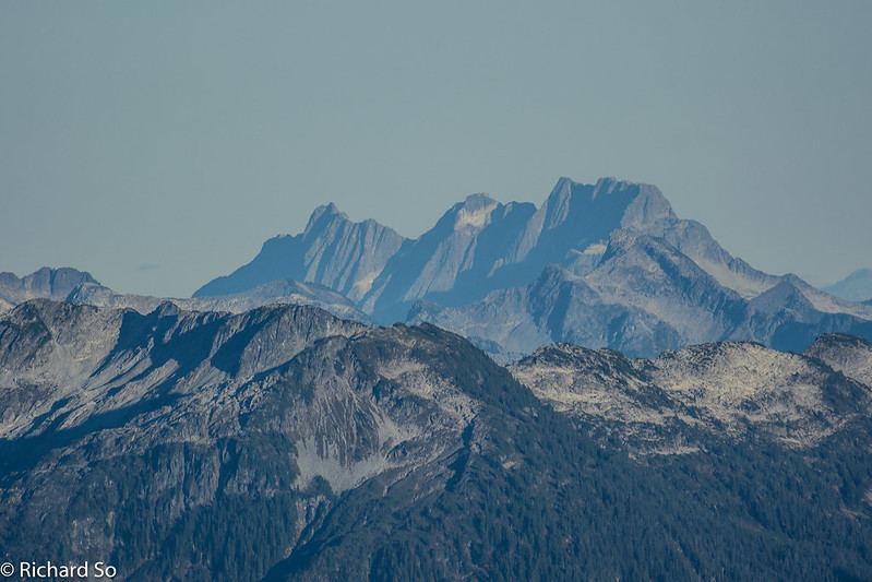
View to the east of Mount Judge Howay. The double summits are easy to recognize from anywhere.
Sarah poses in front of some tarns, with the Tantalus Range just to her right. There was a slight breeze, swimming would wait for later.
A few weeks earlier, Nick Tyler and I climbed Meslilloet Mountain. It’s a wonderful mountain, remote, uncertain access, some bushwhacking and a very pleasant alpine wander. We didn’t have the greatest weather on that trip. The clouds rolled in as we ascended the east ridge (left skyline). The steepest part leading to the summit involves some moderate scrambling. The Meslilloet Glacier was very broken up after a dry winter and summer in 2015.
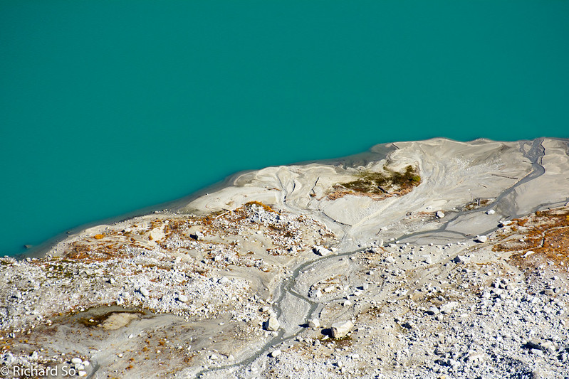
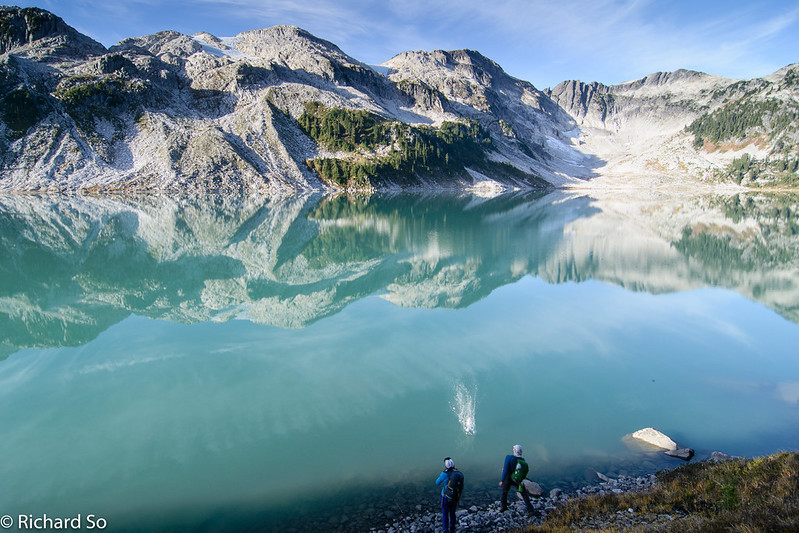
Our route put us in a circle around the oval shaped Pinecone Lake. On the south end of the lake is this fine sandy beach. To get there, you would need to drop down some talus and scree slopes. Check out Pat Mulrooney’s blog post about his weekend adventure to that beach.
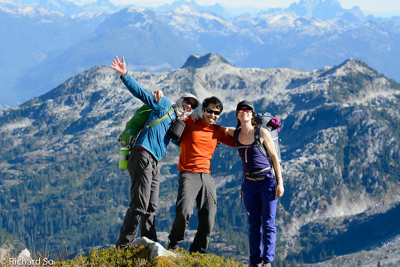
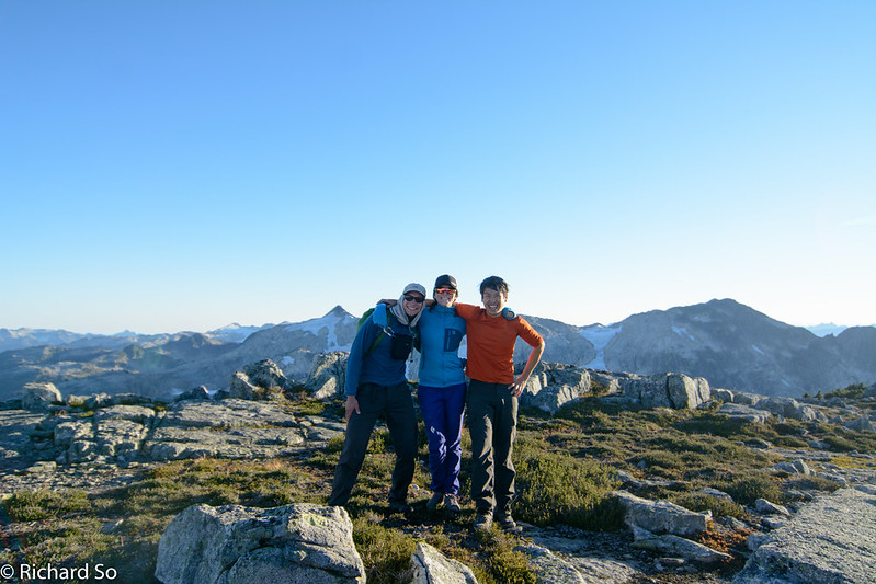
Sarah was quite stoked to be in the mountains.
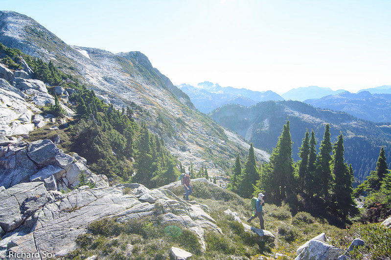
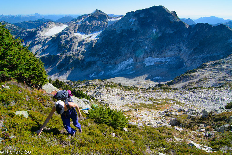
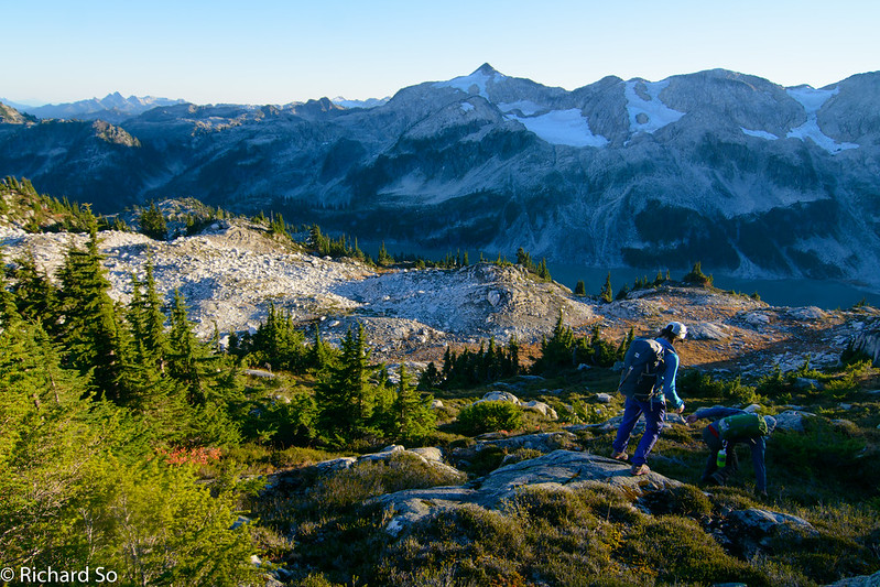
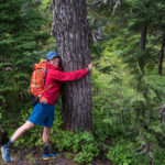
We went up and over Seed Peak, descending grassy slopes and granite ridges. The terrain is very much like how it’s pictured here. Up and down was the theme of the trip.
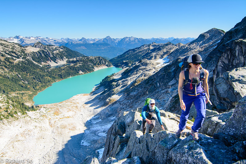
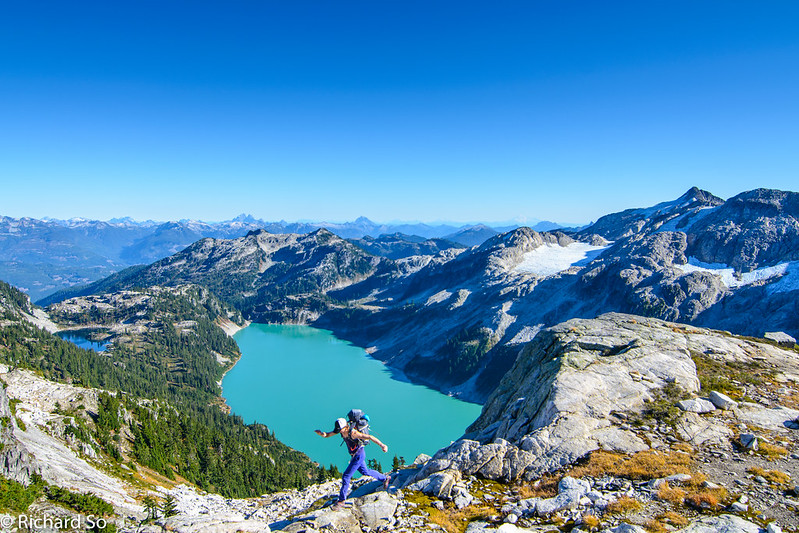
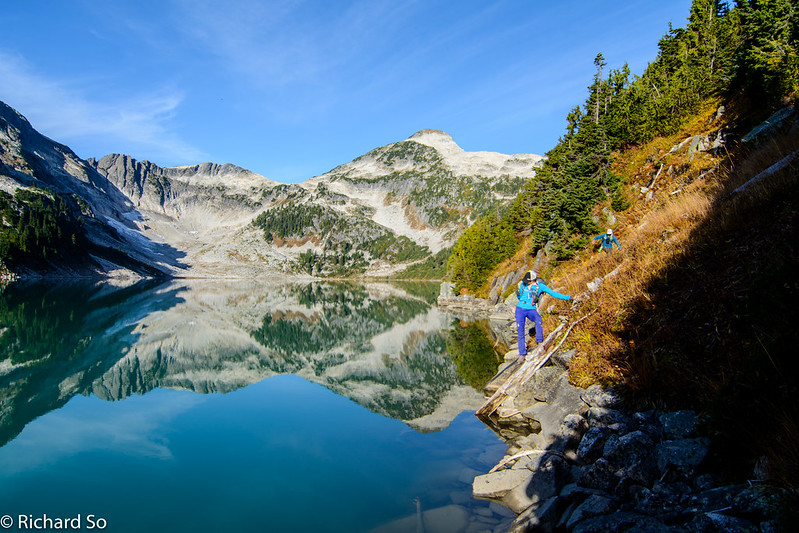
Sarah scrambles up a short section of the ridge around Pinecone Lake. The turquoise waters of Pinecone Lake were very inviting on this warm day, but it would have to wait until the next day. We camped the small lake just above Pinecone Lake. My friend Regan spent the past summer hiking around this year to gather information with BC Parks for park planning. She named the little lake as “Pine-Nut” lake, and that’s the name I’ll use for it in this post.
More scenic ridge rambling with Nick and Sarah. How awesome is that view. Pinecone Lake drains east in the Pitt River Valley. The peaks on the horizon are on the south end of the Misty Icefields.
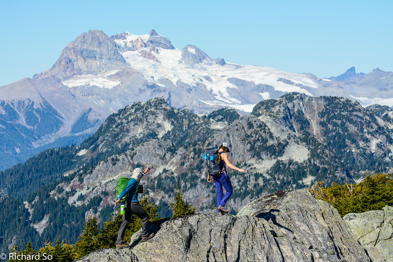
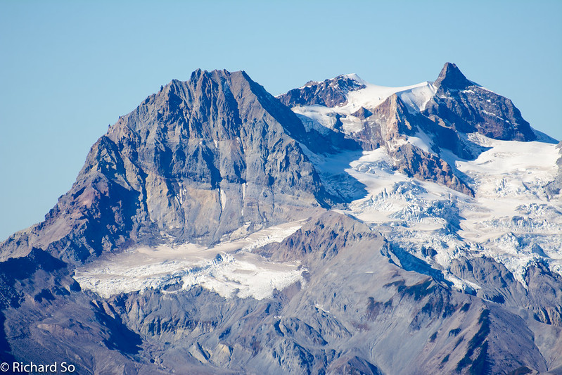
Mount Atwell and Garibaldi behind. There a dusting of snow in the high mountains in early September. Most of it had melted out now, except for some small patches near the summit of Garibaldi.
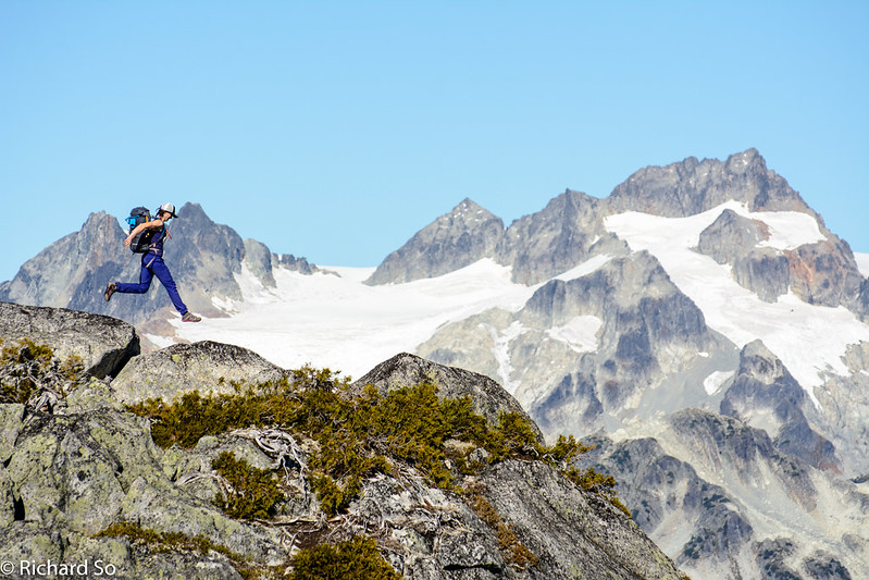
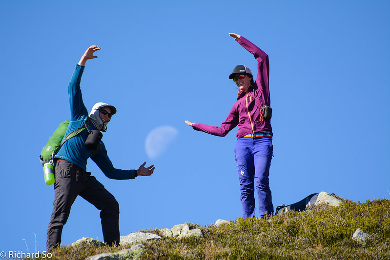
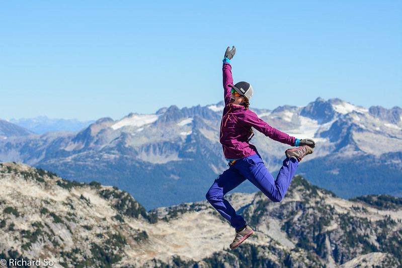
Sarah in flight with the Mamquam massif behind.
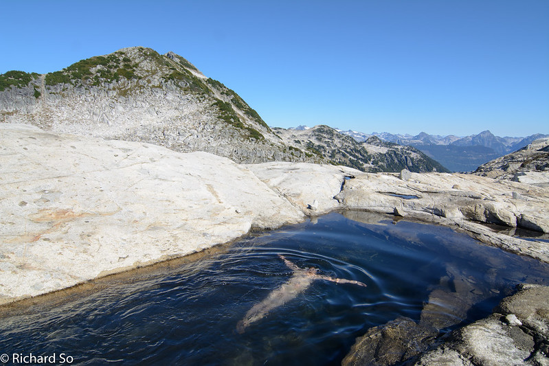
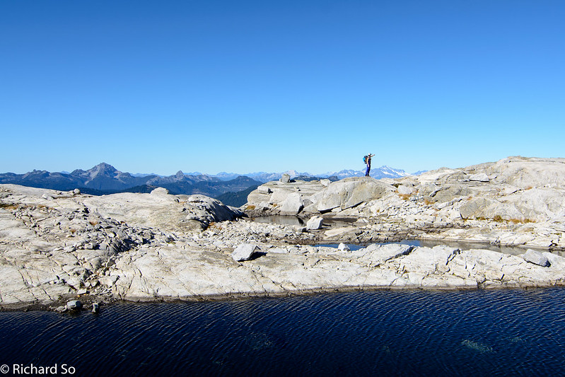
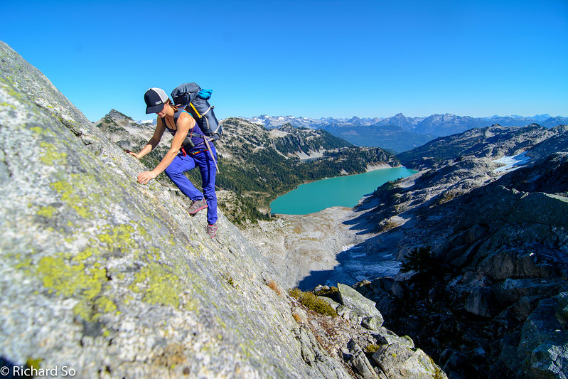
The first swim of the trip in a small tarn north of Pinecone Peak. Our route took us up and over the two summits above, following the rocky and treed ridge to the high point. Going over this summit was the crux of the trip, involving some exposed scrambling. We didn’t try to find an easier route. I was just following Sarah and Nick as they picked the most interesting rock to climb. Looking on Google Earth, I think you could bypass this peak by contouring along a bench at 1775m.
Sarah walks along one of many tarns in the area.
Sarah hiking up with Pinecone Lake below
Sarah scrambles up some steep heather slopes with Mount Gillespie and Seed Peak behind. We climbed Gillespie the following day, taking the sunny glacier on the far left.
October, no snow in the alpine, and t-shirt weather in the sunshine. Completely different than Oct 2016.
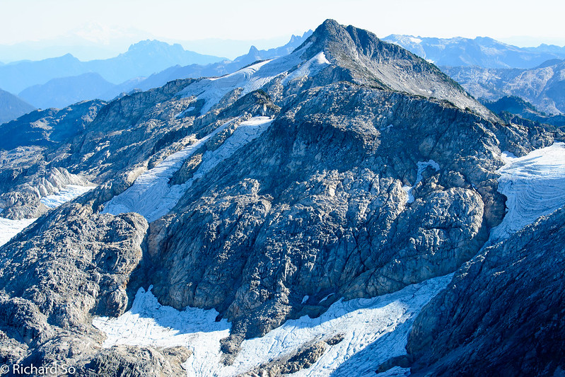
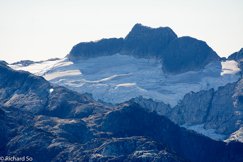
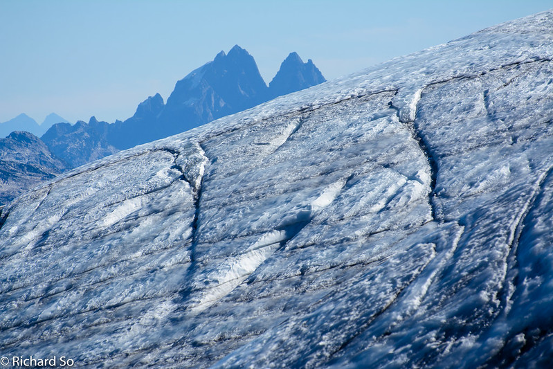
Mount Gillespie again. You can’t make out the glacier hidden behind the rocky ridge in the foreground. We went up that glacier, and then scrambled the obvious ridge in view up to the summit. Lost in the haze is Mount Baker on the left. These low elevation glaciers are receding quickly.
Atwell southeast face. Nothing but choss over there. I was happy to walk on solid rock, while dreaming of this face plastered in a winter coat.
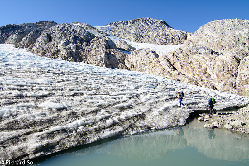
We hiked over the ridges to “Pine-Nut” lake on the left, bushwhacked down through the trees to the lake shore and then to the outlet of the lake. We dropped down to the lake early and followed the tight shoreline to avoid steep cliffy terrain above the outlet of Pinecone Lake. We then followed easy terrain up and right to the toe of the glacier. The route-finding is straight forward if you’re used to travelling in this type of terrain. Expect plently of up and down.
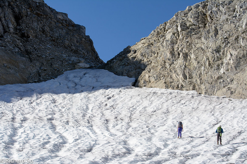
We hiked up this gully towards the summit ridge. It looked blocky from below and we were not sure how much scrambling was involved. We bypassed some airy gendarmes. As I mentioned earlier, I think you could take a lower bench to bypass the scrambling up here if you wanted a less technical trip or wanted to move faster.
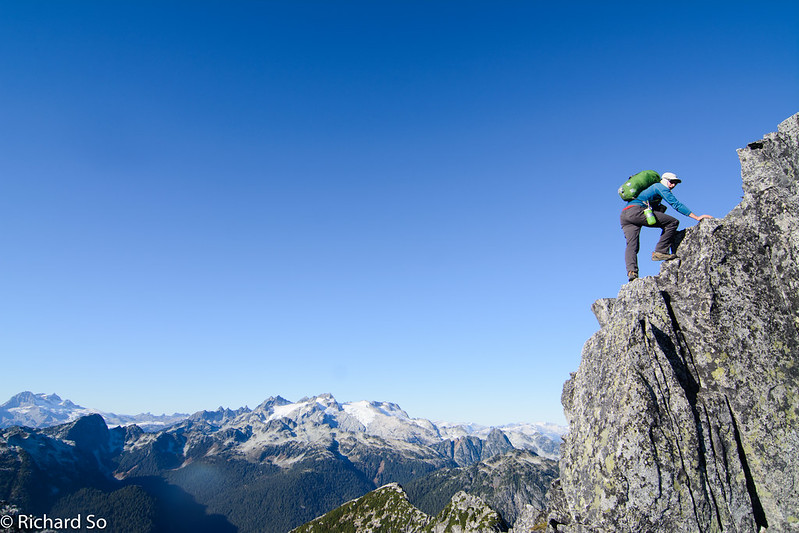
Nick scrambling up the ridge up onto this unnamed peak.
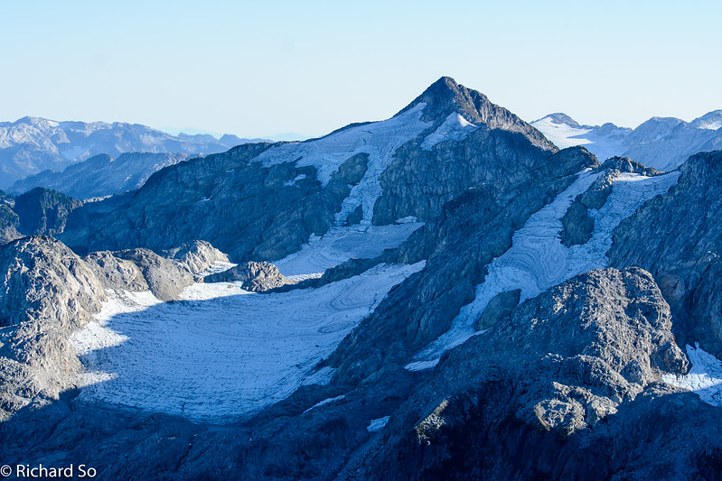
A better view of Mount Gillespie. That line off the summit looks like excellent skiing! There are a few reports of people skiing here in the spring once the Mamquam FSR melts out.
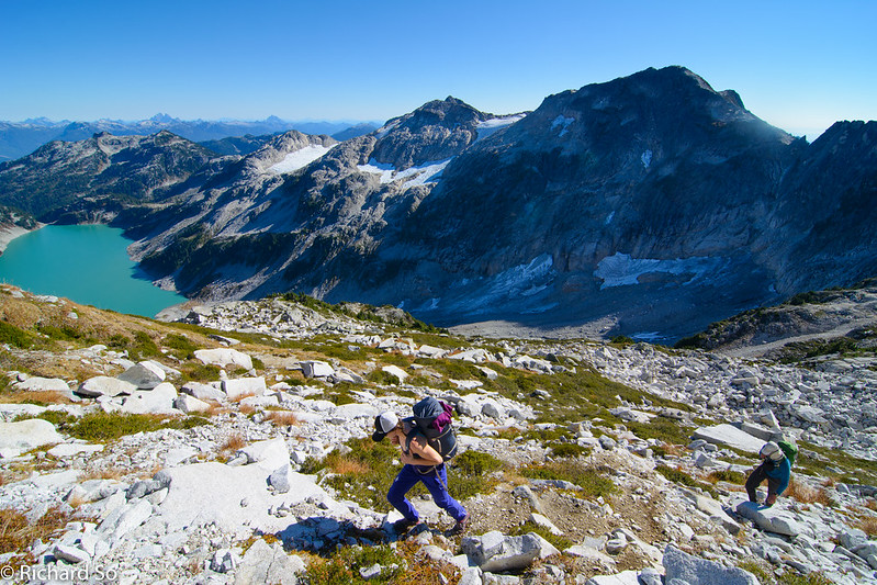
Nick looks back at Seed Peak, Pinecone Peak and the unnamed peak that we traversed over earlier in the day.
The big north faces of Viennese and Clark out in the Chehalis Range. Nick and I traversed the Viennese-Clarke ridge enroute to climbing the north face of Bardean back in 2011.
Enjoying the afternoon light on the ridge top. More distance to go before getting to our campsite. Maybe if I wasn’t taking all these photos, I could move faster.
Dropping down to the rocky basin below. We hiked across and found a treed gully to bushwhack down to Pine Nut Lake. There was only minor amounts of deadfall and steep heather to deal with. Straightforward enough by off-trail standards in the Coast Mountains.
Below this bench, we picked our way down a gully to reach Pine-Nut lake, reaching the lake just the very last of the sunlight.
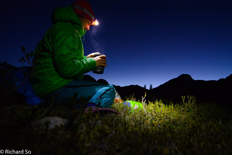
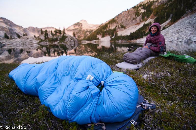
Sarah enjoys her dinner by headlamp. There were not many flat spots next to the lake. We all just found a flat spot, wide enough for our sleeping bag and pad to rest on. Dinner, post-swim. Nick and I jumped in, while Sarah just watched in horror.
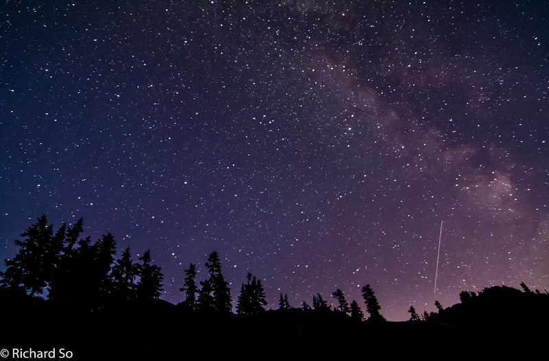
The skies were completely clear than night. We were still close to the city so you could make out the glow of the lights below the horizon. All these photos were taken with my older D7100 and the Tokina 11-16mm lens. I was happy with that setup for this type of astrophotography. But then I upgraded to the D750, a full frame body. I’ve been blown away with what I could get away with at high ISO, without visible noise. These photos are taken at ISO 1000 or at most ISO 2000. Any higher and the images would become too grainy for my taste. With the full frame body, I routinely shoot at ISO 4000 and above without worry.
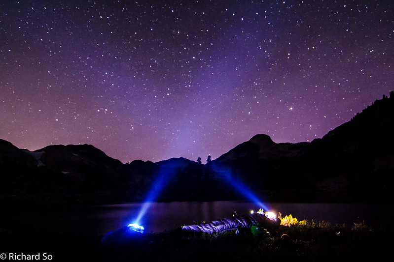
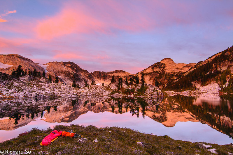
Camping next to Pine Nut Lake. An open air bivy in October with a bomber forecast. Zero chance of rain.
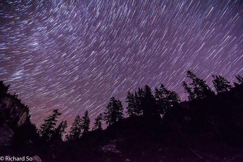
I’ve become fond of taking these composite photos. This is thirty different 25-second exposures, taken about 3 seconds apart, using the built-in intervolmeter. Back home, I use a free software called StarStax which combines all the photos to from the star trails. Unlike the traditional method of leaving the shutter open for (30 shots x 25secs = 12.5 minutes), this method is easier to setup and reduces the in-camera noise. You can take a test shot and check the focus and exposure quickly. You don’t need to worry about overexposing the shot, blowing everything out. On a digital camera, leaving the shutter open for a long duration warms up the sensor and creates additional noise despite using a low ISO.
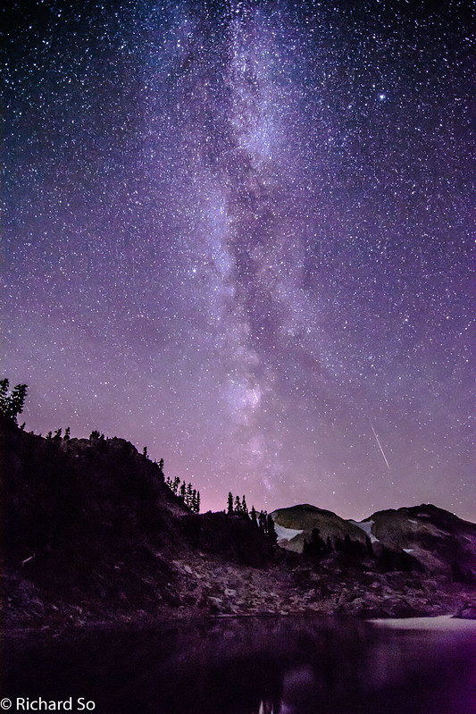
Capturing the milky way over top of Mount Gillespie and Seed Peak
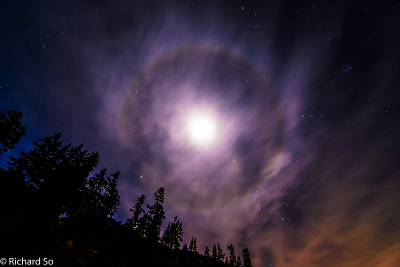
Halo around the moon
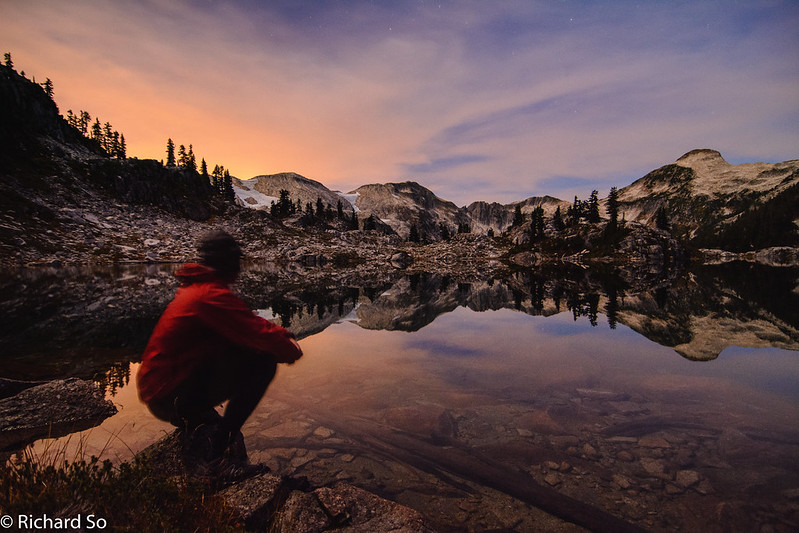
Sunrise the night morning, with the first trickle of colours painting the sky.
There are far worse places to wake up to than this spot. A beautiful place in our backyard.
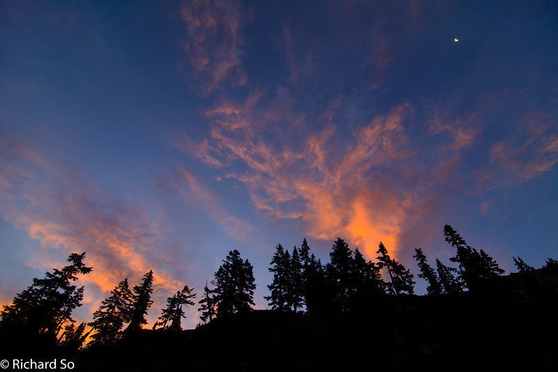
Clouds on fire above the trees.
Sarah enjoying the morning colours from inside her sleeping bag. “Wake up Sarah, check out the sunrise.” There was no movement.
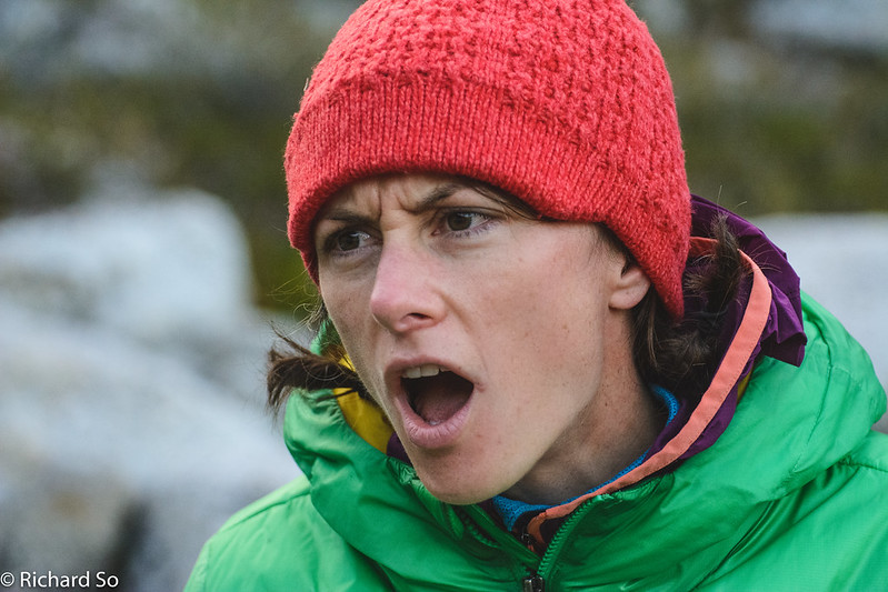
This is what Sarah looks like in the morning when you try to wake her up too early. Don’t poke the dragon.
The rocky buttresses on the left look fun to climb on. They are not as high or as steep as it looks, and probably involves low 5th climbing with some grassy sections. The rock looks good though.
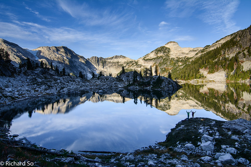
Morning reflections in Pine-Nut lake. A spectacular morning in the alpine. We left camp once I was done taking all these photos. I just couldn’t stop. I ran up above our campsite to capture the wider perspective here.
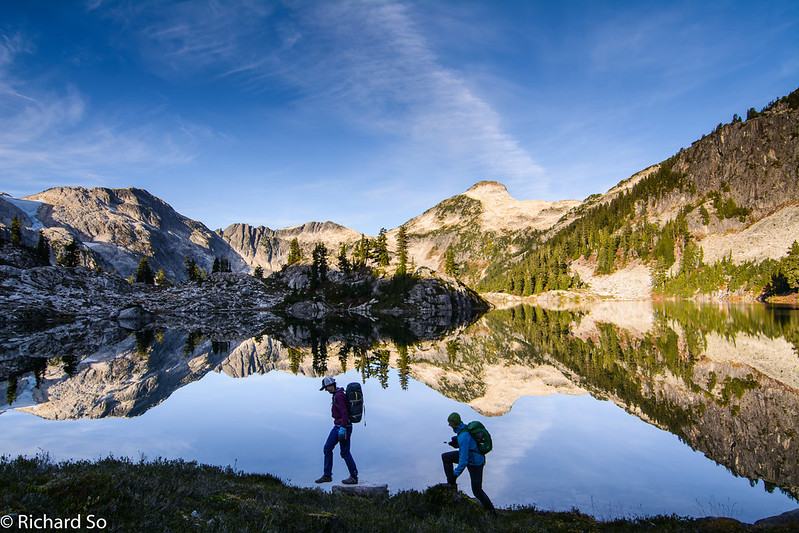
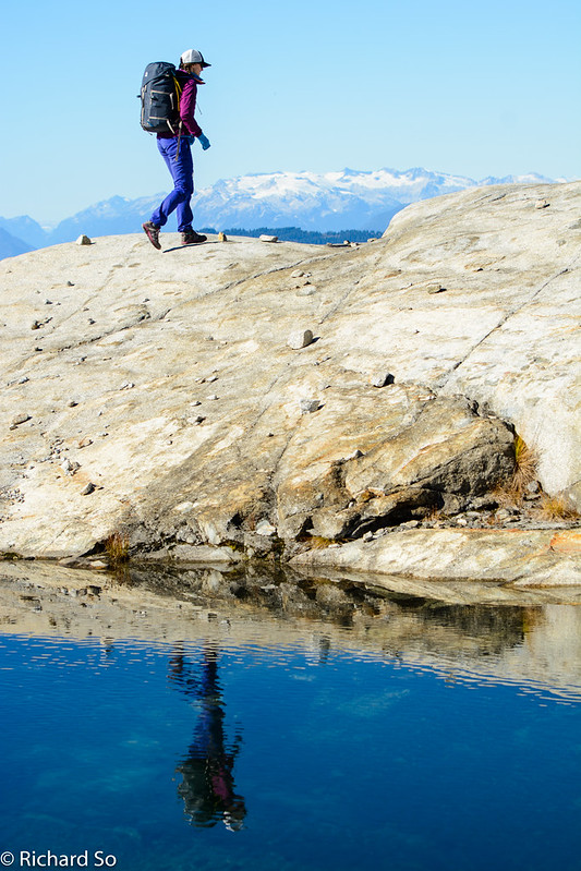
More reflections as Sarah and Nick walk along the lakeshore.
A short section of bushwhacking down to Pinecone Lake. We picked a line through the least steep contours and took a freefall descent through the damp morning bush. It would be tempting to stay high along the bench to avoid traversing the lakeshore, but it looked like there were cliffs further along, preventing an easy descent to the lake.
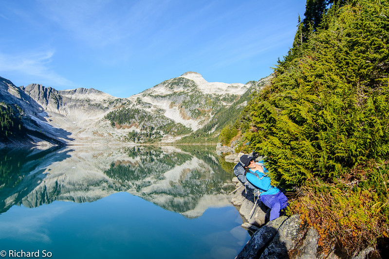
Up and down along the lake shore. Slightly tedious at times, with some loose talus sections. It was slow going, but not a long section. Nick and I stopped for a morning swim part way along, while Sarah watched in horror. Again.
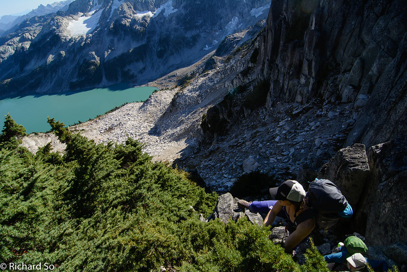
Veggie belays on Pinecone Lake. The northern shore of Pinecone Lake is rocky, with sections requiring the technique displayed by Sarah above.
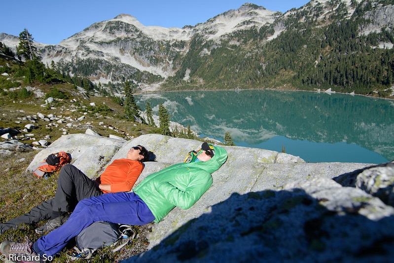
Relaxing in the meadows with Pinecone Peak behind us. From this view, you can see the rocky treeded ridge that we followed up to the unnamed summit on the right. The possible bench is also visible, a shortcut below the peak. We wouldn’t be relaxing here, except Nick forgot his watch down on Pinecone Lake on the opposite shore. He had taken it off when we went for a swim, and left it by the rocks. We watched from up here as Nick ran back down and around the lake to retrieve his watch. The idea of swimming 500m across Pinecone Lake crossed his mind, but running was the faster option.
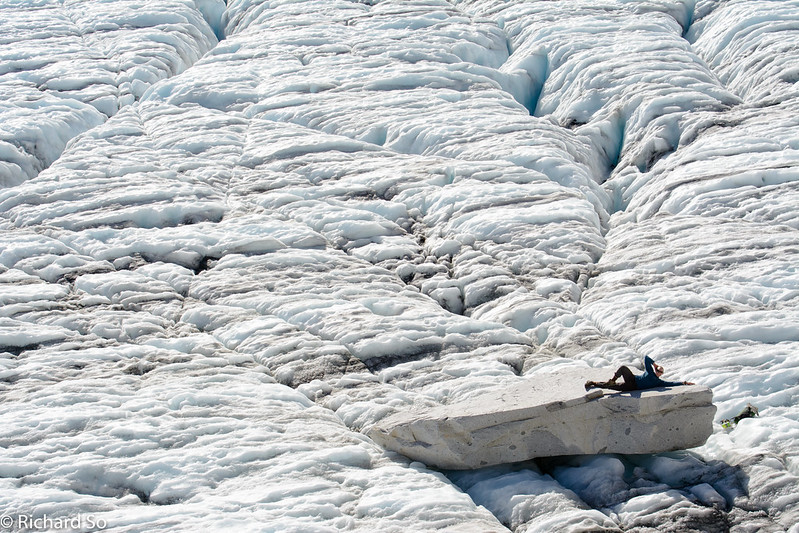
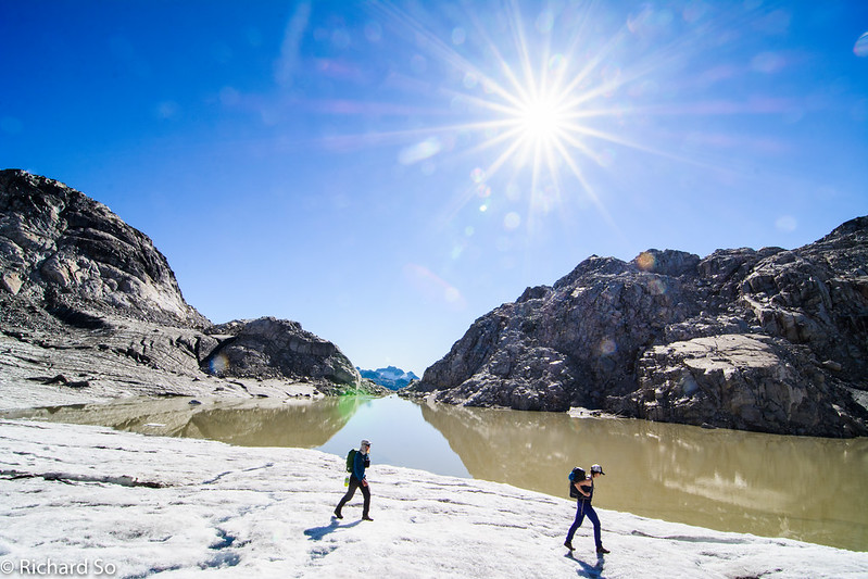
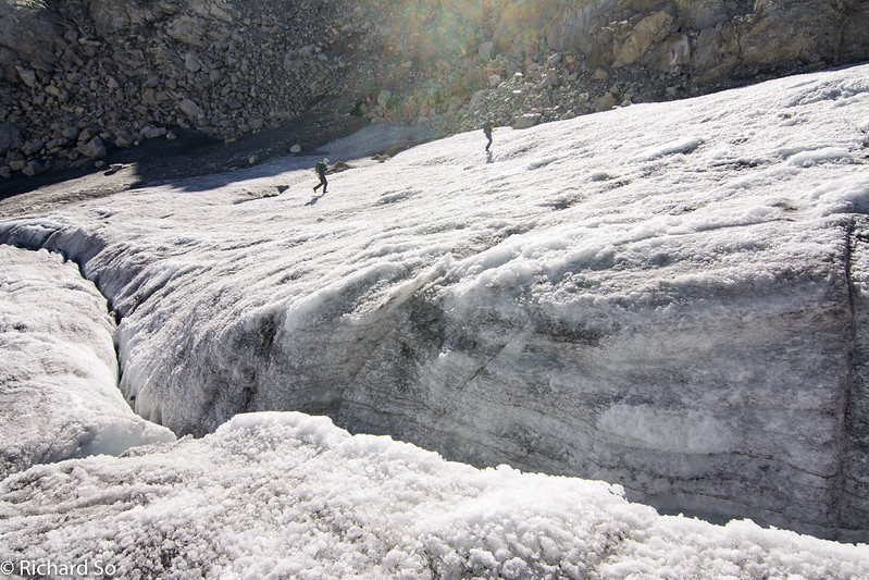
From the grassy bench, we continued up and right. We crossed a moraine, and then followed the meltwater creek up to the toe of this glacier. I was uncertain about the condition of this glacier. We brought a light rope and rescue gear, standard practice for me when travelling on unknown glaciers. It turns out the glacier was quite mellow. Aluminum crampons were useful for the hard snow conditions, but we never felt the need to rope up.
The previous glacier led up to a col at 1745m, with a thin ridge separating the two glaciers. On the other side was a loose scree slope down to the main glacier. Nick poses on a flat rock while I waited for Sarah to make her way down the loose slope, going one at a time.
Sarah climbs to the col at 1800m, north of Gillespie Peak. We left our stuff at the col and picked an easy route up the steeper toe of the ridge, out of view on the right side of the ridge.
A view of Mount Judge Howay from the north ridge of Mount Gillespie.
After hanging out on the summit, we dropped back down to the col. The rock on the west side of the col was terrible. Recent glaciation left behind a choss pile to pick our way down and through. We trundled some rocks to reach a permanent snowfield at 1700m, in the basin between Gillespie and Seed Peak.
Crossing more snow.
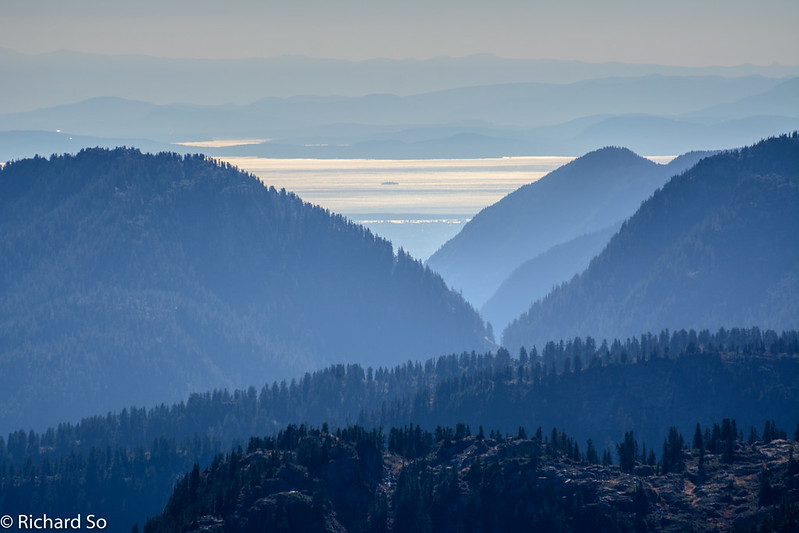
There is a lot of up and down on this trip. We went back up to the ridge crest at 1800m, followed the familiar ridge crest and back down into the forest. This view is looking towards Vancouver, through the Seymour valley, out into the Salish Sea. We live in a special place where we can spend all day walking in the alpine, crossing glaciers and then come across this view. A blend of city, ocean, forest and mountains. I really enjoyed the way this trip worked out in the end.
The access to this area is uncertain in the future. This is the case with many places on the South Coast where access to remote areas is reliant on old logging roads. Once the logging interests go away, the roads are deactivated and left to the fate of nature. The old roads will only become more overgrown and washed out unless the government steps in to repair the road and keep access open. This area is part of the larger Pinecone-Burke Provincial Park, which encompasses a vast area of wilderness from south of Mamquam Mountain, down to Coquitlam.
According to the BC Parks website, a new management plan is being developed by BC parks and the Katzie First Nations. I don’t know if any progress has been made since the initial public input comment period was closed in Nov 2014. There are some more ridges and lakes in the area that I want to explore. I recommend checking on Bivouac.com for the latest road conditions posted by its members, a valuable tool for mountain exploration in the South Coast. As of the summer of 2016, access was still possible here with a 4×4 high clearance vehicle. Here’s a more recent trip report by Steven Song.
Thank you for the amazing and extensive report! Going to check this one out soon… once more snow melts 🙂