The Owl-Tenquille traverse is a two to four day alpine backpacking trip, traversing forest, lakes, and alpine meadows north of Pemberton. Recently in August, Cam Adam Agi and I hiked this trip, from east to west. The area around Tenquille Lake sees quite a bit of traffic, but the complete traverse seems less popular. This may partly be due to the logistical challenge required for a vehicle shuttle, or maybe it’s just the lack of internet beta. Hopefully this will add to the trip reports available online for this highly recommended traverse through the high country above Pemberton.
I figured this would be a fairly relaxing three day trip, so I thought two days in late summer would be good. I’ve wanted to “run” this route in the past, but after this trip, I think its worth camping as there’s just too much driving involved for a day trip. I told Cam that we would both meet Adam and Agi in Squamish at 6am. Having been accustomed to the crack of 11 start as a mountain biker, this seemed way too early to him. We drove up to Pemberton, 16.3 km up the Birkenhead FSR, and then onto the Tenquille Spur for another 5km. The Tenquille Spur requires a 4×4 vehicle, with a creek crossing that required low-range to climb out of on the way back, along with moderate waterbars. We parked my Tracker at the end of the road, and then drove Cam’s Xterra back down the Birkenhead FSR, along Portage Road, and then up the Owl Creek FSR. This is a very steep logging road, and climbs over 1000m in just over 9km. As of August 2015, the road has steep hills with loose eroded sections, low-range and high clearance recommended.
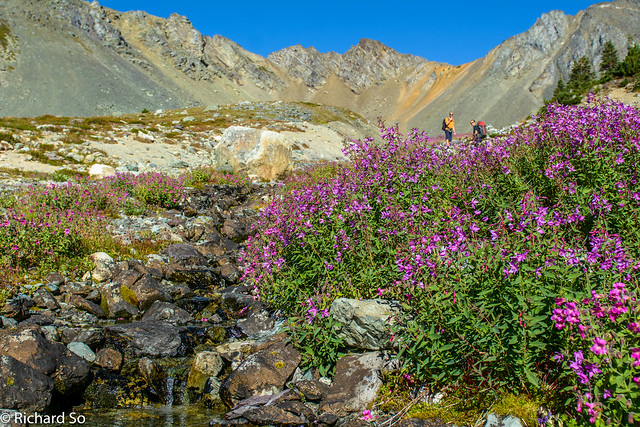
There is some new logging at the end of the road. Just before the last turn, there is a big Pemberton Valley Trail Association (PVTA) sign/map. Continue up the road, and there should be a sign on your left marking the Fowl Lake trail. The first part of the trail is well marked and wanders through the forest and then climbs up to a viewpoint over the Chain Lakes. The trail begins to disappear in some swampy meadows at 1600m, but continue northwards for another 1.5km to Fowl Lake. Good navigation skills with help immensely on this trip, as there is a surprisingly amount of micro-terrain, keeping the route finding interesting. I used Locus Map, with rough gpx track loaded onto it.
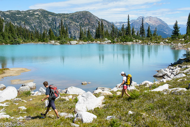
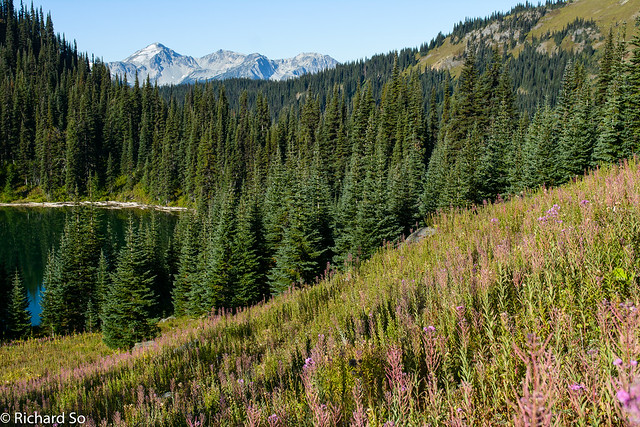
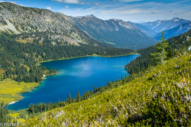
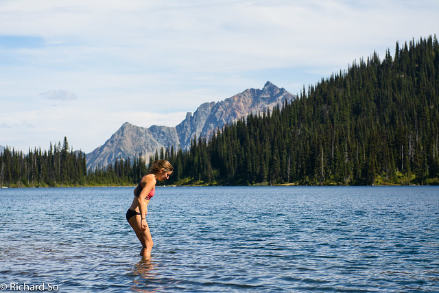
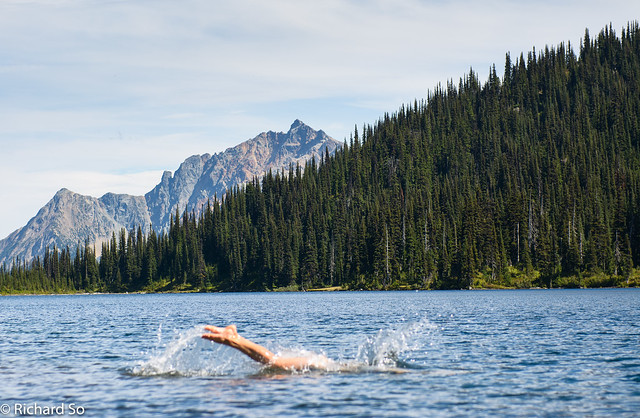
Fowl Lake was the first lake-bag of the trip, a highly recommended swim. There’s a nice sandy beach, clear water with a good drop. If you’re doing this as a four day trip, you might like to camp here. It was only noon, so we continued contouring along the shore to a creek (not marked on the 1:50000 map), and then northwest to Upper Fowl Lake. There’s another great campsite here, and Upper Fowl Lake is also a great lake-bag, but not as warm as Fowl Lake. The dashed line on the PVTA is deceiving as it appears to be a trail, when there is only a route occasionally marked with cairns between here, and Tenquille Lake.
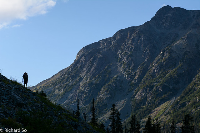
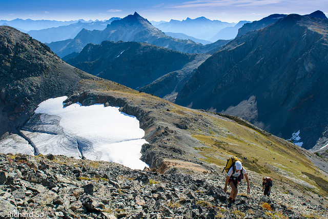
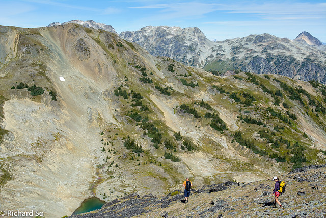
We traversed talus slopes on the north side of the lake, and then up a talus gully in the headwall to the 2040m col, at about 3pm. There are great views to the south, across the Pemberton Valley and beyond to the Pemberton Glacier. We continued across the talus slopes, contouring where possible. We dropped our packs and went for a quick scramble up the south ridge of Mount Ronayne. Up to this point, I had been having fun navigating, but didn’t have a great view of the route as there are many mini summits and micro terrain blocking the view. From the top, I could look down into Tenas Creek, and over to Ogre Lake, 600m below us.
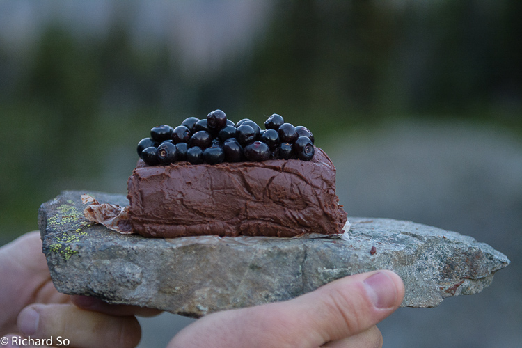
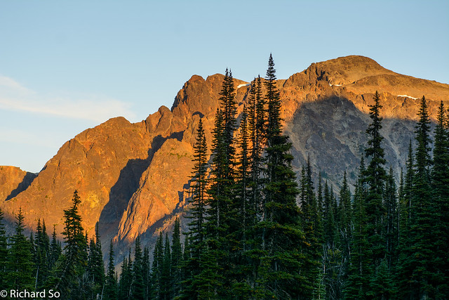
We left the summit at 5pm, and pushed on. As I write this in November, I miss those long summer days, where full days in the mountains like this seem possible without the need for headlamps. From the small lakes at 1850m, we descended into the south fork of Tenas Creek to 1580m, where I found a cairn leading us onto a horse trail across scree slopes above the north fork of Tenas Creek. You could exit the traverse here onto the Tenas Creek FSR, a kilometre to the northeast. We camped at Ogre Lake, at 1700m, and another nice lake-bag. This entire area is bear country, and we saw some very fresh prints in the mud while walking to the lake. To the northeast of Tenquille Lake, is a place named Grizzly Pass. On a rocky moraine above Ogre Lake, we watched Mount Ronayne bask in the orange evening light, while we feasted on a huge pot of quinoa veggie curry (thanks Adam and Agi!) and my no-bake chocolate cake that mostly survived the trip in my backpack.
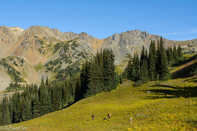
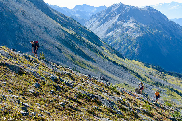
Going light, I went without a tent or tarp and just slept under the stars next to the lake. The next morning, I dried out my frost-covered sleeping bag in the morning sunshine. We left Ogre Lake at 8am, and followed a trail on the north side of the lake. The trail then climbs northwest into vast meadows above 1800m. From here, the route marked on the PVTA map continues north to the lower 2000m col and then drops down around the north side of Mount Barbour. We continued up to the 2150m col, and then scrambled up the east ridge of Mount Barbour. It looks steeper than it is from afar, and the route is an easy scramble with some exposure.
We descended the steep talus on the northwest side of Mount Barbour. This high alpine route now follows the open ridge line, over several small summits, over Mount McLeod. The views down into Pemberton meadows are quite spectacular from here, as you are looking down at the farms almost 2000m below. This vertical relief also attracts a lot of mountain bikers, with the long descent down the Tenquille Trail to the Lillooet River. We were buzzed by the helicopter as they were dropping off bikes and people. I’m a terrible mountain biker, so I wasn’t convinced the terrain up here was worth the price of a helicopter ride.
More talus, and a steep heather scramble took us to the top of Mount McLeod, named after one of the early settlers of Pemberton. We left the summit at 1pm, and wandered down the gentle slopes on the northwest ridge down into Fossil Pass. I thought there was a more well defined path down to Tenquille Lake, but I never found one and just strolled down through the slope covered in heather and grass. In my mind, I was visualizing all the terrain and making mental notes for when the snow came.
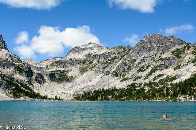
Down at the lake, we all jumped in for the first swim of the day. We were in no rush to go anywhere, but reluctantly left this wonderful area at 3:30pm, off to the truck and to finish off the second half of the long shuttle and drive. I had been debating in the days before about which side to park the truck, either on Branch 12 from the Hurley, or the Tenquille Spur off the Birkenhead FSR. The Branch 12 trail is longer, but the Hurley and Branch 12 road are both in better condition than the Tenquille Spur. I think Owl to Birkenhead is shorter in distance and higher at 1450m, but slower to drive than Owl to Branch 12 which goes to 1250m. The best option is to have two groups doing the trip, both with a 4×4, and camping in the middle at Ogre Lake. If you do this trip, let me know how it goes!
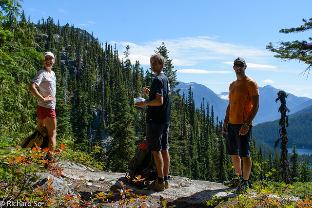
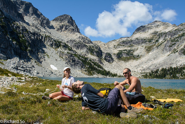
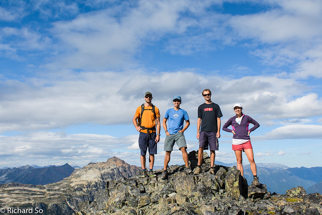
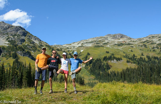
Agi, Adam and Cam with a view of the Chain Lakes on the right
Unnamed lake just before Upper Fowl Lake
Lake-bagging Upper Fowl Lake
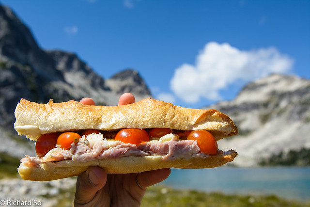
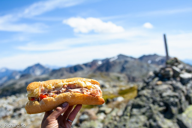
Alpine sandwich. Upper Fowl Lake was a good place
Nice spot for lunch. We went around the lake, and then up the middle of the talus slope behind. This section could be trickier for routefinding from the other direction.
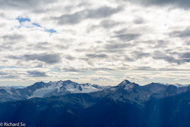
Looking over at the Place Glacier
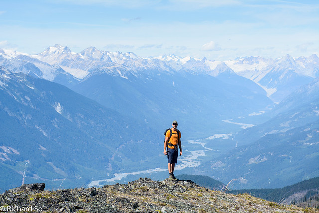
A view to the south towards Ipsoot Mountain
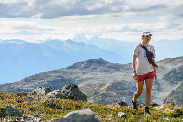
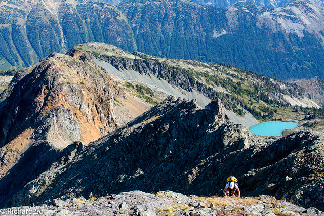
Agi hiking up to the top of Mount Ronayne
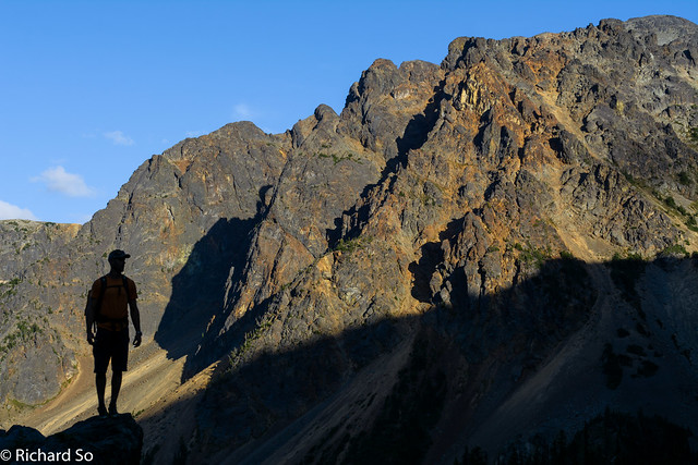
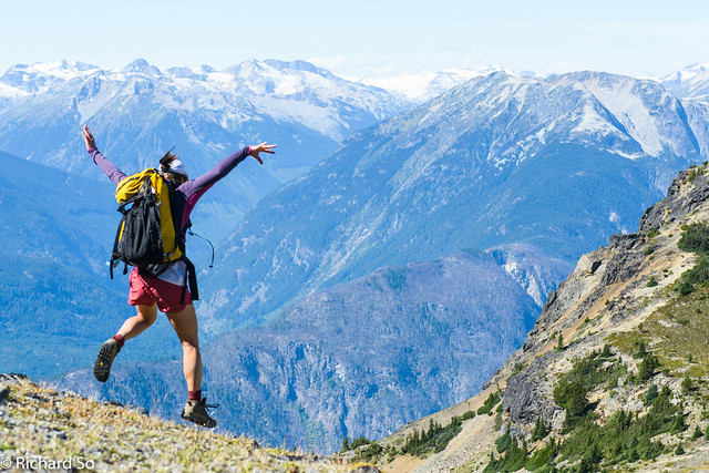
At the tippy top
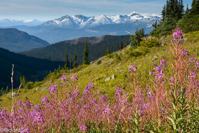
Rhododendron Peak
Adam descending the gentle south ridge of Mount Barbour
Traversing the scree and talus slopes
Cam silhouetted against the crumbly rock on Mount Ronayne
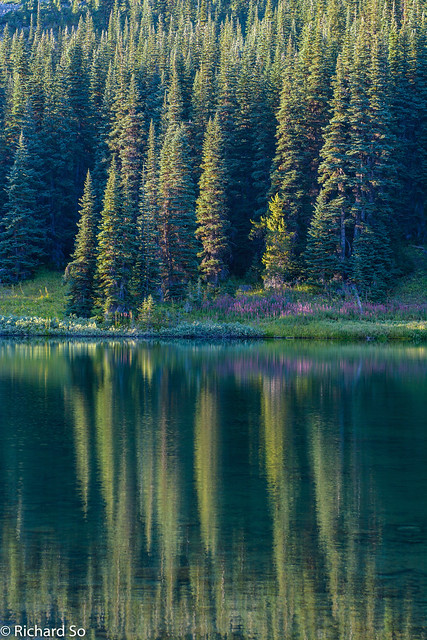
Lake reflections
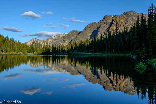
Unnamed lake east of Ogre Lake
Sunset from Ogre Lake
Quinoa veggie curry
No-bake chocolate cake and huckleberries
Hiking past the end of Ogre Lake
Meadows
More open meadows on the south side of Mount Barbour
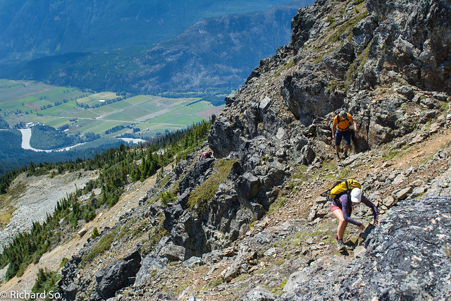
Climbing up. We came from the valley on the left
Above the 2050m col on Mount Barbour, with the lower col on the right, and Sun God Mountain at centre
Scrambling up with the Tenquille Valley way below
Open slopes between Mount Barbour and Mount McLeod
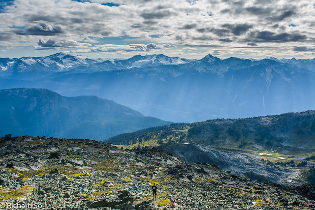
Awesome view of the valley and out towards the Meager Creek area