One of the trips that I’ve wanted to do since becoming a co-owner of a Catalina 27 sailboat was to sail up into Princess Louisa Inlet. My interest in this area started a long time ago, but it wasn’t until last fall when Pete and I spent two days exploring the ridges above the amazing Princess Louisa inlet. In what turned out to be the highlight of my summer, Jeff Al and I sailed from Vancouver, up the Sunshine Coast nearly to the end of Jervis Inlet, into Princess Louisa Inlet, and explored the alpine ridges over ten glorious summer days in July.
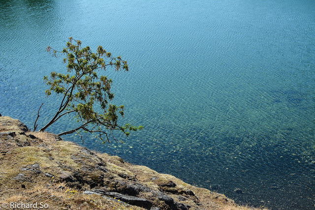
We departed our slip in False Creek, sailed out past English bay and northwards to Buccaneer Bay. The coastline between Gibsons and Sechelt is relatively barren, without any appealing or protected spots for anchorage. Timing the current, waiting for favourable winds, choosing suitable anchorages all play into the coastal puzzle.
Once the high pressure system sets in on the south coast in the summer, the predominant winds are light northwesterly. With light winds, it usually makes for long days of motoring. We usually cruise at five knots (1 knot = 1.85 km/hr) with the outboard engine, but that speed changes depending on the sea state and currents.
Sunset over Vancouver Island
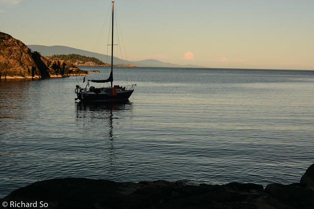
Business Time anchored between Nelson Island and East Point Islet, looking up into Jervis Inlet. The BC Ferries sails from Earl’s Cove to Saltery Bay. From Buccaneer Bay, we motored north past Pender Harbour, up Agamemnon Channel, and then to Egmont.
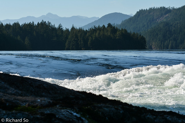
We went to check out the Skookumchuck Narrows, an impressive display of flowing water. The maximum currents run up to 16 knots, complete with standing waves and whirlpools. It’s quite popular with kayakers. Check out the first couple seconds of this clip showing a tugboat capsizing in the narrows.
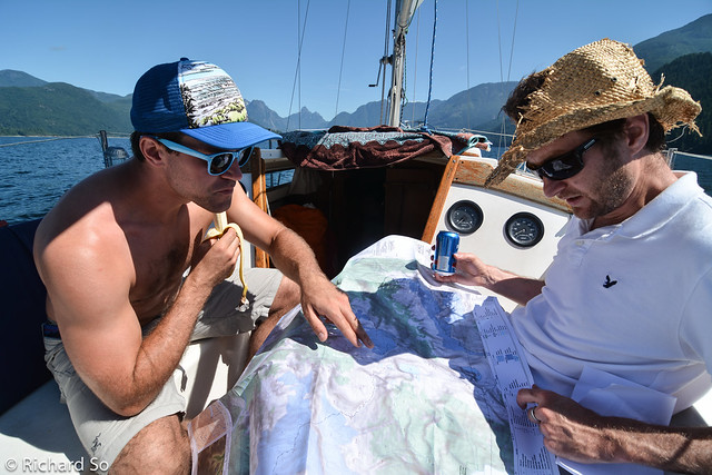
Planning our alpine trip. Both Jeff and Al had sailed up Jervis Inlet previously on Business Time. This marks her third trip up to Princess Louisa inlet.
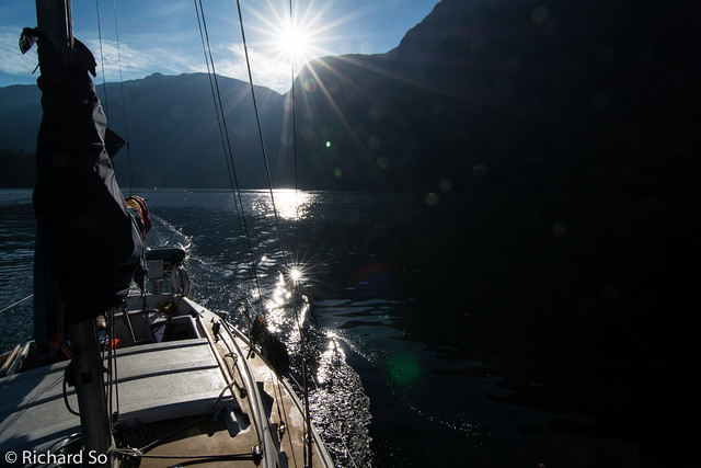
We left Egmont early to catch the late afternoon slack tide at Malibu Rapids to make the 38 mile trip up the inlet. Unlike the power boats, we didn’t have the luxury of speed. A trip up here is a full day ordeal, starting with a steady motor, waiting for the inflow winds to build behind us.
During the day, the solar radiation warms up the mountains, which warm up the air mass just above it. This air mass is now warmer than the air at a similar attitude around it, and rises through convection. This forms a low pressure area where air from the lower region, in this case the inlet, flows. The anabatic effect in the inlet mixed with local topography was quite pronounced. Once we rounded Patrick Point, into Queens Reach, the wind dropped from 20 knots to zero, with a very distinctive wind line. All the wind was funnelling up into Deserted Bay.
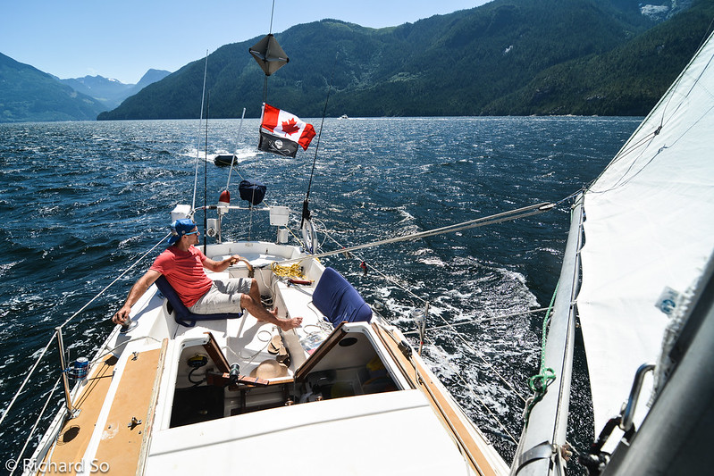
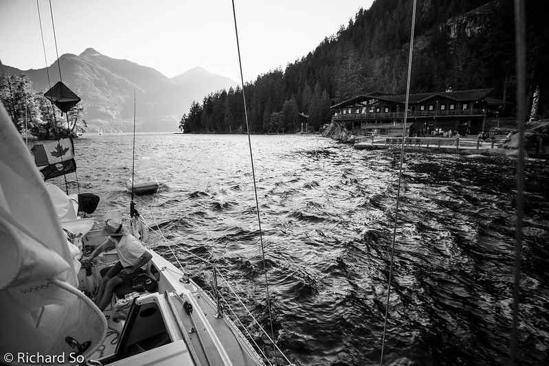
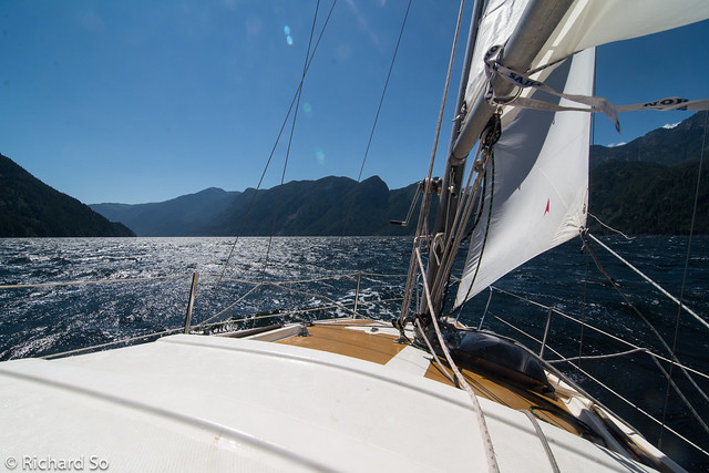
Jeff at the helm, sailing on a broad reach downwind. Wind speeds averaged between fifteen to twenty knots, average boat speed between six to seven knots
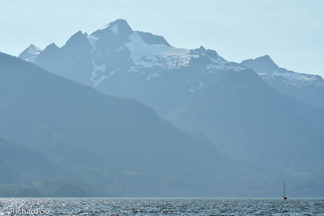
Calm waters in Queens Reach, the most northerly section of Jervis Inlet. The entrance to Princess Louisa Inlet is to the right of my right shoulder. Mount Albert is the glaciated peak right of centre. It’s like Howe Sound, but longer, narrower, and without Squamish at the end!
Mount Albert from the southeast.
After sailing up Jervis Inlet, with an ever growing sense of remoteness, it was a strange site to see the Malibu bible camp here while transiting Malibu Rapids. A narrow entrance between the island on the left, and the waterfront swimming pool on he right, separates the six kilometre long Princess Louisa Inlet from Jervis Inlet. Timing is critical for boaters, the rapids peak at nine knots. Even at slack tide, tidal rips can be seen. It depends on the strength of the flood/ebb, but we try to transit rapids at the predicted slack tide. Transiting at other times between slack and peak can also be possible. A very rough rule of thumb is to avoid currents more than half the maximum boat speed. In 1792, when Captain Vancouver sailed up Jervis Inlet in search of the Northwest Passage, his crew discovered the entrance, but were stopped by a strong ebbing current.
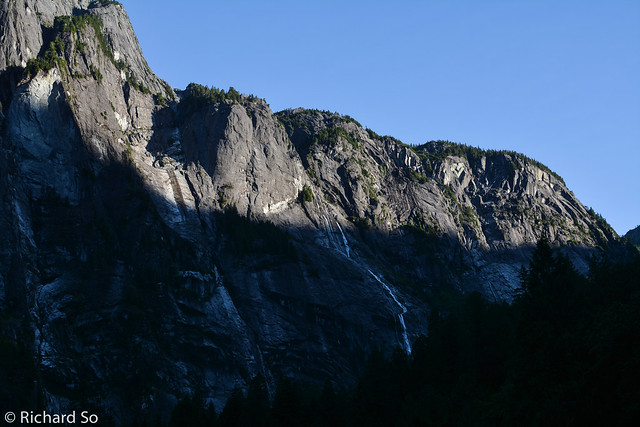
The Princess Louisa Inlet Wall, rising above the fjord. The one and only climbing route on this wall is PLI Trail (17 pitches, ED1/2 V 5.10+) on the lower part of the wall, established by Peter Rowat and John Brodie.
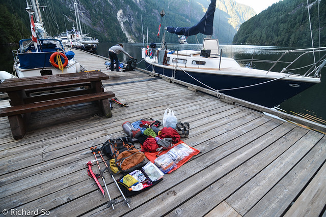
Business Time tied up at the BC parks dock at the head of Princess Louisa Inlet. We arrived too late to get a dock spot and anchored instead. Because we would be away from the boat for two nights, it was important to get a secure spot next to the dock. Anticipating a steep climb up from the water, I tried to keep my pack as light as I could. I went without a tent. I regretted this later while fighting off the mosquitoes in my sleeping bag.
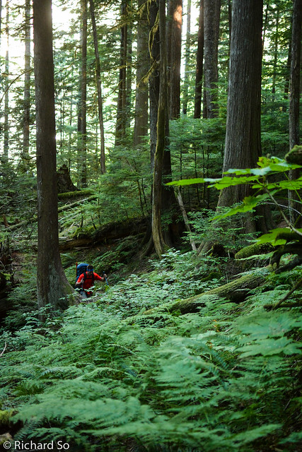
Jeff hiking up the Loquilts trail, a steep climb from sea level to alpine. The trail is rough and steep, a typical no-nonsense, switchback free, coastal trail, but generally obvious and flagged. The trail is marked by BC Parks markers for the first 800m vertical metres to the Trapper’s Cabin, a relict from the past. Beyond here, the trail is more rugged, Two tricky sections include crossing a creek at the Trapper’s Cabin and a less obvious section where the trail crosses a gully before another steep climb to the alpine.
Crossing the creek. This might be challenging during a spring freshet.
A well worn groove up a cliff band.
As yacht owners, our fitness has taken a serious turn for the worse. Beer consumption (and Palm Bays) has reached a record high not seen since my engineering days on campus. When we arrived at Loquilts lake, we were content to spend the rest of the afternoon here. It’s hard to go from sitting on my bum on a boat, floating around and pulling on lines, to actually climbing up steep trails to be in the mountains.
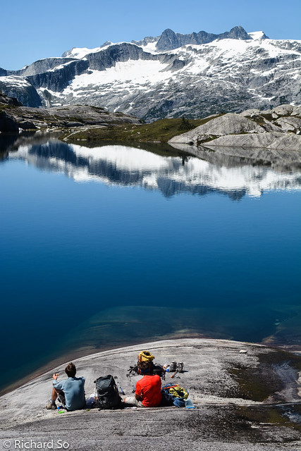
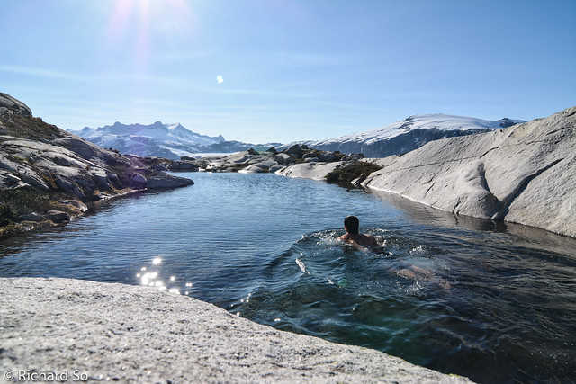
I’m easily restless when the weather is good, so I went for a ramble around Loquits Lake and up to the Contact Lakes, in search of the best view of Princess Louisa Inlet, and the nicest granite tarn to take a dip in.
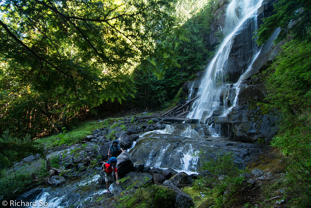
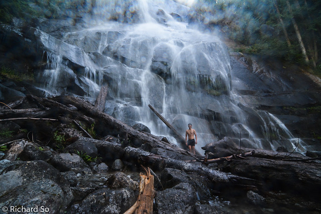
The awesome waterfall pool that I found while exploring the slopes around Loquilts Lake. Not bad, but the water was cold.
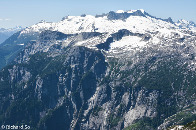
Ah…. much better. Mount Albert on the left, with the Bon Bon glacier below.
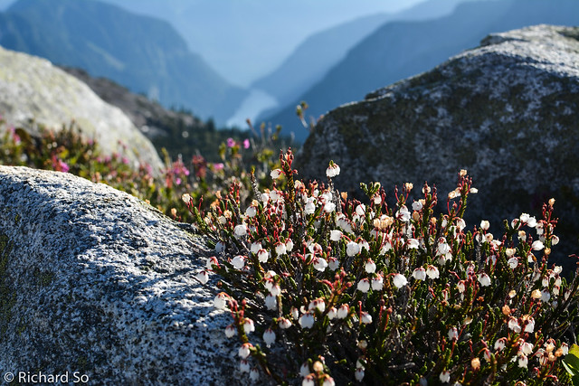
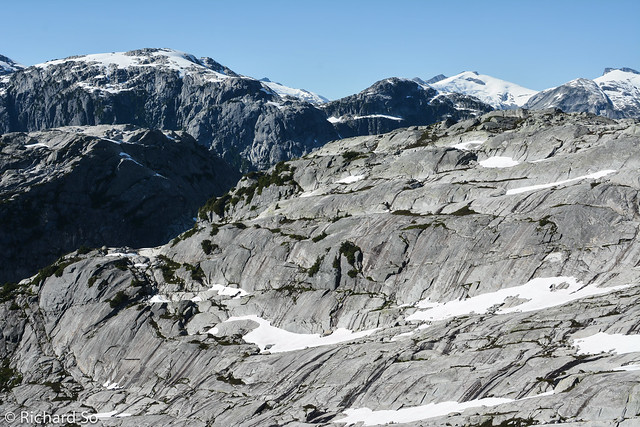
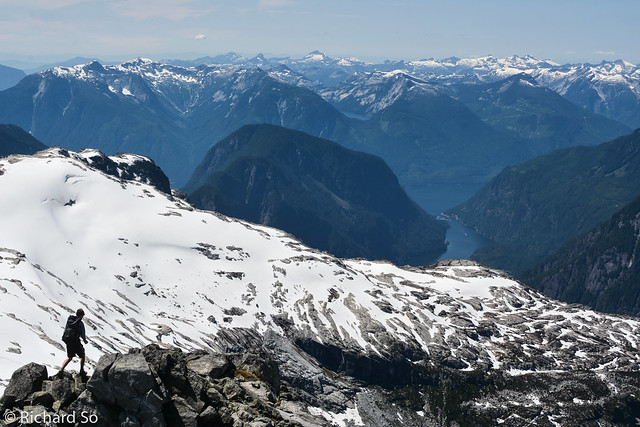
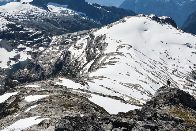
The ridges around here are amazing, endless granite scrambling.
Can you spot Jeff’s tent?
Playing with my camera the next morning, while waiting for Jeff and Al to wake up.
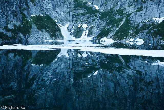
Loquilts Lake reflection. When we returned in afternoon, the icebergs drifted close enough towards us to stand on them.
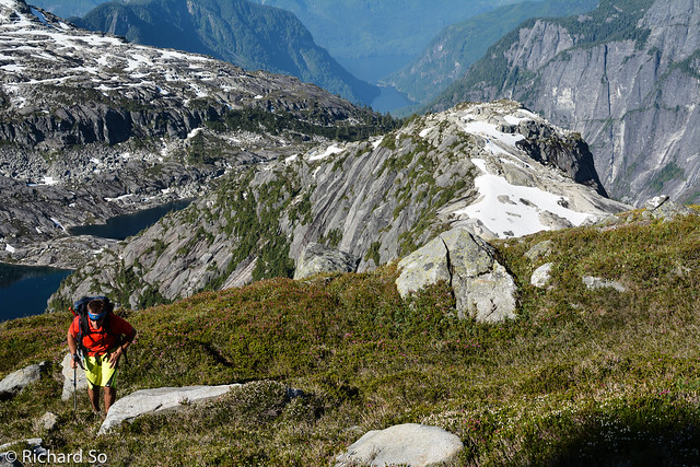
Jeff hiking above Loquilts Lake. We were following goat paths most of the way.
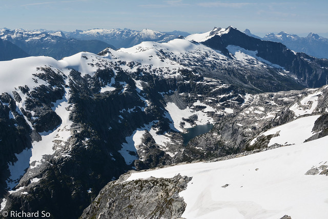
Looking south towards Mount Pearkes. One of John Clarke’s many fine trips, started one summer day from Jervis Inlet, up to Mount Pearkes and then south along the Ashlu-Elaho divide to Squamish.
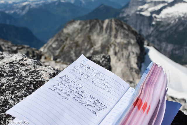
Summit register on Mount John Clarke. It’s not often that I get to write two consecutive entries ninth months apart. A few days later, my friends Lena, Nick, and Michal also came by here, on an impressive trip to Mount Tinniswood and around the Clendenning to Elaho Mountain.
Al scrambling along the ridges above Loquilts Lake, just one of the incredible view up here. The peaks on the far right are part of the Powell-Jervis divide and the Eldred Valley, high on my list of places to go.
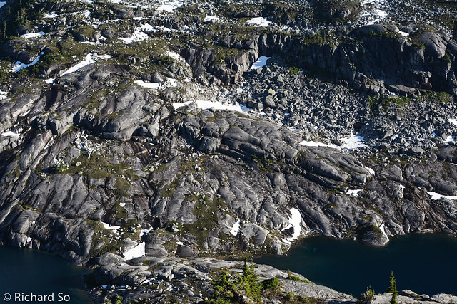
We continued down the rocky ridge, across the snowy ridge, and down the far right skyline back to Loquilts Lake.
The Princess Louisa Wall and Mount Albert. The cut block on the far left are part of the rough trail from tidewater up to Mount Albert.
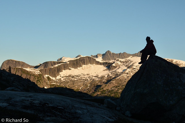
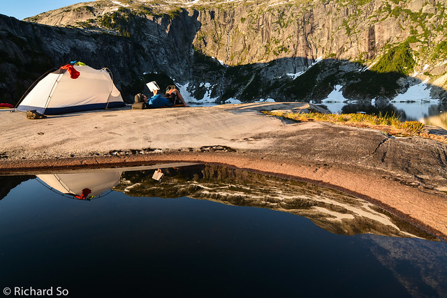
Five star camp site. They don’t get much better than this. It didn’t take long to finish the loop around the lake, not in comparison to the time taken to get here, and to sail back. Instead of hiking back down to the boat, to be confined to the cramp quarters on the boat and a busy dock, we spent the rest of the late afternoon lounging in the sun up here.
A quick shower in the waterfall along the Loquilts trail on the way down the next morning.
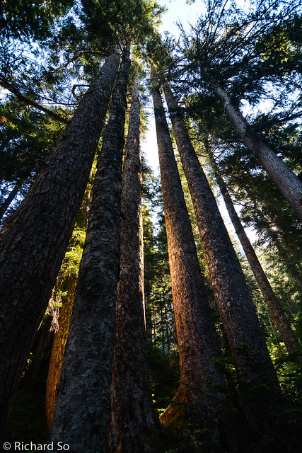
Big trees along the Loquilts trail.
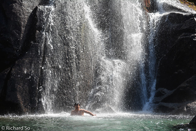
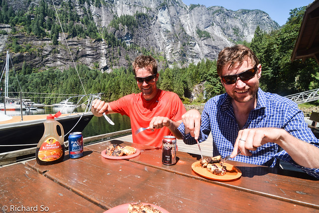
Chocolate banana pancakes after a short but very rewarding trip in the alpine. I’m still waiting to get the photos from Al. Just as Al arrived at the boat, he removed his boots and dove off the bow in the unexpectedly warm water. There are signs at the dock warning of large jellyfish, which we did not see. Unfortunately, his camera was still in his short pockets. The camera spent the rest of the trip in a ziplock bag surrounded by rice.
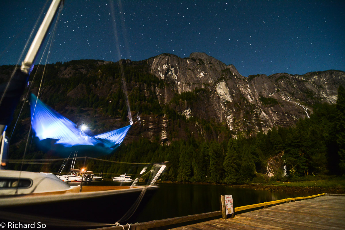
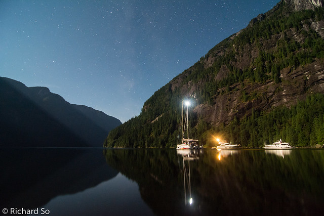
A starry night over the inlet.
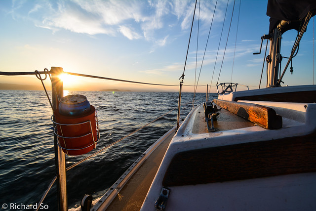
Another early departure the next morning to catch the slack tide at Malibu rapids. We motored south to Patrick Point before finding the inflow winds. They started off light but continued to build as we tacked endlessly down Princess Royal Reach.
Sailing down Princess Royal Reach at 1pm, directly into a strong 20-25 knot inflow, under our “storm” jib and a reefed main. During the peak gusts, our dinghy capsized as it launched over some of the steeper waves. We all looked back in disbelief as the ten foot inflatable surfed over a wave, flipped mid-air, and capsized. This happened two more times in the next thirty minutes, until we rounded the point on the left and the wind died. In hindsight, we should have expected the winds, deflated the dinghy, and stowed it inside the boat instead of towing it. This has been my experience for sailing. 90% of the time it’s very mellow, almost boring, and then 10% of the time it’s downright scary, with noise everywhere and the wind screaming through the rigging.
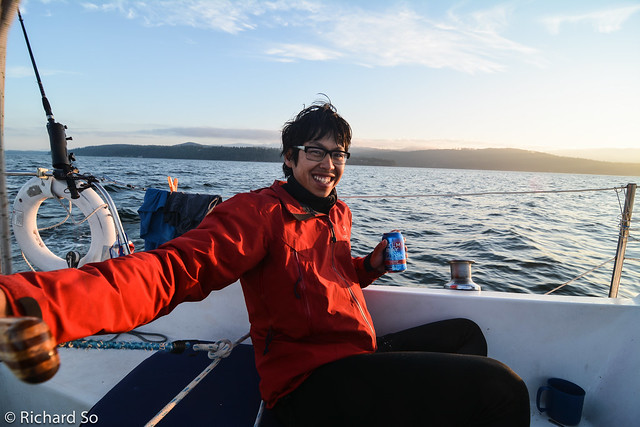
After a tiring sail, and a severe lack of beer, we rolled into the Backeddy Pub, ready to consume the largest burger they had. When we hiked down to the boat, we spent the rest of the afternoon finishing the rest of the beer. At least that’s what Jeff and Al thought. In my careful planning, I stashed away a backup reserve that I pulled out part way down the inlet, and a backup to the backup near the entrance of Jervis Inlet once all the excitement was over. A 16oz burger with a custom bun from the local bakery. Jeff looks skeptical here, but I finished mine. They have a burger eating contest each summer here, with the fastest human time at a shocking 4 minute. The fastest non-human time (currently held by a dog) is somewhere in the 1-2 minute range.
We left Egmont, and sailed south towards Pender Harbour, then west to Jedediah Island, tucked between Lasqueti and Texada Island. This entire island is protected as a marine provincial park, accessible only by boat. It’s a unique spot, complete with feral goats, sheeps, and an old homestead. I would love to come back here on a kayak.
Business Time anchored in Deep Bay. A strong northwesterly blew through this semi-protected anchorage during the night. I woke up to the boat being tossed around and a howling wind on deck. The anchor had dragged. I sat in the cockpit covered in goretex, with my flashlight trying to judge the distance between the cliff and the two boats next to us. I figured we were ok, and crawled back into my sleeping bag, cold and worried, cuddled with the GPS to make sure we weren’t drifting anymore through the night. Fortunately the winds didn’t get any stronger, the anchor stopped dragging and it was back to paradise the next day.
Shallow waters of Home Bay, which dries completely at low tide. An endless abundance of oysters in the warm, but closed to harvesting due to sanitary concerns.
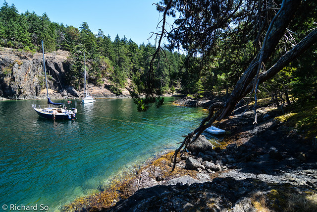
Business Time anchored in a small cove on the southeast corner of South Thormanby Island. Our last stop of the trip.
Motoring south towards Vancouver on the last day. After days of strong wind warnings and big northwesterlys in the Strait of Georgia, the wind changed to a light five to ten knots from the southeast. It turned into a very slow trip back to Vancouver, sailing when there was a puff of wind, and motoring otherwise.
For more photos, check out my large photo set from the trip on Flickr.
nice trip! thanks for document it so well. So my son and i are moving onto a 32' Westerly in the San Juans this summer and I was thinking of shooting for desolation sound in mid august or september even ( in search of swimming water.) But I love the alpine excursions your trip offered. I just wonder if the trail is too steep for my boy. Is there easier way to get above treeline. I got the experience but i gotta take the elevation gain down to 3000 ft a day or so. thanks again for the beta!
I'm sorry I didn't reply! Did you end up going up there? My guess is that the elevation gain would be too much. It's a long ways up from sea level to the lake at 1400m. But there was a possible camp spot lower down, at approx 1100m. Next to a flowing stream, quite pretty too. The Malibu camp takes teenagers up there all summer long.
Hi Rich thank you for sharing this trip online! it is great to see your pictures and stories online. Where did you find the info on The one and only climbing route on this wall is PLI Trail (17 pitches, ED1/2 V 5.10+) on the lower part of the wall, established by Peter Rowat and John Brodie. Ive been searching everywhere and can't find anything on it.
If you can get a copy of it, there is an one page article about it in the Canadian Alpine Journal, 2003, pg 129. I don't know if there's been any other developments up there since then.
A while ago, Peter also had a page on his personal website with some photos and stories, but that link seems to be down now.
Outstanding! Thanks so much for sharing! I have wanted to explore that area for some time and your blog provides great information and inspiration! Great photos, too. Are you still sailing?
Thanks for the kind comment Trevor! PLI and Jervis inlet are definitely well worth exploring. I still sail quite a bit, although more on the racing side on another boat and a little less of this style of cruising/exploring on the Catalina 27.
Thanks so much for the info, I was there Aug 2018. Hard to find good info on Princess Louisa and the hike past there. I had been in there a few times boating and new the trail must go some where. A little map checking then doing some google searches and I was able to connect some dots.
Was able to use your description and going solo made a day trip to the lakes and back. 5 hours up and 3.5 down. I was moving, if overnighting I would assume 6 hours up. Absolute beautiful country and the best write up I could find on the trail.
Trail is pretty beaten in, can't really lose it. Summer camp (Malibu) uses it enough you can't miss it. Looks like they have a camp at trappers cabin (500m) and one maybe an hour past it when you cross over the creek again.
Thanks again for the blog post, it helped me feel better about my plan.
Thanks for this post! Inspired out trip up there this past Easter weekend. If any parties viewing this post are interested in a KML track of our route to the ridge and ski down feel free to send me an email. alexcebulski(at)gmail(dot)com


nice trip! thanks for document it so well. So my son and i are moving onto a 32' Westerly in the San Juans this summer and I was thinking of shooting for desolation sound in mid august or september even ( in search of swimming water.) But I love the alpine excursions your trip offered. I just wonder if the trail is too steep for my boy. Is there easier way to get above treeline. I got the experience but i gotta take the elevation gain down to 3000 ft a day or so. thanks again for the beta!
I'm sorry I didn't reply! Did you end up going up there? My guess is that the elevation gain would be too much. It's a long ways up from sea level to the lake at 1400m. But there was a possible camp spot lower down, at approx 1100m. Next to a flowing stream, quite pretty too. The Malibu camp takes teenagers up there all summer long.
Hi Rich thank you for sharing this trip online! it is great to see your pictures and stories online. Where did you find the info on The one and only climbing route on this wall is PLI Trail (17 pitches, ED1/2 V 5.10+) on the lower part of the wall, established by Peter Rowat and John Brodie. Ive been searching everywhere and can't find anything on it.
Thanks again
Joe
Thanks Joe,
If you can get a copy of it, there is an one page article about it in the Canadian Alpine Journal, 2003, pg 129. I don't know if there's been any other developments up there since then.
A while ago, Peter also had a page on his personal website with some photos and stories, but that link seems to be down now.
Outstanding! Thanks so much for sharing! I have wanted to explore that area for some time and your blog provides great information and inspiration! Great photos, too.
Are you still sailing?
Cheers,
Trevor
Thanks for the kind comment Trevor! PLI and Jervis inlet are definitely well worth exploring. I still sail quite a bit, although more on the racing side on another boat and a little less of this style of cruising/exploring on the Catalina 27.
Thanks so much for the info, I was there Aug 2018. Hard to find good info on Princess Louisa and the hike past there. I had been in there a few times boating and new the trail must go some where. A little map checking then doing some google searches and I was able to connect some dots.
Was able to use your description and going solo made a day trip to the lakes and back. 5 hours up and 3.5 down. I was moving, if overnighting I would assume 6 hours up. Absolute beautiful country and the best write up I could find on the trail.
Trail is pretty beaten in, can't really lose it. Summer camp (Malibu) uses it enough you can't miss it. Looks like they have a camp at trappers cabin (500m) and one maybe an hour past it when you cross over the creek again.
Thanks again for the blog post, it helped me feel better about my plan.
Jonathan
Thanks for this post! Inspired out trip up there this past Easter weekend. If any parties viewing this post are interested in a KML track of our route to the ridge and ski down feel free to send me an email. alexcebulski(at)gmail(dot)com