Sept 21-29, 2009
I’ve wanted to hike in this part of the South Chilcotins for a long time. In late September 2009, I spent eight days hiking with the Take A Hike students in this amazing part of the Coast Mountains, approximately five hours from Vancouver. We took our time going hiking up the Slim Creek trail, then up to Leckie Lake, through Wolverine Pass, through Gun Pass, and then Griswold Pass and out. Going at a different pace than my usual trips allowed for some great photo opportunities. There’s endless potential for longer trips here, and it’s definitely one place that I plan to visit again. Just take one look at this map, and think of all the loops and traverses you could do in this open playground.
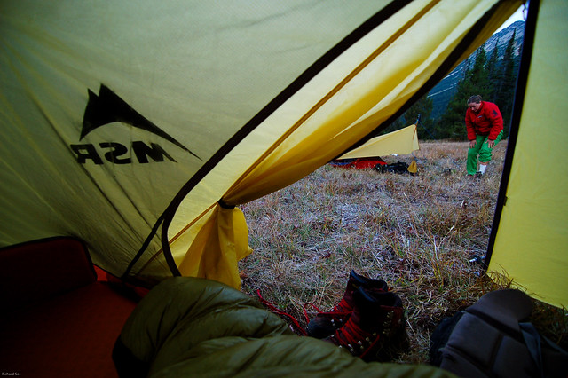
After a proper faff at the school on Monday morning, we made the long drive up to Slim Creek. After another great faff of moving all the student’s gear out of the vans and last minute packing lessons, we hiked for about one kilometre up the road before stopping to set up camp. I would soon adjust to this pace.
Krystil getting ready to wake up the students. Usually it took two hours before we left camp. Pretty relaxing.
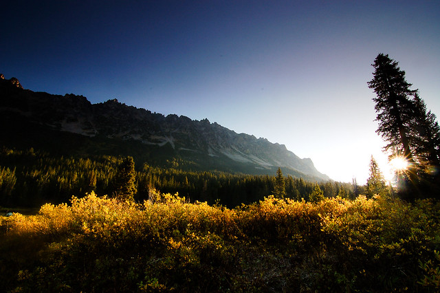
Sunrise in Slim Creek.
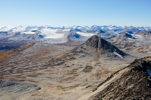
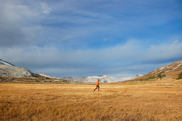
We had near perfect weather until the last night when it started snowing. We didn’t make it much further on the second day. We hiked for about 6km until reaching this spot where the valley opens up with the meandering Slim Creek below. On the third day, we hiked to the confluence of Leckie and Slim Creek. While having lunch there, I found out that I was going to have to hike out one of the students in the other group, back to the trailhead since he had a sprained ankle. I cached most of my food there, and slowly hiked the ten kilometres back to the trailhead that afternoon/evening with one of the teacher. I was really hoping that we would get him out to the trailhead by dark, so I could return and catch up with the rest of the group at Leckie Lake the next day. We managed to get the student out of the trailhead the previous night, and I woke up early the next morning to hike back up the valley to catch up with the group at Leckie Lake. The group was going to do a day hike up one of the peaks to give me a chance at meeting up with them.
We had near perfect weather until the last night when it started snowing. We didn’t make it much further on the second day. We hiked for about 6km until reaching this spot where the valley opens up with the meandering Slim Creek below. On the third day, we hiked to the confluence of Leckie and Slim Creek. While having lunch there, I found out that I was going to have to hike out one of the students in the other group, back to the trailhead since he had a sprained ankle. I cached most of my food there, and slowly hiked the ten kilometres back to the trailhead that afternoon/evening with one of the teacher. I was really hoping that we would get him out to the trailhead by dark, so I could return and catch up with the rest of the group at Leckie Lake the next day. We managed to get the student out of the trailhead the previous night, and I woke up early the next morning to hike back up the valley to catch up with the group at Leckie Lake. The group was going to do a day hike up one of the peaks to give me a chance at meeting up with them.
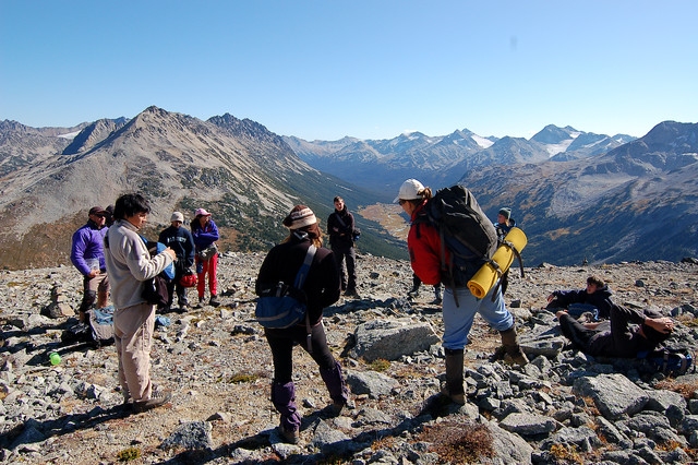
I found the group’s campsite at Leckie Lake, noticed people up on Peak 8069, and made my way up to the summit to join them. The students were quite surprised to see me up here, and were shocked that it only took me a few hours compared to two and a half days.
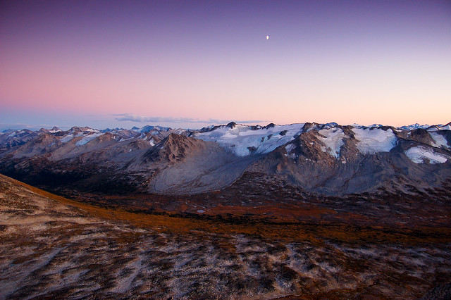
Early morning sunrise at our camp near Leckie Lake, with the Sorcerer group behind, and Slim Creek in the shade below. Self portrait. Enjoying a bit of solo time before the students got out of their tents
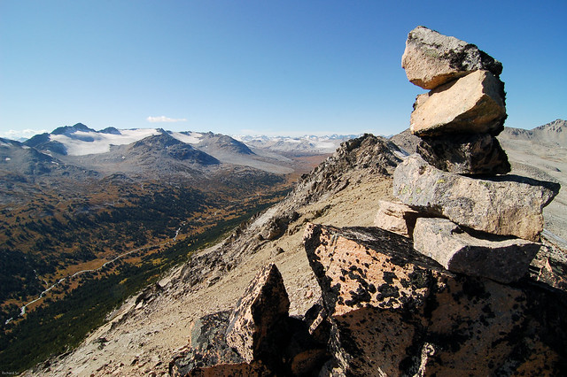
A cairn on the long rambling ridge between Slim Creek and Leckie Lakes. You could keep on walking along this ridge for a few kilometres to Wolverine Pass if you wanted to.

The next day we hiked over Wolverine Pass and down into Gun Creek.
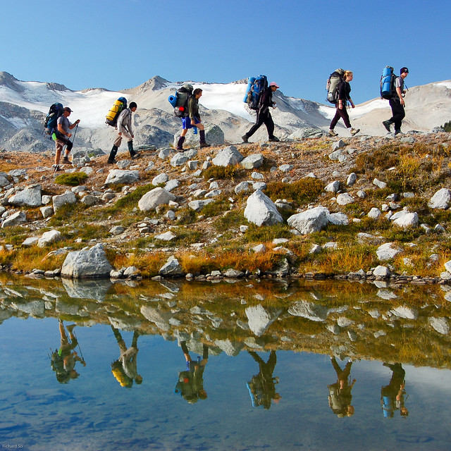
Students of the Take a Hike program and their reflection on Leckie Lake. One of my favourite photos from the trip.
Ominous evening lightning above our camp in the meadows below Gun Pass. The next day, we hiked from Gun Creek over Gun Pass and finally down into the expansive plateau beyond.
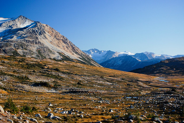
Go here. It’s spectacular. I can’t wait to come go here and do a bigger loop that my friends did a few years ago. Looking west, taken from near the summit of Gun Peak. Or maybe with skis and onto the Lillooet icefield.
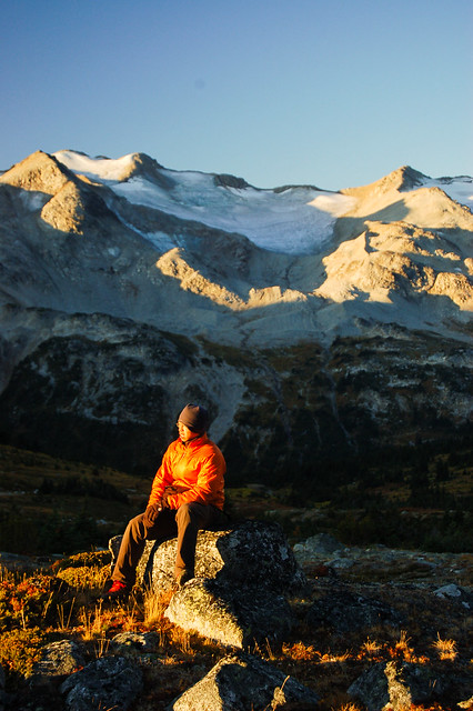
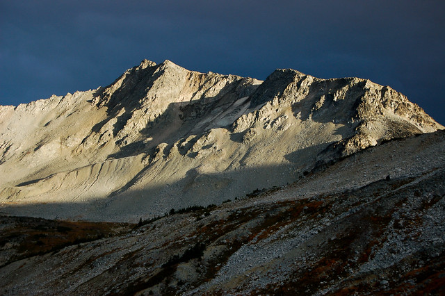
We camped at the small lake at the north side of Peak 8269. That evening I hiked to the summit to get a good view of Slim Pass below. What a magical place to spend a few days.
A sunrise stroll around the lake to get some good photos of the big mountains to the west
Krystil hiking down to the headwaters of Slim Creek. That’s Steve’s Peak back there, completely round on all sides. We were hoping to hike to Griswold Pass with the students, but due to a knee injury we only walked a short distance to Slim Pass that day.
Setting up camp at Slim pass.
Looking back at the headwaters of Nichols Creek, while on an afternoon solo stroll to Griswold Pass from camp at Slim Pass. Glaciers and meadows. The rest of the students enjoyed an afternoon solo in their own spot amongst the trees and rocks at Slim Pass, while I went off for my own solo. It was pretty spectacular, and very remote feeling to be here by myself. One of my favourite afternoon walks to date.
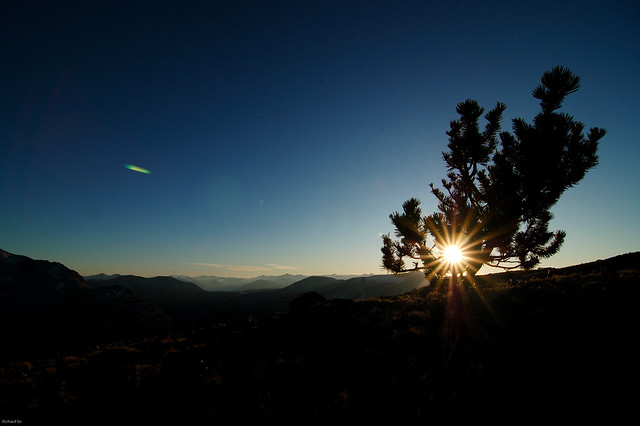
The last of the sunshine on Steve’s Peak, a rounded bump above the Slim Valley. I think this was the only tree that I saw on the summit, stunted and gnarled. From Bivouac.com, “A rounded dome located at the head of Slim Creek and Nichols Creek. It was unofficially named after Steve Klassen during a traverse of the Gun Creek drainage in September 2002. After 4 days of scrambling up steep scree slopes Steve wanted to ascend something exceedingly easy. The summit of “Mount Steve” is a walk from all sides.” I finally met Steve on a trip to the Chilcotins over New Years. Mount Steve is actually labelled on Google Maps now.
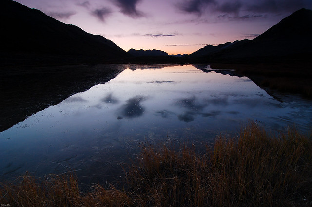
A cold morning reflection at Slim Pass. I ended up standing here for a while waiting for the sun to come out enough to reflect the sunrise over this mini-lake. Of course everybody else was happily inside their sleeping bags.

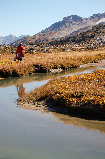
Swooping river meanders at Slim Pass.
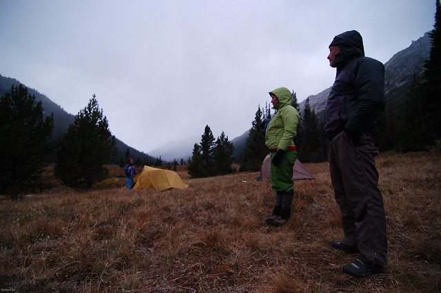
Supervising at our last camp in Slim Creek. The students started to worry when it started snowing. The other half of the class was camped further up the valley where it started snowing earlier.
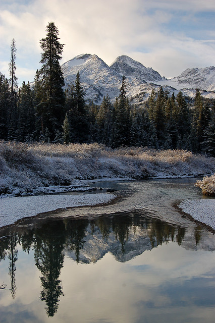
Morning reflection in Slim Creek after a late September snowfall
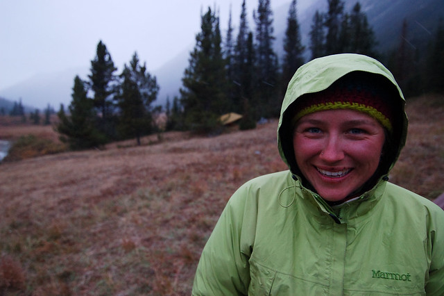
Krystil still smiling in the rain/sleet/snow.
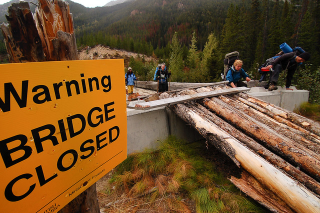
The broken bridge a few kilometres before the end of the Slim Creek FSR. The students were ecstatic that there were so close to the vehicles after a week of hiking in the Chilcotins. I’ve never seen people walk along a logging road so fast.
Fantastic trip. The area looks amazing and your photos are beautiful.
Thanks a lot! It's a special place for sure. Well worth visiting, just watch out for the bugs in the summer!
Looking to explore this area this Summer. Do you have directions to get there? Looks difficult to access by road.