I had a few days off before heading back to school, with nothing to do, and a forecast less than stellar for Squamish cragging. Tim Blair needed somebody to help him out with fieldwork for a few days in Quesnel, and then he said we could go climb some mountains on the way home. There’s an unwritten disclaimer when you sign up for a trip with Tim. This guy bikes twice a week to campus from the North shore, and goes on four hours runs in the mountains regularly. He’s also faff-negative, reducing faff wherever he goes. Tim also claims that a long slog increases the value of a trip, not decrease it. I did tell Tim there’s also an unwritten disclaimer when you go on a trip with me though, I’m never in shape.
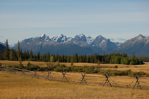
The original plan was to head to Chilko lake, paddle down to Franklin Arm, and then climb every mountain that we could. For some reason I thought Chilko lake was a casual paddle, after looking at some photos from a previous trip there. While in Quesnel, we constantly checked the weather forecast, but it didn’t look great. We decided to go there anyways. After counting enough pebbles in Baker Creek on Monday, we drove towards the gorgeous Nemiah Valley. We didn’t quite make it all the way there that night, stopping at a nice recreation site next to the Taseko river. We woke up early the next morning. This would become a common theme of the trip, where Tim would wake up early, and try to wake me up. At least Tim doesn’t boil water on summer mornings. We finished the rest of the drive to the campground by Chilko lake, stopping to admire all the grand and wild mountains in the area. It’s definitely a nice spot to check out. One of Dave Campbell’s favourite spots on the planet, and that’s saying a lot.
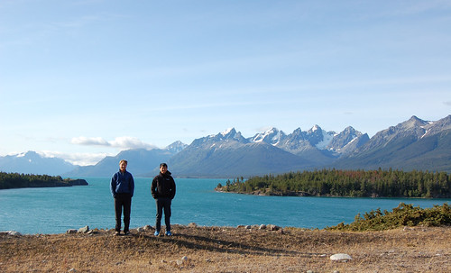
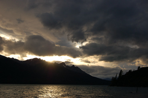
Apparently Chilko lake is known for its strong winds, especially in the afternoon. It’s one of the largest lakes in the southern Coast Mountains. We launched the canoe from the campground around mid-morning, with Tim giving me a crash course in canoeing.
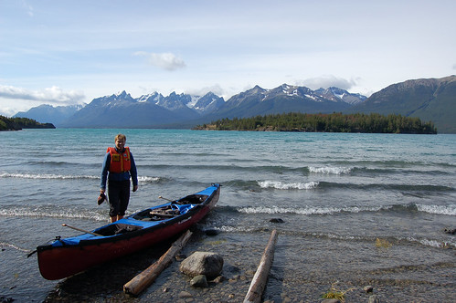
The water was quite choppy, with whitecaps in all direction. Needless to say, we didn’t make it very far before the waves started to bug us. It was almost impossible to paddle against the crashing waves, and turning around was almost as difficult. We made it back to shore, and decided to wait for calmer waters before another attempt. In the meantime, we hiked along a short trail towards Canoe point. From this vantage, we could see down the rest of the lake, and it looked just the same, turquoise blue with white specks everywhere.
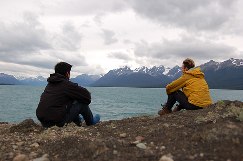
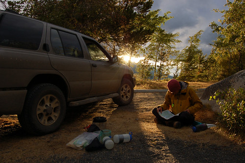
Waiting for the wind to calm down reminded me of waiting inside a tent during a whiteout on a ski traverse. So naturally I took three naps that afternoon. I think Tim wandered around the campground looking for more interesting company. The wind didn’t let up that evening, but we insisted on the campsite right by the water so we would know immediately when the wind died down. This was somewhat silly. For the next two nights, we cooked dinner on the lee side of the truck, and then sat inside the truck eating dinner, and listening to the U.S. democratic convention. That and CBC seemed to be Tim’s choice of radio. And oh, the long term forecast on News1130. We checked that several times a day. Another source of entertainment was canoe-soccer. Tim found a tennis ball in the bushes to kick with, and the net was our canoe, and another canoe 5m away. The alarm was set for 3:30am, just in case the wind did calm down in the early morning. I woke up, and the tent was still shaking in the wind.
The next morning Tim said he had difficulty sleeping because he thought the tent was going to blow away. I reluctantly woke up at 8:30am. Tim was getting antsy that we were car camping, and not doing anything at all. The obvious solution was to climb Mount Tatlow, a 10,000 footer, considered a god by the native population of the Nemaiah valley, and also a “weathermaker”. We drove up an old road and found a cattle track which led up to the alpine. The alpine meadows here are gorgeous, its just endless rambling along heather and low grass. It reminded me of the tundra in Alaska.
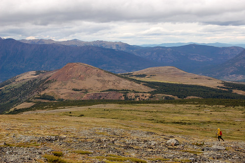
And it was just as windy. In fact, the wind never let up that day. Our route was the north ridge, mostly a big slog on talus. Somewhere just below this ridge, I started to get a really bad headache which didn’t stop until that evening. I thought it might be the rapid rate of ascent that Tim was dragging me up at. Tim also suffered from the headache (though his pace would suggest otherwise), and thought it was just the dry cold air. We almost made it to the summit, but there was a notch plastered with hoarfrost between us and the true summit.
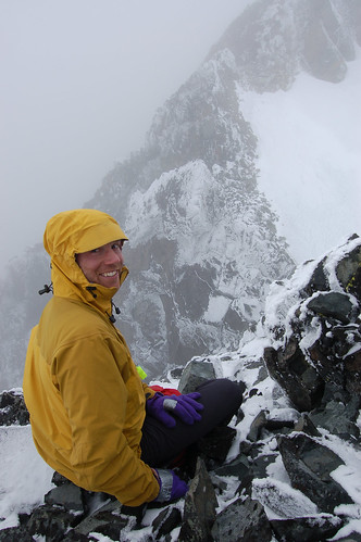
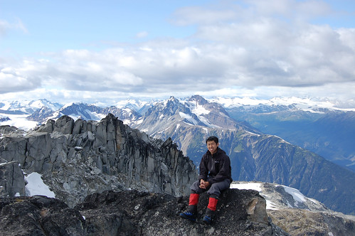
That was ok though, afterall as Tim likes to say, it’s about the journey and not the summit. I don’t have too many good photos from this trip, since everything was blurred because we were moving too fast. We moved to a less windy campsite that night. We woke up again at 3:30am, and we could still hear the waves on Chilko lake.
After waiting at Chilko lake for three mornings, we decided that the weather wasn’t going to be much better and started thinking of where else to go.
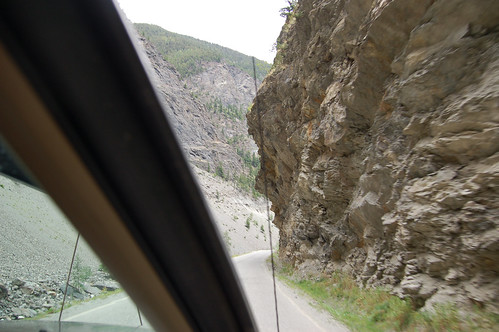
We were so close to the Tchaikazan, but in the end I decided not to go since Tim just wanted to climb big choss piles there (he’s already done all the interesting peaks). Instead we would head to the south Chilcotins, where Tim claims it never rains, and then off to mountaineering camp. The drive from Lillooet to Gold Bridge is quite interesting, the road is quite windy, through steep canyons, and one section of the road has unsupported overhanging rock!
We camped at the Jewel Creek recreation site. The next morning we set off for Dickson Peak. The route is described in Matt Gunn’s book. A steep mining road leads you quite high, and then the route passes through some gorgeous meadows in a steep valley bottom.
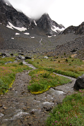
It would have been quite enjoyable, if only it wasn’t raining so hard. Every time I caught up to Tim, I would find him hidden underneath a boulder, somewhat sheltered from the rain and wind. We slogged up the never ending talus slopes to the summit in a full on summer blizzard. Somewhere near the top, I saw Tim, asked him if he already got to the top, and then he just pointed to the top. We both realized the last time we were on a summit with such bad weather, was on separate trips with Fred. Tim was tempted to climb Mount Penrose on the way back too, but it looked way too nasty from this side (imagine vertical scree separated by bands of chossy cliffs). We didn’t actually have a map or route description here. Instead we were relying on Tim’s GPS topo map the whole time. After all, this wasn’t a planned destination.
That evening we drove towards mountaineering camp. We were planning to climb another peak before hiking into the Harrison Hut. We checked out the Truax road and the Noel Creek roads, but figured we didn’t have enough time to climb those peaks. We settled for Grouty Peak, which is on the other side of the Railroad Pass group. There’s good camping a few minutes in on the Semaphore lakes trail.
Once you get pass the steep bushwhacking and steep grassy slopes, the rambling up here is quite nice.
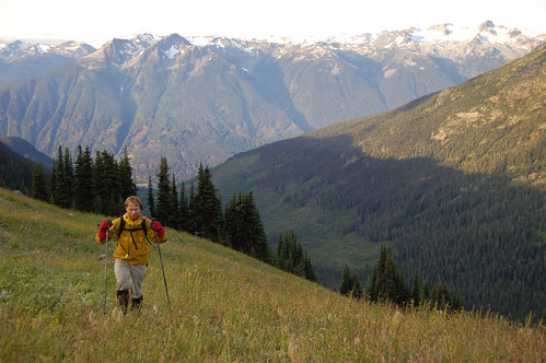
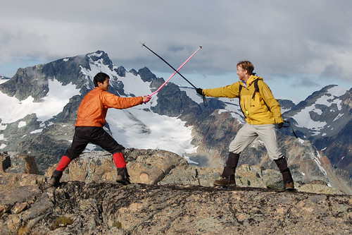
I was actually here a month ago, but Tim claims that getting to the sub-summit wasn’t good enough, and I actually had to climb the true summit with him. Grouty was also high on Tim’s ticklist, which he claims is not in any sort of priority order. This was the first summit of the trip where it was actually sunny. We dueled with our hiking poles to release some inner rage at this point.
Descending the steep grassy slopes to the Hurley road was quite terrifying this time around, everything was frozen or slightly wet. We wished we had crampons.
The day wasn’t quite over yet though (I wish it was). It took a while to pack our bag. You get really lazy when you’ve been car camping for a while, gear was exploded everywhere inside the truck.
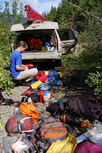
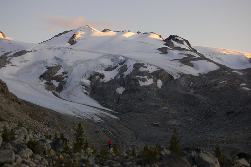
At the top of the road, we had to redistribute the group gear. Basically I gave everything to Tim to slow him down to my pace. Tim thought we could get to the hut in three hours from the bottom of the road, but it actually took us four hours. Once at the hut, we realized our mistake of leaving behind the rope in the truck. Most of the peaks around here are spectacularly glaciated. Tim would have carried the rope anyways.
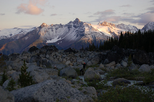
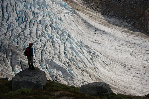
The next morning, most people roped up and took the Rollercoaster glacier route to Overseer, but Tim and I were ropeless, so we went the convoluted way. Tim wanted to climb Urea’s Heap first, but Overseer was the far sexier mountain. We ended up walking on the Madhorse glacier most of the time, it was bare ice and we had crampons. The views from the top of Overseer were great! I think we could see from the Tantalus range to Mount Monmouth (hidden in a cloud). Going fast and light, Tim decided to use a compass instead of a spoon to scoop peanut butter.
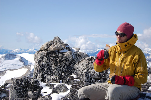
Tim had somewhat ambitious plans for the day so we never did hang around in one place too long. The climb up Urea’s Heap was just as expected, a grand heap of boulders and scree. One thing about Tim is that he has endless energy. Pika Peak was nearby, and even though it was lower in elevation and essentially another heap, Tim had to climb it. So we did.
I think I’ve fallen in with the wrong crowd. I now have a fairly long list of obscure peaks that I’ve climbed, but most of the obvious peaks have seem to evaded me. We actually passed a higher bump on the ridge leading to Pika, but didn’t climb that bump since it wasn’t named. If Overseer wasn’t in the area, most of these heaps might actually be legitimate peaks and more people would climb them. We thought of climbing Frozen Boot on the way back to the hut, but I wanted to save some energy to socialize.
The next morning, while everybody else was still sleeping, Tim woke me up early again. Tim was hoping to drag me through another sloggy day. The plan was to traverse the glacier and ridges from Three Stooges to Frozen Boot.
With borrowed gear from the Nelson’s, we climbed the glacier towards the Three Stooges. We thought the east stooge was the highest one, so we climbed that first. This soon triggered a game of summit chasing, with each westward stooge being higher. I don’t know why it’s called Three Stooges, there’s actually five bumps that we climbed. From the top, the weather looked like it was coming it quick, and neither Tim or I wanted to be in a whiteout around the Pemberton Icefields again.
We went back to the hut instead, packed up, and headed down the trail to catch up with some others for dinner at the Splitz Grill. On the drive home, I discovered that my pocket knife can opener was right-handed only (I was opening canned peaches). Tim was surprised (he tried to make a left-handed joke moments earlier). Good thing school is starting again, I can finally take a rest. Or maybe climb a bit.