From Fairley’s guide, “Peak 7400 (2260m/7400ft), located 6.4km/4mi NW of Callaghan and 2.5km SE of Squamish Glacier snout, is known as ‘Little Ring Peak’. It has been reached in a day on spring snow from roads on the upper Squamish River and ascended from the southeast side (FA: J. Clarke – 1969).
Its a symmetrical volcanic plug, with steep slopes on all sides.
Fred Touche, Jennifer ?? and I left on a cloudy Sunday morning to attempt Little Ring Peak.
We left North Vancouver at 7am, and drove up to approx Mile 45 on the Squamish mainline. That’s about 1.5 hours on a logging road if you’re not a rally driver. Back in April, I had slogged down 17km of this road in my skiboots. We saw two black bears along the way, one on BR200, and one past the Elaho bridge.
We were stopped by a enormous avalanche. We couldn’t see the source, as it snaked down the valley, probably for 2km or more. At the road, the height of the slide was approx 10m. This happened in the last 3 weeks.
Starting at 10am, we hiked 4km up to the logging road, to the washout where Fred had hoped to drive to. THe weather started going bad at this point, and the sucker holes dissapeared. We crossed a fast flowing creek, and got part of my boots wet. There was a short section of bush through the clearcut, and then up through the trees, until we reached a nice bench to travel on. I put on the snowshoes after the clearcut section. Fred ski-wacked through the clearcut.
We reached the south side of Little Ring Peak at around 2pm. The large avalanches that Fred triggered 3 weeks ago were visible, and scary. We waited for better weather, but all we got was some visibility, but no sun. The traverse across the slope was both scary, and difficult with the stupid snowshoes that I was using. Fred triggered a small sluff in front of me. I also triggered one when I fell. Jennifer said she heard a sluff above her, and I was getting way spooked at this point.
I reached a pinnacle on the east rib. Apparently there’s a good gully past this rib, but we didn’t see it. Fred had dropped his pack at this point and gone ahead, and then I heard lots of loose rock and snow crashing down just beyond me. Scary ****.
Jennifer and I figured Fred had severe summit fever since this was his second attempt. We took off the snowshoes, and decided to keep going and see it goes. The first scramble up loose volcanic rock was ok, followed by some snow traversing. The last 50m was the hardest, and sluffing from above had covered Fred’s tracks. We pushed on, with the slope going from 45 to 55 degree. The first crux was a 10 feet section, with rotten snow covered loose exposed rock. The second crux was a spooky traverse left acorss steep snow (to bypass a cornice), with lots of exposure, and then finally mantelling up to the summit plateau.
We couldn’t see anything, but figured we were on top. We took the descent really slowly, especially at those two crux. After getting back to the packs, Fred started skiing, and triggered fairly big, but slow moving (0.5m/s) wet sluff. Jennifer and I decided to get down below the runout zone, but forgot to turn right, and ended up in the direction of the Pemberton Icefields. Luckily, Fred found us before I found our old campsite from April.
On the way back, the weather turned to complete crap, with lots of rain. Somehow, without finding our old tracks, we ended at the exact same spot at the clearcut. Luck?
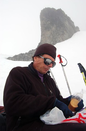
I fell alot on the snowshoes going up and down (thought that only happens on skis), since the snow was really wet and unstable. We got back to the car at 8:30pm, and back home at 11:30pm (mandatory Wendy’s and Tim Horton’s stop). I asked Fred and Jennifer later, and apparently this is typical mountaineering. I think on future trips to the mountains, I’m not going to go unless I can take good pictures.
Total Distance: approx 17-18km, 1700m elevation gain.