
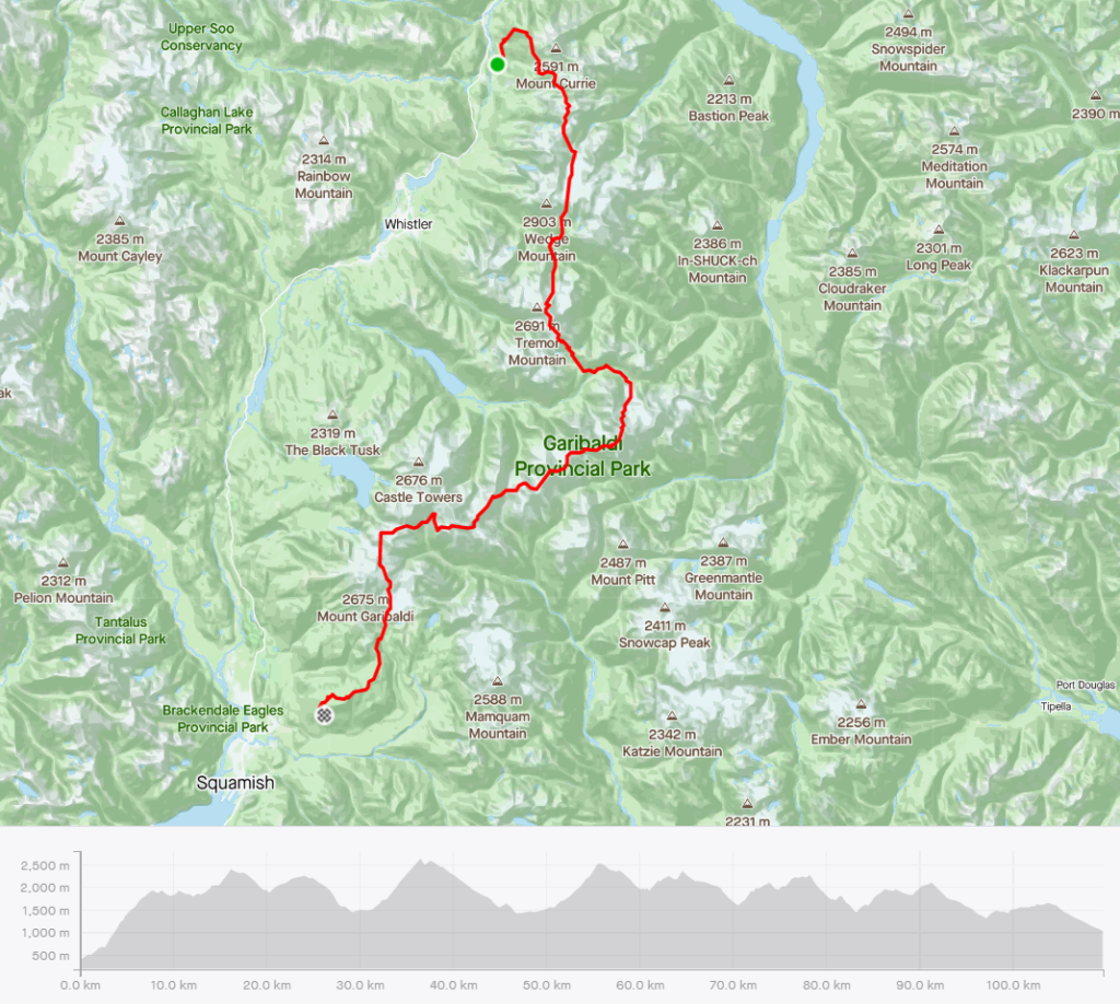
This version of the Garibaldi Park traverse from the Mount Currie trailhead to Red Heather was based on Christian Veenstra’s route, which linked up the Currie-Wedge traverse, McBride traverse, and Neve traverse. Note that he skied the whole thing solo in June 2017, a mind-boggling feat, setting the bar for a long fast non-stop ski traverse in the Coast Mountains. As far as I know, nobody else has repeated his feat, although a few people have talked about it and waited for a weather window too. Nick M and I managed to repeat the same route on May 15-16, 2021. We were waiting for a good window, but it was never quite perfect. The forecast was a bit on the warm side, and with some recent snow from the past weekend. Weather aside, my personal timing wasn’t ideal, as I was also recovering from a 52km trail run the previous weekend, followed up with a week away for work, which left me with little time to prepare and research the route at the last minute (I needed some excuses to be slow). But the forecast was good enough, and it was a worth getting out of bed for some fast(-ish) travel through the mountains, so off we went. I was ok with just doing a McBride traverse in a day too as an alternative plan.
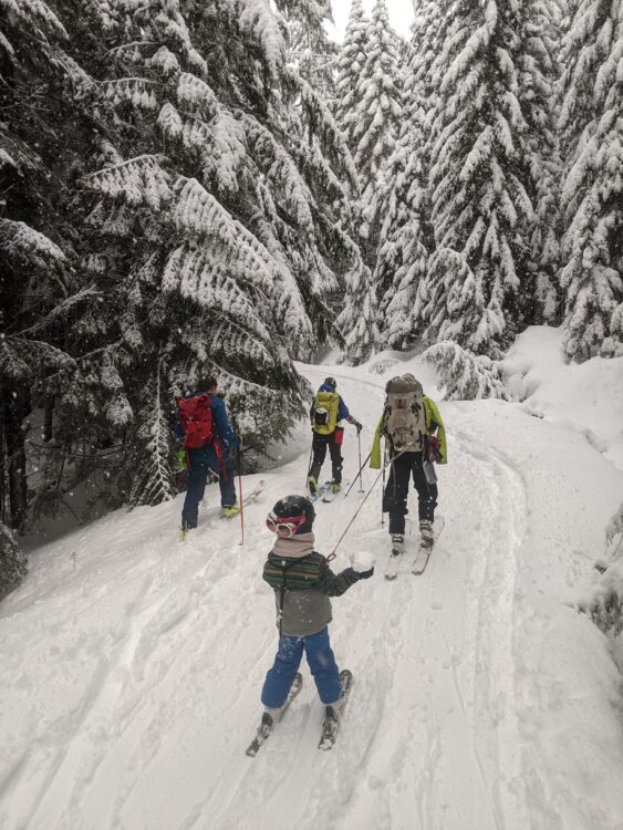
This was only my the 2nd time skiing with Nick this winter, the other time was for his birthday when I took him for a “easy” 2000m ski day on Hollyburn. The rest of the winter, Nick used his limited time off wisely, which mean either lots of skiing with family (and towing his son up Red Heather and everywhere else), or things like skiing the Garibaldi Neve solo twice in a day, for “training.” That double Neve involved going all the way down to the Rubble Creek trailhead in ski boots, then hiking back up, slogging around a slushy lake, a hot climb out of Ring Creek, all while following a skin track that was now completely post-holed on by others.
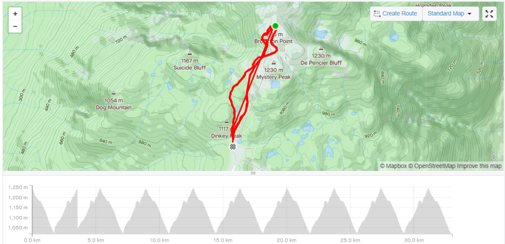
Meanwhile, I felt like I didn’t ski as much I hoped to this year, but I did spend some quality days (and not so great ones) on Hollyburn and Seymour, as I was mostly trying to ski local, even if that meant skiing bad snow. I tried to max out the amount of vertical climbed on skis per minute of driving, which is actually pretty high if you ski Hollyburn (4238 m / 50 min = ~84.76), whereas a trip to the Duffey works out much lower (2000 m / 360 min = ~5.5) . It turns out you need to do about 27 transitions if you plan to ski a 4200m day on Hollyburn, which is what I accidentally did one day back in March this year. And then there were endless hamster wheel laps up and down Brockton Point. My record was ten in a day back in November, but usually I aimed for just two to three. There were also many dawn patrols beyond Brockton Point, with some desperate sideslipping off Pump Peak on the ever-frequent raincrust.
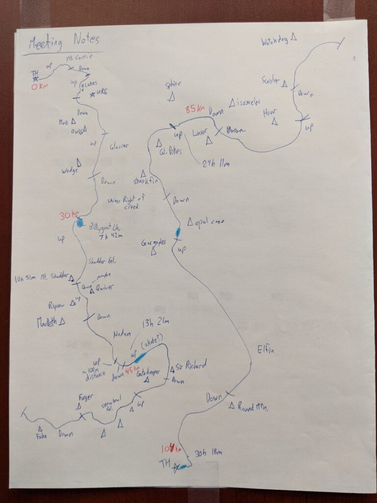
Stage 1: Mount Currie Trailhead to Billygoat Lake
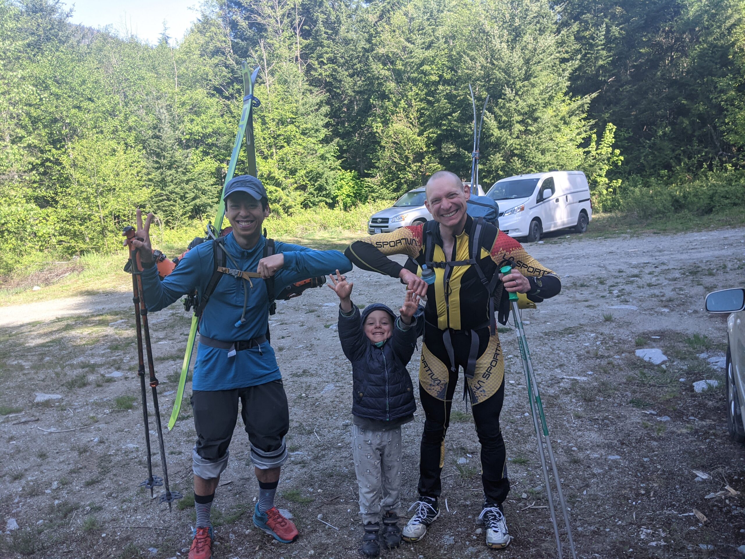
The logistics was simplified thanks to Gobin, who offered to pick up our tired bodies wherever we ended up, whether that was finishing earlier via the Wedgemount lake trail, Whistler, Rubble Creek, Brohm Ridge, but hopefully from the Diamond Head road. Considering that we had a bit of distance cover, we had a very relaxed start time of 9:40am from the car.
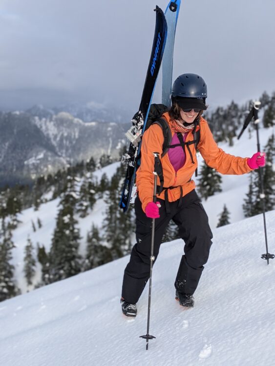
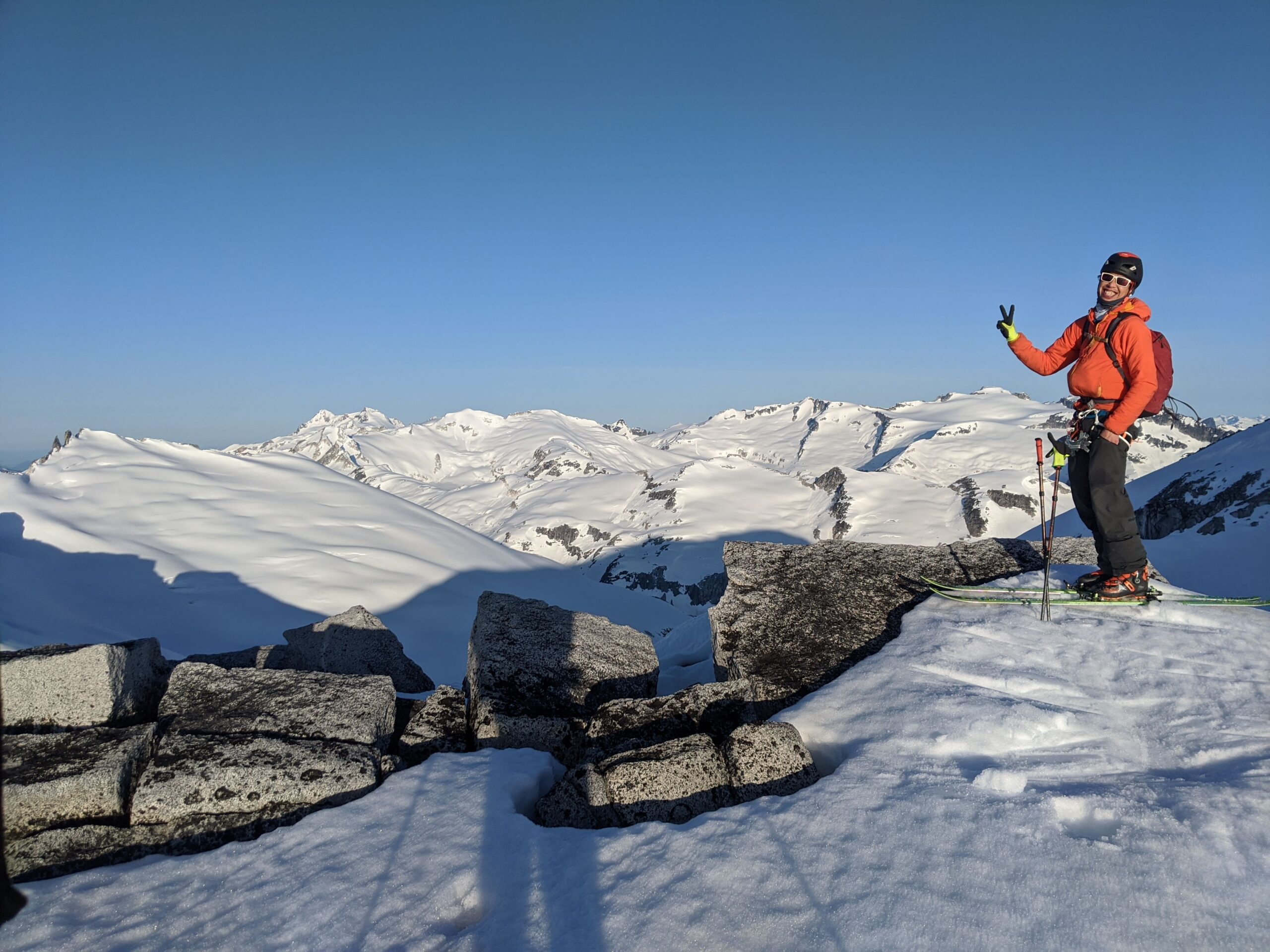
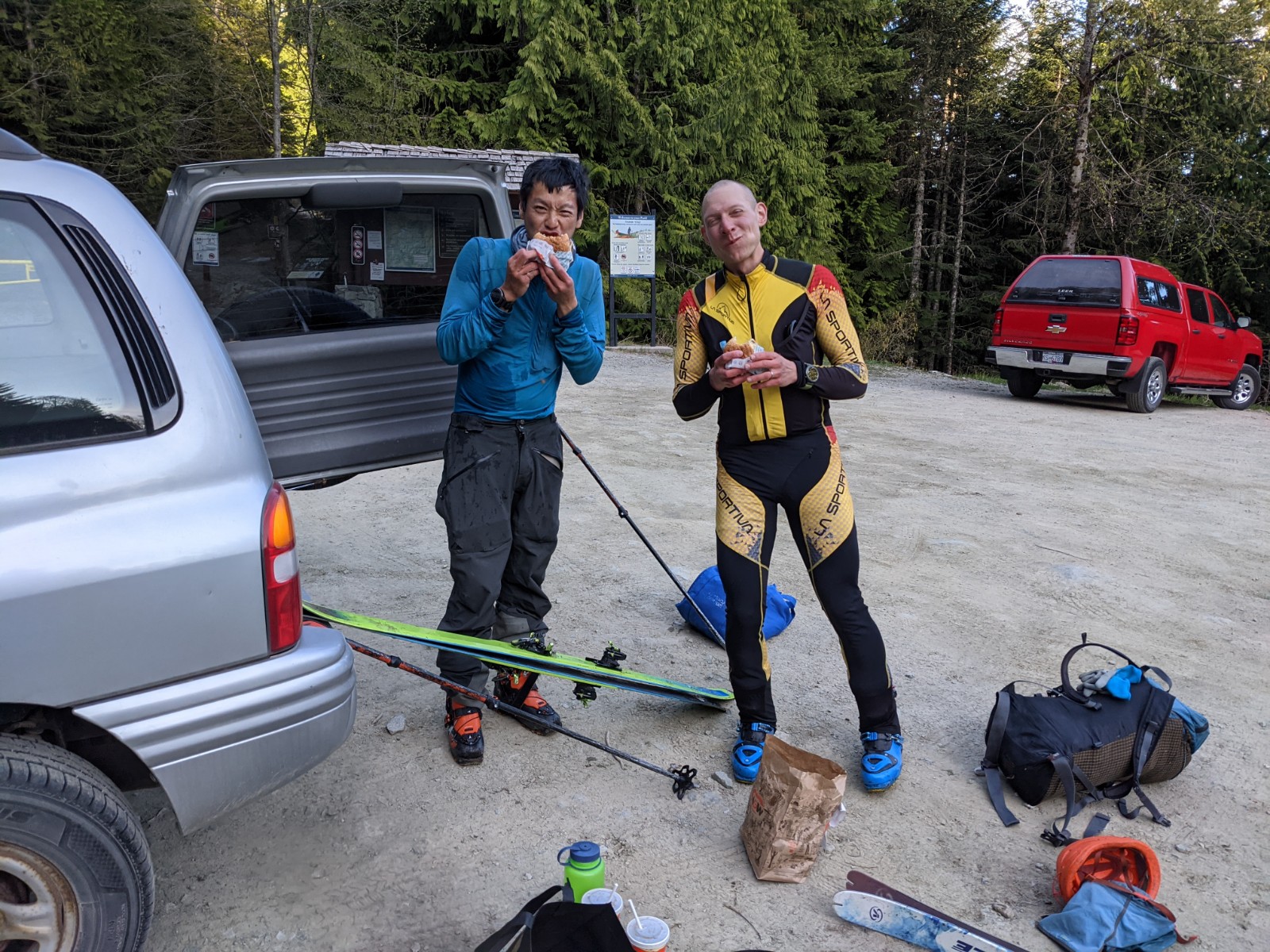
We parked at the 2WD spot shortly after crossing the Green River bridge, and hiked another 15 minutes to the actual Mount Currie trailhead. Lena and Charles followed behind us, and Lena would end up grabbing our shoes from the transition point. Thanks Lena! You could drive slightly further with a 4×4, but you would save very little time. We changed into skis at 1500m, the snowline was lower in the trees, but a straight up bootpack was more efficient below 1500m. We saw two people descending, and those would be only people we would see for for the rest of the day, and the next day until the end.
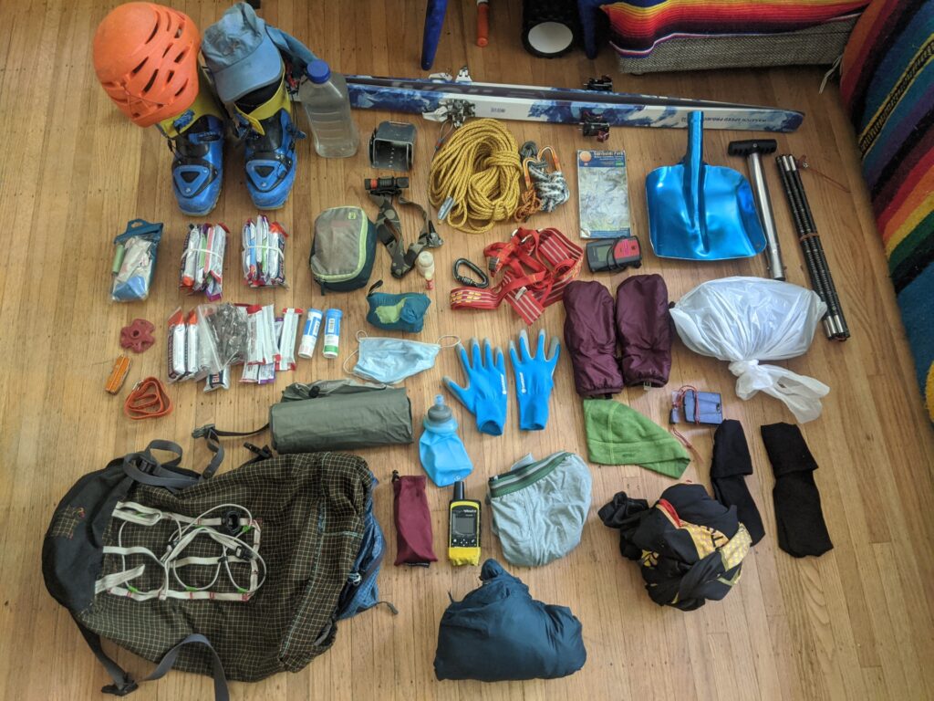
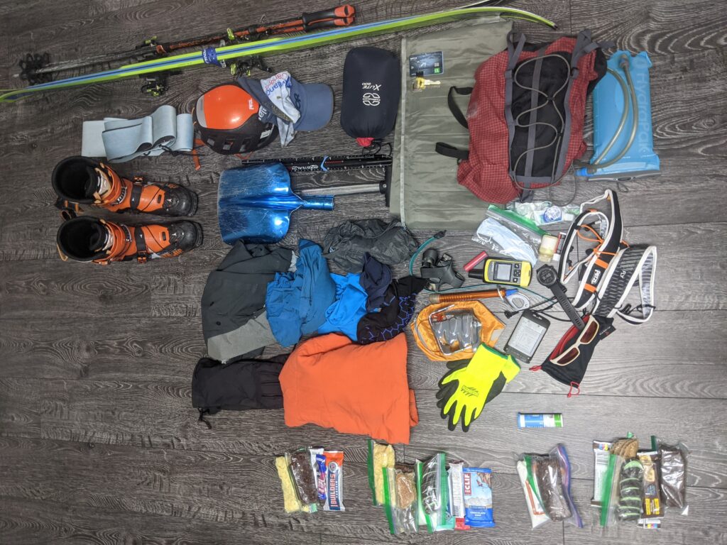
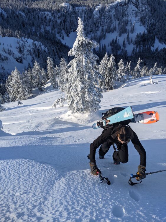
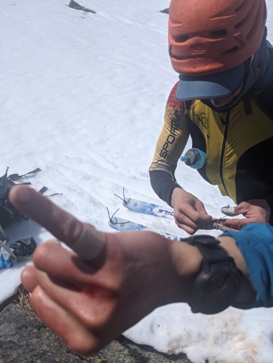
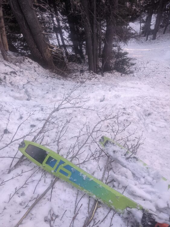
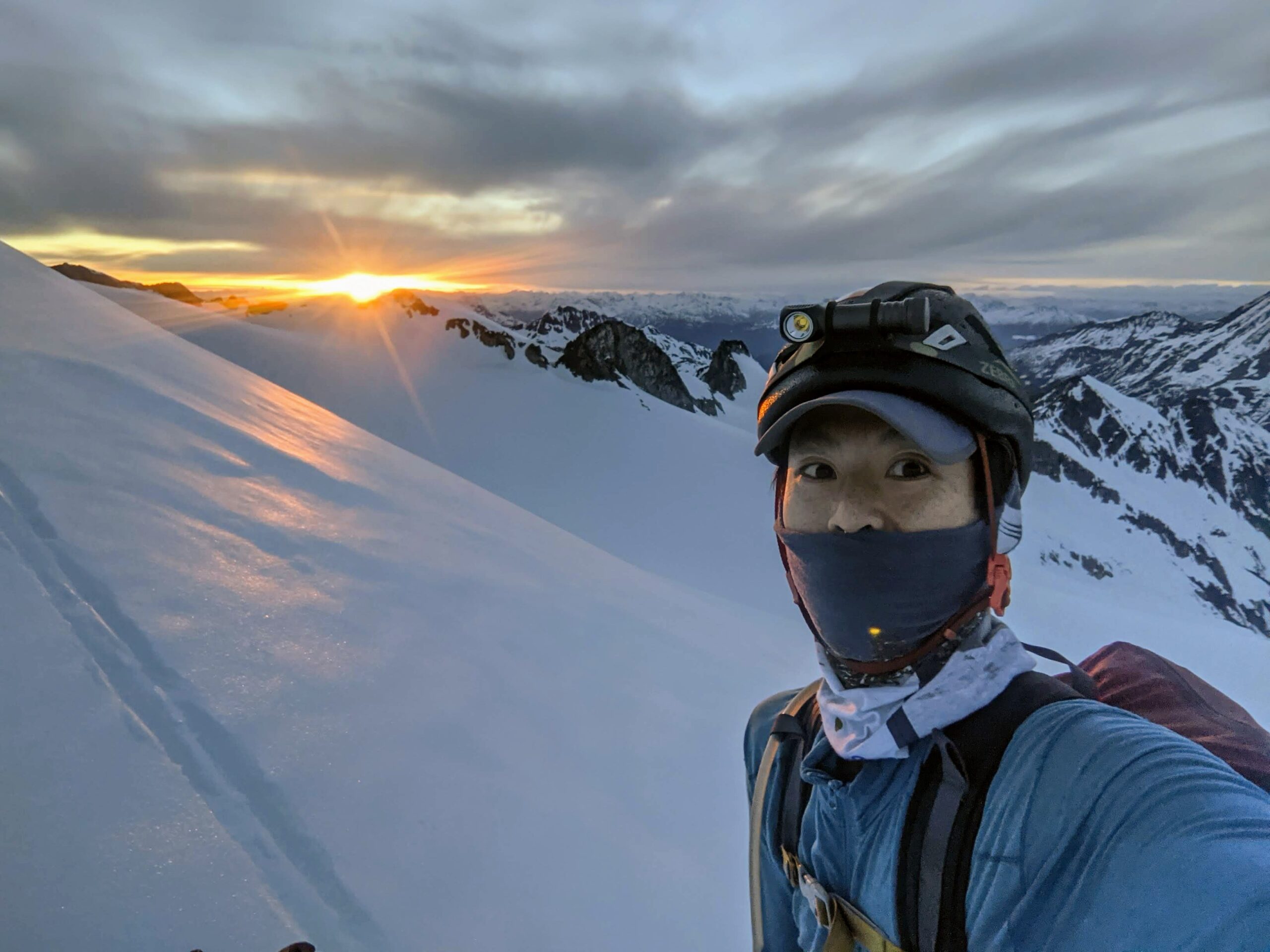
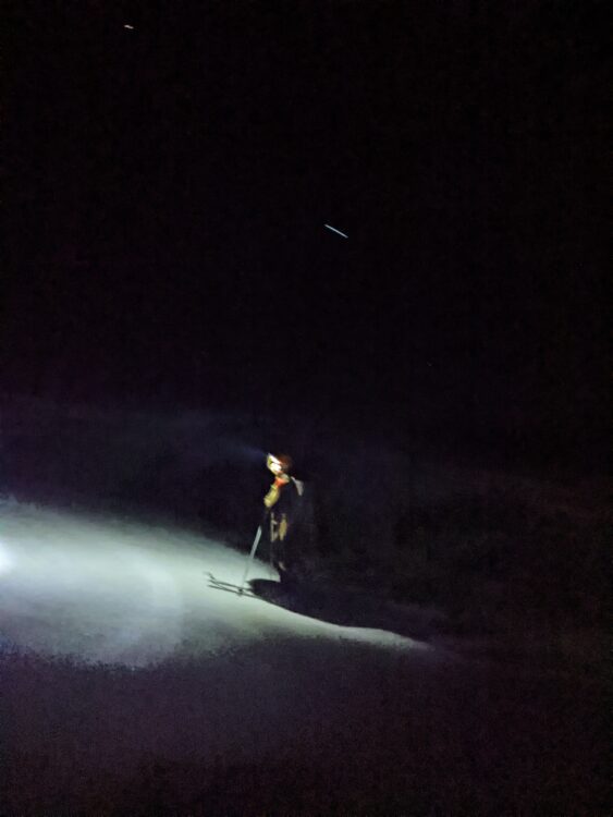
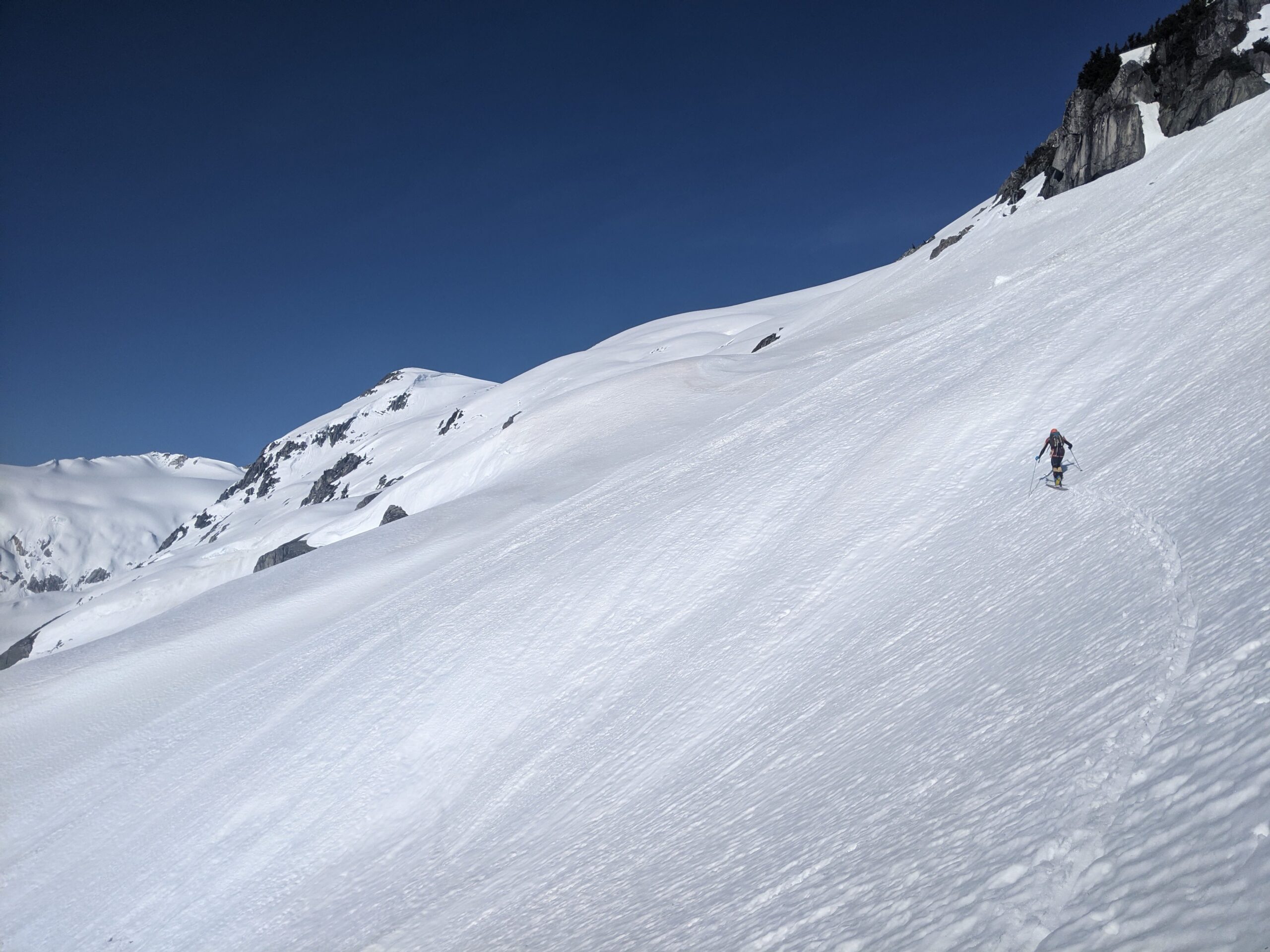
After the nice 1100m warmup hike, there was still more up to go. By the time you get to 1900m, you can start traversing along a bench southwards. We wouldn’t even see how far we had to go at this point. The upper 5cm of snow was slushy, over a firm base, and I was having trouble skinning and keeping up with Nick now, who was on his skinny race skis. After taking skis off for a short walk across a talus slope, I decided to clear some snow that was accumulating underneath my skin tips. I had these Dynafit speed skins that I picked up for a cheap price (thanks Howe Sound Sales!), but they were for a slightly shorter, different ski, and I had noticed snow building up underneath the tips. The loss of glue on the outer edges didn’t help the ice buildup either. Re-touching up my skins with some skin glue was something I forgot about until this point. But I did sharpen my edges, something I rarely do, anticipating exposed icy traversing on steep slopes on the McBride. Unfortunately, I managed to cut my finger clearing the snow gloveless.. This was pretty dumb on my part, and all of a sudden my skins, the snow, and the rocks were covered in blood. The cut didn’t look good, but I managed to stop the bleeding with my now blood-soaked long sleeve shirt, and then we bandaged it up. I skied the next section into the headwaters of Mystery Creek with my right hand above my head. The gloves stayed on for every transition after this one.
The next section is suppose to be an easy contour around Mystery Creek, towards the valley with two lakes north of the Mystery Glacier. With a lack of cloud cover and sunny warm skies, it was a slow wet contour, requiring skins on and trail breaking, not the fast icy conditions we hoped for. The late start didn’t help, but I didn’t have much time to prep for this trip and an alpine start wasn’t possible for me. I continued having skin issues (literally), and so did Nick. I turned around to see him with skis off, trying to dry off his ski base in a desperate attempt to get the skins to stick. This was a recurring theme of the trip.
We took a direct line up the Mystery Glacier, slightly steeper than needed but the snow felt good on this north aspect, with 10cm of slush over a firm base. On the other side, we ripped skins and contoured down towards the Weart Glacier, passing to the east of Mount Moe, aiming southeast towards the toe of the Weart Glacier. Again, conditions were not fast, and we had to sidestep and skate some flatter/uphill sections when we just couldn’t glide far enough in the soft mush. We took skis off again to walk across a short talus slope to get to the toe of the Weart Glacier.
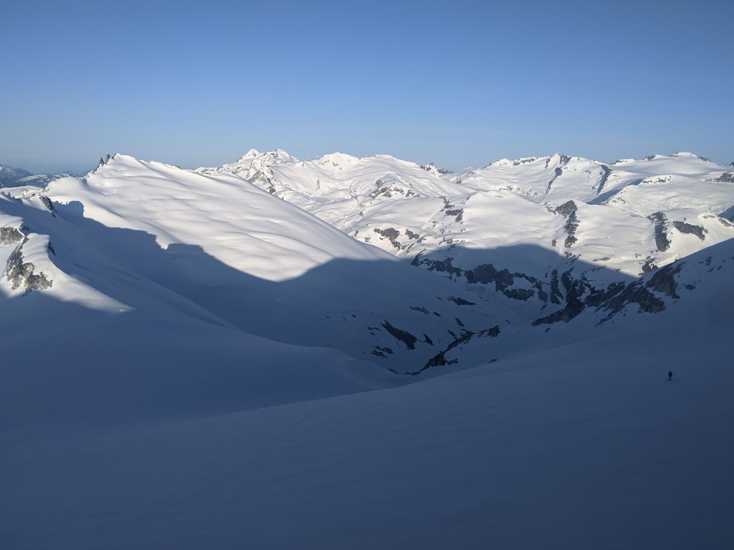
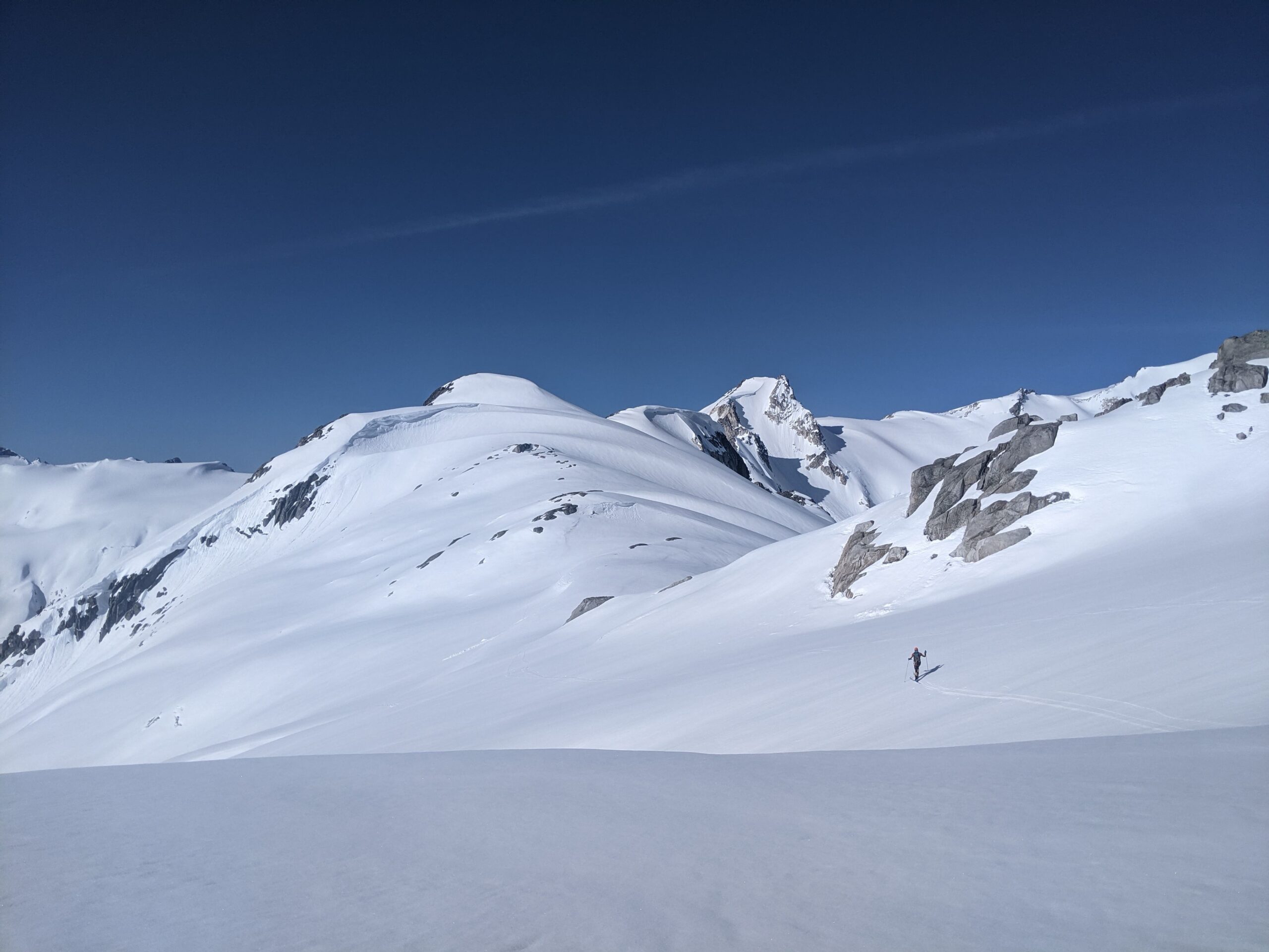
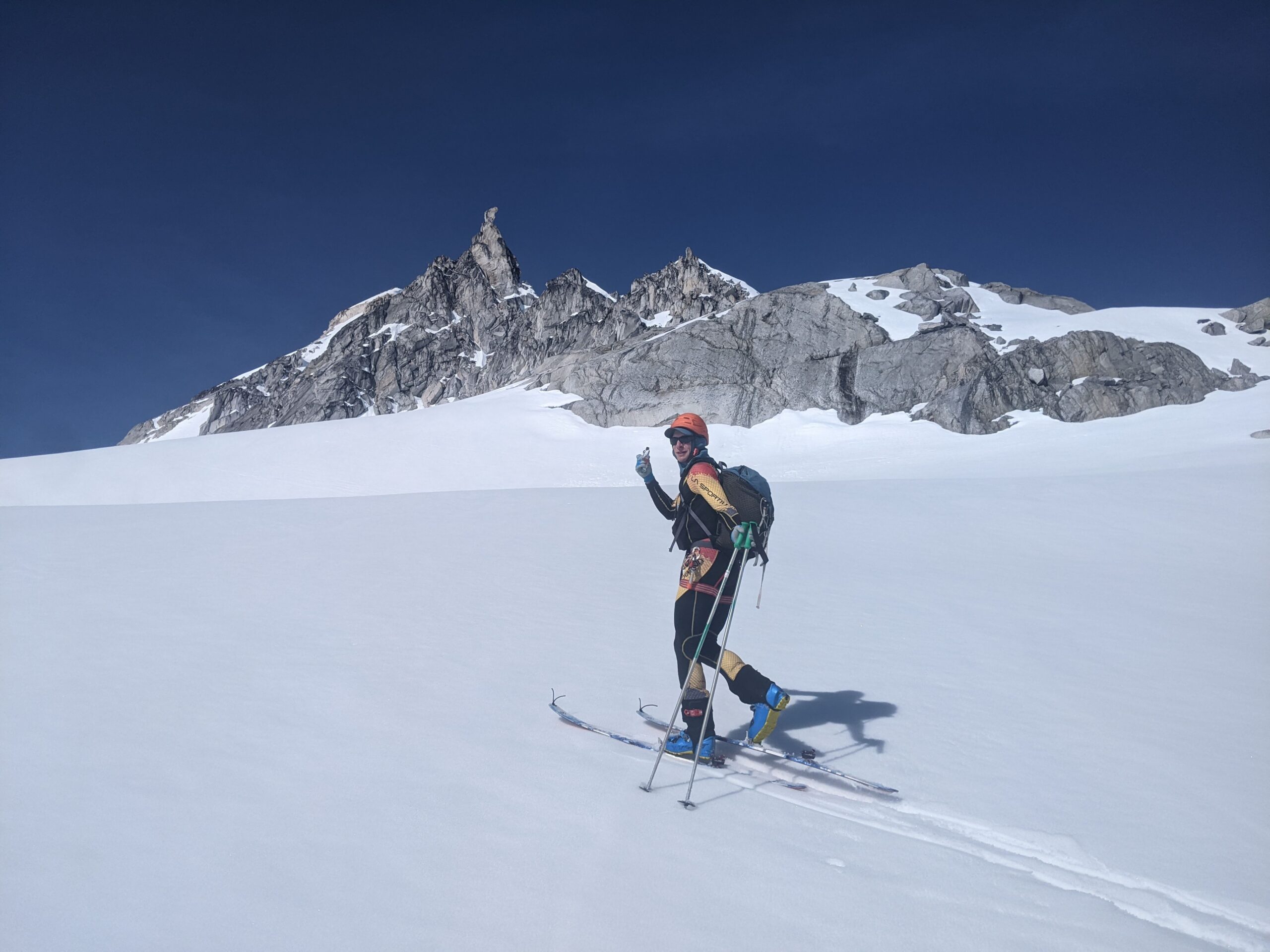
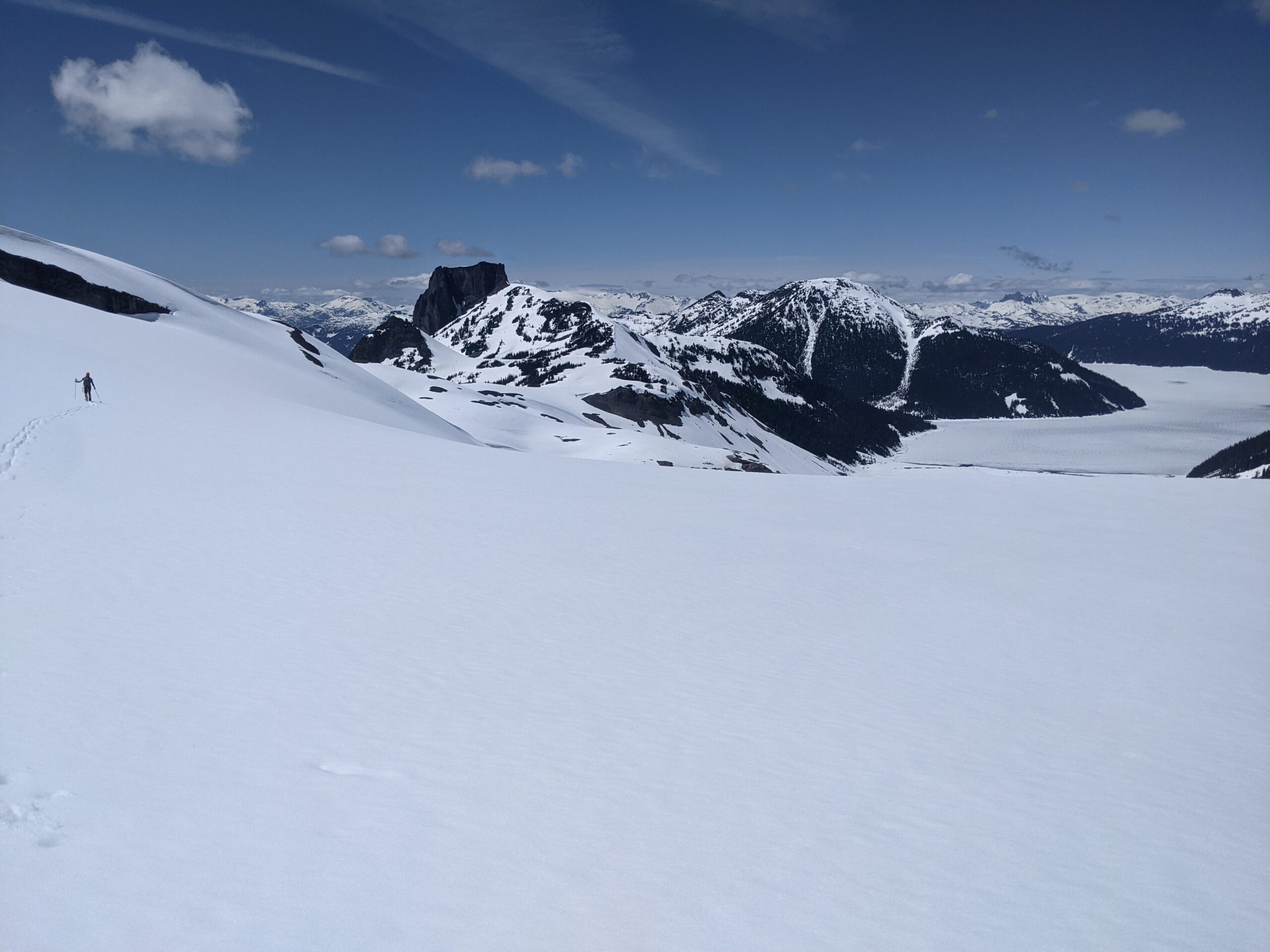
Nick suggested using a pair of skinny skins for the low angle climb up the gentle Weart Glacier. I didn’t have time to make a pair, so I borrowed Lena’s. They are a 30mm wide tail-clip free, 3/4 length skin to optimize traction/glide on low angle terrain. This makes senses on a flat slog like crossing Garibaldi Lake, or if you had skinny skis like Nick’s 65mm’s, but my “skinny” skis are 90mm underfoot, and the 1/3 coverage made for a tedious and slow climb up the toe of the Weart glacier, and I slipped and fell over unexpectedly more than once, while the skin simultaneously detached from the ski. Next time, I’ll go with a 50-75% coverage for my skinny skins. Once it flattened out, the skinny skins made sense, and I caught up to Nick at the 2280m col east of Lesser Wedge.
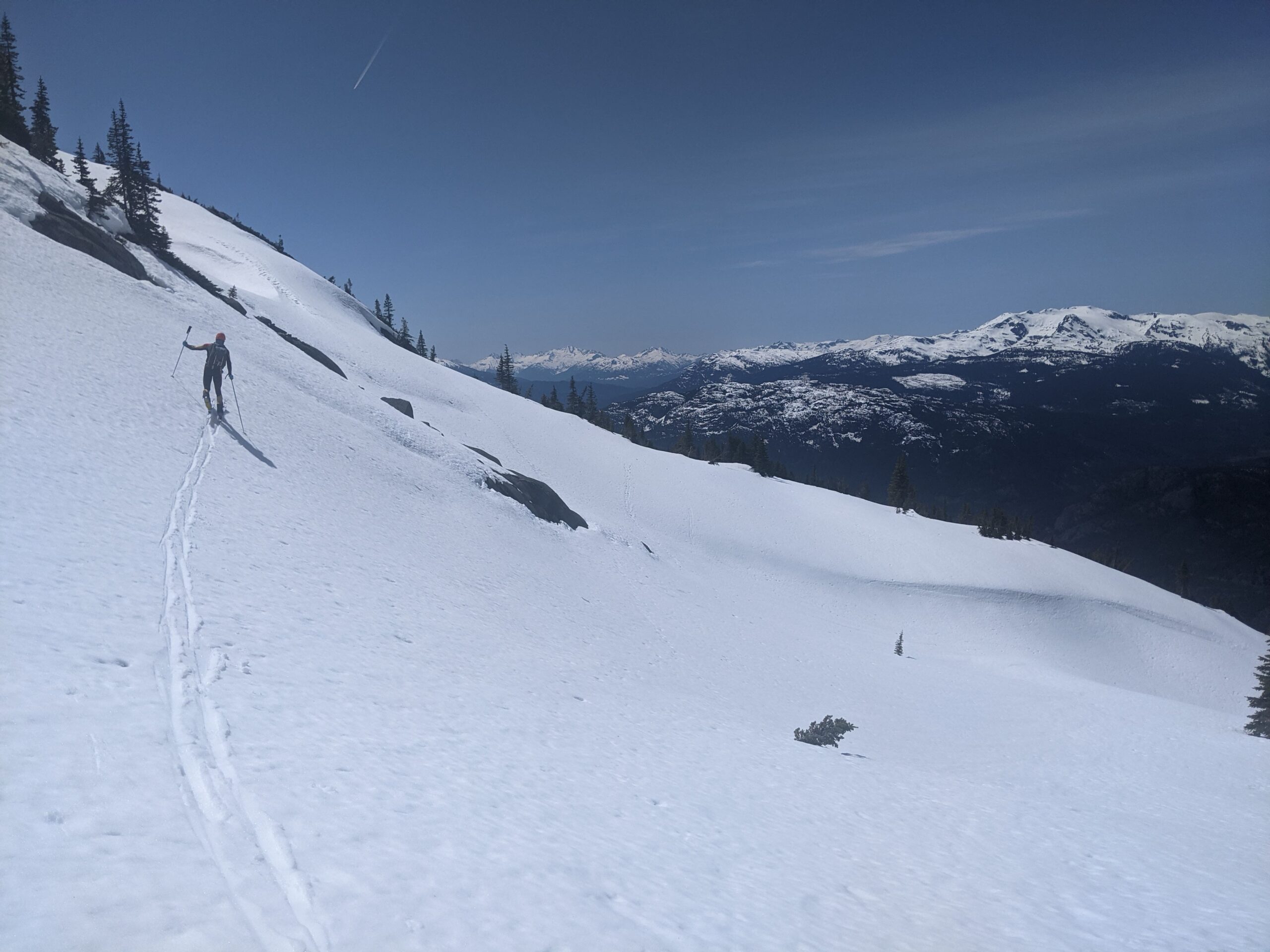
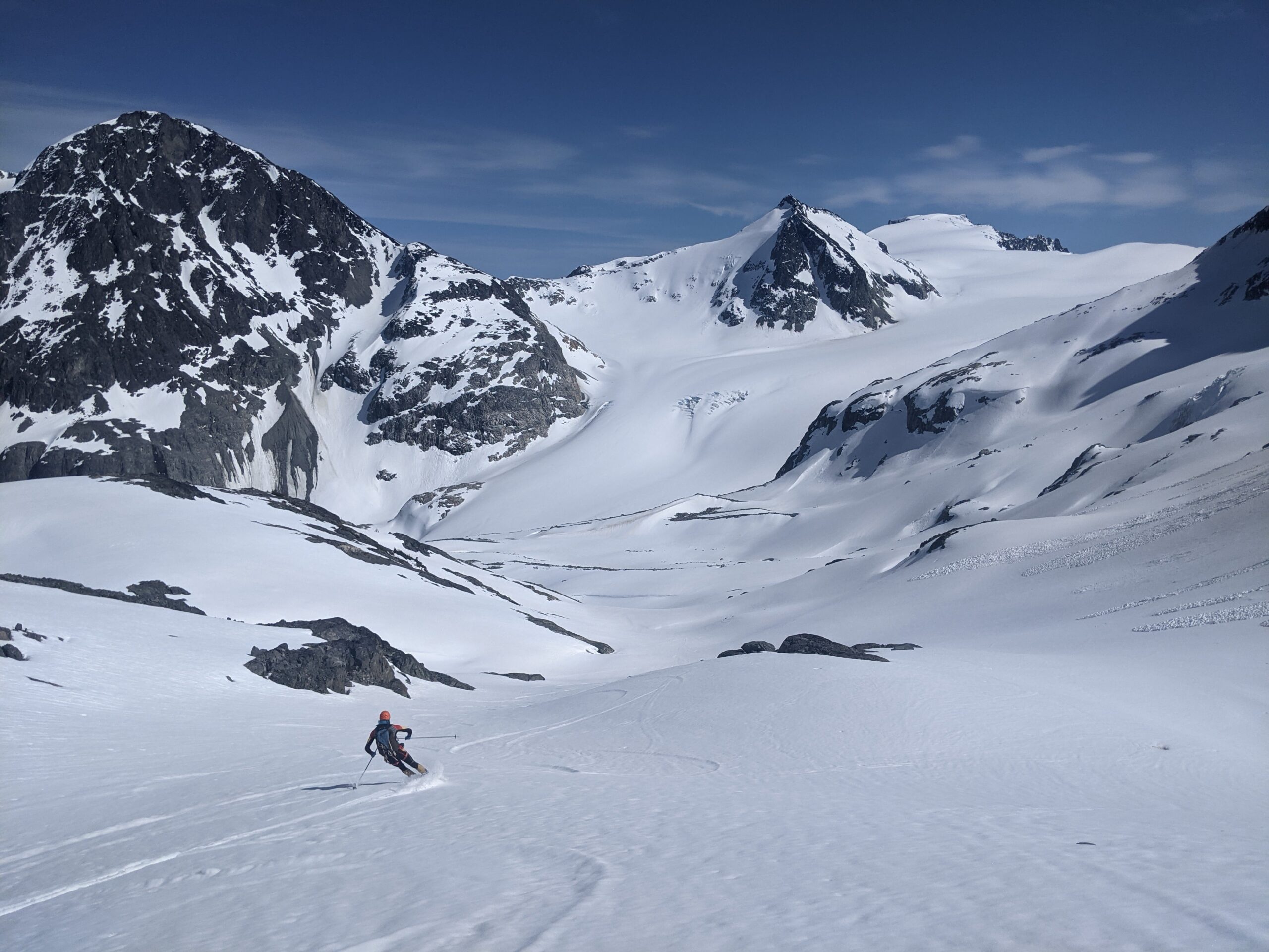
I was not expecting smooth sailing for the long south facing descent down to Billygoat lake. Immediately there was a talus slope on the south side of the col where we walked down a bit before getting skis on. It’s been a windy winter on the South Coast this year, so encountering scoured windward aspects were not surprising. The descent to Billygoat Lake at 1480m required careful forest navigation, especially this time of the year as the big melt begins. Billygoat creek was raging, and we tried our best to stay on the skier’s right side. But you can’t go too far right, as the steeper south slopes were melted out. As a fairly average downhill skier, my ski strategy for all the downhills was to link as few turns as possible to preserve the legs (there is over 8000m of descending on this net-descent traverse). Navigating in the trees with frequent checks on the Gaia app was also a good way to constantly give the legs a break for the legs, something I was used to after a winter of mini-golf skiing on the North Shore. I also had FATMAP on my phone, along with a battery pack. Personally, FATMAP was good for the pre-trip planning, but in the field, I prefer to just use maps over satellite image for on the fly navigation.
Stage 2: Billygoat Lake to Cheakamus River
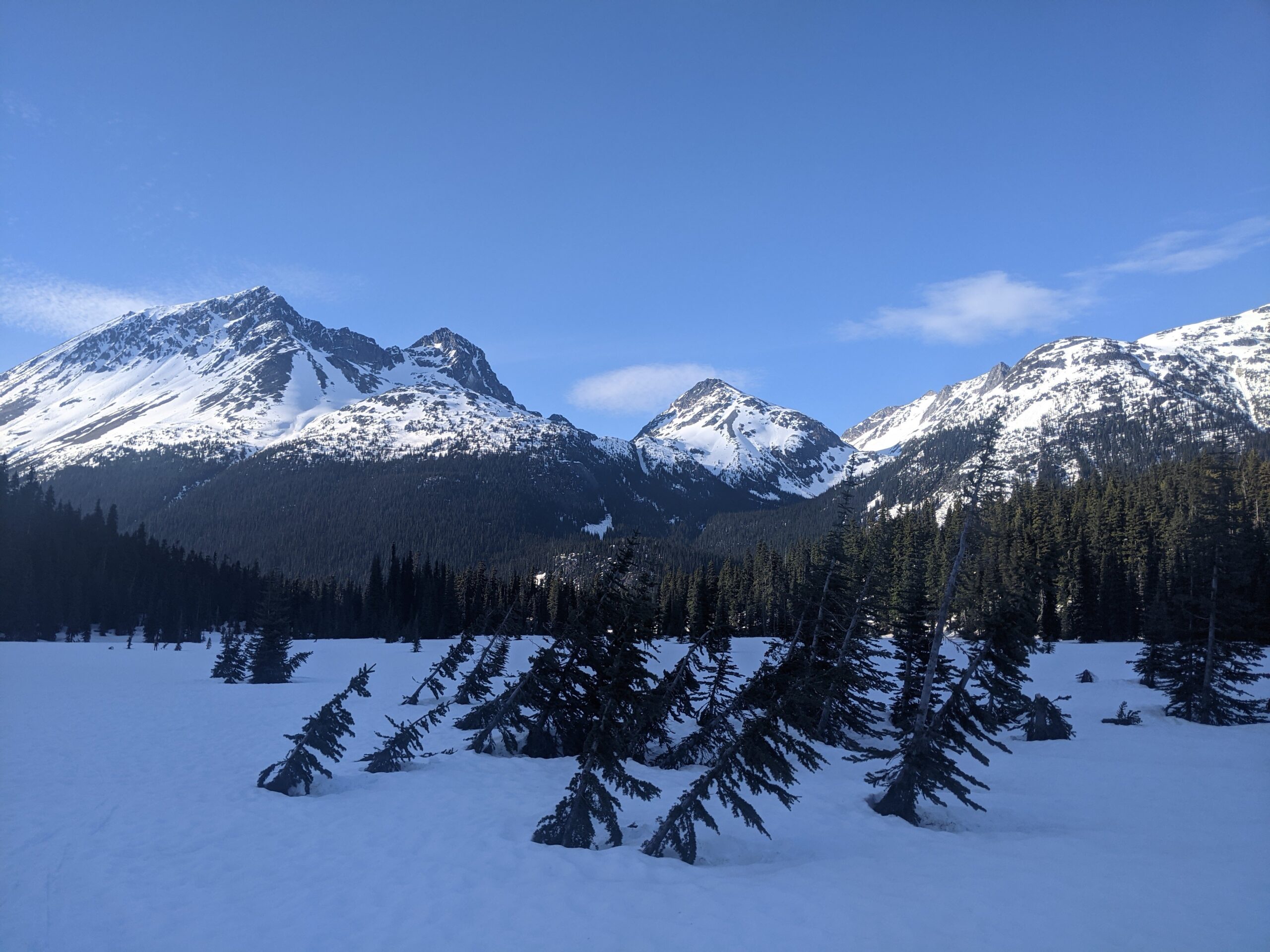
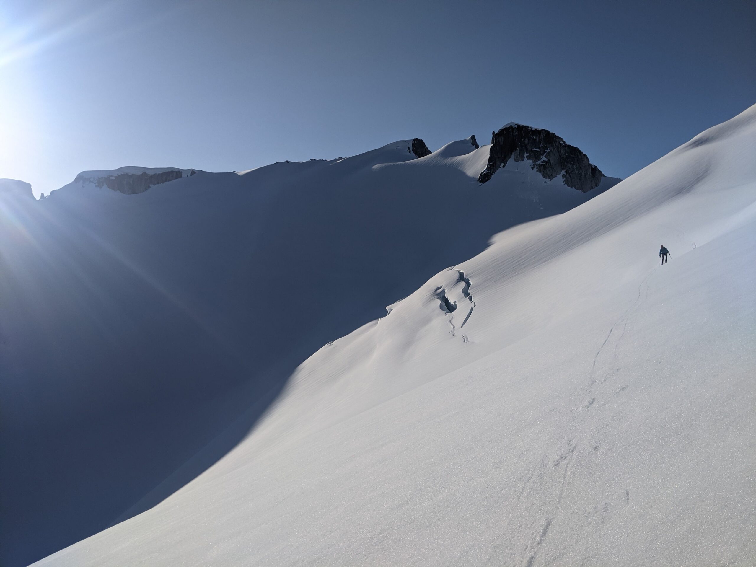
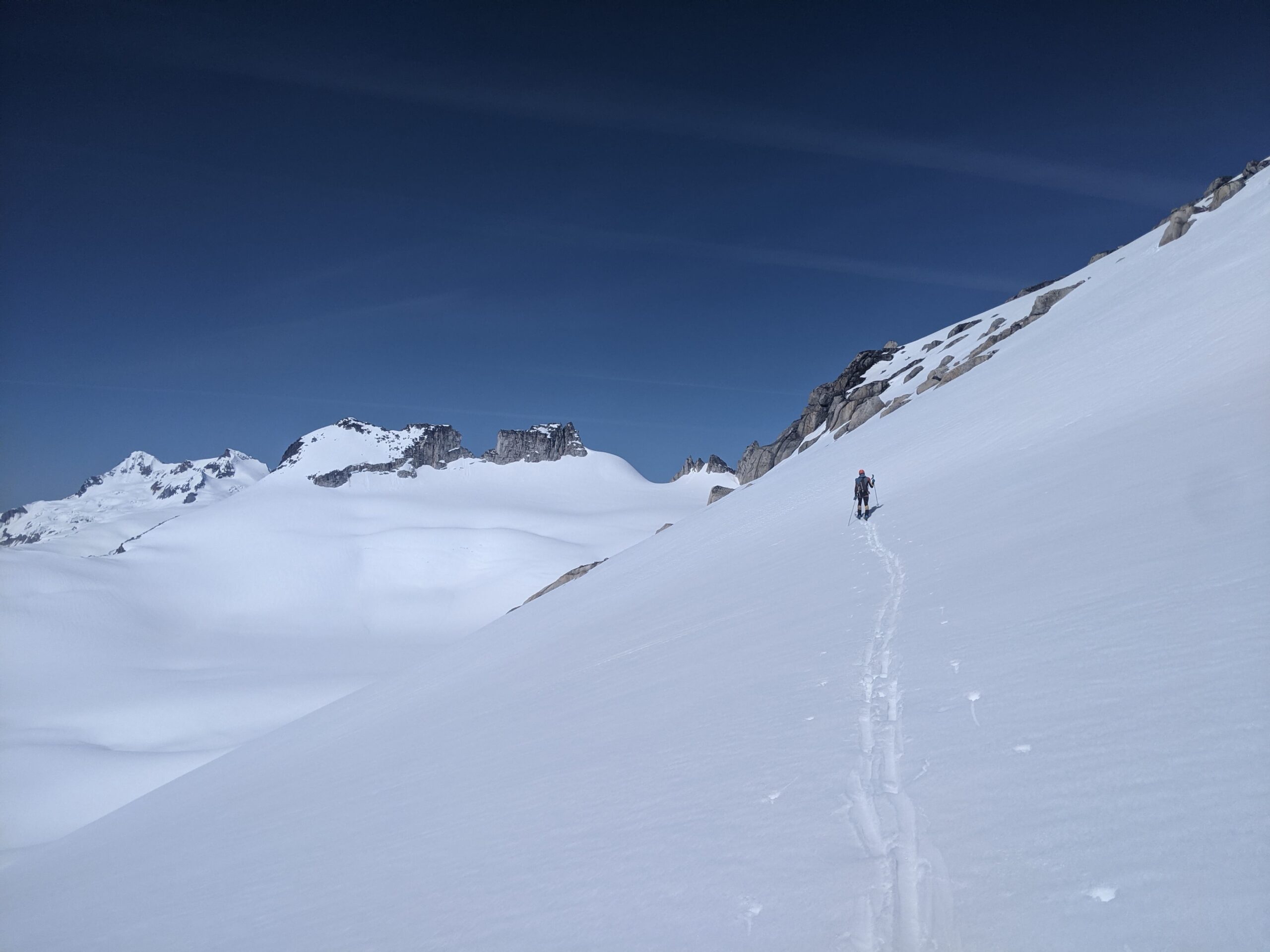
We filled up with water at a small tarn northeast of Billygoat Lake, and continued east contouring through the trees to reach the broad valley below the Shudder Glacier. Out of the sun, we could still feel the warm valley air in occasional updraft. We turned right, and worked our way up a narrow valley and then up the Shudder Glacier. Travel was reasonable despite having to break trail for most of the 1200m climb, as only a thin surface crust was forming, topping out just after sunset.
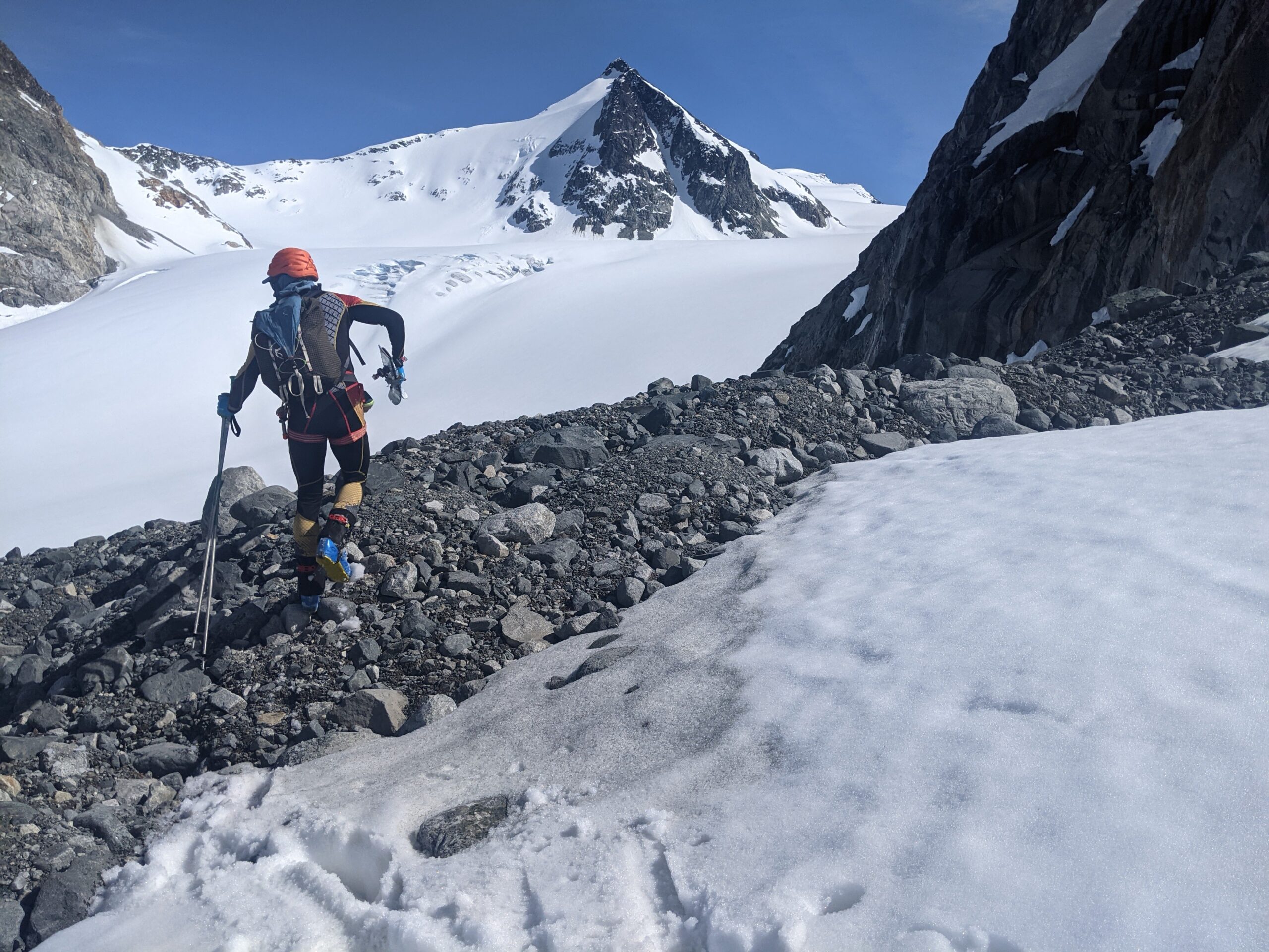
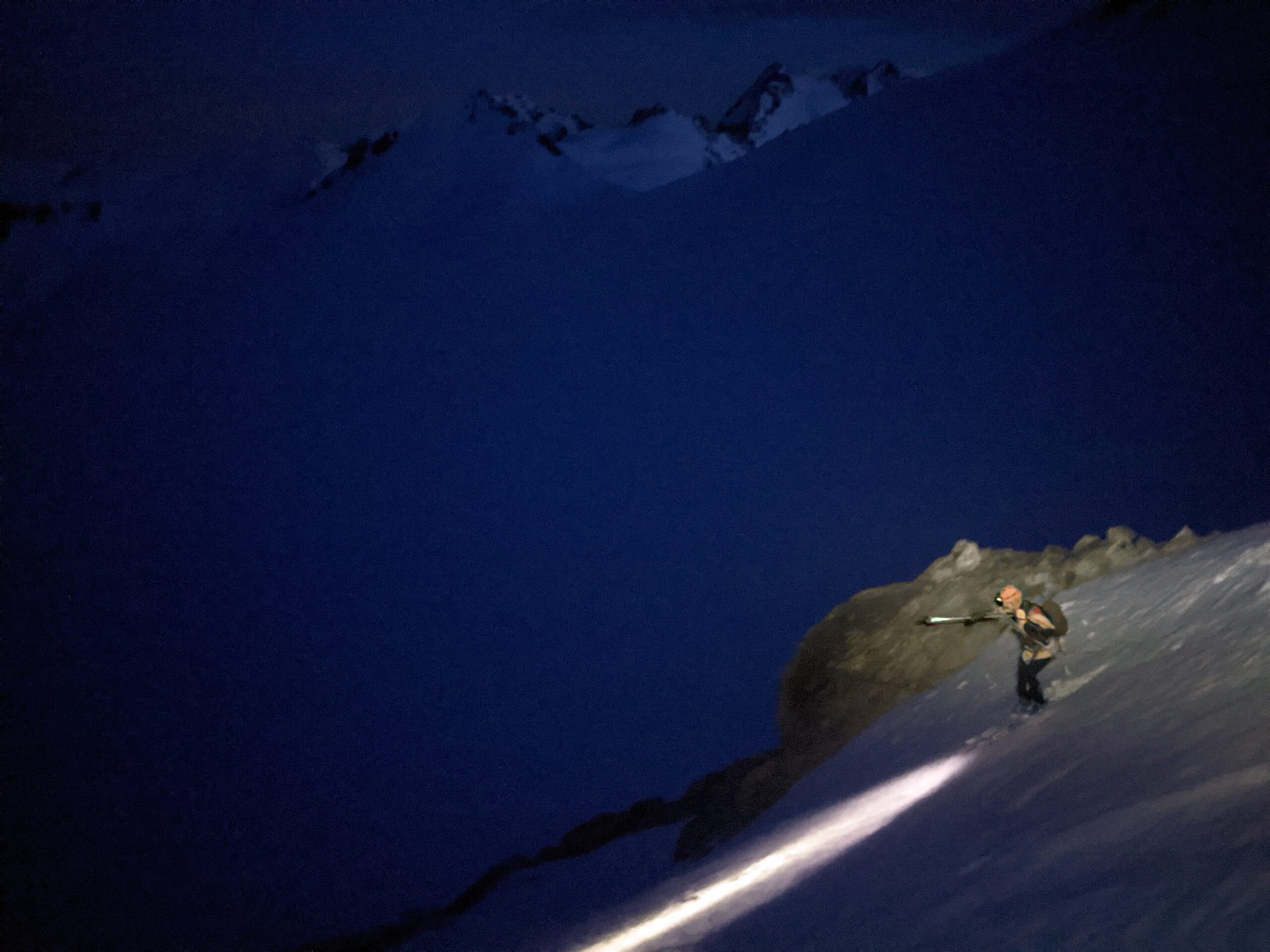
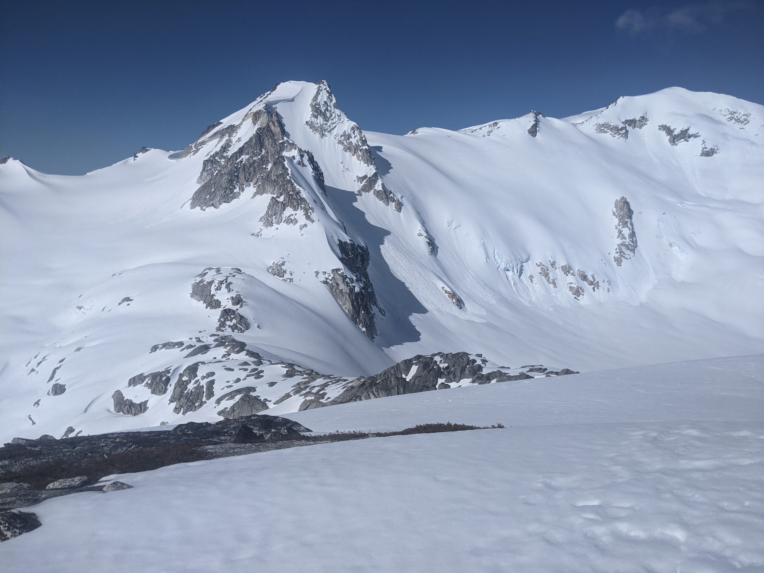
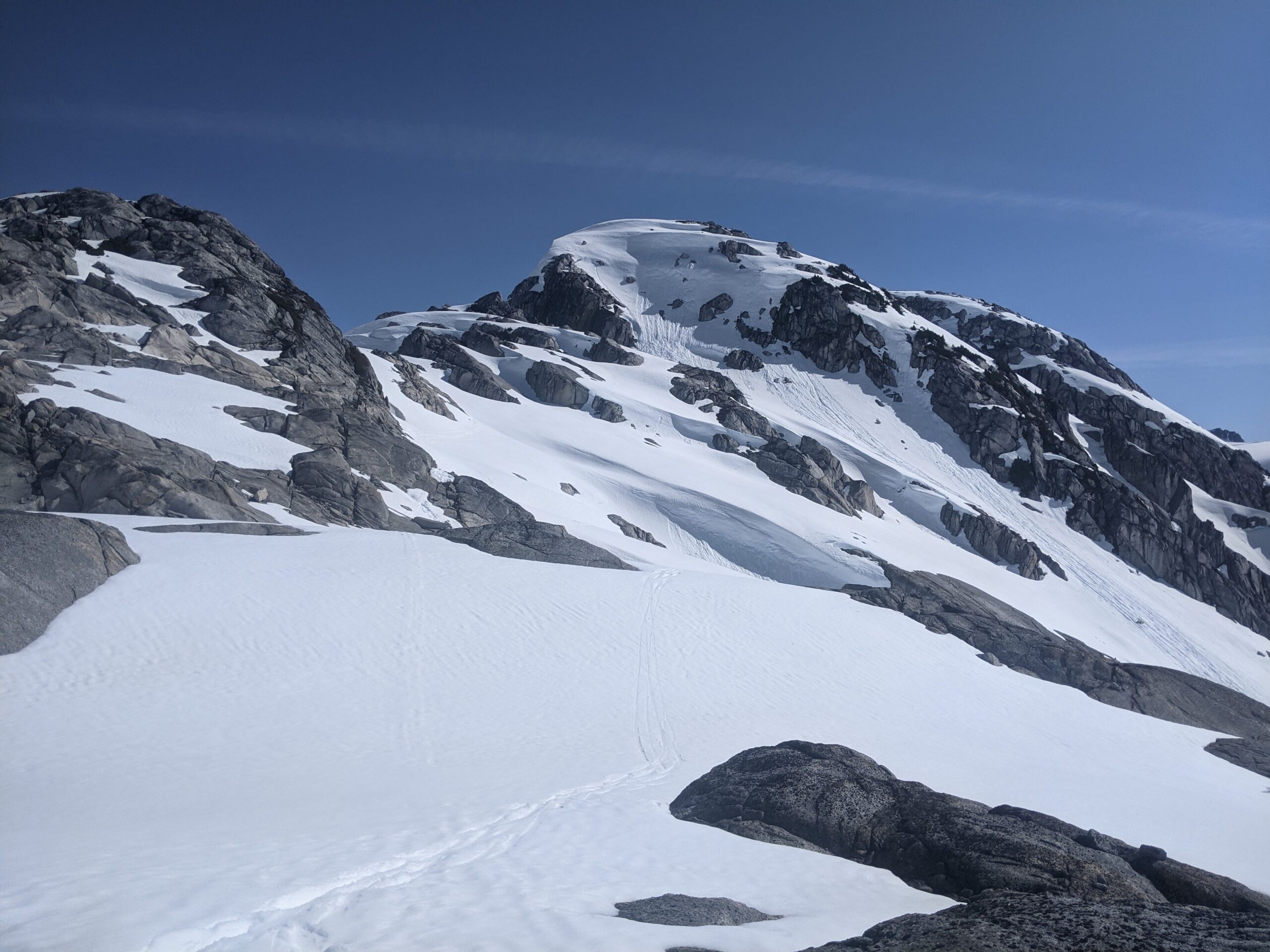
With Whistler/Blackcomb closed, I wasn’t surprised there were no other parties/tracks out on the Spearhead range. Once again, the south side of Shudder Mountain was rocky. The snow below on the Platform Glacier was turning into breakable crust and I regretted not ripping my skins for the short descending traverse. We climbed up to the Platform-Ripsaw col, ripped skins, turned on the headlamps (we both used Zebralights, and brought a spare battery), and traversed across the Ripsaw glacier, mindful of the crevasses paralleling the Ripsaw-Naden col. A quick bootpack to the col, up a bit more, and then down a short steep pitch to get down to the Naden Glacier. From this point on, it was all new terrain to me down the Naden Glacier.
Nick led the way down, headlamps on and dodging small crevasses in the dark. We stayed far skiers right to avoid as much of the glacier as possible, opting to traverse over endless semi-frozen avalanche debris on so. The snow was just freezing over, with a 5cm semi-breakable crust over mush. I was very happy with my choice of 90mm underfoot skis, and managed to descend the entire run by sideslipping or doing kickturns, without needing to put much effort into skiing. Nick on the other hand, was having a much harder time on his skinny skis, which would punch through the crust, but of course he was still at the bottom first.
We put skins for a short 50m climb to cross a broad treed shoulder at 1600m which divides Diavolo and Cheakamus Creek, and then descended northeast into the Cheakamus River valley. The snow was a mix of pine needles, suncups, but soft and not sticky, fairly pleasant tree skiing. Throughout the trip, I kept telling Nick how this was so much better still than some of the worst skiing I did on the North Shore this year. There was one day, up on Hollyburn this winter, when the snowpack was capped solid with a freezing rain layer. While bootpacking up (I was only able to skin some sections and forgot the ski crampons), I couldn’t decide if going up or down was a better idea. I ended up sideslipping all the way down the west side down to the groomers. That was one of two days I wished I stayed in bed instead of skiing this season.
Stage 3: Cheakamus River to Phoenix Glacier
Even by night, the upper Cheakamus River valley was beautiful. We travelled along the north bank, hoping for a snow bridge crossing that would take us across to the more open south side where we needed to be. I was enjoying the tree-bs skinning as we worked our way in the dark around steep trees, pulling ourselves up with branches in crappy skin tracks, but also relived when after about 1.5 km of this, we found a solid snow bridge crossing. Right after we crossed, up on the high side, we heard a whoompf and the snow bridge had settled under our weight, but there was no flowing water and it was still intact at least on the surface. It was midnight now, and we continued along the open valley, being careful not to contour too high – travel is fastest in the flats close to the creek.
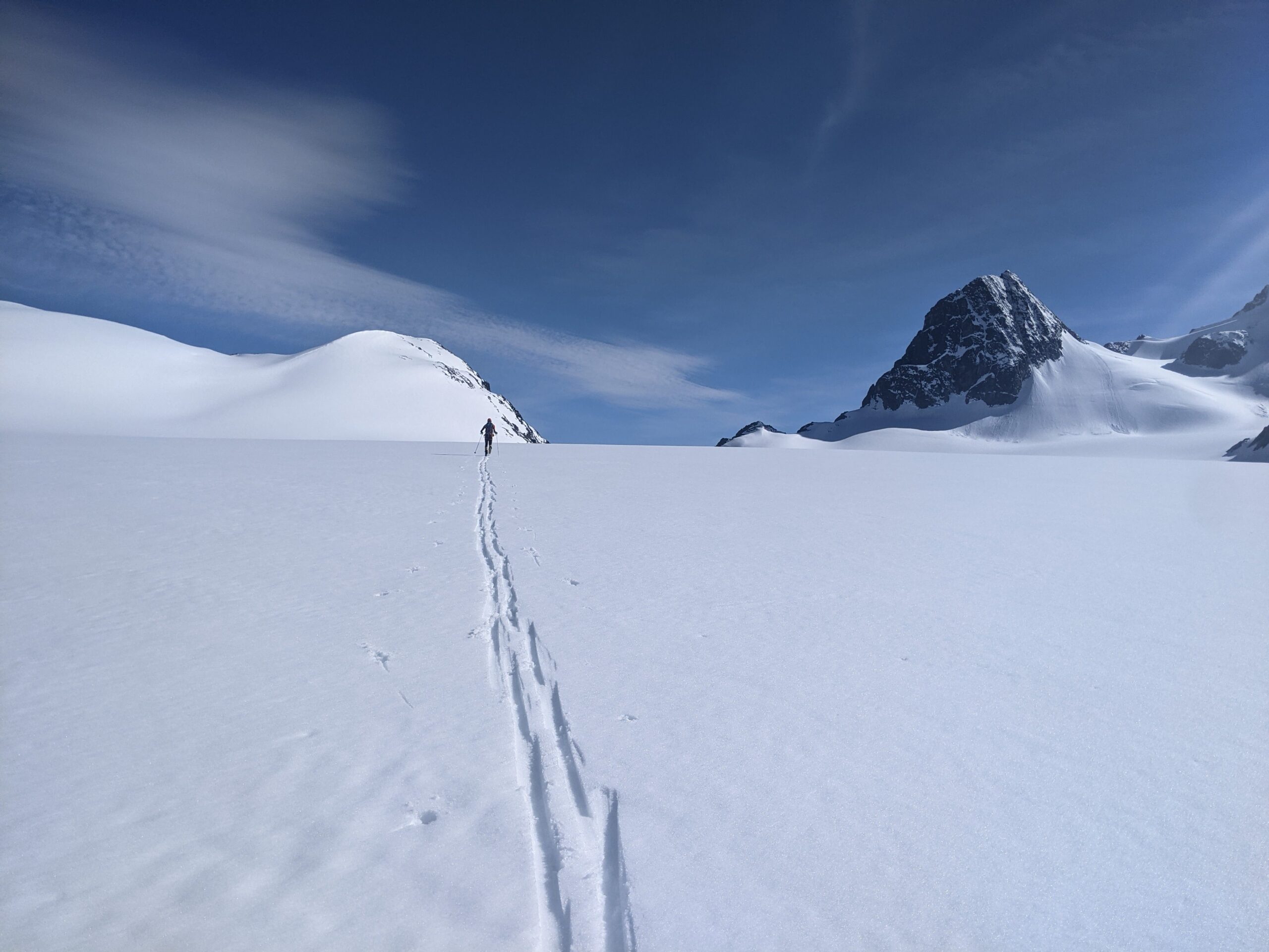
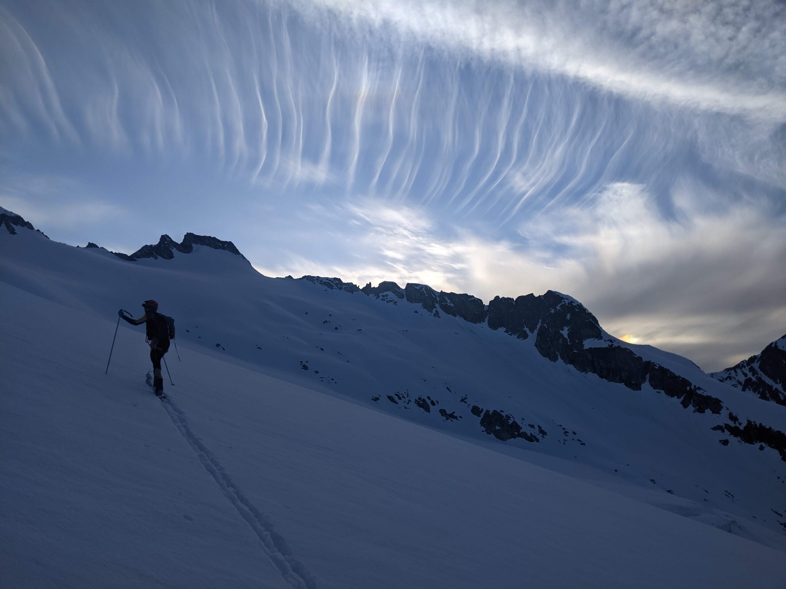
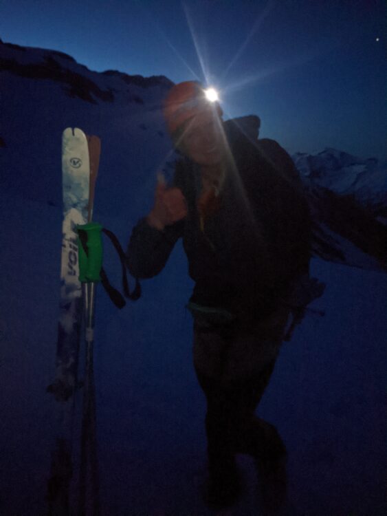
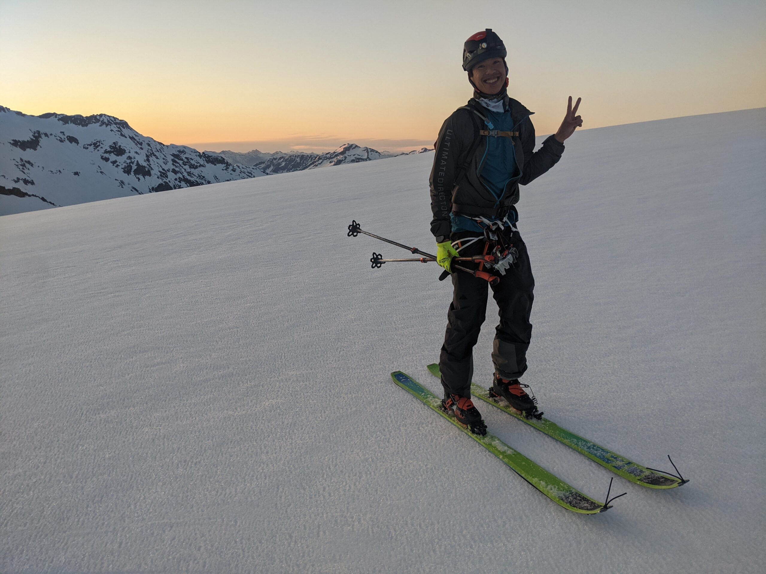
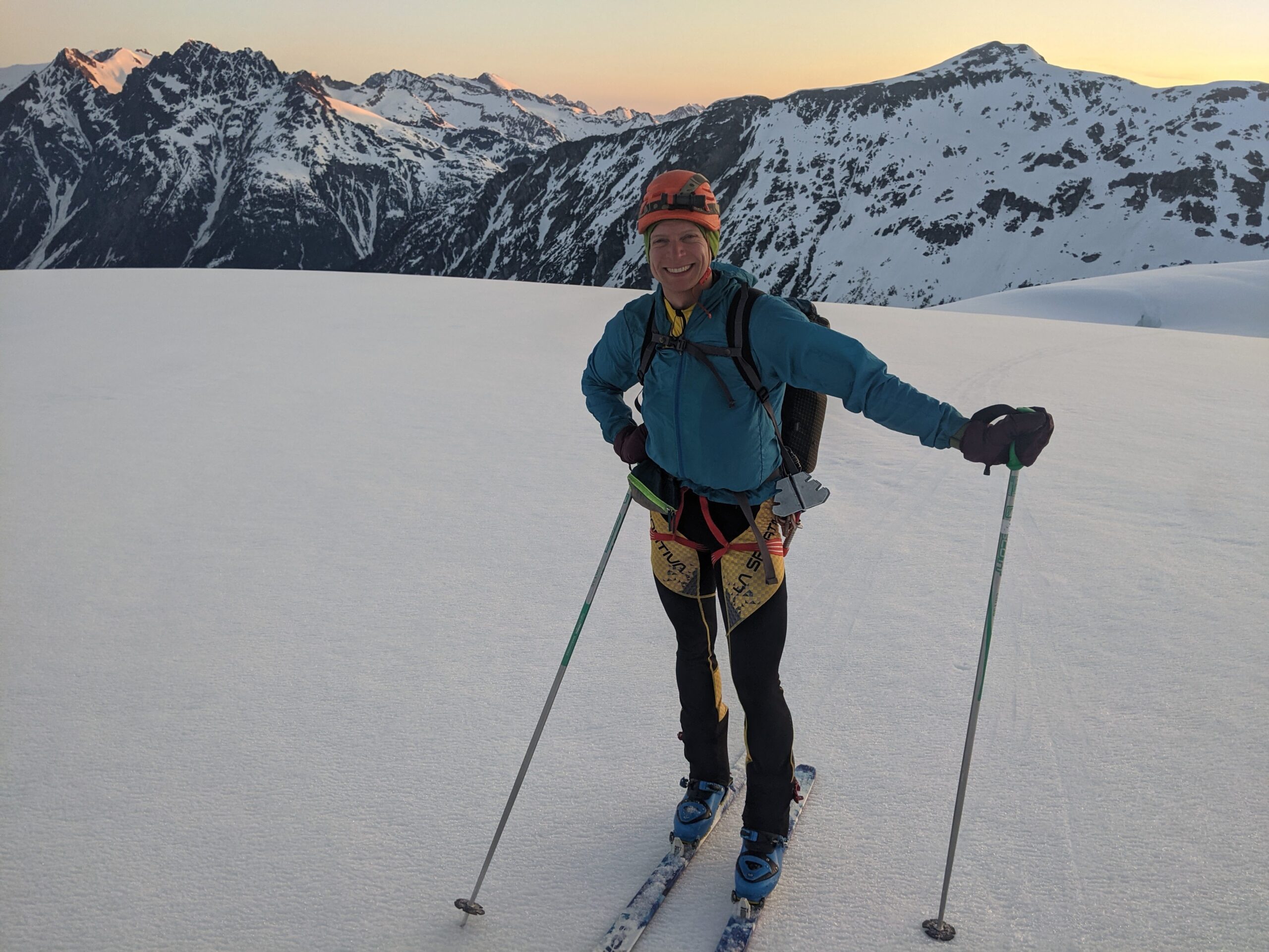
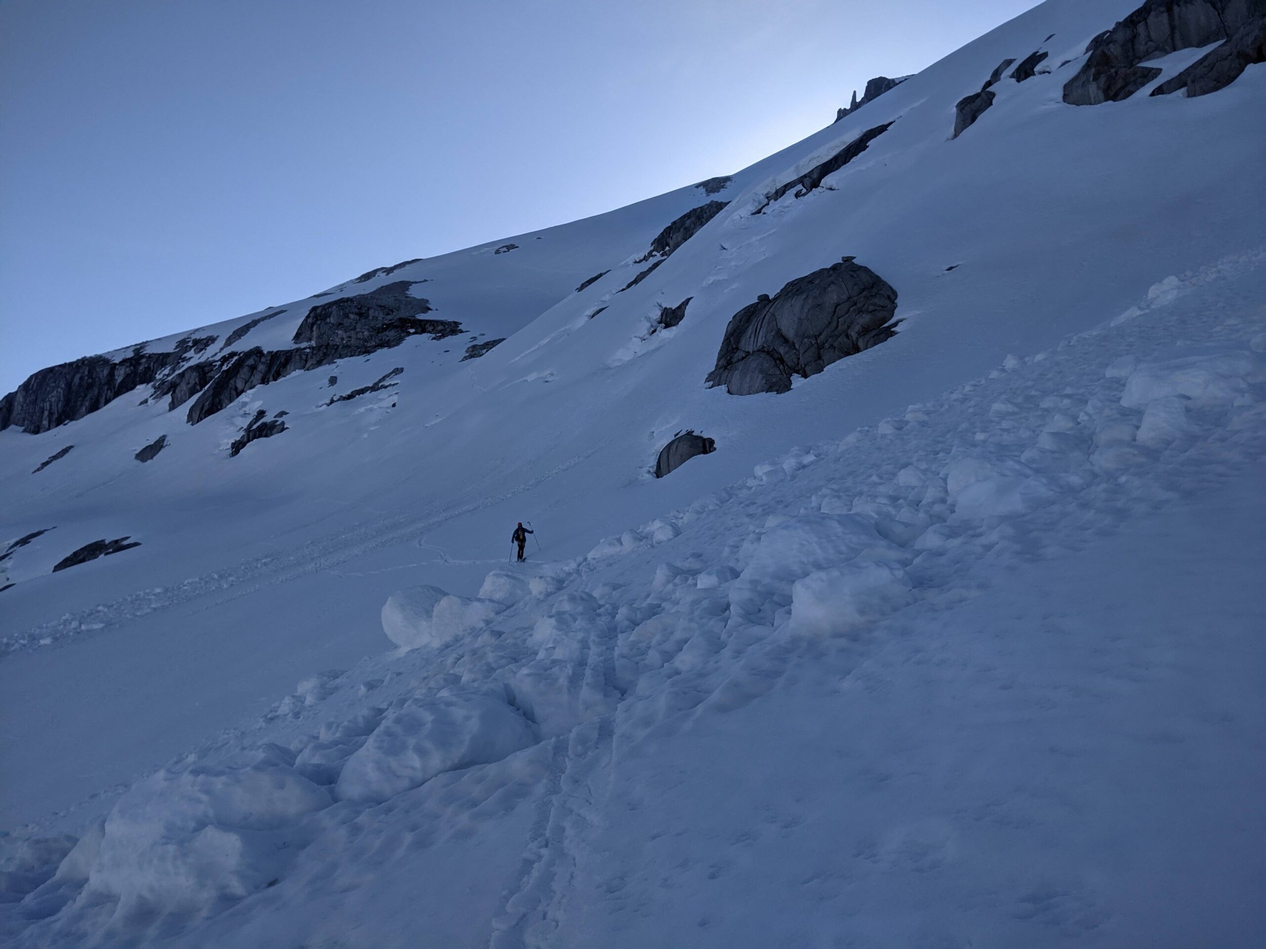
It took us another 3 hours to continue up the rest of the valley, including the 1000m climb up the McBride Glacier to the 2500 m col northeast of Mount Sir Richard. Travel was fairly straightforward, with a decent freeze from radiative cooling despite the 3500m forecasted freezing levels and we used ski crampons for the upper 3rd of the glacier. The stars were brilliant under the moonless sky. We spotted a low-orbit line of bright dots, resembling a caterpillar. It turns out it was from the Starlink satellite launch earlier that evening. This was all a new experience for Nick to push through the night. I’ve done a few all nighters before – running, hiking, sailing and night shifts for work, so I know what no sleep feels like.
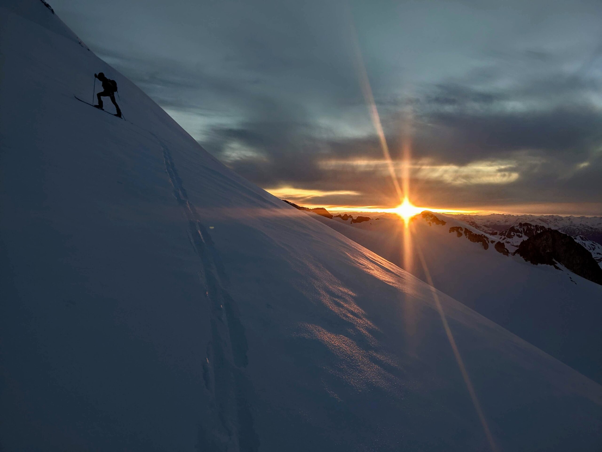
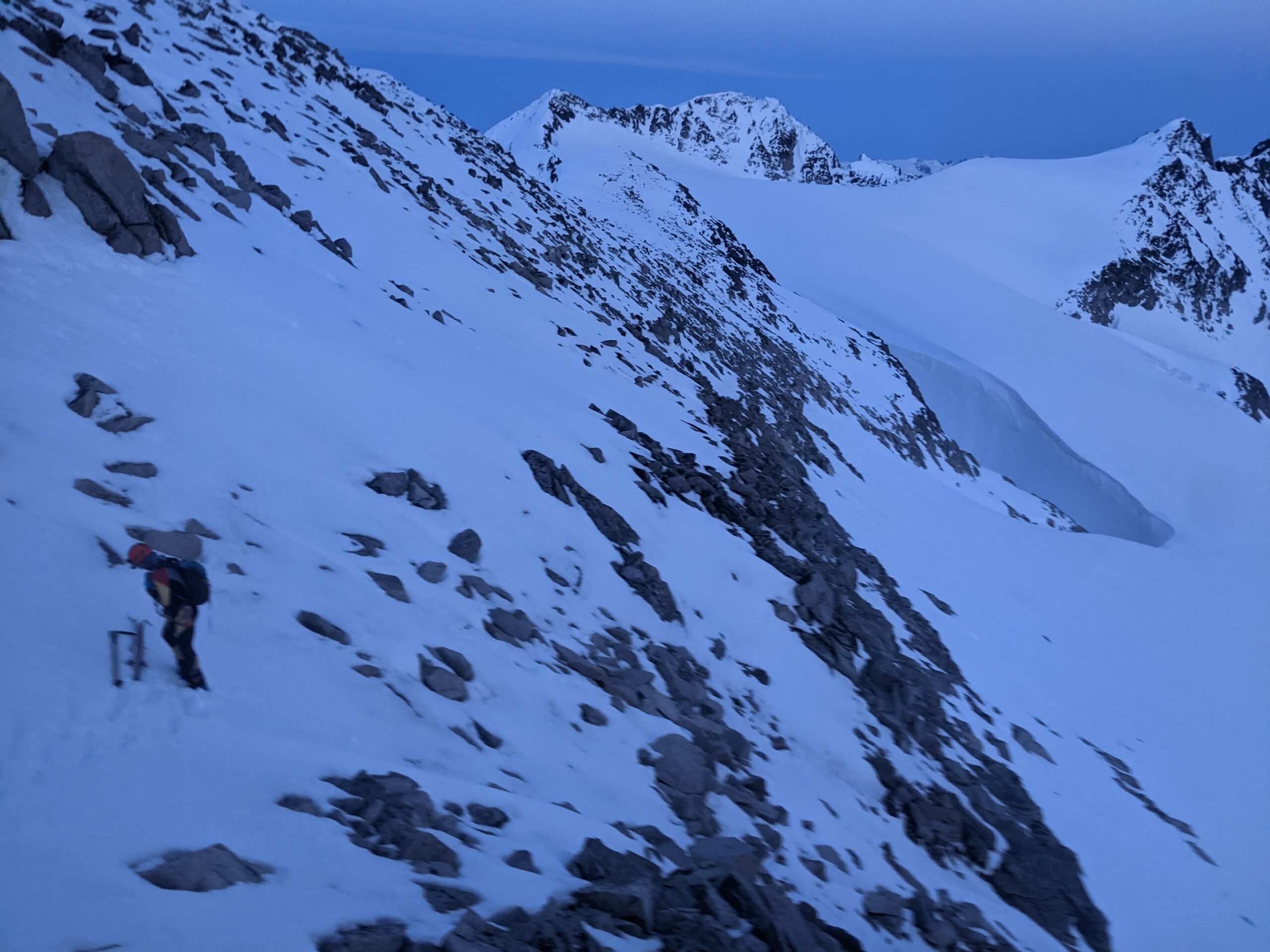
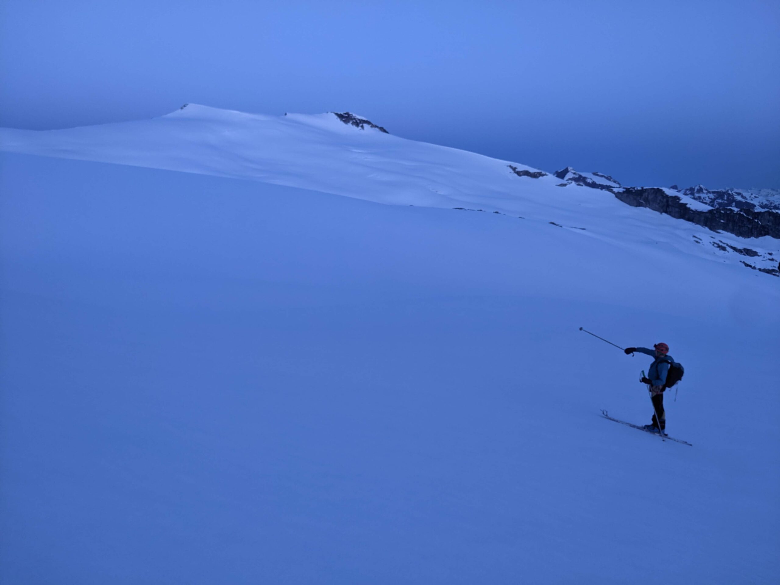
My skins had a ton of snow built up underneath the tips, which had now frozen. Right before the Sir Richard col, I warned Nick I would need to stop and properly scrap off all the ice built up. We each took one of my ski crampons and used the flat edge to scrape off the ridiculous amount of ice that had built up. It wasn’t the warmest spot, with a light westerly blowing, but the task needed to be done. We started the contour around the west side of Mount Sir Richard initially with skins on, ski crampons on, just to see what the snow surface and terrain was feeling like. I wasn’t sure what the exposure was like here above the Ubyssey Glacier, and maybe it was a good thing it was dark. We ripped skins, and I carefully led the way down and across towards the Gatekeeper. I didn’t actually know where that was, and Nick’s memory a previous McBride traverse from ten years ago was very fuzzy. I led the way to the 2560 m col, descending along the ridge to the col at 2250 m. We changed batteries here, it was almost getting light out, but with the crux of getting around the Gatekeeper, I wanted to see as much as I could with my brightest 1600 lumens setting. We carefully worked skied down trending southwest. The surface was icy, but mellow enough to do some very cautious turns. Falling or losing a ski would be bad on many of the steep exposed traverses along the McBride. The steepest part is near the bottom as you contour around to the low point at 1920m. Most of the snow had slid, and we crossed a bunch of frozen avy debris and runnels. A very short 50m bootpack is required to regain the ridge. There is still a small bump to traverse either over, or around on the right (exposed). We went up and over, and then down to Wolverine Pass, arriving at 4:40am, 1890m.
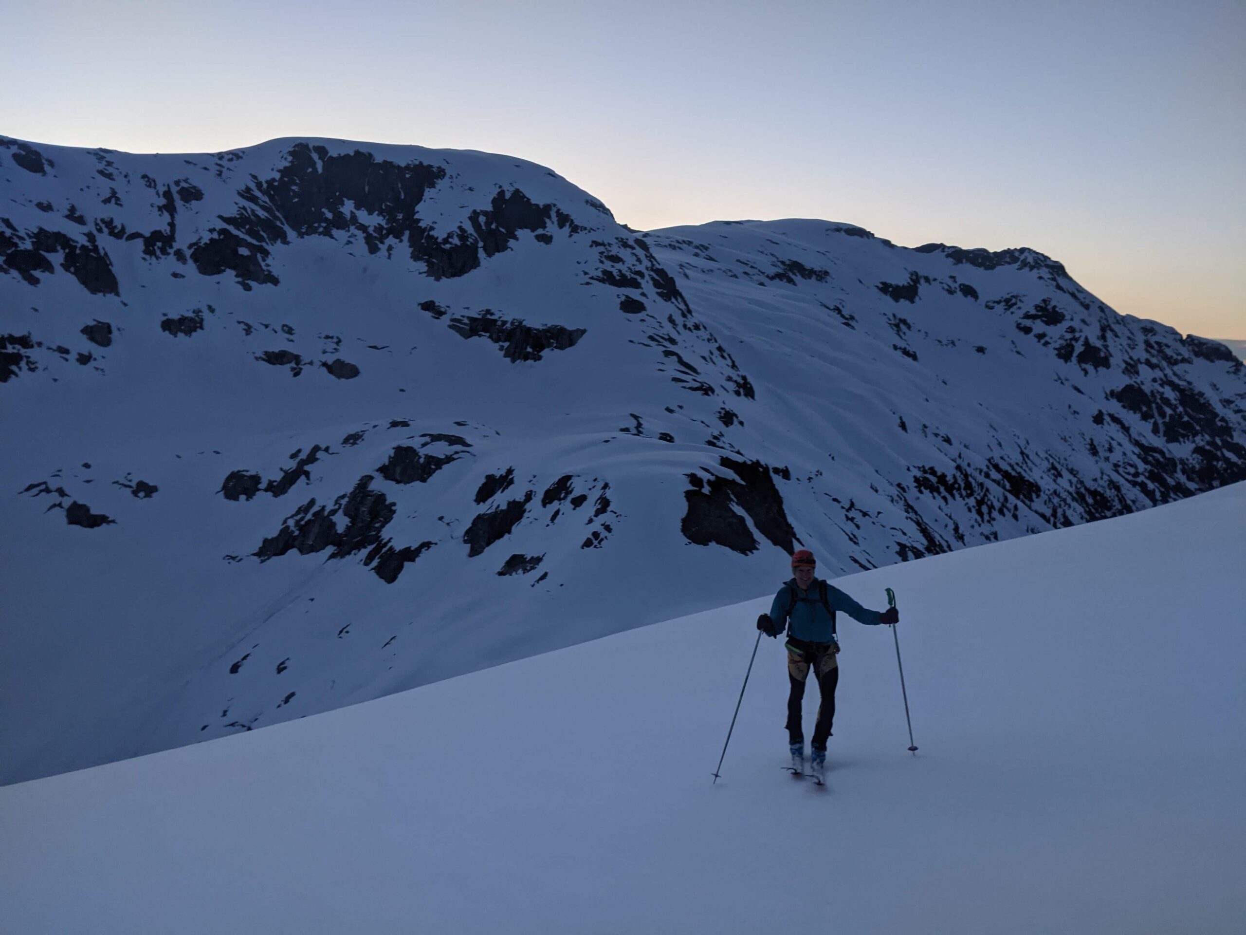
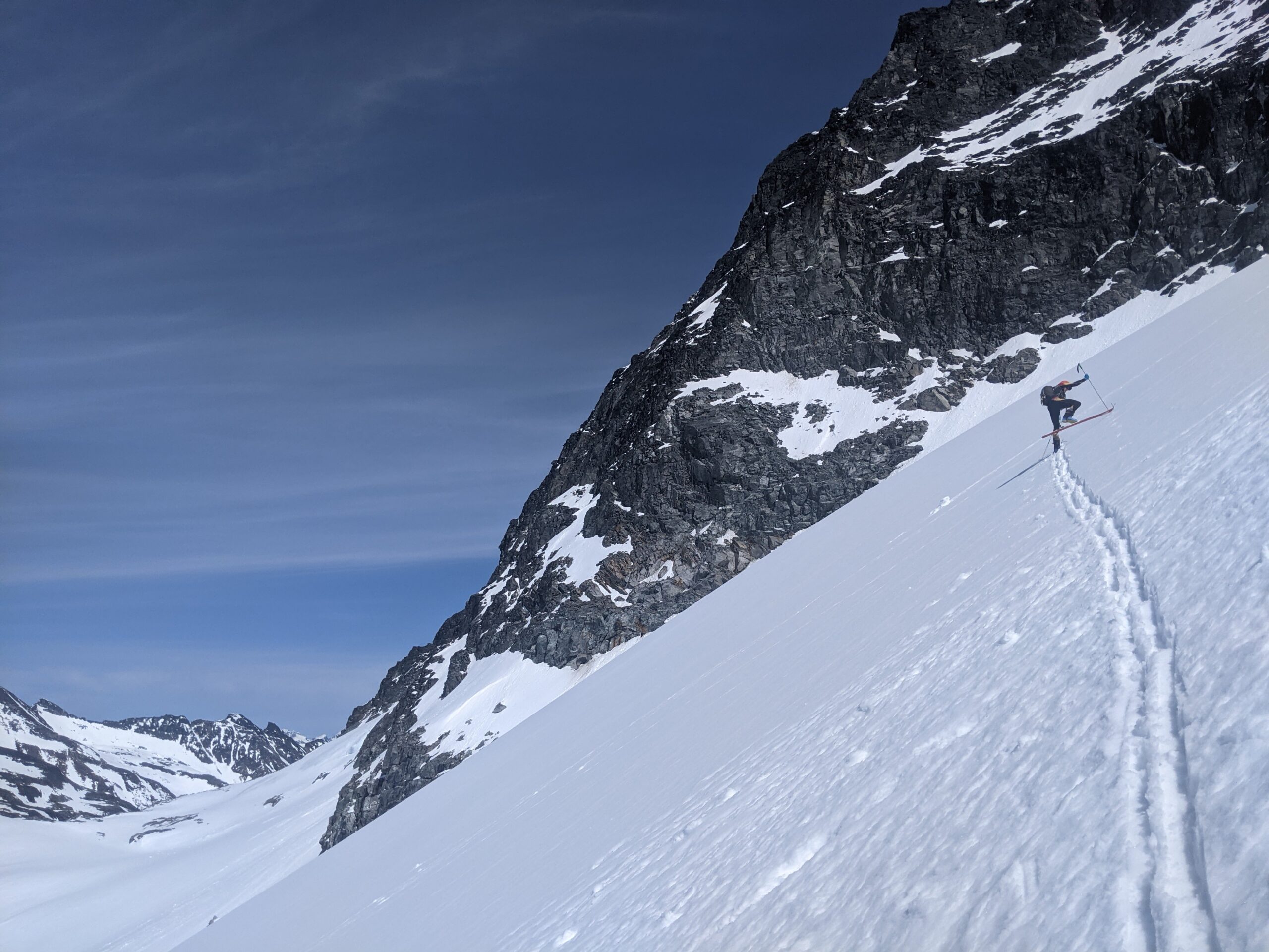
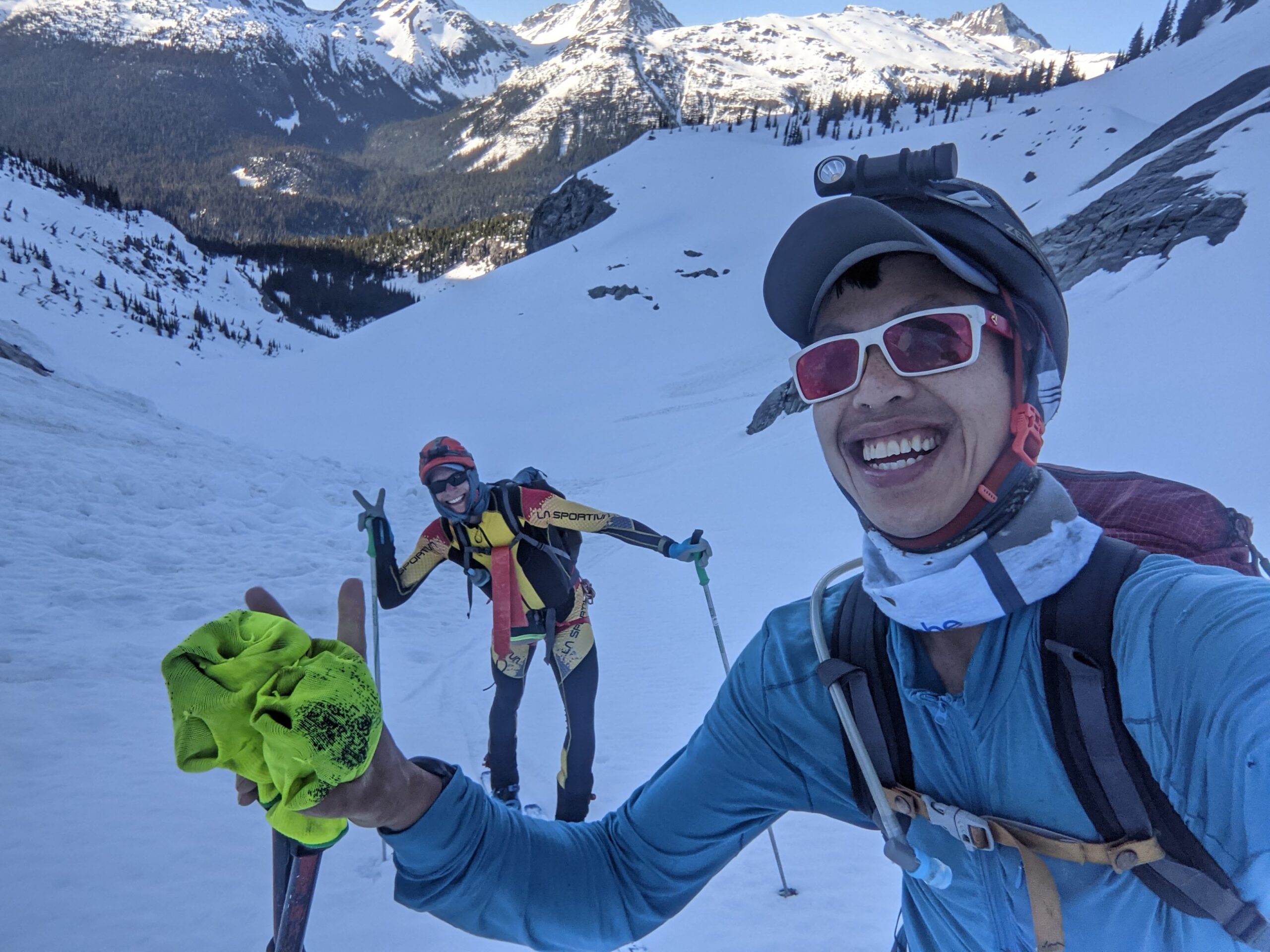
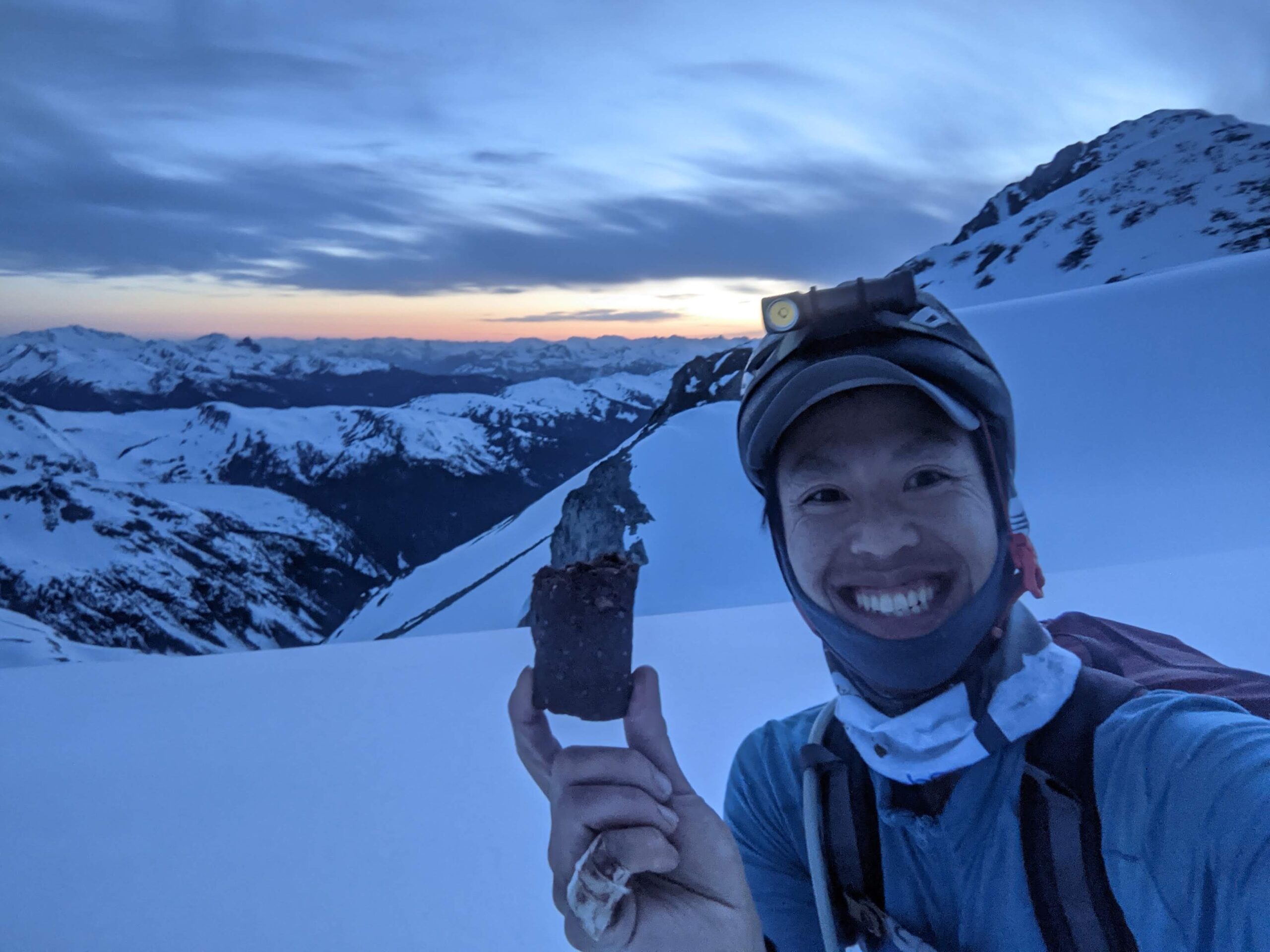
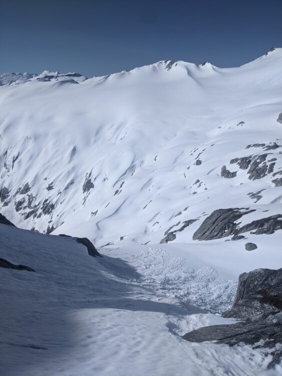
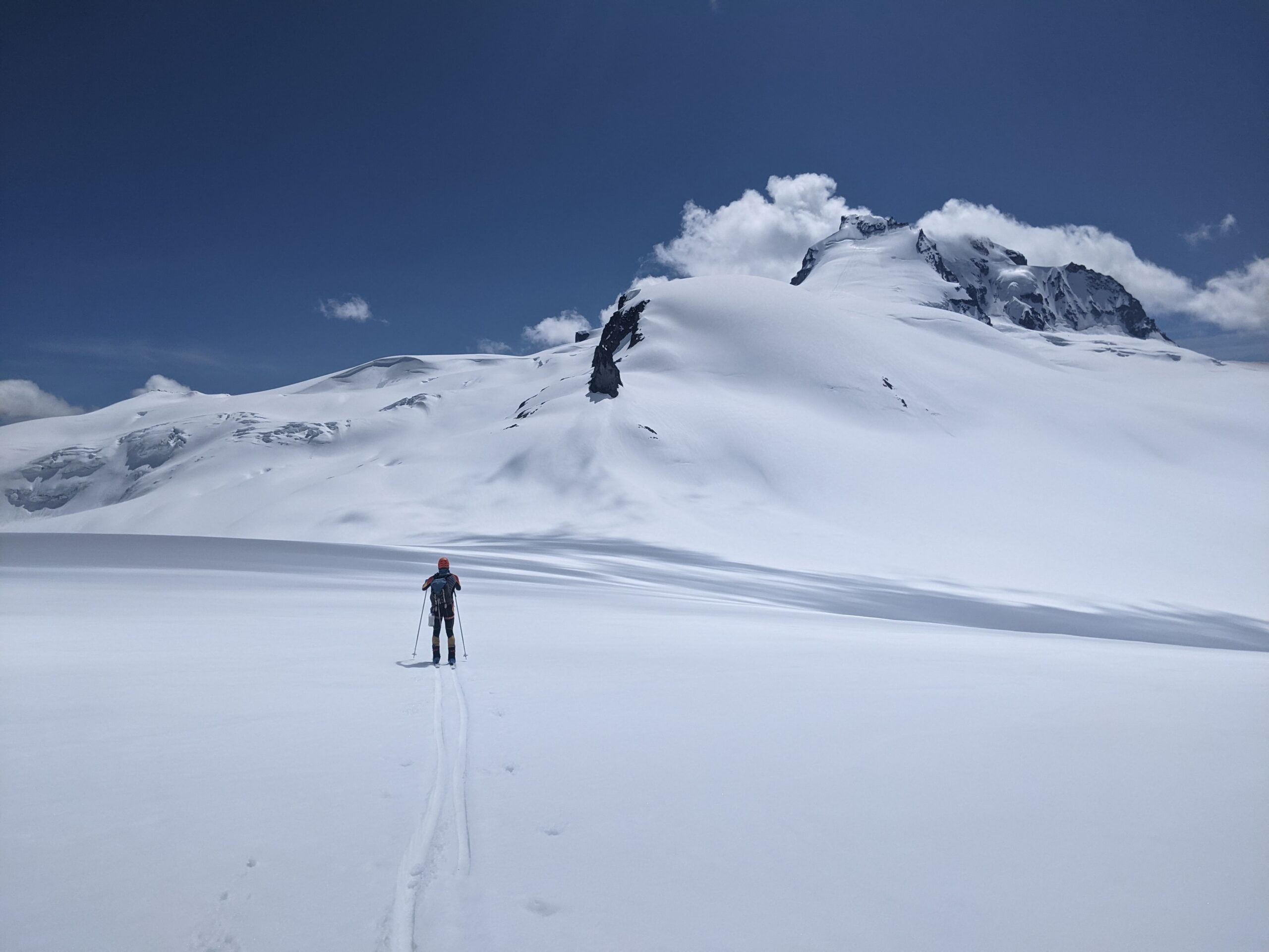
By this point we had hit 5000m of climbing, and I was entering uncharted territory for how my legs would feel on skis beyond, at least for a single non-stop push. Ski crampons were required for an icy sidehill climb out of Wolverine Pass, traversing west on a north facing slope. It was at this point when I realized my Atomic Backland boots were not the best for firm sidehills, as there was a pressure point on my inside leg. I worried about this for later on, but luckily it didn’t get worse. We traversed around the Forger Glacier, and it was at this point, on the climb to the 2320 m col southeast of Forger Peak that I hit my first low. I was going up an icy-ish slope, and just felt my quads shutting down and feeling sluggish for the climb for the first time. Nick was fine and blasted off ahead, while I sorted myself out. I was able to force some food down, checked my phone for the most efficient line to the col, and found myself over the col a little over from Nick, and then he rejoined me. We skied down to the 2100 m col, and I was feeling back like my normal self again. From here, we were looking at an exposed traverse around the north side of Fake Peak, which would take us into Drop Pass. With a bit of sidestepping, I led the way, threading a line between two sets of crevasses, with a particularly open and exposing one below us. Definitely happy to have sharp edges for this point, but it was unnerving as I skied into softer snow occasionally. The steeper west facing slopes down to Drop Pass were manageable, but with the recent warm weather, small moats were opening up near the cliff faces, and careful controlled skiing was required to make our way down to Drop Pass.
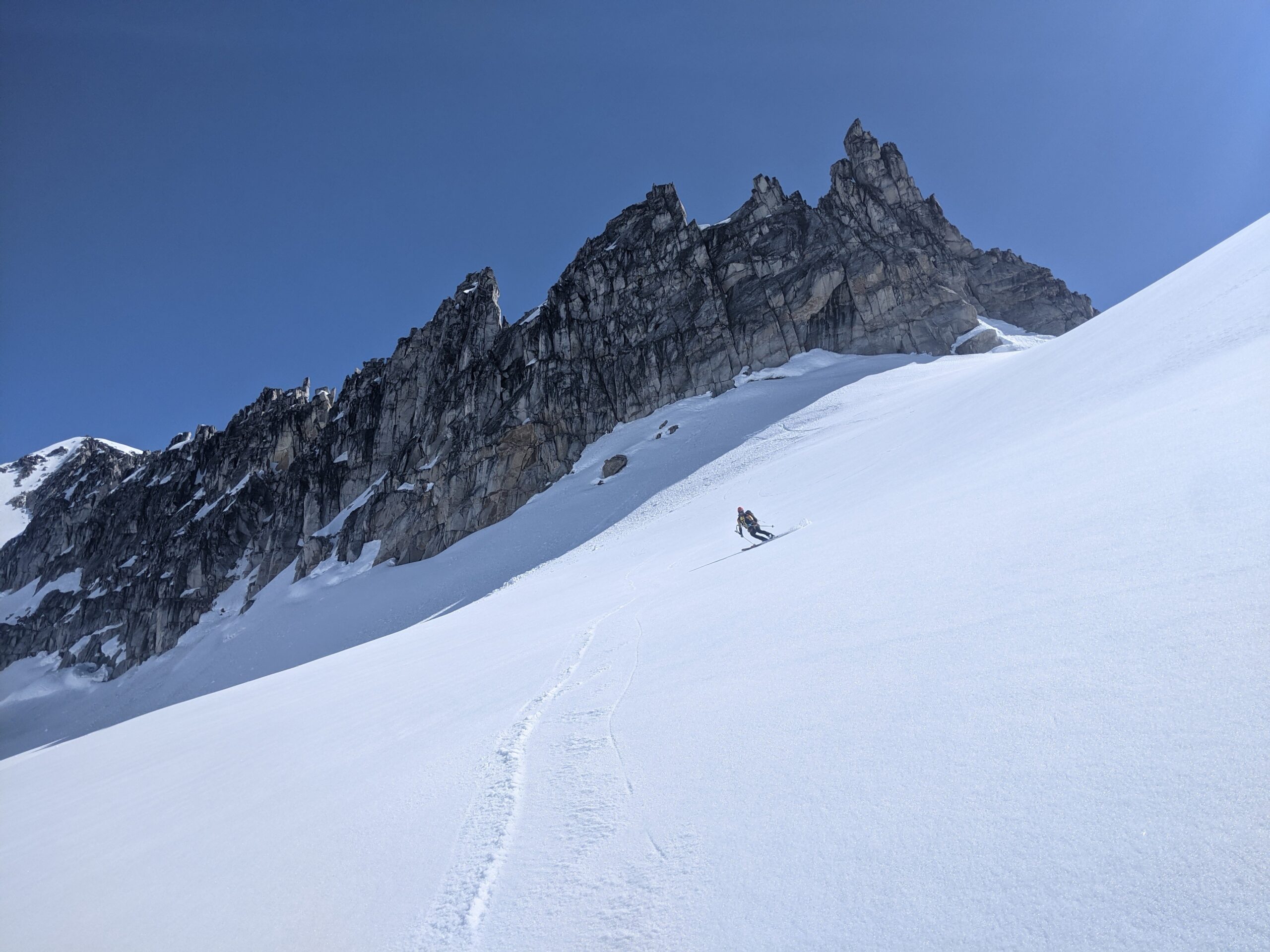
From Drop Pass, the final crux is getting over Sinister Ridge. This is notorious for having poor weather, luckily we had bluebird weather, but it was already getting warm, even at 7:45am. We were able to climb up and climb in a gradual south-southwest direction to gain the ridge. At this point we noticed plenty of down ski tracks, which were from John Baldwin’s party who had done the same traverse, in opposite direction a week earlier over ten days (eight travel). We hardly saw tracks throughout, most of them were melted out, and there was never a southbound skintrack. Just when we thought we had tracks to help with the navigation, they would disappear. There are two options to go over Sinister Ridge. The fastest way is to contour around the northwest side of the high point of Sinister Ridge, described as the “traverse of terror” by some parties, as you are on an exposed slope, traversing underneath a cornice. Nick had already blasted off to the high point of the ridge, so I followed him up to the top rather than investigating that first option. The second option, from the high point, is to descending along the ridge, generally staying skiers right. There are cliffs on the skier’s left side. I was following Nick, who went down too far, and then had to climb back up to where I was. We traversed hard right to find ourselves on top of a steep slope, cliffs on the right side, and probably 40-45deg below us. With some very careful side slipping, and a bit of side stepping, I made my way down this exposed pitch. The snow wasn’t great, just enough grip to shave off snow crystals, with avalanche debris below to work through. I was pretty relieved when I got through this crux, the rest of the day would likely be just slogging in the heat. This slope can be much worse depending on the winds and snowpack.
We contoured around the east side of Hour Peak, now well into the morning snow. The snow was already wet, without a surface crust, and Nick and I took turns trail breaking. The last time we were here, we had triggered a Size 3 avalanche on Hour Peak while attempting to ski it. Skinning through the slush, I was a bit nervous again as we contoured our way around the south facing slope toward Crosscut Ridge, fortunately nowhere near as steep and the snow on the south aspect actually had a thin crust with very little surface sluffing/pinwheeling.
On the other side of Crosscut Ridge, we had a decision point. The best way is to continue traversing north along west facing slopes to Gray Peak, and then descend southwest down a gentle glacier into the Pitt Creek headwaters and then contouring around the south side of Sphinx Peak. This was an oversight in the navigation planning. I had figured out almost the entire route, but had blanked out on this one, thinking it was a straightforward section, the last tricky part before getting to the familiar Garibaldi Neve. Nick didn’t have any input either. During the planning process, he had suggested skiing down complex terrain to a lake at 1700m as a potential water source. At home, I called Nick before the trip and said it wasn’t a good idea as the skiing could be tricky. However, out in the field, sleep deprived, and despite even saying we should just contour to Gray Pass, the 500m fall line descent seemed like a quicker option to get us out. The shortcut is always faster right? This turned into a bit of a convoluted descent as expected, the upper section was on firm edgeable snow, with convex rolls hiding the best way down. And lower down, the steep rock rolls had melted through, forcing us to ski a more exposed line to the left through fresh avalanche debris to a bench at 1700m with exposure from above. In hindsight, this was a poor decision on my part. This wasn’t much of a shortcut, as we now had to skin back north to the lake, and then climb to the 1780m shoulder north of the lake, just to ski back down to the mellow glacier. We descended a gully at the toe of the glacier, rather than taking a high traverse, we skied down further to reduce our solar exposure. I recommend sticking to the first option of contouring around to Gray Pass.
Stage 4: Phoenix Glacier to Red Heather
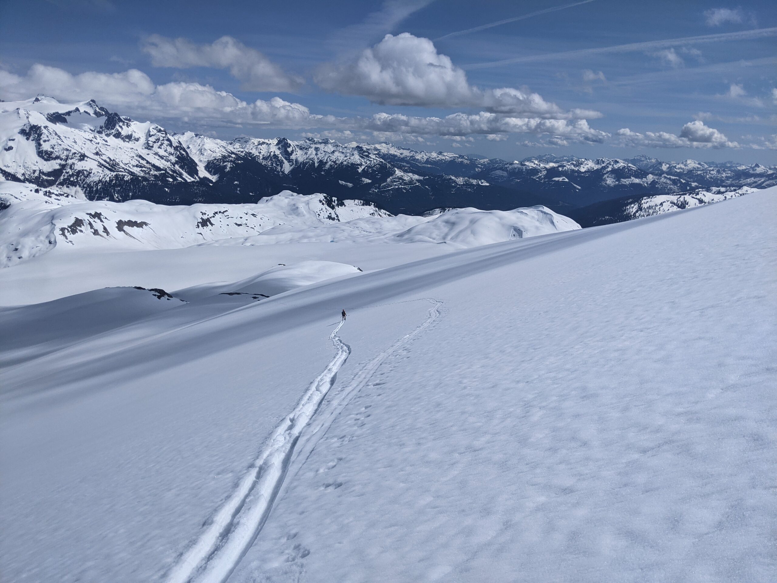
From a low point of 1450m, about a 100m lower than had we traversed, we began the long climb up to the Phoenix Glacier. It was slow going, trailbreaking in boottop slush. The overnight freeze was just enough to get us through the McBrides, but now we were dealing with sloppy conditions. Even at 1900m, on the north facing Sentinel Glacier, it was a slow sticky traverse to wrap around the Glacier Pikes. It should have been a quick glide from the shoulder of the Pikes down to the lowpoint north of the Sharkfin, but it was a slow-mo downhill shuffle. This actually gave both Nick and myself a bit of knee pain doing the forced glide but it was manageable. We didn’t make it to the low point, opting to switch to skins for the rest of the way down.
The climb up the high point of the Neve wasn’t too bad despite the afternoon heat. However, the descent down to Ring Creek from the Opal Cone was tediously slow. Even up higher, we left skins on longer than normal just to get better glide along the now sticky snow. We had them off for the descent to Ring Creek, but in hindsight it might have been faster with skins on in those conditions, we were forced to skate downhill.
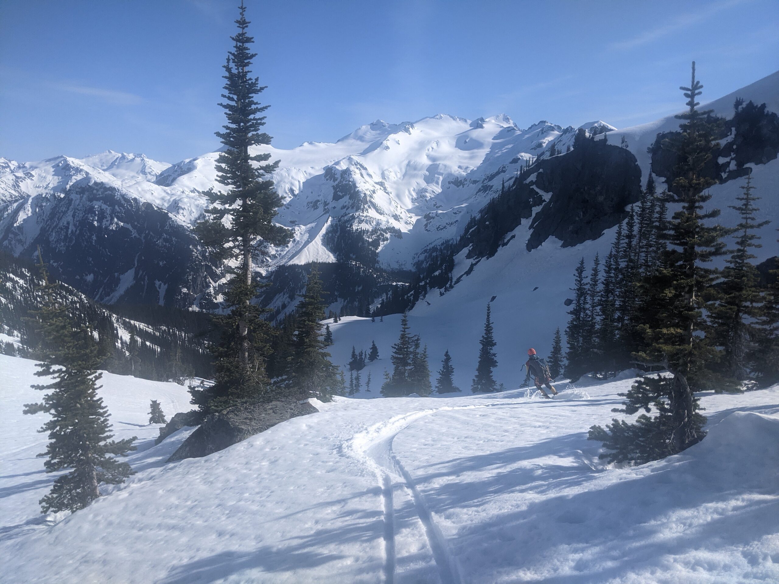
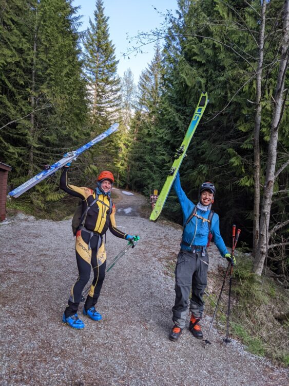
I’ve been able to get to each uphill transition with reasonably fresh legs by recovering on the downs, but that wasn’t the case for the climb out of Ring Creek. It was slow, Nick broke trail, and I just did my best to slog it out and up to the Elfin Lake shelter. Longer and further than I remember, this was probably the only portion of the trip I didn’t enjoy. Nick’s experience from his double Neve day paid off here, he already knew what slogging out of Ring Creek with tired legs felt like. When we got to the top of Red Heather, we called Gobin for a pickup, and then ripped skins for the final descent. It was still sticky, but having ski tracks helped. The snow ended just above the first switchback. And the best part, somebody had written, using tree branches, “short walk” and “skis on” at the start and end of the continuous snow. Turns out that was Gobin’s handiwork, who was already waiting on the road for us. We heard Gobin walking up the road, banging pots and cheering us on. That was an awesome gesture, and to top it off, Gobin had burgers and root beer back at the car. Thanks Gobin!!!
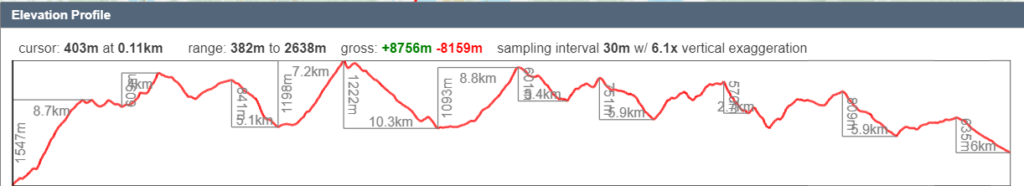
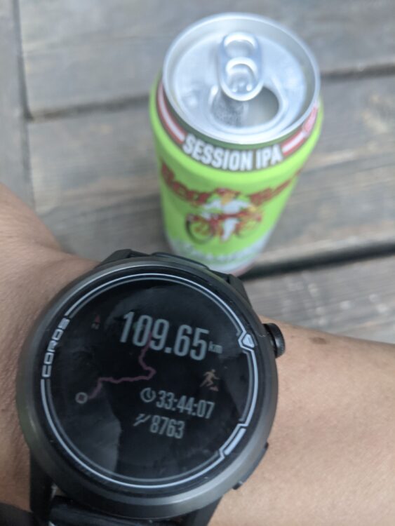
Total Time: 33hr 44min (33 hr, 28 min trailhead to trailhead)
Distance: 109.65 km
Elevation Gain/Loss: 8763m/ 8080m
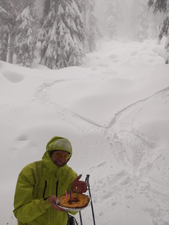
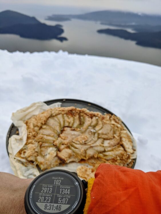
Number of Pies Consumed: Zero. What was the point really?
This was definitely a highlight of a rather weird ski season, where I spent most of it skiing mini-golf terrain on the North Shore mountains. I’ve skied the Wedge-Currie and the Neve before, but never the McBride traverse. Most of the navigating and route finding had to happen on the fly, and in the dark for the McBride. It mostly worked, and hopefully there’s more beta for the various sections in this trip report for fitter parties to ski even faster in better conditions. I think a fast party could do this well under 30 hours, if not 25 (I’m looking at you, Squamish Skimo Team). This seems like a pretty big effort, but for the most part it was very enjoyable, if you break it down into small pieces it’s all doable, and I was happy that I never pushed myself so hard. After a good night’s sleep, I felt mostly fine, aside from some tight hamstrings, and went for an easy 10km trail run two days later.
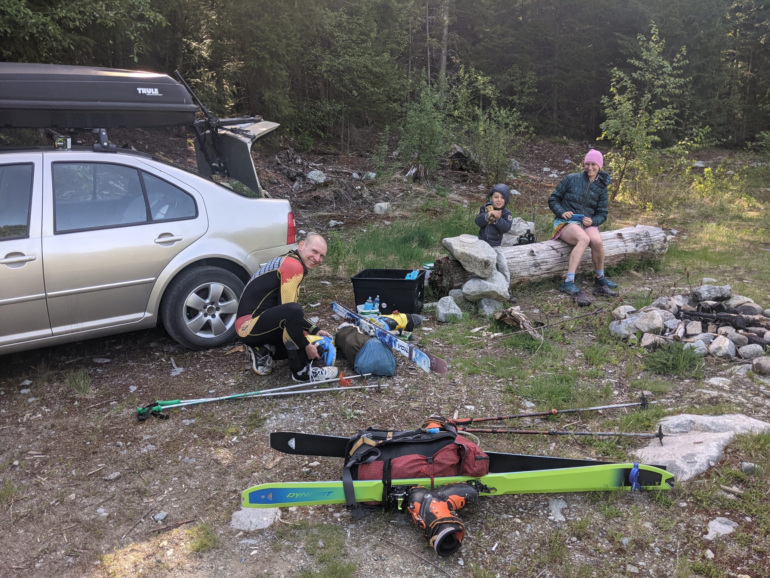
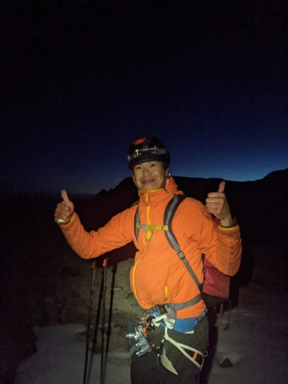
After doing this trip I have an even greater appreciation of what Veenstra accomplished. I am very lucky to have a great friend like Rich to join me on that experience. He put up with my endless nagging emails and went with pretty minimal prep time. His navigation was key to us having a relatively smooth time on the trip including dense sections like Billygoat Lake and the Cheakamus River. Looking back I can’t believe we thought the lake below crosscut ridge would be a shortcut as we had discussed this pre-trip and decided against it. I attribute that to the lack of sleep but we still made it through that okay. Having someone along to talk with and share the experience made this trip even more enjoyable. The icing on the cake was having Gobin join us at the end. Of course this whole trip wouldn’t have been possible without Lena helping out. She drove us to the trailhead, retrieved our shoes, and looked after Charles the whole day along with Sunday when she was on call. She even had supplemental child care lined up in case she had to work. So many pieces had to fit perfectly and we are lucky that it all worked out.
Nick M.
Nice work guys! Your TR brings back memories for sure… you took way more pictures than me. I find it interesting that the Gatekeeper has the reputation as the crux of the McBride; in my eyes Sinister Ridge causes the most trouble – I had trouble in the same spot despite having done that section (in both directions!) before. I agree that a very fit party with skinny skis could do it in under 24 hours, especially with good conditions and if they don’t need to spend too much time thinking about navigation. Such conditions may not often be realized for a full 24 hours, of course!
Well done!
Haha, my photos are built into my rest periods, if I don’t take photos, I’ll just burn myself out! Yeah, I didn’t feel too bad sideslipping/traversing off the Gatekeeper in the frozen conditions, but the steep frozen pitch off Sinister Ridge as definitely at my comfort level for steep sidestepping. Thanks for the inspiration Christian!
My neighbour and I are were the folks descending the Currie Trail. We spent the rest of the hike contemplating how little sleeping was going to happen with size of the mission compared to the packs. Great trip and thanks for sharing!
Haha that’s awesome, nice to run into you Mark! Hope you guys had a good day up there too
Wow, what an amazing/trip/adventure. Thanks for sharing and going into such detail with it all! I hope to make it out there someday.
Thanks Daryl! Hope you get out here too to enjoy it all!
Wow, saying that this was an “epic trip” would hardly do it justice, nice job you two! I enjoyed reading all the little details and the big smiles on your faces. I’m now wondering what’s next…?!
Thanks Gili! What’s next? Probably just enjoying summer!
Such a great trip and trip report. An awesome, impressive feat! Congratulations you two!
Thanks Jane!