Last weekend, I went exploring in the valleys and peaks at the headwaters of the Sockeye, Birkenhead, Noel and Hope Creek rivers. This is an awesome area to explore, with good scrambling peaks, lots of alpine lakes, and sprawling lush meadows. With a decent vehicle, you can get to within 30 minutes of sub-alpine terrain, somewhat of a rarity in the Coast Mountains. I’ve seen these peaks from the Phelix Creek area to the east, and the Tenquille Lake area to the west, but never made the trip into here. Multi-day traverses are possible here, either a shorter version from Phelix Creek to Tenquille Lake (3-4 days), or the full Cadwallader traverse (6-8 days). Take a look at a map of this area, and you’ll quickly realize how many trips you can make here with all the possible exit/entry points.
This weekend, we approached via the Hope Creek FSR. To get here, drive up the Hurley FSR (recently graded) and continued 10km’s past Railroad Pass (highpoint) to an unmarked forest road on the right side. The first 7.2km along this road are smooth and in 2WD conditions (as of July 2015). Take a left turn here, across two bridges, one which is slumping at the west side, with rocks piled up to fill in the gap. The next 5km’s require a high clearance vehicle, with water bars and slide alder guaranteed to add some coast mountain pin stripping to the sides. The bottom of road is also growing over. Parking is at a landing at 12.3km, just before the road makes a turn. Look in Matt’s Scrambles book for a more detailed description on accessing these peaks.
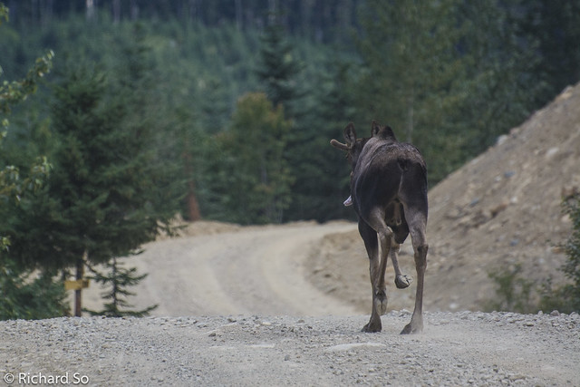
Following a moose up the Hurley FSR. We stopped and waited for him to disappear off the road. A few minutes later, I drove around the corner and found him again.
From the parking spot, head south, crossing the creek twice. Occasional flagging will guide you to a faint trail that leads up to the low pass to the south (only 30 minutes!). The trail will put you on the west side of the pass, towards the Brown Molar and Canine Peak. Drop down to the pass, and then head up over heather slopes to a shoulder on the ridge.
We dropped down into the beautiful Beaujolais Valley, filled with willow herbs, arctic coltsfeet, arnicas, anemones and Indian paintbrushes. Oh, and mosquitoes and horseflies. Lots of them. Not so bad while moving, but they would descend on us the moment we stopped.
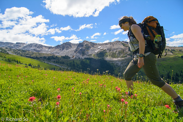
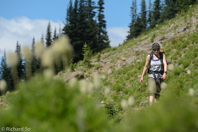
Breanne hiking along the wide open meadows in the Beaujolais Valley.
The peaks in the background are Tenquille, Canine and Brown Molar.
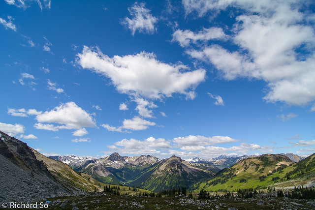
Looking back at where we came from. The Tenquille group is on the left side.
Open alpine terrain below Beaujolais Peak. Water sources were not an issue on this trip.
Looking down into the headwaters of Sockeye Creek. This area is protected as a wilderness conservation zone, part of the Birkenhead Provincial Park and home to the endangered spotted owl and grizzlies.
Breanne with Beaujolais Peak on the right. We dropped down from the Merlot-Beaujolais col into the Sockeye valley, to hike towards Merlot and Vapolicella Peak.
Easy ridge walking up to Vapolicella Peak. These viniferous names came after a BCMC party made an ascent of this peak in a multi-day traverse in 1979. The previous evening at camp, one of the party members pulled out a half-bottle of Valpolicella to go with their freeze-dried dinner. The next day, they climbed this peak, and left the bottle as the summit register.
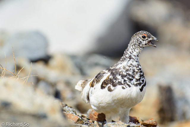
Ptarmigan on top of Valpolicella.
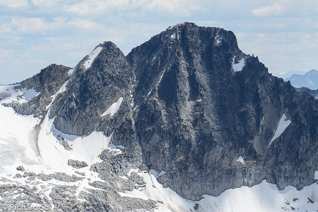
North face of Mystery Peak. This face looks good, but up close the granite is broken up, with loose blocks sitting on sandy ledges. Perhaps that’s the Mystery here, where did the steep granite go?
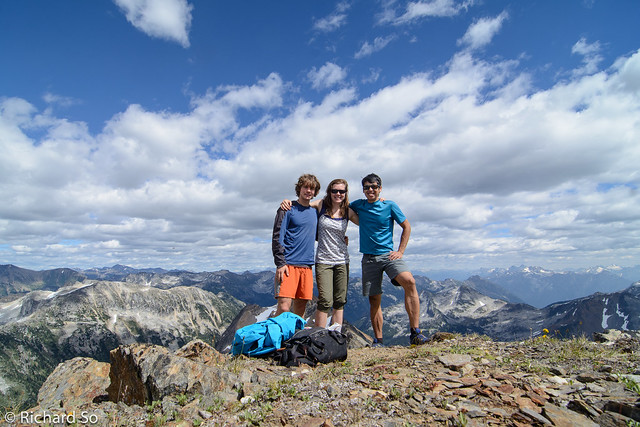
On top of Valpolicella Peak
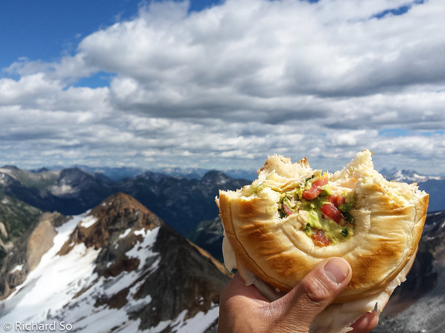
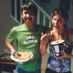
Alpine sandwich time. Chicken, avocado, brie, and salsa.
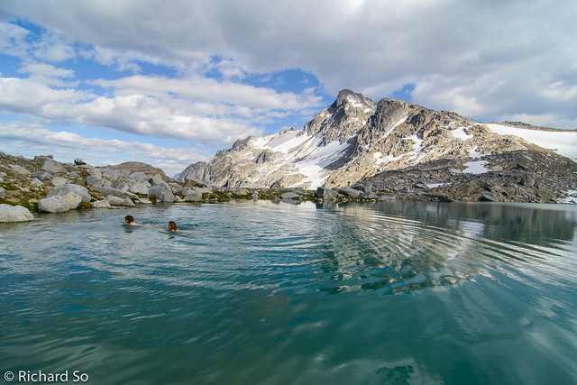
In addition to climbing peaks today, our secondary goal was to swim in as many alpine tarns as possible. With 30-35C in Pemberton, getting up high and into these lakes was a nice way to beat the heat.
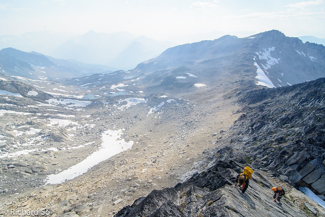
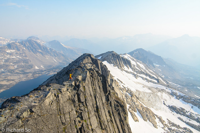
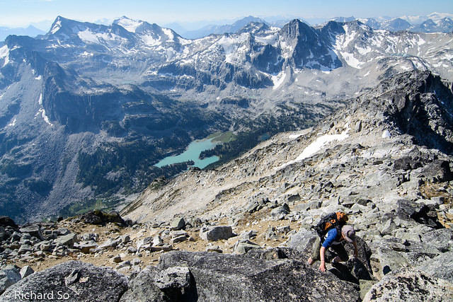
Scrambling up the slab crux on the Beaujolais Peak. It gets a difficult rating in the Scrambles book, but its much easier than the pink slab on Sky Pilot.
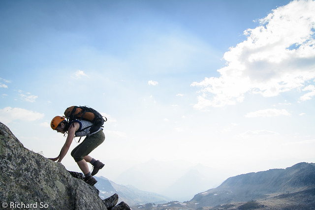
Breanne scrambles on Beaujolais Peak. Aside from the slab, the rest of the route follows broken blocky terrain.
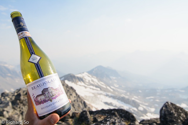
The biggest question in the trip planning email was whether a bottle of Merlot or Beaujolais would fit inside my lightweight pack. Next time, we’re bringing a bottle for each summit.
Alpine wine tasting.
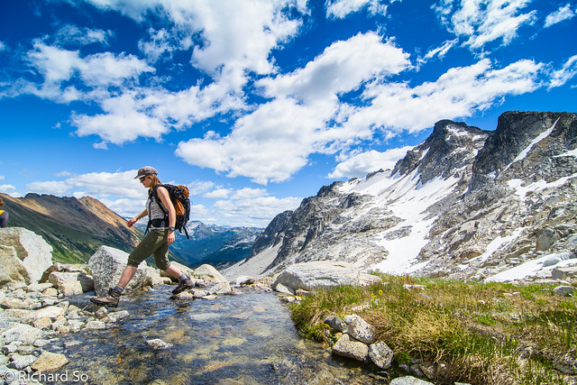
Geoff walking down the southwest ridge. We were heading to the lake at the right. The smoke in the background was from the Boulder Creek fire to the west. It was clear all day, but in the afternoon and late evening the smoke was noticeable.
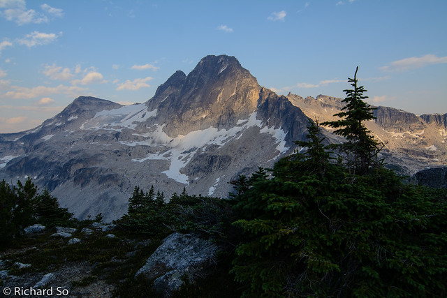
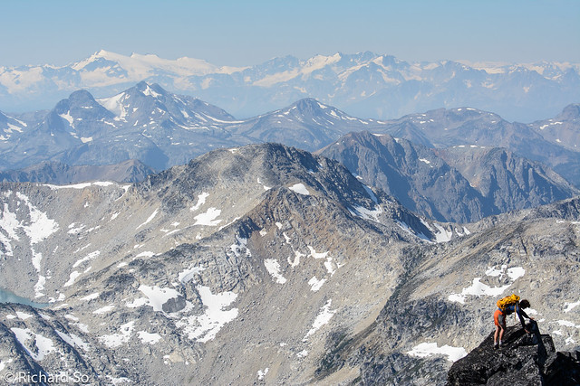
Another view of Mystery Peak, also known as the Sockeye Horn. As one of the highest peaks around, the view was spectacular from the summit.
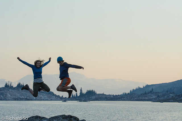
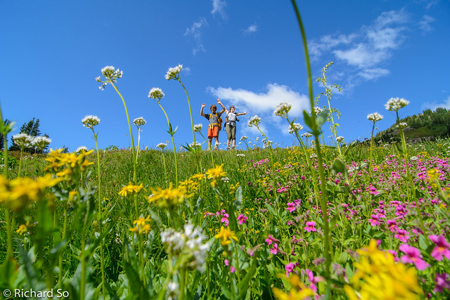
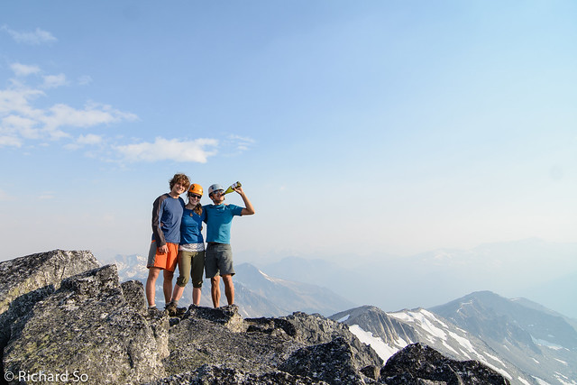
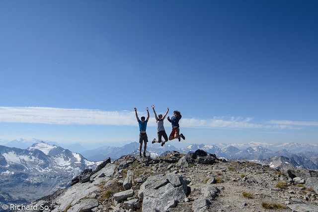
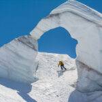
Jump shots were another key part of the weekend, closely behind swimming in lakes.
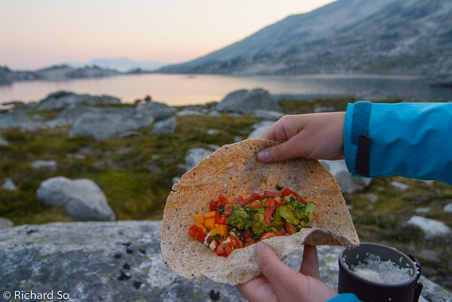
Alpine burritos. Tortilla, instant rice, avocado, cheddar, peppers, and salsa.
I didn’t have a tent, which was part of my light weight strategy. The bugs were getting bad, so I decided to watch the stars and photograph them until I was too tired to notice the bugs in my sleeping bag. It was almost a new moon, and the spot is far enough from city lights for an unpolluted view of the deep sky.
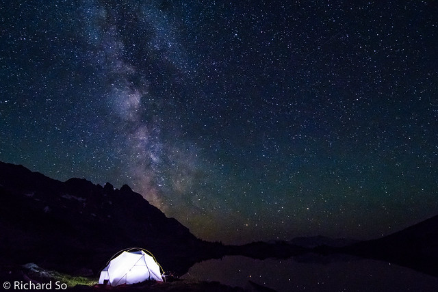
Camping under the Milky Way.
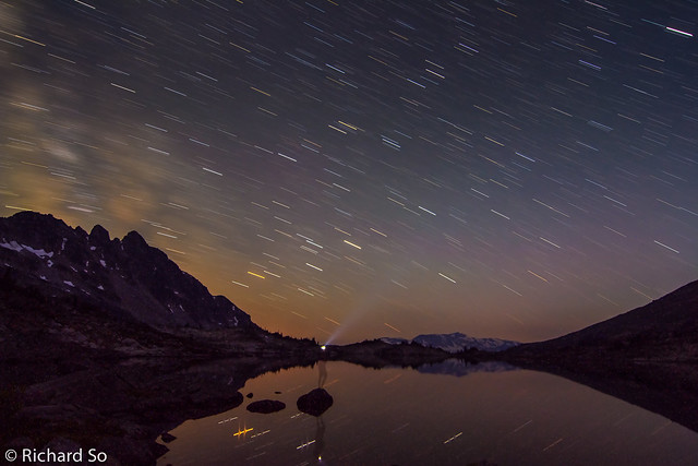
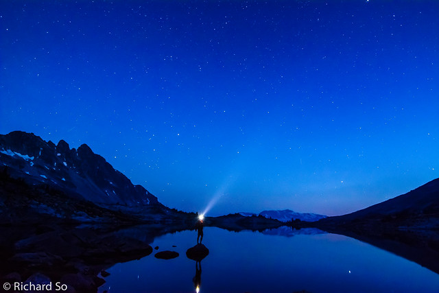
My alpine selfie with a ten minute exposure.
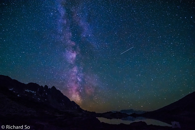
More Milky Way. I’m hoping to get out again in early August to catch the Perseids meteor shower. They coincide with another new moon, which should make for good watching conditions, weather permitting.
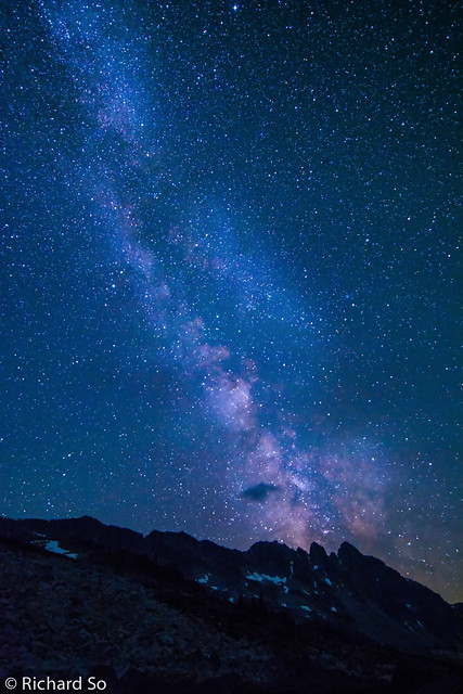
The Deep Sky.
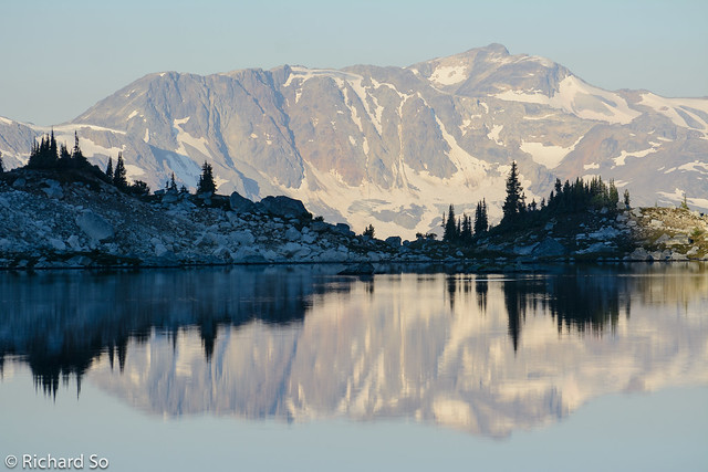
Morning reflection of Tenquille Mountain.
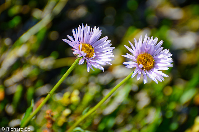
Asters
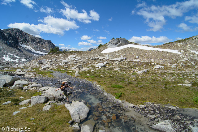
Looking down into another branch of the Sockeye at the col on the south ridge.
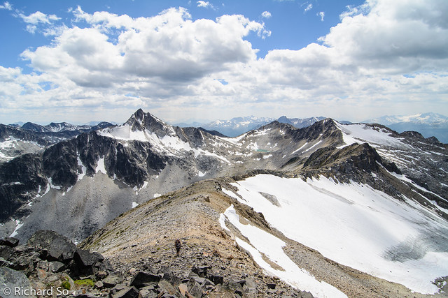
Scrambling up Mystery Peak. While the peaks in the background are unnamed, they are recommended as winter ski camp destination by John Baldwin. Looks like there is some good alpine and tree skiing potential. The area by Hope Creek is used by a cat-skiing company.
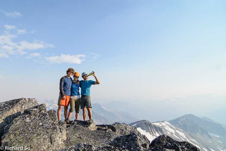
Summit of Mystery Peak. I was trying to getting a good jump shot, but had to set my camera on the interval setting, with a shot every second. This was the closest I could get until Breanne and Geoff refused to jump again.
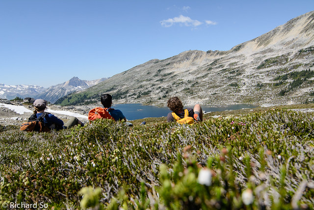
Our alpine relaxation station. We went back to the lake for the second swim of the day, and spent the next two hours sleeping in the meadows. Places like this are hard to leave. From the lake, we followed the far shore, and then up and around the ridge to the left of my head to get back into the Beaujolais Valley. It’s quite easy to climb both peaks in a day but it’s a long drive from Vancouver and the camping is top notch. Why rush?
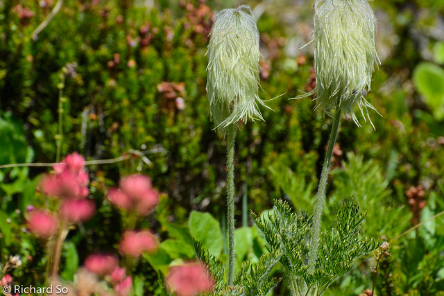
Western Anemone
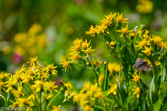
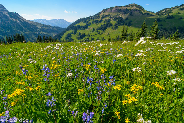
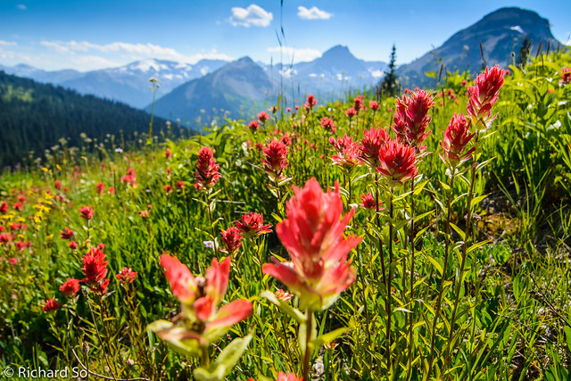
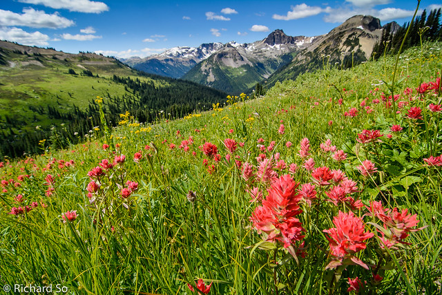
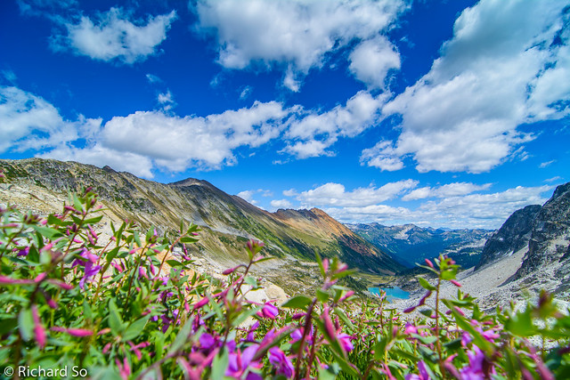
Indian Paintbrush in the Beaujolais valley. Our timing for the wildflower show was perfect. I think the flowers should be good here for another two weeks.
More photos here: https://www.flickr.com/photos/richso/sets/72157653915121793
Nice post! Thanks for the great info. Do you have any idea how the road access is these days?